Category:Africa in the 1890s
Перейти до навігації
Перейти до пошуку

Помірні регіони: Північна Америка · Південна Америка · Африка · Європа · Азія · Океанія i Австралія – Полярні регіони: Антарктида · – Other regions:
Africa in the 19th century: ◀ · 1800‑ті · 1810‑ті · 1820‑ті · 1830‑ті · 1840‑ті · 1850‑ті · 1860‑ті · 1870‑ті · 1880‑ті · 1890‑ті · ▶
English: Africa in the 1890s
Esperanto: Afriko en la 1890-aj jaroj
категорія проєкту Вікімедіа | |||||
| Завантажити медіафайл | |||||
| Є одним із | |||||
|---|---|---|---|---|---|
| Пов'язані з категорією теми | |||||
| Попередник | |||||
| Наступник | |||||
 | |||||
Файли в категорії «Africa in the 1890s»
Показано 200 файлів цієї категорії (із 719).
(попередня сторінка) (наступна сторінка)-
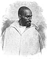
 AFR V2 D008 Arabs, Sudanese negro, and female Shilluk slave.jpg 2007 × 2974; 913 КБ
-
 AFR V2 D009 Title page.jpg 2600 × 4082; 396 КБ
-
 AFR V2 D011 Page header decoration.jpg 2104 × 440; 295 КБ
-
 AFR V2 D012 Chapter end decoration.jpg 308 × 498; 36 КБ
-
 AFR V2 D013 Page header decoration.jpg 2102 × 426; 212 КБ
-
 AFR V2 D017 Page header decoration.jpg 2132 × 432; 263 КБ
-
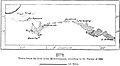
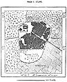
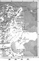
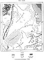
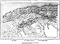
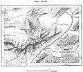
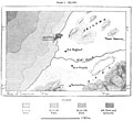
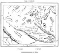
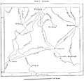
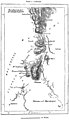
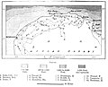 AFR V2 D020 Route of the chief explorers in Cyrenaica.jpg 1834 × 1485; 303 КБ
-
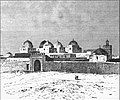
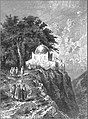 AFR V2 D027 Zawya of Mazuna, in the Algerian Dahra.jpg 2073 × 2815; 1,36 МБ
-
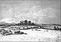
 AFR V2 D030 Tobruk.jpg 1845 × 1997; 575 КБ
-
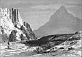
 AFR V2 D032 Cyrene.jpg 1790 × 1549; 525 КБ
-
 AFR V2 D033 View from the Necropolis of Cyrene.jpg 3031 × 2097; 1,58 МБ
-
 AFR V2 D036 Benghazi.jpg 1814 × 2478; 732 КБ
-
 AFR V2 D039 Page header decoration.jpg 2081 × 424; 196 КБ
-
-
 AFR V2 D042 Group of the Aujila oases.jpg 1744 × 1377; 147 КБ
-
 AFR V2 D044 Page header decoration.jpg 2048 × 423; 147 КБ
-
 AFR V2 D046 The Kufra oasis.jpg 2040 × 2972; 1,06 МБ
-
 AFR V2 D049 Kufra oasis.jpg 1818 × 1835; 191 КБ
-
 AFR V2 D050 Page header decoration.jpg 2065 × 365; 172 КБ
-
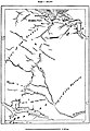
 AFR V2 D051 Routes of the chief explorers in Tripolitania.jpg 2138 × 1410; 225 КБ
-
 AFR V2 D056 Jebel Ghurian.jpg 1832 × 1330; 207 КБ
-
 AFR V2 D057 The Kasr-El-Jebel cirque.jpg 3032 × 2086; 891 КБ
-
 AFR V2 D065 Oases and arable lands of Tripolitania.jpg 1739 × 1747; 375 КБ
-
 AFR V2 D070 Inhabitants of Tripolitania.jpg 1716 × 1710; 378 КБ
-
 AFR V2 D076 Jofra oasis.jpg 1737 × 1408; 321 КБ
-
 AFR V2 D079 Khoms coast district, Tripolitania.jpg 1752 × 1716; 387 КБ
-
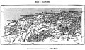
 AFR V2 D082 Tripoli.jpg 1735 × 1788; 516 КБ
-
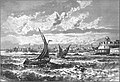 AFR V2 D083 Tripoli from the roadstead.jpg 2980 × 2029; 919 КБ
-
 AFR V2 D088 Decorative letter P.jpg 304 × 339; 28 КБ
-
 AFR V2 D088 Page header decoration.jpg 2062 × 370; 302 КБ
-
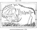
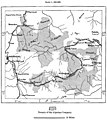
 AFR V2 D090 Routes of the chief explorers of Fezzan.jpg 1784 × 1507; 175 КБ
-
 AFR V2 D093 Oases of Fezzan.jpg 1793 × 1389; 366 КБ
-
 AFR V2 D100 Murzuk.jpg 1113 × 1370; 292 КБ
-
 AFR V2 D101 General view of Murzuk.jpg 3027 × 2091; 922 КБ
-
 AFR V2 D104 Decorative letter A.jpg 319 × 342; 28 КБ
-
 AFR V2 D104 Page header decoration.jpg 2091 × 417; 211 КБ
-
 AFR V2 D105 Ghadames district.jpg 1725 × 1259; 230 КБ
-
 AFR V2 D107 The Ghadames oasis.jpg 1815 × 2050; 602 КБ
-
 AFR V2 D108 General view of the Ghadames.jpg 2968 × 2030; 1,14 МБ
-
 AFR V2 D112 Decorative letter R.jpg 315 × 349; 30 КБ
-
 AFR V2 D112 Page header decoration.jpg 2059 × 370; 171 КБ
-
 AFR V2 D113 Rhat, Libya.jpg 1109 × 2502; 377 КБ
-
 AFR V2 D117 Decorative letter W.jpg 324 × 352; 27 КБ
-
 AFR V2 D117 Page header decoration.jpg 2111 × 380; 168 КБ
-
 AFR V2 D118 Ancient form of Mauritania according to Bourguignat's hypothetis.jpg 1747 × 1361; 508 КБ
-
 AFR V2 D119 Tunisian landscape view taken from the Tellat pass.jpg 3023 × 2067; 871 КБ
-
 AFR V2 D127 Taraka island, view taken from the coast.jpg 3008 × 2061; 798 КБ
-
 AFR V2 D128 Hamada el Kessera.jpg 1850 × 1292; 567 КБ
-
 AFR V2 D130 Left side of Tunis and Constantine map in color.jpg 2333 × 3607; 1,27 МБ
-
 AFR V2 D130 Tunis map left half.jpg 2313 × 3471; 1,31 МБ
-
 AFR V2 D131 Constantine right half of map.jpg 2275 × 3527; 958 КБ
-
 AFR V2 D131 Right side of Tunis and Constantine map in color.jpg 2432 × 3781; 958 КБ
-
 AFR V2 D133 The Jebel Zaghwan.jpg 1909 × 1600; 406 КБ
-
 AFR V2 D135 Lakes of Eskel and Bizerta.jpg 1776 × 2370; 722 КБ
-
 AFR V2 D136 Gorges of the middle Mejerda.jpg 1721 × 1620; 662 КБ
-
 AFR V2 D137 Old beds of the lower Mejerda.jpg 1726 × 2481; 751 КБ
-
 AFR V2 D139 The Mejerda at Slugia, above Mejez-El-Bab.jpg 3027 × 2078; 1,31 МБ
-
 AFR V2 D142 Sill of Cabes.jpg 1761 × 1819; 354 КБ
-
 AFR V2 D143 Zone of the Shotts, South of East Algeria and Tunis.jpg 1730 × 1092; 180 КБ
-
 AFR V2 D144 Tracks of travelers in the Shott-El-Jerid.jpg 1731 × 1370; 376 КБ
-
 AFR V2 D148 Island of Jerba.jpg 1760 × 2076; 482 КБ
-
 AFR V2 D152 Cape Bon and Zembra Island.jpg 1750 × 2493; 790 КБ
-
 AFR V2 D161 Khumir man, women and child.jpg 2055 × 3030; 783 КБ
-
 AFR V2 D167 Tunisian Jewess.jpg 1301 × 1932; 279 КБ
-
 AFR V2 D170 Houses at Kasr El-Mudenin.jpg 1876 × 1583; 576 КБ
-
 AFR V2 D172 Jerba Island Castle near Humt Suk.jpg 2981 × 2042; 911 КБ
-
 AFR V2 D175 Cabes-View taken from the Jara gardens.jpg 3009 × 2027; 665 КБ
-
 AFR V2 D181 Nafta and the Shott-El-Jerid.jpg 2974 × 2033; 763 КБ
-
 AFR V2 D187 Sfakes-View taken in the Leonec street.jpg 2023 × 3023; 673 КБ
-
 AFR V2 D189 Amphitheatre of El-Jem, viewed from the ruined side.jpg 1972 × 1480; 389 КБ
-
 AFR V2 D191 Mahdiya.jpg 1839 × 2493; 635 КБ
-
 AFR V2 D192 Monastir and Susa.jpg 1814 × 1744; 359 КБ
-
 AFR V2 D193 Kairwan.jpg 1827 × 1754; 297 КБ
-
 AFR V2 D194 Kasbah of Susa, viewed from the French consulate.jpg 1857 × 1347; 322 КБ
-
 AFR V2 D196 Kairwan, the Mosque of the Swords.jpg 1870 × 1565; 416 КБ
-
 AFR V2 D197 General view of Kairwan.jpg 3040 × 2089; 871 КБ
-
 AFR V2 D201 Ruins of Sbeitla, the ancient Suffetla.jpg 3021 × 2058; 1,21 МБ
-
 AFR V2 D202 Susa and Enfida.jpg 1794 × 2449; 483 КБ
-
 AFR V2 D205 Aqueducts of Carthage.jpg 1249 × 2565; 571 КБ
-
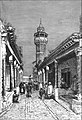 AFR V2 D211 Tunis-street in the Suk district.jpg 2053 × 3016; 771 КБ
-
 AFR V2 D213 Tunis.jpg 1736 × 2102; 552 КБ
-
 AFR V2 D219 Carthage.jpg 1783 × 2186; 493 КБ
-
 AFR V2 D221 Ancient ports of Carthage.jpg 1550 × 2356; 626 КБ
-
 AFR V2 D223 General view of El-Kef.jpg 3036 × 2103; 1,07 МБ
-
 AFR V2 D231 Tabarka.jpg 1781 × 2454; 847 КБ
-
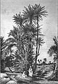
 AFR V2 D232 Cork tree of Fernana.jpg 1850 × 1558; 438 КБ
-
 AFR V2 D236 Railways and highways of Tunis.jpg 1546 × 2602; 466 КБ
-
 AFR V2 D241 Page decoration.jpg 2103 × 381; 160 КБ
-
 AFR V2 D246 Left half of Algiers and Oran map in color.jpg 2534 × 4004; 1,26 МБ
-
 AFR V2 D247 Right half of Algiers and Oran map in color.jpg 2534 × 4004; 1022 КБ
-
 AFR V2 D253 Erosions of the mountains near Tiaret.jpg 1843 × 1593; 426 КБ
-
 AFR V2 D255 Junction of the geodetic lines between Algeria and Spain.jpg 1801 × 2244; 593 КБ
-
 AFR V2 D257 Ancient glaciers of the Haizer mountains.jpg 1782 × 1617; 410 КБ
-
 AFR V2 D258 Gorges of the Wed Agriun.jpg 1656 × 2489; 951 КБ
-
 AFR V2 D261 Cape de Fer.jpg 1748 × 1656; 389 КБ
-
 AFR V2 D264 Lakes of La Calle.jpg 1777 × 1526; 361 КБ
-
 AFR V2 D268 Shott Melhigh and projected inland sea.jpg 1801 × 1774; 301 КБ
-
 AFR V2 D269 Artesian Wells of Ziban and the Wed Righ.jpg 1691 × 2328; 378 КБ
-
 AFR V2 D270 Barrage of the Hamiz.jpg 1155 × 2408; 571 КБ
-
 AFR V2 D272 Rainfall of the Sahara in 1884.jpg 1747 × 1393; 462 КБ
-
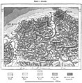
 AFR V2 D282 Chief ancient cities of Algeria.jpg 1758 × 1034; 378 КБ
-
 AFR V2 D284 Chief Tribes of Algeria.jpg 1758 × 1285; 480 КБ
-
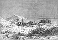
 AFR V2 D291 Saharian landscape, nomad encampment.jpg 3011 × 2064; 724 КБ
-
 AFR V2 D294 Suk-Ahras and its environs.jpg 1761 × 1640; 772 КБ
-
 AFR V2 D302 Edugh and Lake Fetzara.jpg 1888 × 1182; 425 КБ
-
 AFR V2 D305 The natural arch of Constantine.jpg 2062 × 3036; 958 КБ
-
 AFR V2 D319 Zwawa and Ait-Iraten Territory.jpg 1799 × 2345; 771 КБ
-
 AFR V2 D330 Palestro and Gorges of the Isser.jpg 1759 × 2515; 906 КБ
-
 AFR V2 D331 Lower Sebau and Isser valleys.jpg 1764 × 1792; 530 КБ
-
 AFR V2 D338 Military lines of Algiers.jpg 1722 × 2407; 864 КБ
-
 AFR V2 D340 Algerian Sahel.jpg 1876 × 1834; 552 КБ
-
 AFR V2 D347 Isthmus of Tipaza.jpg 1809 × 1816; 504 КБ
-
 AFR V2 D350 Gorges of the Shelif.jpg 1730 × 2086; 737 КБ
-
 AFR V2 D353 Medea.jpg 1776 × 2024; 574 КБ
-
 AFR V2 D354 Miliana, Sill of Affreville.jpg 1822 × 1660; 562 КБ
-
 AFR V2 D361 Plain of Andalusians.jpg 1802 × 1572; 348 КБ
-
 AFR V2 D363 Tlemcen.jpg 1775 × 2501; 1017 КБ
-
 AFR V2 D365 Mouth of the Tafna.jpg 1793 × 2643; 648 КБ
-
 AFR V2 D369 The Sheliya and plain of Medina.jpg 1762 × 1660; 590 КБ
-
 AFR V2 D371 Fum Ksantina.jpg 1619 × 2548; 700 КБ
-
 AFR V2 D372 Ancient Roman towns in north Aures.jpg 1732 × 1507; 467 КБ
-
 AFR V2 D376 Emancipated negress, Biskra.jpg 1876 × 2514; 1,09 МБ
-
 AFR V2 D379 Oases of the northern and southern Zibans.jpg 1732 × 1082; 133 КБ
-
 AFR V2 D380 The Wed Righ Oasis.jpg 981 × 2598; 145 КБ
-
 AFR V2 D389 Mzab and Metlili.jpg 1606 × 2325; 232 КБ
-
 AFR V2 D400 Teniet-El-Haad and its forests.jpg 1778 × 1342; 602 КБ
-
 AFR V2 D404 Domain of the Algerian Company.jpg 1781 × 1992; 528 КБ
-
 AFR V2 D407 Growth of the foreign trade of Algeria since 1830.jpg 1740 × 2051; 139 КБ
-

-
 AFR V2 D415 Relative population of the Algerian communes.jpg 1731 × 988; 97 КБ
-
 AFR V2 D421 Tiaret and Tagdemt.jpg 1809 × 1317; 466 КБ
-
 AFR V2 D424 Routes of the chief explorers in Marocco.jpg 1806 × 2286; 458 КБ
-
 AFR V2 D425 Bled-el-Makhzen and Bled-es-Siba.jpg 1794 × 2237; 588 КБ
-
 AFR V2 D427 Crests and passes of the Atlas south of Marrakesh.jpg 1776 × 2404; 657 КБ
-
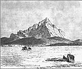
 AFR V2 D428 Jebel Tiza - view taken from the Tagherut pass.jpg 2997 × 2064; 1,07 МБ
-
 AFR V2 D432 The Tetuan Highlands.jpg 1751 × 1866; 553 КБ
-
 AFR V2 D434 The Sherat river.jpg 3026 × 2060; 985 КБ
-
 AFR V2 D435 Lower course of the Sebu.jpg 1768 × 1602; 275 КБ
-
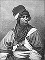
 AFR V2 D436 Arabs and Berbers of Maghreb-el-Aksa.jpg 1797 × 2463; 753 КБ
-
 AFR V2 D440 Left side of Morocco map in color.jpg 2534 × 4004; 997 КБ
-
 AFR V2 D440 Map of Morroco left page.jpg 2251 × 3560; 864 КБ
-
 AFR V2 D440 Map of Morroco.jpg 4534 × 3560; 1,75 МБ
-
 AFR V2 D441 Map of Morroco right page.jpg 2222 × 3464; 854 КБ
-
 AFR V2 D441 Right side of Morocco map in color.jpg 2534 × 3972; 837 КБ
-
 AFR V2 D446 A Tangier Arab.jpg 1545 × 1964; 502 КБ
-
 AFR V2 D447 Arab woman of Tangier.jpg 1652 × 1997; 354 КБ
-
 AFR V2 D450 Arab camel driver.jpg 1590 × 1948; 564 КБ
-
 AFR V2 D453 Ujda, Isly, and the Angad plain.jpg 1848 × 1509; 346 КБ
-
 AFR V2 D455 General view of Tetuan.jpg 3004 × 2057; 699 КБ
-
 AFR V2 D457 Tetuan.jpg 1743 × 1929; 492 КБ
-
 AFR V2 D458 Ceuta.jpg 1728 × 1562; 505 КБ
-
 AFR V2 D460 Tangier.jpg 1750 × 1913; 698 КБ
-
 AFR V2 D461 Tangier, view taken from the east.jpg 3012 × 2051; 719 КБ
-
 AFR V2 D464 El Araish and Chemmish.jpg 1779 × 1748; 390 КБ
-
 AFR V2 D465 Fez and neighbourhood.jpg 1808 × 1325; 274 КБ
-
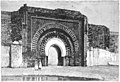
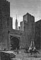
 AFR V2 D466 A gateway in Fez.jpg 1894 × 2537; 873 КБ
-
 AFR V2 D468 Mecnes and Volubilis.jpg 1718 × 2550; 680 КБ
-
 AFR V2 D470 Mulai Tayeb, sherif of Wezzan.jpg 1723 × 1886; 494 КБ
-
 AFR V2 D472 Rbat and mouth of the Bu-Regrag, view tken from Sla.jpg 2967 × 2027; 1,17 МБ
-
 AFR V2 D473 Rbat and Sla.jpg 1871 × 2587; 430 КБ
-
 AFR V2 D475 Mazagan and Azemur.jpg 1802 × 1700; 243 КБ
-
 AFR V2 D477 Marocco, the Christian's Gate.jpg 3044 × 2088; 705 КБ
-
 AFR V2 D478 Marrakesh.jpg 1835 × 2222; 698 КБ
-
 AFR V2 D480 Bogador and neighbourhood.jpg 1753 × 1607; 317 КБ
-
 AFR V2 D482 Tarudant.jpg 1760 × 1491; 278 КБ
-
 AFR V2 D485 Ifni and neighbourhood coast.jpg 1699 × 2571; 606 КБ
-
 AFR V2 D489 Wed Zis and Tafilelt oases.jpg 1338 × 2442; 251 КБ
-
 AFR V2 D491 Wed El-Haluf near Figuig.jpg 3004 × 2070; 708 КБ
-
 AFR V2 D493 El-Bahariat of the Wed Guir.jpg 1794 × 2220; 333 КБ
-
 AFR V2 D494 Figuig oasis.jpg 1876 × 2284; 830 КБ
-
 AFR V2 D497 General view of Fez.jpg 3068 × 2108; 598 КБ
-
 AFR V2 D499 A school in Fez.jpg 1943 × 1620; 401 КБ
-
 AFR V2 D500 Frontiers of Algeria and Marocco.jpg 1131 × 2480; 447 КБ
-
 AFR V2 D501 Fez, gateway of the Kasbah.jpg 2021 × 2974; 583 КБ
-
 AFR V2 D510 The great east Erg.jpg 1801 × 2150; 365 КБ
-
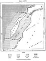
 AFR V2 D517 Eastern Sahara.jpg 2447 × 3702; 838 КБ
-
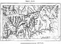
 AFR V2 D519 Routes of the chief explorers in the Eastern Sahara.jpg 1839 × 2035; 230 КБ
-
 AFR V2 D520 Northern Tibesti.jpg 1762 × 1119; 308 КБ
-
 AFR V2 D523 Group of Tibbus.jpg 3055 × 2085; 613 КБ
-
 AFR V2 D527 Borku.jpg 1761 × 1616; 206 КБ
-
 AFR V2 D531 Kawar oasis.jpg 1042 × 2348; 159 КБ
-
-
 AFR V2 D536 Geology of the Sahara, south of Algeria.jpg 1788 × 1964; 633 КБ
-
 AFR V2 D537 Jebel Khanfusa.jpg 3056 × 2077; 596 КБ
-
 AFR V2 D546 Targui type.jpg 1587 × 2094; 822 КБ
-
 AFR V2 D547 Tuaregs on a journey.jpg 2062 × 3025; 691 КБ
-
 AFR V2 D552 Issawan valley.jpg 1873 × 2318; 402 КБ
-
 AFR V2 D556 Gurara and Wed Saura.jpg 1830 × 1659; 307 КБ
-
 AFR V2 D559 The Egueri gorge.jpg 3037 × 2098; 641 КБ
-
 AFR V2 D562 Thwat and Tidikelt.jpg 1741 × 1294; 190 КБ
-
 AFR V2 D567 Air, Morrocco.jpg 1342 × 2332; 211 КБ
-
 AFR V2 D572 Routes of the chief explorers in the western Sahara.jpg 1852 × 2024; 319 КБ
-
 AFR V2 D573 Western Sahara.jpg 2586 × 3738; 875 КБ
-
 AFR V2 D577 Rio de Oro.jpg 1634 × 2146; 311 КБ
-
 AFR V2 D579 Mouth of the Wed Draa, view taken from the sea.jpg 2991 × 2057; 569 КБ
-
 AFR V2 D588 Appendix statistical data.jpg 2159 × 3484; 573 КБ
-
 AFR V2 D589 Appendix statistical data.jpg 2221 × 3570; 291 КБ
-
 AFR V2 D590 Appendix statistical data.jpg 2054 × 3435; 407 КБ
-
 AFR V2 D591 Appendix statistical data.jpg 2157 × 3551; 409 КБ
-
 AFR V2 D592 Appendix statistical data.jpg 2152 × 3506; 377 КБ


