Category:Alexander Archipelago
Zur Navigation springen
Zur Suche springen
Inselgruppe im Pazifischen Ozean  | |||||
| Medium hochladen | |||||
| Ist ein(e) | |||||
|---|---|---|---|---|---|
| Benannt nach | |||||
| Ort |
| ||||
| Liegt am oder im Gewässer | |||||
| Fläche |
| ||||
 | |||||
Unterkategorien
Es werden 6 von insgesamt 6 Unterkategorien in dieser Kategorie angezeigt:
In Klammern die Anzahl der enthaltenen Kategorien (K), Seiten (S), Dateien (D)
Medien in der Kategorie „Alexander Archipelago“
Folgende 52 Dateien sind in dieser Kategorie, von 52 insgesamt.
-
 1940 Census Enumeration District Maps - Alaska - Alaska State - NARA - 5822482 (page 24).jpg 6.228 × 6.116; 3,85 MB
-
 Admiralty Islands.jpg 2.816 × 2.112; 2,05 MB
-
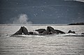
 Adult Humpback Whale breaching.jpg 3.648 × 2.736; 6,73 MB
-
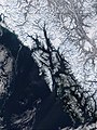 Alexander archipelago.jpg 1.050 × 1.400; 529 KB
-
 Alexander Takımadaları ( Alexander Archipelago ) - panoramio.jpg 1.644 × 900; 1,21 MB
-
-
 BI mountain Alaska.jpg 1.242 × 1.462; 2,66 MB
-
 Black sand blank islands Alaska.jpg 1.242 × 1.492; 2,39 MB
-
 Blanck forest.jpg 1.242 × 1.476; 2,66 MB
-
 Blanck island pond.jpg 3.024 × 4.032; 5,57 MB
-
 Blanck Islands-air.jpg 1.242 × 622; 484 KB
-
 Castilleja unalaschensis 4351.png 869 × 963; 1,05 MB
-
 Coot Cove 4301-02.png 3.224 × 942; 4,01 MB
-
 Deceptive C aground.png 796 × 531; 589 KB
-
 Duncan-Canal-Alaska-2-USGS.jpg 480 × 296; 25 KB
-
 FMIB 34487 United States Salmon Hatchery, Yes Bay, Alaska.jpeg 625 × 464; 61 KB
-
 FMIB 34911 Salmon Hatchery and Rearing Ponds, Yes Bay, Alaska.jpeg 631 × 382; 65 KB
-
 FMIB 35450 Salmon Hatchery, Heckman Lake, Southeast Alaska.jpeg 961 × 716; 107 KB
-
 FMIB 40792 Sketch of Kunk Lake and Stream, Etolin Island, Alaska.jpeg 1.090 × 1.042; 206 KB
-
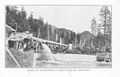
 FMIB 44221 Steamer Queen Entering Yes Bay.jpeg 1.624 × 1.141; 418 KB
-

-
 FMIB 44494 Government Hatchery at Yes Bay, Alaska.jpeg 802 × 640; 206 KB
-
 FMIB 48489 Large Bed of Nereocystis near Shakan Bay.jpeg 1.271 × 807; 236 KB
-
-
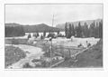
 FMIB 49133 Yes Bay Hatchery buildings.jpeg 1.323 × 1.008; 340 KB
-
 FMIB 49134 Intake of water-supply flume at Yes Bay Hatchery.jpeg 1.209 × 772; 182 KB
-
 FMIB 49135 Tramway from Yes Bay to Lake McDonald.jpeg 692 × 1.149; 207 KB
-
 FMIB 49136 Main hatchery building and retaining rack, Yes Bay Station.jpeg 1.174 × 754; 150 KB
-

-
 FMIB 49148 Rearing ponds at Fortmann Hatchery.jpeg 1.201 × 885; 237 KB
-
 FMIB 49149 Interior of Fortmann Hatchery.jpeg 1.191 × 859; 170 KB
-
-
 Funter Bay 4305.png 1.938 × 879; 2,37 MB
-
 Geological Dike Cross-Island Trail Alaska.jpg 2.592 × 1.944; 2,36 MB
-
 Glass Peninsula and Admiralty Island.jpg 1.776 × 1.421; 1,11 MB
-
 Humpbacks 8 Mouths 801.jpg 5.907 × 3.889; 8,92 MB
-
 Idaho Inlet 4315.png 1.519 × 576; 1,17 MB
-
 Lindenberg Peninsula muskeg 4181.jpg 2.048 × 1.536; 742 KB
-
 Line3563 - Flickr - NOAA Photo Library.jpg 2.288 × 1.712; 1,26 MB
-
 Line5114 - Flickr - NOAA Photo Library.jpg 3.008 × 2.000; 823 KB
-
 Mouth of Stikine River, ca. 1899 - DPLA - 4e786ce8847fb91cb504c806bf344881.jpg 4.363 × 3.080; 1,29 MB
-
 Ocean Eagle and barge aground.PNG 792 × 526; 741 KB
-
 Pleasant Island 4402.png 1.782 × 432; 912 KB
-
 Point Hugh 4148.png 1.780 × 729; 1,21 MB
-
 Point Retreat Lighthouse 303.jpg 3.600 × 2.372; 2,73 MB
-

-
 Rock Arch on St. Lazaria by Nora Rojek USFWS.jpg 1.536 × 2.048; 298 KB
-
 Shelter Island 4288.png 1.753 × 567; 1,1 MB
-
 Stephens Passage & Admiralty Island pano.JPG 2.411 × 708; 241 KB
-
 Stephens Passage and Admiralty Island, AK.JPG 4.608 × 3.456; 3,13 MB
-
 Tlevak Strait-Suemez Island.jpg 640 × 419; 61 KB
-
 View of Yes Bay from water, ca 1912 (THWAITES 331).jpeg 766 × 455; 34 KB
.jpg)


_-_panoramio.jpg)
_(14779106664).jpg)


.jpg)


.jpeg)