Category:Alignements d'An Eured Veign
Jump to navigation
Jump to search
|
This building is en partie classé, en partie inscrit au titre des monuments historiques de la France. It is indexed in the base Mérimée, a database of architectural heritage maintained by the French Ministry of Culture, under the reference PA00089842
|
| Object location | | View all coordinates using: OpenStreetMap |
|---|
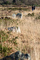
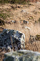
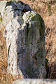
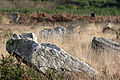
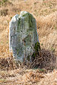
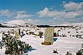
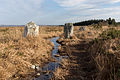
alignment of some 77 standing stones in Brittany, France  | |||||
| Upload media | |||||
| Instance of | |||||
|---|---|---|---|---|---|
| Location | Brasparts, canton of Pleyben | ||||
| Heritage designation |
| ||||
 | |||||
Media in category "Alignements d'An Eured Veign"
The following 30 files are in this category, out of 30 total.
-
 Alignement mégalithique de la Noce de Pierres, Brasparts, France-2.jpg 5,130 × 3,420; 10.39 MB
-
 Alignement mégalithique de la Noce de Pierres, Brasparts, France-3.jpg 3,456 × 5,184; 7.02 MB
-
 Alignement mégalithique de la Noce de Pierres, Brasparts, France-4.jpg 5,184 × 3,456; 8.81 MB
-
 Alignement mégalithique de la Noce de Pierres, Brasparts, France-5.jpg 3,456 × 5,184; 8.09 MB
-
 Alignement mégalithique de la Noce de Pierres, Brasparts, France-6.jpg 3,456 × 5,184; 8.46 MB
-
 Alignement mégalithique de la Noce de Pierres, Brasparts, France-7.jpg 3,456 × 5,184; 8.95 MB
-
 Alignement mégalithique de la Noce de Pierres, Brasparts, France-8.jpg 5,184 × 3,456; 7.99 MB
-
 Alignement mégalithique de la Noce de Pierres, Brasparts, France-9.jpg 3,456 × 5,184; 9.33 MB
-
 Alignement mégalithique de la Noce de Pierres, Brasparts, France.jpg 3,011 × 4,517; 7.19 MB
-
 Braspartz-euredvein-erch.jpg 1,536 × 1,024; 729 KB
-
 Brasparzh - An Eured Vein 20141214-01.jpg 4,854 × 3,236; 10.81 MB
-
 Brasparzh - An Eured Vein 20141214-02.jpg 4,948 × 3,299; 13.23 MB
-
 Brasparzh - An Eured Vein 20141214-03.jpg 5,472 × 3,648; 13.45 MB
-
 Brasparzh - An Eured Vein 20141214-04.jpg 5,472 × 3,648; 13.7 MB
-
 Brasparzh - An Eured Vein 20141214-05.jpg 4,856 × 3,237; 14.04 MB
-
 Brasparzh - An Eured Vein 20141214-06.jpg 3,648 × 5,472; 14.83 MB
-
 Brasparzh - An Eured Vein 20141214-07.jpg 3,575 × 5,363; 15.16 MB
-
 Brasparzh - An Eured Vein 20141214-08.jpg 3,648 × 5,472; 16.54 MB
-
 Brasparzh - An Eured Vein 20141214-09.jpg 5,472 × 3,648; 19.07 MB
-
 Brasparzh - An Eured Vein 20141214-10.jpg 3,894 × 2,596; 8.34 MB
-
 Brasparzh - An Eured Vein 20141214-11.jpg 5,097 × 3,398; 9.88 MB
-
 Brasparzh - An Eured Vein 20141214-12.jpg 3,648 × 5,472; 12.62 MB
-
 Brasparzh - An Eured Vein 20141214-13.jpg 5,472 × 3,648; 15.81 MB
-
 Brasparzh - An Eured Vein 20141214-14.jpg 4,575 × 3,050; 10.65 MB
-
 Brasparzh - An Eured Vein 20141214-15.jpg 4,885 × 3,257; 11.02 MB
-
 Brasparzh - An Eured Vein 20141214-16.jpg 5,259 × 3,506; 13.52 MB
-
 Brasparzh - An Eured Vein 20141214-17.jpg 3,549 × 5,323; 13.71 MB
-
 Brasparzh - An Eured Vein 20141214-18.jpg 5,472 × 3,648; 15.76 MB
-
 Brasparzh - An Eured Vein 20141214-19.jpg 5,472 × 3,648; 16.57 MB
-
 Panneau Noce de pierres.jpg 4,000 × 3,000; 4.52 MB


