Category:All Cannings
Jump to navigation
Jump to search
English: Images relating to All Cannings, Wiltshire, England. For more information see the Wikipedia article All Cannings.
village in the United Kingdom  | |||||
| Upload media | |||||
| Instance of | |||||
|---|---|---|---|---|---|
| Location | Wiltshire, South West England, England | ||||
| official website | |||||
 | |||||
Subcategories
This category has the following 4 subcategories, out of 4 total.
A
- Allington, All Cannings (14 F)
L
Media in category "All Cannings"
The following 200 files are in this category, out of 408 total.
(previous page) (next page)-
 ... former post office in All Cannings, Wiltshire. (4341295274).jpg 2,744 × 2,263; 3.39 MB
-
 1stconcrete.jpg 160 × 120; 7 KB
-
 5 Allington (geograph 5751984).jpg 4,320 × 3,240; 2.53 MB
-
 A blot on the land - geograph.org.uk - 5753238.jpg 4,320 × 3,240; 2.05 MB
-
 A field and power lines, near All Cannings - geograph.org.uk - 1743212.jpg 1,440 × 1,080; 773 KB
-
 A house named Sarsen - geograph.org.uk - 5754502.jpg 4,320 × 3,240; 2.48 MB
-
 Across the field - geograph.org.uk - 4501451.jpg 4,320 × 3,240; 5.01 MB
-
 All Cannings - geograph.org.uk - 5753233.jpg 4,320 × 3,240; 1.93 MB
-
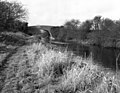
 All Cannings Bridge (no 127) - geograph.org.uk - 3704122.jpg 1,024 × 768; 140 KB
-
 All Cannings Bridge - geograph.org.uk - 4496076.jpg 4,320 × 3,240; 4.94 MB
-

-
 All Cannings Down - 1 - geograph.org.uk - 1941565.jpg 640 × 480; 100 KB
-
 All Cannings Down - 1 - geograph.org.uk - 1942016.jpg 640 × 480; 95 KB
-
 All Cannings Down - 2 - geograph.org.uk - 1941574.jpg 640 × 480; 119 KB
-
 All Cannings Down - 2 - geograph.org.uk - 1942031.jpg 640 × 480; 95 KB
-
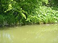
 All Cannings from Kennet and Avon Canal - geograph.org.uk - 4482648.jpg 3,214 × 2,380; 1.72 MB
-
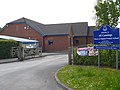 All Cannings Primary School (1) - geograph.org.uk - 4501704.jpg 4,320 × 3,240; 5.08 MB
-
 All Cannings Primary School (2) - geograph.org.uk - 4501754.jpg 4,320 × 3,240; 4.32 MB
-
 All Cannings village hall - geograph.org.uk - 4929388.jpg 640 × 427; 64 KB
-
 All Saints Church across All Cannings village green - geograph.org.uk - 2955938.jpg 3,648 × 2,736; 1.94 MB
-
 All Saints Church, All Cannings - geograph.org.uk - 4929385.jpg 640 × 427; 87 KB
-
 All Saints, All Cannings, altar - geograph.org.uk - 4288505.jpg 640 × 473; 72 KB
-
 All Saints, All Cannings, banner - geograph.org.uk - 4288496.jpg 480 × 640; 54 KB
-

-
 All Saints, All Cannings, churchyard (a) - geograph.org.uk - 4288437.jpg 640 × 480; 103 KB
-

-
 All Saints, All Cannings, churchyard (c) - geograph.org.uk - 4288441.jpg 640 × 480; 144 KB
-

-
 All Saints, All Cannings, churchyard (f) - geograph.org.uk - 4288444.jpg 640 × 468; 110 KB
-

-

-

-

-
 All Saints, All Cannings, churchyard (k) - geograph.org.uk - 4288449.jpg 640 × 480; 113 KB
-
 All Saints, All Cannings, churchyard (l) - geograph.org.uk - 4288450.jpg 640 × 480; 128 KB
-

-

-
 All Saints, All Cannings, churchyard (o) - geograph.org.uk - 4288456.jpg 640 × 480; 146 KB
-
 All Saints, All Cannings, churchyard (p) - geograph.org.uk - 4288452.jpg 640 × 480; 120 KB
-
 All Saints, All Cannings, churchyard (q) - geograph.org.uk - 4288455.jpg 640 × 480; 125 KB
-

-
 All Saints, All Cannings, font - geograph.org.uk - 4288459.jpg 480 × 640; 63 KB
-

-

-

-

-

-

-

-

-

-

-

-

-
-

-

-

-
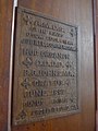
 All Saints, All Cannings, organ - geograph.org.uk - 4288508.jpg 468 × 640; 60 KB
-

-
 All Saints, All Cannings, pulpit - geograph.org.uk - 4288458.jpg 640 × 480; 75 KB
-

-

-

-

-

-
-

-
 All Saints, All Cannings, tower - geograph.org.uk - 4288457.jpg 480 × 640; 64 KB
-

-
 Allington Bridge (No 130), from the west - geograph.org.uk - 4494737.jpg 1,024 × 768; 138 KB
-
 Allington Bridge, Kennet and Avon Canal - geograph.org.uk - 424695.jpg 640 × 498; 126 KB
-
 Allington Cottage - geograph.org.uk - 5754503.jpg 4,320 × 3,240; 4.56 MB
-
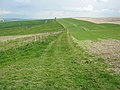
 Allington Down - geograph.org.uk - 3831764.jpg 1,200 × 806; 1.09 MB
-
 Allington Down - geograph.org.uk - 3831770.jpg 1,200 × 814; 950 KB
-
 Allington Down - geograph.org.uk - 4589619.jpg 640 × 480; 74 KB
-
 Allington Down - geograph.org.uk - 6202662.jpg 1,024 × 678; 776 KB
-
 Allington Down - geograph.org.uk - 6203118.jpg 1,024 × 678; 917 KB
-
 Allington Down - geograph.org.uk - 6203120.jpg 1,024 × 678; 819 KB
-
 Allington Down - geograph.org.uk - 6203121.jpg 1,024 × 678; 856 KB
-
 Allington Down - geograph.org.uk - 6203122.jpg 1,024 × 678; 791 KB
-
 Allington Down - geograph.org.uk - 6203123.jpg 1,024 × 678; 899 KB
-
 Allington House (1) - geograph.org.uk - 5752038.jpg 4,320 × 3,240; 4.28 MB
-
 Allington House (2) - geograph.org.uk - 5753224.jpg 4,320 × 3,240; 4.4 MB
-
 Allington House (3) - geograph.org.uk - 5753225.jpg 4,320 × 3,240; 2.71 MB
-
 Allington pumping station - geograph.org.uk - 5775188.jpg 4,320 × 3,240; 5.32 MB
-
 Allington Swing Bridge - geograph.org.uk - 4482983.jpg 3,264 × 2,448; 1.72 MB
-
 Allington Swing Bridge - geograph.org.uk - 4930618.jpg 640 × 427; 107 KB
-

-
 Allington swingbridge (no 129) - geograph.org.uk - 3704111.jpg 1,024 × 768; 146 KB
-
 Approaching Allington Bridge (No 130) - geograph.org.uk - 4494733.jpg 1,024 × 768; 141 KB
-
 Arable fields near Allington - geograph.org.uk - 2458689.jpg 640 × 480; 65 KB
-
 Bales in the field - geograph.org.uk - 5059417.jpg 4,320 × 3,240; 3.55 MB
-
 Bales in the field - geograph.org.uk - 5060303.jpg 4,320 × 3,240; 2.57 MB
-
 Baptist chapel (geograph 5753240).jpg 4,067 × 3,050; 2.97 MB
-
 Barn in the trees - geograph.org.uk - 5754501.jpg 4,320 × 3,240; 2.9 MB
-
 Barns and manure - geograph.org.uk - 5611504.jpg 4,320 × 3,240; 3.21 MB
-
 Barns at All Cannings Down - geograph.org.uk - 1941823.jpg 640 × 480; 116 KB
-
 Below Milk Hill - geograph.org.uk - 6206750.jpg 1,024 × 678; 772 KB
-
 Below Milk Hill - geograph.org.uk - 6206754.jpg 1,024 × 678; 734 KB
-
 Bench Mark, All Saints' Church - geograph.org.uk - 2459016.jpg 480 × 640; 82 KB
-
 Bethel Chapel, Allington - geograph.org.uk - 4289008.jpg 640 × 480; 133 KB
-
 Blooming blue - geograph.org.uk - 5775186.jpg 4,320 × 3,240; 3.81 MB
-
 Bricktemplate.jpg 160 × 120; 7 KB
-
 Bridge to nowhere - geograph.org.uk - 4501690.jpg 4,320 × 3,240; 4.64 MB
-
 Bridleway crosses the canal (1) - geograph.org.uk - 5753228.jpg 4,320 × 3,240; 4.44 MB
-
 Bridleway crosses the canal (2) - geograph.org.uk - 5753230.jpg 4,320 × 3,240; 4.05 MB
-
 Bridleway crosses the canal (3) - geograph.org.uk - 5753231.jpg 3,240 × 4,320; 4.27 MB
-
 Bridleway heading to All Cannings - geograph.org.uk - 5652109.jpg 640 × 480; 91 KB
-
 Bridleway on Harestone Down - geograph.org.uk - 5610545.jpg 4,320 × 3,240; 4.94 MB
-
 Bridleways leave the road - geograph.org.uk - 5754498.jpg 4,320 × 3,240; 3.15 MB
-
 Buildings off Gunsite Road - geograph.org.uk - 6206576.jpg 1,024 × 678; 917 KB
-
 Burden's Cottage - geograph.org.uk - 4492400.jpg 4,320 × 3,240; 4.83 MB
-
 By-way to Woodway Bridge - geograph.org.uk - 2996411.jpg 640 × 480; 192 KB
-
 Byway near Allington - geograph.org.uk - 2458715.jpg 640 × 480; 73 KB
-
 Byway repair kit - geograph.org.uk - 5754510.jpg 4,320 × 3,240; 3.35 MB
-
 Byway, All Cannings - geograph.org.uk - 1429888.jpg 640 × 480; 121 KB
-
 Canning Cross Farm - geograph.org.uk - 5775182.jpg 4,219 × 3,164; 2.3 MB
-
 Cannings Cross Farm - geograph.org.uk - 4929396.jpg 640 × 427; 84 KB
-
 Carisbrook, 30 and 32 The Street (geograph 4492282).jpg 4,320 × 3,240; 4.78 MB
-
 Carisbrooke cottages numbers 30 and 32 - geograph.org.uk - 2955837.jpg 3,591 × 2,615; 1.53 MB
-
 Chalkpit - geograph.org.uk - 6197361.jpg 1,024 × 678; 769 KB
-
 Chalkpit - geograph.org.uk - 6197364.jpg 1,024 × 678; 723 KB
-
 Church Hatch (geograph 4491923).jpg 4,320 × 3,240; 4.61 MB
-
 Churchyard and Old Rectory, All Cannings - geograph.org.uk - 4929386.jpg 640 × 427; 100 KB
-
 Cliff Farmhouse - geograph.org.uk - 4492957.jpg 4,320 × 3,240; 5.01 MB
-
Common Moorhen (Gallinula chloropus).webm 1 min 44 s, 1,920 × 1,080; 104.54 MB
-
 Concrete and chalk (1) - geograph.org.uk - 5754508.jpg 4,320 × 3,240; 2.96 MB
-
 Concrete and chalk (2) - geograph.org.uk - 5754509.jpg 4,113 × 3,084; 2.59 MB
-
 Concrete base - geograph.org.uk - 6197302.jpg 1,024 × 678; 727 KB
-
 Cottages in The Street (geograph 4496041).jpg 4,320 × 3,240; 5.09 MB
-
 Dew Pond - geograph.org.uk - 6197295.jpg 1,024 × 678; 766 KB
-
 Downhill at last - geograph.org.uk - 5612339.jpg 4,320 × 3,240; 3.08 MB
-
 Downland road approaches Park Farm, Allington - geograph.org.uk - 2952644.jpg 3,648 × 2,506; 1.55 MB
-
 Downland view (1) - geograph.org.uk - 5611489.jpg 4,320 × 3,240; 3.28 MB
-
 Downland view (2) - geograph.org.uk - 5611501.jpg 4,320 × 3,240; 2.22 MB
-
 Downland view - geograph.org.uk - 5612353.jpg 4,320 × 3,240; 2.93 MB
-
 Downland, All Cannings - geograph.org.uk - 844984.jpg 640 × 480; 109 KB
-
 Downland, All Cannings - geograph.org.uk - 844985.jpg 640 × 480; 116 KB
-
 Downland, All Cannings - geograph.org.uk - 844989.jpg 640 × 480; 115 KB
-
 Downland, All Cannings - geograph.org.uk - 846168.jpg 640 × 480; 121 KB
-
 Downland, All Cannings - geograph.org.uk - 846207.jpg 640 × 480; 118 KB
-
 Downland, All Cannings - geograph.org.uk - 846217.jpg 640 × 480; 136 KB
-
 Downland, All Cannings - geograph.org.uk - 846283.jpg 640 × 480; 129 KB
-
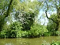
 Ducklings on the Kennet and Avon Canal - geograph.org.uk - 4496674.jpg 4,320 × 3,240; 4.96 MB
-
 Entrance to All Cannings - geograph.org.uk - 4589155.jpg 640 × 480; 56 KB
-
 Entrance to Allington - geograph.org.uk - 4582301.jpg 640 × 432; 59 KB
-
 Evening Light on the Canal near Allington - geograph.org.uk - 5073845.jpg 1,024 × 691; 167 KB
-
 Farm buildings off Gunsite Road - geograph.org.uk - 6191391.jpg 1,024 × 678; 737 KB
-
 Farm track on All Cannings Down - geograph.org.uk - 1941548.jpg 640 × 480; 112 KB
-
 Farm track on All Cannings Down - geograph.org.uk - 1941618.jpg 640 × 480; 95 KB
-
 Farm track on Thorn Hill - geograph.org.uk - 1941995.jpg 640 × 480; 115 KB
-
 Farm track, near All Cannings - geograph.org.uk - 1743406.jpg 1,440 × 1,080; 876 KB
-
 Farmland - geograph.org.uk - 4589644.jpg 640 × 480; 54 KB
-
 Farmland between All Cannings and Coate - geograph.org.uk - 4494714.jpg 1,024 × 768; 153 KB
-
 Farmland near Tanhill Penning - geograph.org.uk - 4930582.jpg 640 × 427; 46 KB
-

-
 Farmland, All Cannings - geograph.org.uk - 846367.jpg 640 × 480; 113 KB
-
 Farmland, horses and riders near All Cannings Bridge - geograph.org.uk - 1744589.jpg 1,440 × 1,080; 814 KB
-
 Field edge tumulus - geograph.org.uk - 5611520.jpg 4,320 × 3,240; 3.73 MB
-
 Field edge way (1) - geograph.org.uk - 5058961.jpg 4,303 × 3,227; 2.98 MB
-
 Field edge way (2) - geograph.org.uk - 5059394.jpg 4,313 × 3,235; 2.49 MB
-
 Fields and horse - geograph.org.uk - 5753236.jpg 4,320 × 3,240; 3.68 MB
-
 Flat field - geograph.org.uk - 4501553.jpg 4,320 × 3,240; 4.67 MB
-
 Footpath - geograph.org.uk - 6207311.jpg 1,024 × 678; 598 KB
-
 Footpath junction on the Wansdyke - geograph.org.uk - 4930523.jpg 640 × 427; 87 KB
-

-
 Footpath, All Cannings - geograph.org.uk - 2459105.jpg 640 × 480; 85 KB
-
 Four ways to go (1) - geograph.org.uk - 5610493.jpg 4,320 × 3,240; 3.95 MB
-
 Four ways to go (1) - geograph.org.uk - 5611528.jpg 4,320 × 3,240; 2.54 MB
-
 Four ways to go (2) - geograph.org.uk - 5610495.jpg 4,094 × 3,069; 2.21 MB
-
 Four ways to go (2) - geograph.org.uk - 5611538.jpg 4,320 × 3,240; 2.32 MB
-
 Four ways to go (3) - geograph.org.uk - 5610496.jpg 4,320 × 3,240; 2.9 MB
-
 Four ways to go (3) - geograph.org.uk - 5611541.jpg 4,320 × 3,240; 2.31 MB
-
 Four ways to go (4) - geograph.org.uk - 5610497.jpg 4,232 × 3,173; 2.62 MB
-
 Four ways to go (4) - geograph.org.uk - 5611543.jpg 4,320 × 3,240; 2.83 MB
-
 Gate on the way - geograph.org.uk - 5059407.jpg 4,320 × 3,240; 2.77 MB
-
 Grass track on All Cannings Down - geograph.org.uk - 1941600.jpg 3,648 × 2,736; 4.31 MB
-
 Harestone Down (1) - geograph.org.uk - 5610548.jpg 4,320 × 3,240; 4.7 MB
-
 Harestone Down (2) - geograph.org.uk - 5610553.jpg 4,320 × 3,240; 4.77 MB
-
 Harestone Down (3) - geograph.org.uk - 5610577.jpg 4,320 × 3,240; 4.71 MB
-
 Harestone Down - geograph.org.uk - 6206577.jpg 1,024 × 678; 854 KB
-
 Harestone Down - geograph.org.uk - 6206579.jpg 1,024 × 678; 807 KB
-
 Harestone Down - geograph.org.uk - 6206581.jpg 1,024 × 678; 935 KB
-
 Harestone Down - geograph.org.uk - 6206583.jpg 1,024 × 678; 704 KB
-
 Harestone Down - geograph.org.uk - 6206592.jpg 1,024 × 678; 888 KB
-
 Harestone Down - geograph.org.uk - 6206593.jpg 1,024 × 678; 793 KB
-
 Harestone Down - geograph.org.uk - 6206594.jpg 1,024 × 678; 779 KB
-
 Harestone Down - geograph.org.uk - 6206596.jpg 1,024 × 678; 743 KB
-
 Hawthorn blossom - geograph.org.uk - 4496100.jpg 4,320 × 3,240; 4.92 MB
-
 He was told - geograph.org.uk - 5058951.jpg 3,240 × 4,320; 4.46 MB
-
 Hereford bull on All Cannings Down - geograph.org.uk - 1941580.jpg 640 × 480; 93 KB
-
 Home Farm Cottages - geograph.org.uk - 5775187.jpg 3,941 × 2,956; 3.44 MB
-
 Home for hens - geograph.org.uk - 5753237.jpg 4,320 × 3,240; 4.09 MB
-
 House on the green at All Cannings - geograph.org.uk - 4929384.jpg 640 × 427; 116 KB
-
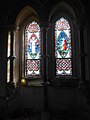
 Inside All Saints, All Cannings (I) - geograph.org.uk - 4288460.jpg 640 × 480; 50 KB
-
 Inside All Saints, All Cannings (II) - geograph.org.uk - 4288462.jpg 478 × 640; 59 KB
-

-
 Inside All Saints, All Cannings (IV) - geograph.org.uk - 4288464.jpg 480 × 640; 42 KB
-
 Inside All Saints, All Cannings (IX) - geograph.org.uk - 4288471.jpg 640 × 480; 72 KB
.jpg)

.jpg)


_-_geograph.org.uk_-_3704122.jpg)


_-_geograph.org.uk_-_4501704.jpg)
_-_geograph.org.uk_-_4501754.jpg)


_-_geograph.org.uk_-_4288437.jpg)
_-_geograph.org.uk_-_4288440.jpg)
_-_geograph.org.uk_-_4288441.jpg)
_-_geograph.org.uk_-_4288443.jpg)
_-_geograph.org.uk_-_4288444.jpg)
_-_geograph.org.uk_-_4288445.jpg)
_-_geograph.org.uk_-_4288446.jpg)
_-_geograph.org.uk_-_4288447.jpg)
_-_geograph.org.uk_-_4288448.jpg)
_-_geograph.org.uk_-_4288449.jpg)
_-_geograph.org.uk_-_4288450.jpg)
_-_geograph.org.uk_-_4288451.jpg)
_-_geograph.org.uk_-_4288454.jpg)
_-_geograph.org.uk_-_4288456.jpg)
_-_geograph.org.uk_-_4288452.jpg)
_-_geograph.org.uk_-_4288455.jpg)
_-_geograph.org.uk_-_4288517.jpg)

_-_geograph.org.uk_-_4288485.jpg)
_-_geograph.org.uk_-_4288486.jpg)
_-_geograph.org.uk_-_4288487.jpg)
_-_geograph.org.uk_-_4288488.jpg)
_-_geograph.org.uk_-_4288489.jpg)
_-_geograph.org.uk_-_4288490.jpg)
_-_geograph.org.uk_-_4288493.jpg)
_-_geograph.org.uk_-_4288494.jpg)
_-_geograph.org.uk_-_4288495.jpg)
_-_geograph.org.uk_-_4288510.jpg)
_-_geograph.org.uk_-_4288513.jpg)
_-_geograph.org.uk_-_4288514.jpg)
_-_geograph.org.uk_-_4288515.jpg)
_-_geograph.org.uk_-_4288516.jpg)
_-_geograph.org.uk_-_4288518.jpg)


_-_geograph.org.uk_-_4288497.jpg)
_-_geograph.org.uk_-_4288499.jpg)
_-_geograph.org.uk_-_4288501.jpg)
_-_geograph.org.uk_-_4288502.jpg)
_-_geograph.org.uk_-_4288503.jpg)
_-_geograph.org.uk_-_4288504.jpg)


,_from_the_west_-_geograph.org.uk_-_4494737.jpg)


_-_geograph.org.uk_-_5752038.jpg)
_-_geograph.org.uk_-_5753224.jpg)
_-_geograph.org.uk_-_5753225.jpg)


_-_geograph.org.uk_-_3704111.jpg)
_-_geograph.org.uk_-_4494733.jpg)


.jpg)


_-_geograph.org.uk_-_5753228.jpg)
_-_geograph.org.uk_-_5753230.jpg)
_-_geograph.org.uk_-_5753231.jpg)


.jpg)


.jpg)


_-_geograph.org.uk_-_5754508.jpg)
_-_geograph.org.uk_-_5754509.jpg)

.jpg)


_-_geograph.org.uk_-_5611489.jpg)
_-_geograph.org.uk_-_5611501.jpg)


_-_geograph.org.uk_-_5058961.jpg)
_-_geograph.org.uk_-_5059394.jpg)


_-_geograph.org.uk_-_5610493.jpg)
_-_geograph.org.uk_-_5611528.jpg)
_-_geograph.org.uk_-_5610495.jpg)
_-_geograph.org.uk_-_5611538.jpg)
_-_geograph.org.uk_-_5610496.jpg)
_-_geograph.org.uk_-_5611541.jpg)
_-_geograph.org.uk_-_5610497.jpg)
_-_geograph.org.uk_-_5611543.jpg)


_-_geograph.org.uk_-_5610548.jpg)
_-_geograph.org.uk_-_5610553.jpg)
_-_geograph.org.uk_-_5610577.jpg)


_-_geograph.org.uk_-_4288460.jpg)
_-_geograph.org.uk_-_4288462.jpg)
_-_geograph.org.uk_-_4288463.jpg)
_-_geograph.org.uk_-_4288464.jpg)
_-_geograph.org.uk_-_4288471.jpg)