Category:Allée couverte de Plate-Roche
Jump to navigation
Jump to search
| Object location | | View all coordinates using: OpenStreetMap |
|---|
 | |||||
| Upload media | |||||
| Instance of | |||||
|---|---|---|---|---|---|
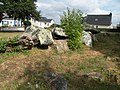
| Location | Saint-Lunaire, arrondissement of Saint-Malo, Ille-et-Vilaine, Brittany, Q88521114, Metropolitan France, France | ||||
 | |||||
Media in category "Allée couverte de Plate-Roche"
The following 5 files are in this category, out of 5 total.
-
 Allée couverte à Saint-Lunaire 01.jpg 5,260 × 3,505; 15.87 MB
-
 Allée couverte à Saint-Lunaire 02.jpg 5,260 × 3,505; 15.84 MB
-
 Allée couverte à Saint-Lunaire 03.jpg 5,260 × 3,505; 19.16 MB
-
 Allée couverte à Saint-Lunaire 04.jpg 5,260 × 3,505; 16.63 MB
-
 Saint-Lunaire - Plate Roche.jpg 3,264 × 2,448; 2.42 MB


