Category:Alte Kapelle Leegebruch
Jump to navigation
Jump to search
| Object location | | View all coordinates using: OpenStreetMap |
|---|
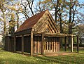
church building in Brandenburg state, Germany  | |||||
| Upload media | |||||
| Instance of | |||||
|---|---|---|---|---|---|
| Location | Leegebruch, Oberhavel District, Brandenburg, Germany | ||||
| Street address |
| ||||
| Architectural style | |||||
| Heritage designation | |||||
| Inception |
| ||||
 | |||||
Français : Ancienne chapelle, commune de Leegebruch, arrondissement de Haute-Havel, état fédéral de Brandebourg, Allemagne
This is the category of the Brandenburger Baudenkmal (cultural heritage monument) with the ID 09165281 (Wikidata)
|
Media in category "Alte Kapelle Leegebruch"
This category contains only the following file.
-
 Leegebruch chapel.jpg 2,640 × 2,001; 1.07 MB