Category:Alte St. Peter-Kirche (Tirschenreuth)
Jump to navigation
Jump to search
| Object location | | View all coordinates using: OpenStreetMap |
|---|
church  | |||||
| Upload media | |||||
| Instance of | |||||
|---|---|---|---|---|---|
| Named after | |||||
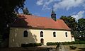
| Location | Tirschenreuth, Upper Palatinate, Bavaria, Germany | ||||
| Street address |
| ||||
| Has part(s) |
| ||||
| Heritage designation | |||||
 | |||||
This is the category of the Bavarian Baudenkmal (cultural heritage monument) with the ID D-3-77-154-45 (Wikidata)
|
Media in category "Alte St. Peter-Kirche (Tirschenreuth)"
The following 4 files are in this category, out of 4 total.
-
 Alte St. Peter-Kirche Altar.jpg 4,320 × 3,240; 4.11 MB
-
 Alte St. Peter-Kirche-2012.jpg 4,024 × 2,416; 2.54 MB
-
 Alte St. Peter-Kirche-innen1.jpg 4,320 × 3,240; 3.65 MB
-
 Alte St. Peter-Kirche-Kanzel.jpg 4,320 × 3,240; 3.84 MB


