Category:Altham, Lancashire
Jump to navigation
Jump to search
English: Altham is a village and civil parish in the district of Hyndburn, in Lancashire, England. It is the only parish in the district – the rest of the district is an unparished area. The village is north-east of Clayton-le-Moors, and is on the A678 Blackburn to Burnley road. The River Calder passes to the north of the village, and forms part of the parish boundary. In the south-west corner of the parish is Altham West, a suburb of Accrington. The 2001 census recorded a population of 897.

village in Lancashire, England  | |||||
| Upload media | |||||
| Instance of | |||||
|---|---|---|---|---|---|
| Location | Hyndburn, Lancashire, North West England, England | ||||
| Said to be the same as | Altham (Wikimedia duplicated page, civil parish) | ||||
 | |||||
Subcategories
This category has the following 4 subcategories, out of 4 total.
Media in category "Altham, Lancashire"
The following 200 files are in this category, out of 268 total.
(previous page) (next page)-
 "Simon Jersey" - geograph.org.uk - 674739.jpg 628 × 470; 189 KB
-

-
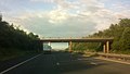
 A footbridge over the M65 - geograph.org.uk - 4223641.jpg 1,500 × 991; 121 KB
-
 A large site for scrap cars - geograph.org.uk - 3378787.jpg 3,872 × 2,592; 4.49 MB
-

-
 A swing bridge on the Leeds and Liverpool Canal (No 115) - geograph.org.uk - 4843791.jpg 4,244 × 2,824; 7.79 MB
-
 A678 - geograph.org.uk - 2324772.jpg 640 × 480; 170 KB
-
 Accrington Brick Works - geograph.org.uk - 3379958.jpg 3,872 × 2,592; 3.67 MB
-
 Allotment Hall Farm - geograph.org.uk - 6127485.jpg 800 × 494; 68 KB
-
 Altham Ambulance Station - geograph.org.uk - 2908480.jpg 640 × 481; 404 KB
-
 Altham Ambulance Station - geograph.org.uk - 6127501.jpg 800 × 493; 57 KB
-
 Altham Bridge (Canal) - geograph.org.uk - 3953407.jpg 4,320 × 3,240; 2.28 MB
-
 Altham Bridge - geograph.org.uk - 4571329.jpg 2,522 × 1,868; 2.8 MB
-
 Altham Bridge No 118 - geograph.org.uk - 5940668.jpg 640 × 443; 65 KB
-
 Altham Bridge No 118 - geograph.org.uk - 5941930.jpg 640 × 480; 92 KB
-
 Altham Bridge, Leeds ^ Liverpool Canal - geograph.org.uk - 3707962.jpg 1,600 × 1,200; 462 KB
-
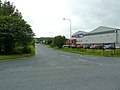
 Altham Business Park - geograph.org.uk - 4593713.jpg 1,024 × 721; 132 KB
-
 Altham Lane (Altham Bridge) - geograph.org.uk - 2935516.jpg 640 × 480; 497 KB
-
 Altham Lane at Altham Bridge - geograph.org.uk - 2935521.jpg 640 × 480; 548 KB
-
 Altham Lane crosses the M65 - geograph.org.uk - 4073578.jpg 1,271 × 717; 127 KB
-
 Altham Lane, Altham - geograph.org.uk - 6127735.jpg 4,442 × 3,096; 4.22 MB
-
 Ambulance Station, Burnley Road - geograph.org.uk - 2908482.jpg 640 × 481; 441 KB
-
 Anyone for some asbestos^ - geograph.org.uk - 2056106.jpg 480 × 640; 159 KB
-
 Approaching Farm above Altham Clough - geograph.org.uk - 3954603.jpg 4,320 × 3,240; 3.7 MB
-
 Approaching Junction 8 of the M65 - geograph.org.uk - 2357442.jpg 3,872 × 2,592; 3.63 MB
-
 Approaching the M65 - geograph.org.uk - 3954531.jpg 4,320 × 3,240; 5.28 MB
-
 Available space on Shorten Brook Drive - geograph.org.uk - 2357483.jpg 3,872 × 2,592; 4.44 MB
-
 Bales at Moorside Farm - geograph.org.uk - 5789871.jpg 800 × 556; 118 KB
-
 Banastre Street off Whalley Road, Accrington - geograph.org.uk - 4500788.jpg 2,000 × 1,500; 590 KB
-
 Barn, Lane Side Terrace, Altham - geograph.org.uk - 6127497.jpg 800 × 525; 77 KB
-
 Beech Crescent, Accrington - geograph.org.uk - 2159539.jpg 800 × 600; 253 KB
-
 Bend at Syke Side - geograph.org.uk - 3494525.jpg 4,422 × 2,902; 2.45 MB
-
 Bolton Avenue, Accrington - geograph.org.uk - 3061521.jpg 640 × 480; 119 KB
-
 Bolton Avenue, Huncoat - geograph.org.uk - 3379953.jpg 3,872 × 2,592; 2.76 MB
-
 Boundary Marker - geograph.org.uk - 2941345.jpg 481 × 640; 513 KB
-
 Bridge 115, Leeds ^ Liverpool Canal - geograph.org.uk - 6252232.jpg 1,280 × 720; 443 KB
-
 Bridge 115A, Leeds ^ Liverpool Canal - geograph.org.uk - 6252231.jpg 1,280 × 720; 433 KB
-
 Bridge 118, Leeds ^ Liverpool Canal - geograph.org.uk - 6251116.jpg 1,280 × 850; 632 KB
-
 Building remains by the M65 - geograph.org.uk - 3379926.jpg 3,872 × 2,592; 6.63 MB
-
 Burnley Road (A678) - geograph.org.uk - 2908486.jpg 640 × 480; 464 KB
-
 Burnley Road (A678) towards Altham - geograph.org.uk - 6127494.jpg 800 × 600; 174 KB
-
 Burnley Road approaching Altham - geograph.org.uk - 6261817.jpg 2,700 × 1,994; 513 KB
-

-
 Burnley Road at The Walton Arms - geograph.org.uk - 3337404.jpg 640 × 480; 74 KB
-
 Burnley Road entering Altham - geograph.org.uk - 6261838.jpg 2,700 × 1,976; 436 KB
-
 Burnley Road leaving Clayton-Le-Moors - geograph.org.uk - 6261790.jpg 2,700 × 1,962; 477 KB
-
 Burnley Road leaving Clayton-Le-Moors - geograph.org.uk - 6261797.jpg 2,700 × 2,025; 483 KB
-
 Burnley Road, Syke Side - geograph.org.uk - 2908484.jpg 640 × 481; 457 KB
-
 BurnleyBUA2011.png 1,101 × 816; 827 KB
-

-
 Business Unit, Altham - geograph.org.uk - 6127512.jpg 800 × 487; 98 KB
-
 Callender, Altham Industrial Estate - geograph.org.uk - 966089.jpg 640 × 480; 139 KB
-

-
 Car Park outside Accrington Stanley Football Ground - geograph.org.uk - 5832820.jpg 5,184 × 3,456; 5.15 MB
-
 Choice of three - geograph.org.uk - 819676.jpg 640 × 480; 97 KB
-
 Churchyard and church of St James, Altham - geograph.org.uk - 2357504.jpg 3,872 × 2,592; 5.57 MB
-
 Clough Bank - geograph.org.uk - 2324718.jpg 640 × 480; 152 KB
-
 Clough Bank - geograph.org.uk - 2324720.jpg 640 × 480; 139 KB
-
 Clough Bank - geograph.org.uk - 2324721.jpg 640 × 480; 167 KB
-
 Clough Bank - geograph.org.uk - 2324724.jpg 640 × 480; 163 KB
-
 Clough Bank - geograph.org.uk - 2324725.jpg 640 × 480; 154 KB
-
 Clough Bank - geograph.org.uk - 2324730.jpg 640 × 480; 128 KB
-
 Clough Bank Bridge - geograph.org.uk - 2935941.jpg 640 × 480; 524 KB
-
 Clough Bank Bridge - geograph.org.uk - 2936004.jpg 640 × 481; 612 KB
-
 Clough Bank Bridge No 117 - geograph.org.uk - 5789902.jpg 800 × 600; 167 KB
-
 Countryside next to the M65 motorway - geograph.org.uk - 5044148.jpg 800 × 553; 133 KB
-
 Derelict building at Lower Clough Bank - geograph.org.uk - 3707946.jpg 1,600 × 1,200; 399 KB
-
 Derelict building by Lower Clough Bank swing-bridge - geograph.org.uk - 3379934.jpg 3,872 × 2,592; 3.2 MB
-

-

-
 Ducks in field - geograph.org.uk - 2357465.jpg 3,872 × 2,592; 4.13 MB
-
 Elizabeth II postbox on Altham Lane, Altham - geograph.org.uk - 6127732.jpg 2,407 × 4,463; 3.35 MB
-
 Enfield Road in Huncoat Village - geograph.org.uk - 5790952.jpg 800 × 498; 86 KB
-
 Enfield Road, Huncoat - geograph.org.uk - 3061514.jpg 640 × 480; 116 KB
-
 Entering Huncoat Village - geograph.org.uk - 3379948.jpg 3,872 × 2,592; 3.88 MB
-
 Entrance to Hanson's Brickworks - geograph.org.uk - 1709394.jpg 640 × 480; 104 KB
-
 Entrance to Whinney Hill Quarry - geograph.org.uk - 4238937.jpg 3,595 × 2,568; 1.88 MB
-
 Fancy brick work - geograph.org.uk - 2056074.jpg 640 × 480; 194 KB
-
 Farm above Wind Engine Clough - geograph.org.uk - 3737826.jpg 3,569 × 2,379; 2.13 MB
-
 Fields and Whinney Hill Landfill Site - geograph.org.uk - 3378788.jpg 3,872 × 2,592; 4.41 MB
-
 Five hundred years old - geograph.org.uk - 2997855.jpg 2,048 × 1,536; 1.22 MB
-
 Floating dry dock, Leeds and Liverpool Canal - geograph.org.uk - 6251118.jpg 1,280 × 720; 612 KB
-
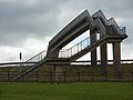
 Footbridge across the M65 motorway - geograph.org.uk - 5790940.jpg 800 × 580; 81 KB
-
 Footbridge across the M65 motorway - geograph.org.uk - 5790943.jpg 800 × 590; 101 KB
-
 Footbridge below Huncoat - geograph.org.uk - 3954505.jpg 4,320 × 3,240; 5.09 MB
-
 Footbridge over M65 - geograph.org.uk - 1596454.jpg 640 × 480; 60 KB
-
 Footbridge over the M65 - geograph.org.uk - 2324702.jpg 640 × 480; 96 KB
-
 Footbridge over the M65 - geograph.org.uk - 3954514.jpg 4,320 × 3,240; 4.03 MB
-
 Footbridge over the M65 - geograph.org.uk - 4223635.jpg 1,500 × 999; 118 KB
-
 Footbridge over the M65 Motorway - geograph.org.uk - 2935949.jpg 640 × 481; 516 KB
-
 Footpath beside Nether Holker House - geograph.org.uk - 3954494.jpg 4,320 × 3,240; 5.72 MB
-

-

-
 Footpath between Lower Clough Bank and Syke Side - geograph.org.uk - 3954540.jpg 4,320 × 3,240; 5.16 MB
-
 Footpath Junction Lower Moor Side Farm - geograph.org.uk - 2612065.jpg 3,648 × 2,736; 2.61 MB
-
 Footpath leaving Burnley Road - geograph.org.uk - 3378779.jpg 3,872 × 2,592; 3.65 MB
-
 Footpath near Livingstone Road - geograph.org.uk - 2056095.jpg 480 × 640; 148 KB
-
 Footpath off Burnley Road - geograph.org.uk - 3378785.jpg 3,872 × 2,592; 6.07 MB
-
 Footpath to The Old Engine - geograph.org.uk - 4843601.jpg 4,453 × 2,731; 6.74 MB
-
 Former site of Altham Vitriol Works - geograph.org.uk - 2324763.jpg 640 × 480; 107 KB
-
 Free electricity - geograph.org.uk - 2056082.jpg 640 × 480; 117 KB
-
 From St. James' churchyard in Altham - geograph.org.uk - 4014557.jpg 1,024 × 768; 713 KB
-
 GM Furniture Store - geograph.org.uk - 5229318.jpg 640 × 480; 42 KB
-
 Graveyard, St. James' Church, Altham - geograph.org.uk - 6127510.jpg 800 × 600; 209 KB
-
 Grazing near Allotment Hall Farm - geograph.org.uk - 6127490.jpg 800 × 600; 172 KB
-
 Houghton Barn Cottage - geograph.org.uk - 3707968.jpg 1,600 × 1,200; 518 KB
-

-
 Houghton Barn Farm - geograph.org.uk - 5941911.jpg 640 × 496; 63 KB
-
 Lancashire Tree Aid 1989s - geograph.org.uk - 2056092.jpg 640 × 480; 218 KB
-
 Leeds and Liverpool Canal - geograph.org.uk - 2935522.jpg 640 × 481; 533 KB
-
 Leeds and Liverpool Canal - geograph.org.uk - 2935922.jpg 640 × 480; 450 KB
-
 Leeds and Liverpool Canal - geograph.org.uk - 2935925.jpg 640 × 480; 636 KB
-
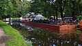
 Leeds and Liverpool Canal - geograph.org.uk - 6127476.jpg 800 × 600; 101 KB
-

-
 Leeds and Liverpool Canal Near Altham - geograph.org.uk - 2935916.jpg 640 × 480; 443 KB
-

-

-
 Leeds and Liverpool Canal Near Huncoat - geograph.org.uk - 2935958.jpg 640 × 481; 483 KB
-
 Leeds and Liverpool Canal near Huncoat - geograph.org.uk - 2935998.jpg 640 × 481; 555 KB
-
 Leeds and Liverpool Canal near Huncoat - geograph.org.uk - 5789910.jpg 800 × 588; 163 KB
-

-
 Leeds and Liverpool Canal, Altham Bridge - geograph.org.uk - 2935530.jpg 640 × 481; 575 KB
-

-
 Leeds and Liverpool Canal, Moorfield - geograph.org.uk - 2941405.jpg 640 × 481; 621 KB
-
 Leeds Liverpool Canal between Altham Lane and Clough Bank - geograph.org.uk - 3954488.jpg 4,320 × 3,240; 2.98 MB
-
 Leeds ^ Liverpool Canal - geograph.org.uk - 6252967.jpg 1,280 × 862; 803 KB
-
 Leeds ^ Liverpool Canal, Altham - geograph.org.uk - 6250285.jpg 1,280 × 850; 538 KB
-
 Leeds ^ Liverpool Canal, Altham - geograph.org.uk - 6251119.jpg 1,280 × 720; 543 KB
-
 Low Row, Altham - geograph.org.uk - 3954970.jpg 4,320 × 3,240; 3.23 MB
-
 Lower Clough Bank - geograph.org.uk - 2324742.jpg 480 × 640; 76 KB
-
 Lower Clough Bank - geograph.org.uk - 2324746.jpg 480 × 640; 103 KB
-
 Lower Clough Bank - geograph.org.uk - 2324748.jpg 640 × 480; 128 KB
-
 Lower Clough Bank - geograph.org.uk - 2324749.jpg 640 × 480; 124 KB
-
 Lower Clough Bank, Altham - geograph.org.uk - 6251120.jpg 1,280 × 875; 561 KB
-
 Lower Clough Bank, Altham - geograph.org.uk - 6251122.jpg 1,280 × 875; 603 KB
-
 Lychgate and War Memorial - geograph.org.uk - 2900431.jpg 640 × 480; 542 KB
-
 Lychgate, St. James' Church, Altham - geograph.org.uk - 6127508.jpg 800 × 600; 191 KB
-
 Lychgate, St. James', Altham - geograph.org.uk - 4016003.jpg 4,000 × 3,000; 4.08 MB
-
 Lydia Ernestine Becker memorial stone - geograph.org.uk - 6252971.jpg 1,280 × 850; 682 KB
-
 M65 eastbound near Clayton-le-Moors - geograph.org.uk - 4727501.jpg 640 × 481; 27 KB
-

-
 M65 looking West - geograph.org.uk - 1199047.jpg 640 × 480; 59 KB
-
 M65 looking West - geograph.org.uk - 2513622.jpg 2,430 × 1,819; 518 KB
-
 M65 looking West - geograph.org.uk - 2513646.jpg 2,417 × 1,812; 1.22 MB
-
 M65 Motorway Near Huncoat - geograph.org.uk - 2900375.jpg 640 × 480; 448 KB
-
 M65 Motorway Near Huncoat - geograph.org.uk - 2935974.jpg 640 × 481; 466 KB
-
 M65 motorway towards junction 7 - geograph.org.uk - 5790023.jpg 800 × 555; 83 KB
-
 M65 Near Huncoat - geograph.org.uk - 2937065.jpg 640 × 480; 477 KB
-
 M65, Altham Lane Bridge - geograph.org.uk - 3922056.jpg 640 × 480; 265 KB
-
 M65, Approaching Junction 8 - geograph.org.uk - 2900376.jpg 640 × 481; 438 KB
-

-
 Media Village - geograph.org.uk - 6127469.jpg 800 × 459; 62 KB
-
 Mile Stone, Burnley Road - geograph.org.uk - 1199419.jpg 640 × 490; 79 KB
-
 Milestone at Allotment Hall Farm - geograph.org.uk - 3494523.jpg 4,608 × 2,463; 2.26 MB
-
 Moor Side, Altham.jpg 4,010 × 3,006; 5.57 MB
-
 Moorfield Colliery Memorial - geograph.org.uk - 2941384.jpg 640 × 480; 593 KB
-
 Moorfield Colliery Memorial - geograph.org.uk - 2941392.jpg 640 × 481; 615 KB
-
 Moorfield Colliery Memorial - geograph.org.uk - 2941397.jpg 444 × 592; 453 KB
-
 Moorfield Colliery Memorial - geograph.org.uk - 6252976.jpg 1,280 × 850; 780 KB
-

-

-

-

-
 Nearer Holker House - geograph.org.uk - 1596440.jpg 640 × 480; 60 KB
-
 Nearer Holker House - geograph.org.uk - 2935993.jpg 640 × 481; 589 KB
-
 North along Altham Lane - geograph.org.uk - 2159159.jpg 800 × 600; 211 KB
-
 Northern Accrington from Whinney Hill - geograph.org.uk - 3379967.jpg 3,872 × 2,592; 4.81 MB
-
 Old milestone on Burnley Road (A678) - geograph.org.uk - 6127486.jpg 800 × 796; 208 KB
-
 Old stile near Smith's Bridge - geograph.org.uk - 2324735.jpg 480 × 640; 81 KB
-
 Old track at Clough Bank - geograph.org.uk - 2324728.jpg 640 × 480; 153 KB
-
 Old track south of Clough Bank Bridge - geograph.org.uk - 2324707.jpg 640 × 480; 126 KB
-
 One way at a time - geograph.org.uk - 819671.jpg 640 × 480; 53 KB
-
-
-

-

-
 Path through the churchyard at Altham - geograph.org.uk - 4014529.jpg 1,024 × 768; 704 KB
-
 Path to Nearer Holker House - geograph.org.uk - 2941185.jpg 480 × 640; 549 KB
-
 Pilkington Bridge - geograph.org.uk - 2941413.jpg 640 × 480; 488 KB
-
 Pipe Bridge - geograph.org.uk - 4571314.jpg 2,560 × 1,920; 3.03 MB
-
 Pipe Bridge 115A - geograph.org.uk - 5789859.jpg 800 × 560; 127 KB
-
 River Calder - geograph.org.uk - 2900455.jpg 640 × 480; 468 KB
-
 River Calder at Altham - geograph.org.uk - 5941990.jpg 640 × 463; 65 KB
-
 River Calder Near Altham - geograph.org.uk - 2900442.jpg 640 × 480; 431 KB
-
 River Calder, Altham Bridge - geograph.org.uk - 6127516.jpg 800 × 600; 106 KB
-
 River Calder, St James' Church Altham - geograph.org.uk - 2900443.jpg 640 × 480; 526 KB
-
 Road in Altham Business Park - geograph.org.uk - 3061530.jpg 640 × 480; 126 KB
-
 Road in Altham Business Park - geograph.org.uk - 3061537.jpg 640 × 480; 126 KB
-
 Road junction - geograph.org.uk - 674799.jpg 640 × 480; 174 KB
-
 Road to Moor Side House - geograph.org.uk - 2324771.jpg 480 × 640; 91 KB
-
 Roundabout at Altham on the A678 - geograph.org.uk - 4593706.jpg 1,024 × 768; 162 KB
-
 RSPCA Altham Animal Centre - geograph.org.uk - 3379940.jpg 3,872 × 2,592; 3.7 MB
-
 RSPCA Sanctuary, Nearer Holker House - geograph.org.uk - 2941190.jpg 640 × 479; 461 KB
-
 Ruin at Lower Clough Bank - geograph.org.uk - 3954533.jpg 4,320 × 3,240; 3.23 MB
-
 Settlement Pond, Whinney Hill - geograph.org.uk - 1470548.jpg 640 × 480; 90 KB
-

-

-
 Shoe tree^ - geograph.org.uk - 3707956.jpg 1,600 × 1,200; 1.08 MB
-

-


_2_Whalley_Road,_Clayton_Le_Moors,_Accrington,_Lancashire_BB5_5DT_-_geograph.org.uk_-_2390203.jpg)


_-_geograph.org.uk_-_4843791.jpg)


_-_geograph.org.uk_-_3953407.jpg)


_-_geograph.org.uk_-_2935516.jpg)


_-_geograph.org.uk_-_2908486.jpg)
_towards_Altham_-_geograph.org.uk_-_6127494.jpg)


,_Altham_-_geograph.org.uk_-_6127507.jpg)


_-_geograph.org.uk_-_6127486.jpg)


