Category:Alton, Hampshire
Jump to navigation
Jump to search
town in Hampshire, England  | |||||
| Upload media | |||||
| Instance of | |||||
|---|---|---|---|---|---|
| Location | East Hampshire, Hampshire, South East England, England | ||||
| Different from | |||||
| official website | |||||
 | |||||
English: Alton is a small market town in Hampshire, England, to the southwest of Farnham. It had a population of 16,584 at the 1991 census, and is administered by East Hampshire district council.
Subcategories
This category has the following 17 subcategories, out of 17 total.
A
- Alton College (1 P, 10 F)
- Alton Town Hall, Hampshire (11 F)
B
C
M
- Maps of Alton, Hampshire (4 F)
N
- Neatham (2 F)
P
R
- Alton railway station (167 F)
S
- Streets in Alton, Hampshire (19 F)
Pages in category "Alton, Hampshire"
This category contains only the following page.
Media in category "Alton, Hampshire"
The following 200 files are in this category, out of 643 total.
(previous page) (next page)-
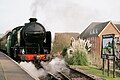
 "Black Five" entering Alton station - geograph.org.uk - 5584099.jpg 5,202 × 3,465; 2.53 MB
-
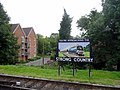 "Strong Country" sign, Alton Station, Hampshire - geograph.org.uk - 3111846.jpg 1,024 × 768; 503 KB
-
 'Cheltenham' at Alton - geograph.org.uk - 5641026.jpg 4,177 × 2,785; 7.81 MB
-
 'Cheltenham' at Alton - geograph.org.uk - 5641042.jpg 4,070 × 2,714; 7.66 MB
-
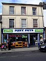 'Just Pets', High Street, Alton - geograph.org.uk - 2715045.jpg 767 × 1,024; 160 KB
-
 106-112 High St, Alton.jpg 4,608 × 3,456; 3.64 MB
-
 11 Windmill Lane - geograph.org.uk - 3466803.jpg 640 × 427; 162 KB
-
 11 Windmill Lane - geograph.org.uk - 3479330.jpg 640 × 303; 109 KB
-
 12 Normandy St, Alton.jpg 2,912 × 3,117; 1.4 MB
-

-
 14, 12, 10 High Street, alton - geograph.org.uk - 3971597.jpg 3,771 × 2,820; 1.86 MB
-
-
 1979 GMC motorhome - Alton, Hampshire - UK (17314667625).jpg 4,000 × 2,248; 5.28 MB
-
 2016, a year on Geograph (Day 127) - geograph.org.uk - 4938983.jpg 640 × 480; 125 KB
-
 2016, a year on Geograph (Day 160) - geograph.org.uk - 4988027.jpg 640 × 480; 73 KB
-
 2016, a year on Geograph (Day 279) - geograph.org.uk - 5145202.jpg 640 × 480; 59 KB
-
 21 and 19 Normandy Street, Alton.jpg 3,496 × 2,939; 1.75 MB
-
 230SL (10024847156).jpg 3,872 × 2,592; 4.04 MB
-
 3 Normandy Street and 1 High Street, Alton - geograph.org.uk - 3971662.jpg 4,320 × 3,240; 2.39 MB
-
 43-45 Normandy St, Alton.jpg 4,608 × 3,456; 3.92 MB
-
 5 Normandy St, Alton.jpg 2,205 × 3,173; 1.09 MB
-
 6 High St, Alton.jpg 2,288 × 2,884; 1.33 MB
-
 A battlefield^ - geograph.org.uk - 5755786.jpg 640 × 360; 69 KB
-
 A bit of a mess - geograph.org.uk - 2315696.jpg 2,272 × 1,704; 2.17 MB
-
 A history of Hampshire and the Isle of Wight (Page 472) BHL20977735.jpg 1,788 × 1,599; 1.08 MB
-

-
 A31 bridge over the A339 - geograph.org.uk - 5212589.jpg 640 × 426; 58 KB
-
 A31 crosses the railway - geograph.org.uk - 4070220.jpg 3,648 × 2,736; 2.17 MB
-
 A31 north of Neatham Manor - geograph.org.uk - 4070216.jpg 3,572 × 2,667; 1.5 MB
-
 A31 northwest of Kiln House - geograph.org.uk - 4070193.jpg 3,648 × 2,736; 1.42 MB
-
 Aga, Market Street - geograph.org.uk - 4330096.jpg 480 × 640; 49 KB
-
 Aldersey Fields, Alton - geograph.org.uk - 6221623.jpg 1,024 × 768; 215 KB
-
 All Saints Church, Alton - geograph.org.uk - 5682633.jpg 1,236 × 1,600; 460 KB
-

-

-
 All Saints, Alton, incumbency board - geograph.org.uk - 6133740.jpg 640 × 419; 58 KB
-
 Alton (Hampshire) banner The Public Gardens.jpg 2,800 × 400; 723 KB
-
 Alton - Bus Rally 2016 - geograph.org.uk - 5271731.jpg 2,560 × 1,920; 2.21 MB
-
 Alton - Bus Rally 2016 - geograph.org.uk - 5271733.jpg 2,097 × 1,417; 1.53 MB
-
 Alton - Bus Rally 2016 - geograph.org.uk - 5271735.jpg 2,560 × 1,920; 2.18 MB
-
 Alton - Crown Hotel - geograph.org.uk - 5272676.jpg 2,560 × 1,920; 2.38 MB
-
 Alton - Grave of Fanny Adams - geograph.org.uk - 1354595.jpg 2,592 × 3,872; 3.09 MB
-
 Alton - High Street - geograph.org.uk - 5272671.jpg 2,560 × 1,920; 3.08 MB
-
 Alton - Market Place - geograph.org.uk - 5272677.jpg 2,560 × 1,920; 2.64 MB
-
 Alton - Public Gardens - geograph.org.uk - 5272756.jpg 2,560 × 1,920; 3.49 MB
-
 Alton - River Wey - geograph.org.uk - 5272684.jpg 2,560 × 1,920; 3.72 MB
-
 Alton 10 Jan.JPG 3,872 × 2,592; 4.17 MB
-
 Alton Brewery - geograph.org.uk - 2589080.jpg 2,560 × 1,920; 2.32 MB
-
 Alton Bypass - geograph.org.uk - 2589032.jpg 2,560 × 1,920; 2.45 MB
-
 Alton Cemetery - geograph.org.uk - 6221637.jpg 1,024 × 768; 148 KB
-
-
 Alton Cleaning Centre, High Street - geograph.org.uk - 4323150.jpg 480 × 640; 79 KB
-
 Alton Community Centre - geograph.org.uk - 3973296.jpg 3,602 × 2,699; 1.55 MB
-
 Alton Computers, Market Street - geograph.org.uk - 4330513.jpg 480 × 640; 59 KB
-
 Alton Eye Care, Market Street - geograph.org.uk - 4330519.jpg 480 × 640; 48 KB
-
 Alton hampshire 1666.png 1,936 × 1,624; 6.38 MB
-
 Alton High Street - geograph.org.uk - 1138141.jpg 640 × 427; 98 KB
-
 Alton High Street - panoramio.jpg 1,050 × 700; 732 KB
-
 Alton House Hotel - geograph.org.uk - 945827.jpg 640 × 455; 117 KB
-
 Alton House Hotel.jpg 4,608 × 3,456; 3.71 MB
-
 Alton Infant School - geograph.org.uk - 2314860.jpg 2,272 × 1,704; 2.33 MB
-
 Alton Infant School - geograph.org.uk - 3971630.jpg 2,884 × 2,160; 1,005 KB
-
 Alton King's Pond Gauging Station - geograph.org.uk - 2589058.jpg 2,560 × 1,920; 2.42 MB
-
 Alton library - geograph.org.uk - 282574.jpg 640 × 458; 77 KB
-
 Alton Model Centre - geograph.org.uk - 3971651.jpg 3,792 × 2,841; 1.69 MB
-
 Alton Nails, High Street - geograph.org.uk - 4330112.jpg 480 × 640; 57 KB
-
 Alton Parish Church hit by lightning 24 June 1880 - geograph.org.uk - 5839711.jpg 2,003 × 2,501; 3.72 MB
-

-
 Alton Post Office, High Street - geograph.org.uk - 4325241.jpg 640 × 480; 68 KB
-
 Alton Railway Station - geograph.org.uk - 5304643.jpg 4,000 × 2,666; 7.76 MB
-
 Alton Railway Station - geograph.org.uk - 5304646.jpg 3,973 × 2,648; 5.4 MB
-
 Alton Sports, Butts Road - geograph.org.uk - 5752685.jpg 640 × 360; 55 KB
-
 Alton Station - geograph.org.uk - 4868910.jpg 640 × 427; 64 KB
-
 Alton Station - geograph.org.uk - 5075253.jpg 2,304 × 1,728; 833 KB
-
 Alton Station - threatened bridge - geograph.org.uk - 4960247.jpg 640 × 427; 65 KB
-
 Alton Station car park - geograph.org.uk - 5075825.jpg 2,304 × 1,728; 800 KB
-
 Alton Station platform - geograph.org.uk - 5075250.jpg 2,304 × 1,728; 854 KB
-
 Alton Station platform - geograph.org.uk - 5075258.jpg 2,304 × 1,728; 812 KB
-
 Alton station, looking north - geograph.org.uk - 6223040.jpg 1,600 × 975; 534 KB
-
 Alton station, looking north - geograph.org.uk - 6223049.jpg 1,600 × 910; 510 KB
-
 Alton station, looking south - geograph.org.uk - 6223062.jpg 1,600 × 1,058; 584 KB
-
 Alton station. Mid Hants Railway platform - geograph.org.uk - 5584107.jpg 5,202 × 3,465; 3.19 MB
-
 Alton United F.C. - geograph.org.uk - 2430993.jpg 2,560 × 1,920; 2.37 MB
-

-
 Alton, Flood Meadows - geograph.org.uk - 2434013.jpg 2,560 × 1,920; 2.42 MB
-
 Alton, Hampshire - England (UK) (11656082284).jpg 3,552 × 2,000; 3.76 MB
-
 Alton, Hampshire.jpg 4,608 × 2,592; 5.29 MB
-
 Alton, High Street banks - geograph.org.uk - 3190481.jpg 640 × 480; 73 KB
-
 Alton, the Assembly Rooms - geograph.org.uk - 3190474.jpg 640 × 480; 61 KB
-
 Alton, the High Street - geograph.org.uk - 3190471.jpg 480 × 640; 78 KB
-
 Alton, the Market Square - geograph.org.uk - 3190454.jpg 640 × 480; 75 KB
-
 Amery Cottage, Alton - geograph.org.uk - 3973291.jpg 3,201 × 2,393; 1.66 MB
-
 Amery Hill - geograph.org.uk - 4775100.jpg 1,600 × 1,067; 1.19 MB
-
 Amery Hill School in the gloaming - geograph.org.uk - 2178494.jpg 640 × 480; 78 KB
-
 Amery Hill, Alton - geograph.org.uk - 3973287.jpg 2,883 × 2,160; 814 KB
-
 Amery Street - geograph.org.uk - 2434029.jpg 2,560 × 1,920; 2.35 MB
-
 Amery Street, Alton - geograph.org.uk - 3973310.jpg 2,883 × 2,160; 934 KB
-
 Amery Street, Alton - geograph.org.uk - 3973443.jpg 2,884 × 2,160; 863 KB
-
 Amery Street, April 2018 - geograph.org.uk - 5752720.jpg 360 × 640; 35 KB
-
 An historic doorway (2) - geograph.org.uk - 5755790.jpg 360 × 640; 45 KB
-
 An historic doorway - geograph.org.uk - 5755788.jpg 361 × 640; 72 KB
-

-
 Anstey Park, Alton - geograph.org.uk - 5555589.jpg 4,608 × 3,456; 3.06 MB
-
 Anstey Park, Alton United FC - geograph.org.uk - 2430989.jpg 2,560 × 1,920; 2.23 MB
-
 Anstey Road, Alton - geograph.org.uk - 2434199.jpg 2,560 × 1,920; 2.01 MB
-
 Anstey Road, Alton - geograph.org.uk - 6221355.jpg 1,024 × 768; 148 KB
-
 Any Old Iron^ - geograph.org.uk - 2433954.jpg 2,560 × 1,920; 2.24 MB
-
 Approaching Butts Bridge, Alton - geograph.org.uk - 2954902.jpg 1,600 × 1,200; 571 KB
-
 Approaching the bend on Bolle Road - geograph.org.uk - 4125584.jpg 800 × 600; 151 KB
-
 Arriving at Alton - geograph.org.uk - 5304641.jpg 4,610 × 3,073; 5.63 MB
-
 Assembly Rooms - geograph.org.uk - 2434074.jpg 2,560 × 1,920; 1.78 MB
-
 Assembly Rooms, Alton - geograph.org.uk - 736792.jpg 640 × 480; 129 KB
-
 B3004 towards Alton - geograph.org.uk - 4841981.jpg 640 × 480; 77 KB
-
 B3006 at Whitehouse Farm - geograph.org.uk - 4710452.jpg 1,024 × 417; 71 KB
-
 B3006 towards Selborne - geograph.org.uk - 4841999.jpg 640 × 428; 93 KB
-
 Backs of buildings in Market Street, Alton - geograph.org.uk - 3971538.jpg 4,320 × 3,240; 2.25 MB
-
 Bandstand in the public garden - geograph.org.uk - 2260149.jpg 640 × 434; 89 KB
-
 Barclays, High Street - geograph.org.uk - 4330543.jpg 480 × 640; 53 KB
-
 Barn by Brick Kiln Lane - geograph.org.uk - 4575043.jpg 640 × 428; 123 KB
-
 Barn with pheasant at Manor Farm - geograph.org.uk - 2284872.jpg 800 × 600; 152 KB
-
 Basingstoke Road - approaching Alton - geograph.org.uk - 1980342.jpg 640 × 442; 69 KB
-
 Basingstoke Road - geograph.org.uk - 1369229.jpg 640 × 427; 108 KB
-
 Basingstoke Road, Alton - geograph.org.uk - 4360981.jpg 1,600 × 1,200; 608 KB
-
 Beer Barrels - geograph.org.uk - 2589113.jpg 2,560 × 1,920; 2.26 MB
-
 Bench and postbox on Kings Road - geograph.org.uk - 4123715.jpg 800 × 600; 172 KB
-
 Bennet Close, Alton - geograph.org.uk - 1092603.jpg 640 × 427; 87 KB
-
 Bert (9985166015).jpg 3,312 × 2,476; 5.14 MB
-
 Between the lines, Market Street - geograph.org.uk - 4330094.jpg 480 × 640; 42 KB
-
 Bikers turning into Church Street - geograph.org.uk - 5755787.jpg 640 × 360; 48 KB
-
 Bird notes (1911) (14561865439).jpg 2,528 × 1,594; 611 KB
-
 Blue plaque in the High Street (a) - geograph.org.uk - 4329335.jpg 640 × 480; 63 KB
-
 Bollards in Amery Hill - geograph.org.uk - 2178519.jpg 640 × 480; 55 KB
-
 Bonham's Farm - geograph.org.uk - 2315732.jpg 2,272 × 1,704; 2.25 MB
-

-
 Borovere Gardens - geograph.org.uk - 4905978.jpg 3,264 × 1,840; 1.62 MB
-

-
 BP petrol station on Butts Road, Alton - geograph.org.uk - 5075929.jpg 2,304 × 1,728; 855 KB
-
 Bridleway by Cuckoo's Corner - geograph.org.uk - 2349124.jpg 2,560 × 1,920; 1.78 MB
-
 Bridleway reaches Brockham Hill Lane - geograph.org.uk - 2285595.jpg 800 × 600; 172 KB
-
 Brockham Hill from Howards Lane - geograph.org.uk - 1128166.jpg 640 × 414; 115 KB
-
 Building at Alton College - geograph.org.uk - 4575039.jpg 640 × 428; 99 KB
-
 Buildings on Church Street - geograph.org.uk - 4775095.jpg 1,600 × 1,075; 1.02 MB
-
 Bungalows south of Queens Road - geograph.org.uk - 4125543.jpg 800 × 600; 184 KB
-
 Bus in Orchard Lane - geograph.org.uk - 3285403.jpg 640 × 480; 98 KB
-

-
 Bus stop outside Vodafone - geograph.org.uk - 4328701.jpg 480 × 640; 71 KB
-
 Bus stops on the A31 near Holybourne - geograph.org.uk - 2284858.jpg 800 × 600; 74 KB
-

-
 Butterys Court - geograph.org.uk - 3971623.jpg 2,883 × 2,160; 1.2 MB
-
 Butties Alley to Market Street - geograph.org.uk - 1138133.jpg 640 × 427; 74 KB
-
 Butts Bridge - Watercress Line - geograph.org.uk - 1853962.jpg 800 × 567; 132 KB
-
 Butts Bridge, Mid Hants Railway - geograph.org.uk - 3548377.jpg 640 × 480; 169 KB
-
 Butts Bridge, Watercress Line building works 01.jpg 4,128 × 3,096; 5.76 MB
-
 Butts Bridge, Watercress Line building works 02.jpg 4,128 × 3,096; 7.05 MB
-
 Butts Road, Alton - geograph.org.uk - 1454561.jpg 640 × 480; 68 KB
-
 Butts Road, Alton - geograph.org.uk - 1454571.jpg 640 × 480; 100 KB
-
 Butts Road, Alton - geograph.org.uk - 2788435.jpg 4,288 × 3,216; 3.75 MB
-
 Cadnam Farm - geograph.org.uk - 2430998.jpg 2,560 × 1,920; 2.35 MB
-
 Cadnam Farm north of Alton - geograph.org.uk - 2285578.jpg 800 × 600; 139 KB
-
 Caffè Nero, High Street - geograph.org.uk - 4330110.jpg 480 × 640; 54 KB
-
 Caker Stream.jpg 3,264 × 1,836; 3.55 MB
-
 Car park entrance in Vicarage Hill - geograph.org.uk - 5755778.jpg 640 × 360; 89 KB
-
 Cardiac Rehab Shop, Market Street - geograph.org.uk - 4330516.jpg 640 × 480; 78 KB
-
 Cars in the High Street - geograph.org.uk - 3285444.jpg 640 × 480; 65 KB
-
 CCTV camera in the High Street - geograph.org.uk - 4325898.jpg 480 × 640; 63 KB
-
 Charters, High Street - geograph.org.uk - 4330081.jpg 640 × 480; 78 KB
-
 Chauntsingers Cottages - geograph.org.uk - 3973255.jpg 3,882 × 2,910; 2.06 MB
-
 Chauntsingers Road, Alton - geograph.org.uk - 6221370.jpg 1,024 × 768; 137 KB
-
 Chauntsingers Road, Alton - geograph.org.uk - 6221613.jpg 1,024 × 768; 124 KB
-
 Chauntsingers Road, Alton - geograph.org.uk - 6221646.jpg 1,024 × 768; 142 KB
-
 Chemists in the High Street - geograph.org.uk - 4330080.jpg 640 × 480; 83 KB
-
 Child patients on the beach Wellcome L0074521.jpg 4,603 × 3,744; 8.51 MB
-
 Children in the sun, 1937 Wellcome L0074519.jpg 4,781 × 3,646; 7.67 MB
-
 Chinese Medic, High Street - geograph.org.uk - 4328700.jpg 480 × 640; 75 KB
-
 Christmas at Alton Red Cross Hospital.jpg 700 × 442; 103 KB
-

-
 Church Street, Alton - geograph.org.uk - 2434103.jpg 2,560 × 1,920; 2.25 MB
-
 Church Street, Alton - geograph.org.uk - 2788646.jpg 4,288 × 3,216; 3.84 MB
-
 Church Street, Alton - geograph.org.uk - 5690427.jpg 1,600 × 1,216; 443 KB
-
 Church Street, Alton - geograph.org.uk - 6221614.jpg 1,024 × 768; 130 KB
-

-
 Communication tower on Mill Road, Alton - geograph.org.uk - 5076022.jpg 2,304 × 1,728; 881 KB
-
 Connaught Way, Alton - geograph.org.uk - 2230006.jpg 480 × 640; 105 KB
-
 Coor's Brewery, Alton - geograph.org.uk - 945743.jpg 640 × 455; 65 KB
-
 Coor's Brewery, Alton - geograph.org.uk - 945758.jpg 408 × 640; 54 KB
-
 Coor's Brewery, Alton - geograph.org.uk - 945762.jpg 640 × 455; 101 KB
-
 Coors Alton.JPG 4,928 × 3,264; 6.51 MB
-
 Cottage in the High Street - geograph.org.uk - 3285446.jpg 640 × 480; 73 KB
-
 Cottages along Church Lane - geograph.org.uk - 3097701.jpg 640 × 429; 62 KB
-
 Cottages along Church Street - geograph.org.uk - 4775090.jpg 1,600 × 1,067; 1.07 MB
-
 Cottages in Church Street, Alton - geograph.org.uk - 3973261.jpg 2,883 × 2,160; 1.12 MB
-
 Cottages in Church Street, Alton - geograph.org.uk - 3973265.jpg 4,320 × 3,240; 2.21 MB
-
 Cottages in London Road, Holybourne - geograph.org.uk - 3480308.jpg 640 × 427; 85 KB
-
 Crank Cycles, High Street - geograph.org.uk - 4324068.jpg 480 × 640; 84 KB
-
 Cresta (10001514343).jpg 3,412 × 2,508; 5.26 MB
-
 Cromwell House, Alton - geograph.org.uk - 2788462.jpg 4,288 × 3,216; 3.81 MB
-
 Cromwell House, Church Street, Alton - geograph.org.uk - 3973273.jpg 4,320 × 3,240; 1.93 MB
-
 Cross ^ Pillory Lane - geograph.org.uk - 5752699.jpg 640 × 360; 52 KB
-
 Crown Close, Alton 01 - Assembly Rooms.jpg 4,608 × 3,456; 4.12 MB
-
 Crown Close, Alton 02.jpg 4,608 × 3,456; 4.07 MB


.jpg)

.jpg)
.jpg)
_-_geograph.org.uk_-_4938983.jpg)
_-_geograph.org.uk_-_4988027.jpg)
_-_geograph.org.uk_-_5145202.jpg)

.jpg)


_BHL20977735.jpg)


_(11656082284).jpg)


_-_geograph.org.uk_-_5755790.jpg)


.jpg)


_(14561865439).jpg)
_-_geograph.org.uk_-_4329335.jpg)


.jpg)


_banner_The_Public_Gardens.jpg)