Category:Alvanley
Aller à la navigation
Aller à la recherche
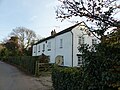
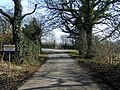
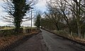
English: Alvanley is a small rural village and civil parish near the village of Helsby, in the unitary authority of Cheshire West and Chester and the ceremonial county of Cheshire, England.
village britannique  | |||||
| Téléverser des médias | |||||
| Nature de l’élément | |||||
|---|---|---|---|---|---|
| Lieu | Cheshire West and Chester, Cheshire, Angleterre du Nord-Ouest, Angleterre | ||||
 | |||||
Sous-catégories
Cette catégorie comprend 3 sous-catégories, dont les 3 ci-dessous.
Média dans la catégorie « Alvanley »
Cette catégorie comprend 123 fichiers, dont les 123 ci-dessous.
-
 Alvanley Road, Helsby - geograph.org.uk - 4521443.jpg 3 000 × 2 250 ; 1,36 Mio
-
 Ash Cottage, Alvanley 01.jpg 4 000 × 3 000 ; 4,78 Mio
-
 Ash Cottage, Alvanley 02.jpg 3 000 × 4 000 ; 4,59 Mio
-
 B5393 at Crabtree Farm - geograph.org.uk - 3359527.jpg 640 × 480 ; 48 kio
-
 B5393 Manley Road - geograph.org.uk - 1995936.jpg 4 416 × 3 312 ; 5,16 Mio
-
 Back Lane, Helsby - geograph.org.uk - 4521474.jpg 2 000 × 1 500 ; 867 kio
-
 Barn at Poplar Tree Farmhouse, Alvanley.jpg 4 000 × 3 000 ; 4,7 Mio
-
 Barn in frosty weather - geograph.org.uk - 2183968.jpg 1 024 × 768 ; 205 kio
-
 Bridge, Primrose Lane - geograph.org.uk - 6242314.jpg 1 024 × 576 ; 333 kio
-
 Burrows Lane, off Commonside - geograph.org.uk - 2652055.jpg 640 × 480 ; 110 kio
-
 Bushells Lane-New Pale Road junction - geograph.org.uk - 2560896.jpg 640 × 480 ; 50 kio
-
 Caravan Site - geograph.org.uk - 1735055.jpg 3 648 × 2 736 ; 4,25 Mio
-
 Cheshire Farmland near Lowerhall Farm - geograph.org.uk - 331533.jpg 640 × 480 ; 160 kio
-
 Church House Farm, Alvanley.jpg 4 000 × 3 000 ; 4,82 Mio
-
 Clematis Cottage, Alvanley.jpg 1 800 × 1 350 ; 1,22 Mio
-
 Commonside - geograph.org.uk - 4522576.jpg 3 000 × 2 250 ; 1,37 Mio
-
 Commonside approaching the B5393 - geograph.org.uk - 2560928.jpg 640 × 480 ; 57 kio
-
 Commonside at Burrows Lane - geograph.org.uk - 2560916.jpg 640 × 480 ; 104 kio
-
 Commonside Farm, Alvanley.JPG 1 200 × 900 ; 290 kio
-
 Crops at Commonside Farm - geograph.org.uk - 4522541.jpg 3 000 × 2 250 ; 2,33 Mio
-
 Crossroads at Alvanley - geograph.org.uk - 4524252.jpg 2 500 × 1 875 ; 1,56 Mio
-
 Crossroads at Alvanley - geograph.org.uk - 4524257.jpg 3 000 × 2 250 ; 1,64 Mio
-
 Cut Mark, Bank House Farm, Alvanley - geograph.org.uk - 2267560.jpg 3 648 × 2 736 ; 3,47 Mio
-
 Cut Mark, Greengate Farm, Towers Lane, Alvanley - geograph.org.uk - 2267553.jpg 3 648 × 2 736 ; 3,37 Mio
-
 Cut Mark, Railway Bridge, Towers Lane, Helsby-Alvanley - geograph.org.uk - 2307629.jpg 3 648 × 2 736 ; 4,47 Mio
-
 D&N Garden Products, Commonside - geograph.org.uk - 4521571.jpg 3 000 × 2 250 ; 1,12 Mio
-
 Farm buildings at Greengate Farm - geograph.org.uk - 4665451.jpg 3 000 × 2 250 ; 1,58 Mio
-
 Farmland north of Alvanley - geograph.org.uk - 5963212.jpg 5 184 × 3 888 ; 4,81 Mio
-
 Footpath and Sandstone Ridge - geograph.org.uk - 1995950.jpg 4 416 × 3 312 ; 3,55 Mio
-
 Footpath at Wheeldon Copse - geograph.org.uk - 4524280.jpg 2 000 × 1 500 ; 1,42 Mio
-
 Footpath at Wheeldon Copse - geograph.org.uk - 4524282.jpg 2 000 × 1 500 ; 1,57 Mio
-
 Footpath through Helsby Golf Club - geograph.org.uk - 4664419.jpg 4 000 × 3 000 ; 2,77 Mio
-
 Footpath through Helsby Golf Club - geograph.org.uk - 4664425.jpg 3 000 × 2 250 ; 1,95 Mio
-
 Footpath to Buckoak - geograph.org.uk - 4666757.jpg 3 000 × 2 250 ; 2,2 Mio
-
 Footpath to Maiden's Cross - geograph.org.uk - 4524297.jpg 2 000 × 1 500 ; 1,2 Mio
-
 Footpath to the Road - geograph.org.uk - 1995586.jpg 4 416 × 3 312 ; 3,34 Mio
-
 Footpath to Towers Lane - geograph.org.uk - 4665354.jpg 3 000 × 2 250 ; 1,85 Mio
-
 Footpath towards Alvanley - geograph.org.uk - 1995578.jpg 4 416 × 3 312 ; 4,19 Mio
-
 Four Lane Ends junction - geograph.org.uk - 2560899.jpg 640 × 480 ; 67 kio
-
 Frodsham Road - geograph.org.uk - 2640688.jpg 640 × 426 ; 67 kio
-
 Frosty morning on North Cheshire Way near Alvanley - geograph.org.uk - 2183972.jpg 1 024 × 768 ; 324 kio
-
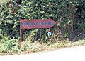
 Guidepost at Four Lane End, Alvanley, England.jpg 3 712 × 5 568 ; 14,52 Mio
-
 Helsby Golf Course - geograph.org.uk - 2788129.jpg 640 × 480 ; 118 kio
-
 Landscape at Commonside - geograph.org.uk - 4522587.jpg 3 000 × 2 250 ; 1,78 Mio
-
 Lane Junction, Helsby - geograph.org.uk - 4521458.jpg 3 000 × 2 250 ; 1,7 Mio
-
 Manley Mere - geograph.org.uk - 214252.jpg 640 × 438 ; 103 kio
-
 Manley Road, Alvanley - geograph.org.uk - 4665467.jpg 3 000 × 2 250 ; 1,6 Mio
-
 New Pale Road - geograph.org.uk - 4524302.jpg 2 500 × 1 875 ; 1,09 Mio
-

-
 Path (?) through the rape - geograph.org.uk - 433073.jpg 640 × 480 ; 169 kio
-

-
 Peck Mill Lane looking east - geograph.org.uk - 3359511.jpg 640 × 480 ; 161 kio
-
 Poplar Tree Farmhouse, Alvanley.jpg 4 000 × 3 000 ; 4,45 Mio
-
 Redundant kissing gate - geograph.org.uk - 5963220.jpg 5 184 × 3 888 ; 6,92 Mio
-
 Ridgeway heading towards Commonside and Four Lane Ends - geograph.org.uk - 5978123.jpg 4 000 × 3 000 ; 4,44 Mio
-
 Ridgeway Wood from the Sandstone Trail - geograph.org.uk - 2817764.jpg 1 600 × 1 198 ; 759 kio
-
 Sandstone outcrop beside the Sandstone Trail - geograph.org.uk - 430921.jpg 637 × 477 ; 556 kio
-
 Sandstone signpost near Alvanley Cliff - geograph.org.uk - 2817789.jpg 1 600 × 1 198 ; 693 kio
-
 Sandstone Trail signpost on the Ridgeway - geograph.org.uk - 2817760.jpg 1 600 × 1 198 ; 857 kio
-
 Signpost and Cheshire Railings - geograph.org.uk - 4521515.jpg 3 000 × 2 250 ; 1,86 Mio
-
 St John's Church at Alvanley - geograph.org.uk - 4788034.jpg 4 557 × 2 695 ; 6,51 Mio
-
 Stile and footpath near Alvanley - geograph.org.uk - 4665348.jpg 3 000 × 2 250 ; 2,63 Mio
-
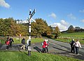
 Sunday walkers leaving me behind - geograph.org.uk - 2177899.jpg 627 × 463 ; 100 kio
-
 Tarvin Road (B5393) near Alvanley - geograph.org.uk - 4521484.jpg 3 000 × 2 250 ; 1,54 Mio
-
 The Dismantled Helsby to Mouldsworth Railway - geograph.org.uk - 4665338.jpg 2 000 × 1 500 ; 1,56 Mio
-
 The greens at Helsby Golf Club - geograph.org.uk - 2788128.jpg 640 × 480 ; 115 kio
-
 The Longster Trail at Commonside - geograph.org.uk - 4522536.jpg 3 000 × 2 250 ; 1,78 Mio
-
 The Longster Trail at The Green - geograph.org.uk - 4666746.jpg 3 000 × 2 250 ; 2,03 Mio
-
 The North Cheshire Way near Helsby - geograph.org.uk - 4521557.jpg 2 000 × 1 500 ; 1,49 Mio
-
 The North Cheshire Way near Helsby - geograph.org.uk - 4665329.jpg 3 000 × 2 250 ; 1,8 Mio
-
 The Ridgeway - geograph.org.uk - 4788253.jpg 4 304 × 2 631 ; 6,49 Mio
-
 The Rock, Helsby - geograph.org.uk - 4521452.jpg 3 000 × 2 250 ; 1,85 Mio
-
 The Sandstone Trail - geograph.org.uk - 4522789.jpg 3 000 × 2 250 ; 1,88 Mio
-
 The Sandstone Trail - geograph.org.uk - 4522796.jpg 2 933 × 2 200 ; 1,78 Mio
-
 The Sandstone Trail - geograph.org.uk - 4522799.jpg 2 500 × 1 875 ; 1,93 Mio
-
 The Sandstone Trail - geograph.org.uk - 4794193.jpg 4 155 × 2 772 ; 7,64 Mio
-
 The Sandstone Trail near Queen Charlotte's Wood - geograph.org.uk - 2817769.jpg 1 600 × 1 198 ; 613 kio
-
 The Sandstone Trail skirts Alvanley Cliff - geograph.org.uk - 2817774.jpg 1 600 × 1 198 ; 564 kio
-
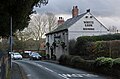
 The White Lion at Alvanley - geograph.org.uk - 214278.jpg 640 × 481 ; 120 kio
-
 The White Lion at Alvanley - geograph.org.uk - 4787181.jpg 4 181 × 2 743 ; 7,74 Mio
-
 The White Lion, Alvanley - geograph.org.uk - 4572124.jpg 3 184 × 2 123 ; 1,47 Mio
-
 They went two by two - geograph.org.uk - 2177902.jpg 611 × 441 ; 110 kio
-
 Towers Lane looking east - geograph.org.uk - 3359514.jpg 640 × 480 ; 147 kio
-
 Towers Lane, off Manley Road - geograph.org.uk - 2652028.jpg 640 × 480 ; 76 kio
-
 View from near Alvanley - geograph.org.uk - 5009149.jpg 640 × 437 ; 144 kio
-
 View from the North Cheshire Way - geograph.org.uk - 4665369.jpg 4 000 × 3 000 ; 2,18 Mio
-
 View towards Frodsham Hill - geograph.org.uk - 4521529.jpg 3 000 × 2 250 ; 1,78 Mio
-
 Wheeldon Copse - geograph.org.uk - 2614581.jpg 1 024 × 768 ; 209 kio
-
 Wheeldon Copse Wildflower Meadow - geograph.org.uk - 207143.jpg 640 × 480 ; 169 kio
-
 Wheeldon Copse, Avanley - geograph.org.uk - 4524277.jpg 2 500 × 1 875 ; 1,93 Mio
-
 Wheeldon Copse, Avanley - geograph.org.uk - 4524284.jpg 2 000 × 1 500 ; 1,44 Mio
-
 White Lion PH, Alvanley - geograph.org.uk - 433077.jpg 640 × 480 ; 154 kio
-
 Yarrangall Green heading towards Crabtree Farm and the B5393 road - geograph.org.uk - 5978132.jpg 4 000 × 3 000 ; 4,81 Mio
-
 Alvanley - path through barley. - geograph.org.uk - 175819.jpg 640 × 480 ; 62 kio
-
 Alvanley - view along the Sandstone Trail - geograph.org.uk - 499646.jpg 640 × 480 ; 112 kio
-
 Alvanley - view from the Sandstone Trail - geograph.org.uk - 499643.jpg 640 × 480 ; 94 kio
-
 Alvanley - view from the Sandstone Trail - geograph.org.uk - 499645.jpg 640 × 480 ; 112 kio
-
 Cheshire CC footpath sign - geograph.org.uk - 219051.jpg 393 × 640 ; 141 kio
-
 Claim Farm near Delamere Forest - geograph.org.uk - 31336.jpg 640 × 480 ; 91 kio
-
 Crabtree farm - geograph.org.uk - 219032.jpg 635 × 476 ; 150 kio
-
 Direction sign for Manley Old Hall - geograph.org.uk - 214265.jpg 640 × 466 ; 151 kio
-
 Fishing pool near Manley Old Hall - geograph.org.uk - 430925.jpg 640 × 480 ; 122 kio
-
 Footpath and Gate Entrance - geograph.org.uk - 331503.jpg 640 × 480 ; 272 kio
-
 Footpath and Kissing gate - geograph.org.uk - 507206.jpg 640 × 480 ; 150 kio
-
 Frodsham - view along footpath 83 - geograph.org.uk - 499638.jpg 640 × 480 ; 169 kio
-
 Frodsham - view from Waterloo Lane - geograph.org.uk - 499636.jpg 640 × 480 ; 118 kio
-
 Hairpin Bend at Lowerhall Farm - geograph.org.uk - 331515.jpg 640 × 480 ; 215 kio
-
 Hidden valley near The Royalty, Frodsham - geograph.org.uk - 175815.jpg 640 × 480 ; 105 kio
-
 Landslide - in Cheshire^^ - geograph.org.uk - 736762.jpg 640 × 480 ; 97 kio
-
 Manley - view along the Delamere Way - geograph.org.uk - 499632.jpg 640 × 480 ; 103 kio
-
 Manley Bridleway 3 - geograph.org.uk - 421922.jpg 640 × 480 ; 170 kio
-
 Manley Mere watersports centre - geograph.org.uk - 214254.jpg 640 × 481 ; 59 kio
-

-
 Manley primary school - geograph.org.uk - 214268.jpg 640 × 481 ; 145 kio
-
 Manley primary school - geograph.org.uk - 214270.jpg 640 × 467 ; 134 kio
-
 Manley Road, Alvanley - geograph.org.uk - 421919.jpg 640 × 480 ; 110 kio
-
 New House Farm - geograph.org.uk - 422475.jpg 614 × 460 ; 272 kio
-
 Quarry Lane Junction - geograph.org.uk - 331452.jpg 640 × 480 ; 247 kio
-
 Quarry Lane, Manley - geograph.org.uk - 331480.jpg 640 × 480 ; 245 kio
-
 Railway bridge near Manley - geograph.org.uk - 219057.jpg 640 × 454 ; 138 kio
-
 Road sign outside Lowerhall Farm - geograph.org.uk - 214261.jpg 640 × 466 ; 161 kio
-
 Swinford House - geograph.org.uk - 214249.jpg 640 × 506 ; 125 kio
-
 Swinford House, Dunham Heath - geograph.org.uk - 214247.jpg 633 × 402 ; 107 kio


_through_the_rape_-_geograph.org.uk_-_433073.jpg)


_near_Alvanley_-_geograph.org.uk_-_4521484.jpg)


