Category:Cheshire West and Chester
Jump to navigation
Jump to search


unitary authority area with borough status in England  | |||||
| Upload media | |||||
| Instance of | |||||
|---|---|---|---|---|---|
| Named after | |||||
| Location | Cheshire, North West England, England | ||||
| Capital | |||||
| Legislative body |
| ||||
| Inception |
| ||||
| Population |
| ||||
| Area |
| ||||
| Elevation above sea level |
| ||||
| Replaces | |||||
| official website | |||||
 | |||||
Subcategories
This category has the following 127 subcategories, out of 127 total.
!
A
- Agden, Cheshire West and Chester (38 F)
B
- Barton, Cheshire (37 F)
- Bostock (24 F)
C
- Chidlow, Cheshire (10 F)
- Clutton, Cheshire (25 F)
- Croughton, Cheshire (28 F)
D
- Duckington (55 F)
E
F
G
H
I
K
- Kingsmead, Cheshire (16 F)
L
- Littleton, Cheshire (49 F)
M
N
P
R
S
- Sproston (134 F)
T
U
W
- Wervin (47 F)
Media in category "Cheshire West and Chester"
The following 200 files are in this category, out of 420 total.
(previous page) (next page)-
 'Super Tots' day nursery - geograph.org.uk - 423277.jpg 640 × 480; 133 KB
-
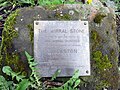 'The Wirral Stone' information plaque - geograph.org.uk - 6034511.jpg 1,600 × 1,200; 629 KB
-
 'The Wirral Stone', Willaston - geograph.org.uk - 6034490.jpg 1,600 × 1,200; 745 KB
-
 12 & 13, The Groves (geograph 6729933).jpg 1,024 × 684; 123 KB
-
 2023 Cheshire West and Chester Council election.svg 512 × 384; 438 KB
-
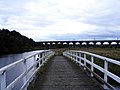
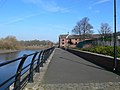
 A walkway across the River Dee - geograph.org.uk - 2399665.jpg 800 × 600; 318 KB
-

-
 Anderton Nature Park - the dipping pond - geograph.org.uk - 804471.jpg 640 × 426; 133 KB
-

-

-
 Approaching Chester beside the River Dee - geograph.org.uk - 2989395.jpg 1,600 × 1,200; 325 KB
-

-

-
 Ash Brook near Pool Head Farm. - geograph.org.uk - 537149.jpg 640 × 480; 108 KB
-
 B5130 - Chester Road - panoramio.jpg 1,000 × 573; 179 KB
-
 B5133, Windle Hill - geograph.org.uk - 6185900.jpg 800 × 497; 148 KB
-
 Band of woodland and stream, Bradley Lane - geograph.org.uk - 330175.jpg 509 × 640; 175 KB
-
 Barn at Bickley Hall Farm - geograph.org.uk - 261973.jpg 640 × 443; 122 KB
-
 Bath in Bumpers Lane - geograph.org.uk - 3096198.jpg 3,192 × 2,348; 1.28 MB
-
 Battle of Rowton Moor Re-enactment 2015 - geograph.org.uk - 4644655.jpg 3,184 × 2,123; 2.2 MB
-
 Battle of Rowton Moor Re-enactment 2015 - geograph.org.uk - 4644665.jpg 3,184 × 2,123; 2.19 MB
-
 Battle of Rowton Moor Re-enactment 2015 - geograph.org.uk - 4644671.jpg 3,184 × 2,123; 1.81 MB
-
 Battle of Rowton Moor Re-enactment 2015 - geograph.org.uk - 4644679.jpg 3,184 × 2,123; 1.28 MB
-
 Battle of Rowton Moor Re-enactment 2015 - geograph.org.uk - 4645900.jpg 3,542 × 2,296; 1.42 MB
-
 Battle of Rowton Moor Re-enactment 2015 - geograph.org.uk - 4645908.jpg 4,466 × 3,234; 2.34 MB
-
 Battle of Rowton Moor Re-enactment 2015 - geograph.org.uk - 4645913.jpg 5,184 × 3,456; 4.56 MB
-
 Bench mark next to the riverside path - geograph.org.uk - 4895789.jpg 1,200 × 900; 756 KB
-
 Bench mark on 'The Wirral Stone', Willaston - geograph.org.uk - 6034482.jpg 1,200 × 1,600; 763 KB
-
 Beneath the railway bridge over the Dee in Chester - geograph.org.uk - 4895233.jpg 4,000 × 3,000; 3.84 MB
-
 Benty Heath Lane - geograph.org.uk - 5557529.jpg 4,000 × 3,000; 4.48 MB
-
 Birds of Prey at Blakemere - geograph.org.uk - 298664.jpg 640 × 480; 61 KB
-

-

-
 Bracket fungi in Earlsway, Curzon Park - geograph.org.uk - 4773074.jpg 3,456 × 4,608; 4.39 MB
-
 Bridge Pool, Burton Mere - geograph.org.uk - 6222733.jpg 3,800 × 2,850; 2.07 MB
-
 Buildings in Saddlery Way - geograph.org.uk - 3971394.jpg 640 × 408; 58 KB
-
 Burton Mere Wetlands RSPB reserve - geograph.org.uk - 5405984.jpg 4,032 × 3,024; 1.82 MB
-
 Burton Point Farm - geograph.org.uk - 6222708.jpg 5,152 × 3,864; 7.67 MB
-
 Burton Point Nature Reserve - geograph.org.uk - 2280343.jpg 1,200 × 803; 262 KB
-

-
 Cafe and toilets, Little Roodee Car Park - geograph.org.uk - 5341680.jpg 2,000 × 1,500; 590 KB
-
 Car dealership on the A548, Chester - geograph.org.uk - 6184830.jpg 800 × 496; 62 KB
-

-
 Cheshire West and Chester Council - 2019.svg 360 × 185; 4 KB
-
 Cheshire West and Chester Council composition.svg 360 × 185; 4 KB
-

-
 CHESTER 1998 boundary stone on the A548 - geograph.org.uk - 5398943.jpg 768 × 1,024; 347 KB
-
 Chester Half Marathon 1997 at Chester Racecourse - geograph.org.uk - 5250812.jpg 3,276 × 2,136; 1.59 MB
-
 Chester High Road (A540) - geograph.org.uk - 6185862.jpg 800 × 600; 99 KB
-
 Chester High Road (A540) - geograph.org.uk - 6185887.jpg 800 × 597; 122 KB
-
 Chester Race Course - geograph.org.uk - 6144567.jpg 800 × 557; 90 KB
-

-
 Chester Racecourse - geograph.org.uk - 4482928.jpg 640 × 426; 51 KB
-
 Chester Racecourse from The City Walls - geograph.org.uk - 6254767.jpg 3,805 × 2,006; 3.96 MB
-
 Chester Racecourse, aerial 2015 - geograph.org.uk - 4695536.jpg 1,024 × 683; 224 KB
-
 Chester Racecourse, The Roodee - geograph.org.uk - 2156598.jpg 800 × 600; 247 KB
-
 Chester Racecourse-The Roodee - geograph.org.uk - 2342246.jpg 640 × 480; 69 KB
-
 Chester Races - geograph.org.uk - 6246710.jpg 4,128 × 3,096; 3.94 MB
-
 Chester Races, May 1977 - geograph.org.uk - 5213850.jpg 3,400 × 2,112; 1.58 MB
-
 Chester Races, May 1977 - geograph.org.uk - 5213855.jpg 3,352 × 2,248; 1.63 MB
-
 Chester Races, May 1977 - geograph.org.uk - 5213867.jpg 3,088 × 2,028; 1.41 MB
-
 Chester Races, May 1977 - geograph.org.uk - 5213872.jpg 3,408 × 2,240; 1.27 MB
-
 Chester Railway Bridge - geograph.org.uk - 2338573.jpg 640 × 480; 88 KB
-
 Chester Railway Viaduct - geograph.org.uk - 2342260.jpg 640 × 480; 61 KB
-
 Chester railway viaduct - geograph.org.uk - 3391888.jpg 1,024 × 731; 277 KB
-

-
 Chester-River Dee - geograph.org.uk - 2338582.jpg 640 × 480; 83 KB
-
 Chester-River Dee - geograph.org.uk - 2345962.jpg 640 × 480; 72 KB
-
 Chester-Saddlery Way - geograph.org.uk - 2339616.jpg 640 × 480; 64 KB
-
 Cholmondeley Deer Park - geograph.org.uk - 626304.jpg 640 × 480; 117 KB
-
 Cop Park, Chester - geograph.org.uk - 2838214.jpg 640 × 480; 138 KB
-
 Cormorants roosting above the River Dee - geograph.org.uk - 5623056.jpg 766 × 1,024; 383 KB
-
 Country Lane. - geograph.org.uk - 511259.jpg 427 × 640; 109 KB
-
 Countryside, Cheshire - scan02.jpg 2,016 × 1,440; 2.06 MB
-
 Countryside, Cheshire - scan03.jpg 2,016 × 1,440; 2.05 MB
-
 Countryside, Cheshire - scan04.jpg 1,440 × 2,008; 2.4 MB
-
 Curzon Park North, Chester - geograph.org.uk - 4323903.jpg 5,472 × 3,648; 4.25 MB
-
 Cycle path beside Deva Link, Chester - geograph.org.uk - 6184828.jpg 800 × 600; 133 KB
-
 Cycle track beside North Road - geograph.org.uk - 6184228.jpg 800 × 600; 159 KB
-
 Cycle track beside the River Dee - geograph.org.uk - 2927194.jpg 1,600 × 1,200; 294 KB
-

-
 Dee Branch Middle Lock in Chester - geograph.org.uk - 6177505.jpg 800 × 537; 107 KB
-
 Dee Coast Path - geograph.org.uk - 6184855.jpg 800 × 600; 85 KB
-
 Development by the railway - geograph.org.uk - 4561569.jpg 640 × 499; 48 KB
-
 Disused level crossing on North Road - geograph.org.uk - 6184224.jpg 800 × 600; 102 KB
-
 Disused Railway Building on the Wirral Way - geograph.org.uk - 5555684.jpg 4,000 × 3,000; 4.51 MB
-
 Disused railway off North Road - geograph.org.uk - 6184225.jpg 800 × 600; 184 KB
-

-
 Earlsway and a boundary stone - geograph.org.uk - 3700932.jpg 640 × 480; 147 KB
-
 Earlsway, Curzon Park at its junction with Northway - geograph.org.uk - 4773076.jpg 4,608 × 3,456; 5.61 MB
-
 Eastgate clock - panoramio.jpg 2,592 × 1,944; 2.42 MB
-
 Eastgate Street - panoramio.jpg 2,592 × 1,944; 2.42 MB
-
 Eaton Road, Heronbridge - geograph.org.uk - 3337034.jpg 5,184 × 3,456; 4.67 MB
-

-
 Elizabeth II postbox on Sealand Road, Chester - geograph.org.uk - 6186706.jpg 3,368 × 4,617; 3.1 MB
-
 Entrance gateway to Heronbridge House - geograph.org.uk - 4846649.jpg 640 × 480; 121 KB
-

-
 Exit road from Vauxhall car plant - geograph.org.uk - 6184233.jpg 800 × 516; 97 KB
-
 Express from London Paddington approaching Chester, 1963 - geograph.org.uk - 4266672.jpg 2,440 × 1,536; 1.95 MB
-
 Field near Heath Farm - geograph.org.uk - 6185873.jpg 800 × 600; 107 KB
-
 Finchett's Gutter - geograph.org.uk - 6184835.jpg 800 × 600; 125 KB
-
 Finchett's Gutter Outfall into the River Dee - geograph.org.uk - 4773335.jpg 4,608 × 3,456; 4.14 MB
-
 Flats of Sealand Road, Chester - geograph.org.uk - 6184837.jpg 800 × 600; 123 KB
-
 Flowerpot Man, Blacon - geograph.org.uk - 3095283.jpg 3,648 × 2,736; 2.07 MB
-
 Follyfield Nurseries, Willaston - geograph.org.uk - 5556342.jpg 4,000 × 3,000; 2.94 MB
-
 Foraged Fruit (223560429).jpeg 2,048 × 1,374; 1.54 MB
-
 Former chapel, Norbury - geograph.org.uk - 380634.jpg 640 × 434; 145 KB
-
 Frodsham - Castle Park House (geograph 3116662).jpg 1,600 × 1,193; 624 KB
-
 Fungus, Shakerley Mere, Cheshire - geograph.org.uk - 476999.jpg 640 × 530; 104 KB
-
 Gate into Parkmoss Wood - geograph.org.uk - 401120.jpg 600 × 450; 147 KB
-
 George V postbox on Chester Road, Ellesmere Port - geograph.org.uk - 6185183.jpg 2,601 × 4,523; 2.81 MB
-
 Graffiti in The Cop park - December 2010 - geograph.org.uk - 4306637.jpg 640 × 480; 151 KB
-
 Graffiti in The Cop park - January 2015 - geograph.org.uk - 4306597.jpg 640 × 480; 137 KB
-
 Graffiti Update - geograph.org.uk - 2906943.jpg 3,648 × 2,736; 2.75 MB
-
 Greyhound Park, Chester - geograph.org.uk - 2838435.jpg 640 × 426; 65 KB
-
 Grosvenor Bridge (Chester) - geograph.org.uk - 5110731.jpg 1,500 × 1,004; 1.45 MB
-
 Grosvenor Bridge, Chester - geograph.org.uk - 4895237.jpg 4,000 × 3,000; 3.44 MB
-
 Grosvenor Road, Chester - geograph.org.uk - 6163217.jpg 800 × 600; 148 KB
-

-
 Heronbridge - geograph.org.uk - 5489644.jpg 1,024 × 768; 239 KB
-
 High Whitley - geograph.org.uk - 373772.jpg 640 × 480; 126 KB
-
 Hough Green, Chester - geograph.org.uk - 6163225.jpg 800 × 600; 126 KB
-
 House of Shelter (geograph 6754900).jpg 1,024 × 684; 255 KB
-
 House on Chester High Road (A540) - geograph.org.uk - 6185874.jpg 800 × 498; 136 KB
-
 Household Cavalry display on the Roodee, Chester - geograph.org.uk - 5594990.jpg 3,392 × 2,256; 4.32 MB
-
 Houses at Chester sewage works - geograph.org.uk - 2927127.jpg 1,600 × 1,200; 446 KB
-
 Houses on Hough Green, Chester - geograph.org.uk - 6163223.jpg 5,184 × 3,888; 4.49 MB
-
 Houses, Church Street, Malpas - geograph.org.uk - 653935.jpg 640 × 432; 77 KB
-
 Hummock near Coronation Wood - geograph.org.uk - 712117.jpg 640 × 435; 168 KB
-
 In a railway cutting - geograph.org.uk - 4482822.jpg 640 × 398; 78 KB
-
 Inner Marsh Farm hide, RSPB Burton Mere Wetlands reserve - geograph.org.uk - 5405972.jpg 4,032 × 3,024; 4.28 MB
-
 Leaving Chester for Llandudno - geograph.org.uk - 2275784.jpg 640 × 408; 94 KB
-
 Looking along Chester racecourse - geograph.org.uk - 2399672.jpg 800 × 600; 236 KB
-
 Looking over to Burton Marsh - geograph.org.uk - 2151346.jpg 1,500 × 986; 178 KB
-

-
 Manning the Yards on The Roodee, Chester - geograph.org.uk - 5595710.jpg 5,208 × 6,906; 4.58 MB
-
 Marching Band on the Roodee, Chester - geograph.org.uk - 5594964.jpg 3,400 × 2,240; 1.89 MB
-
 Marching Band on the Roodee, Chester - geograph.org.uk - 5594974.jpg 3,392 × 2,256; 1.85 MB
-
 Meadowland at Burton Point (2) - geograph.org.uk - 6235107.jpg 5,152 × 3,864; 7.7 MB
-
 Middle pool at RSPB Burton Point - geograph.org.uk - 2499489.jpg 1,595 × 741; 206 KB
-
 Mocked Monument (217761729).jpeg 1,689 × 2,048; 933 KB
-
 Mond Statue.jpg 3,096 × 4,128; 3.9 MB
-

-
 Mountain Bike and the M6 - geograph.org.uk - 383223.jpg 640 × 480; 163 KB
-
-
 Neston Road, Burton - geograph.org.uk - 6165465.jpg 800 × 600; 100 KB
-
 North Road - geograph.org.uk - 6184722.jpg 800 × 600; 152 KB
-
 North Road beside the Vauxhall car plant - geograph.org.uk - 6184231.jpg 800 × 600; 115 KB
-
 Obelisk Cenotaph to George Marsh (Martyr) (geograph 6726013).jpg 684 × 1,024; 107 KB
-
 Old Port Square Lift Bridge 126D - geograph.org.uk - 6177445.jpg 800 × 518; 114 KB
-
 Old Stables at National Waterways Museum Ellesmere Port.jpg 4,928 × 3,264; 9.2 MB
-
 Oldfield Crescent - Chester - panoramio.jpg 2,592 × 1,944; 2.45 MB
-
 Overleigh Cemetery - geograph.org.uk - 4846737.jpg 640 × 480; 88 KB
-
 Parachute Regiment display, Roodee, Chester - geograph.org.uk - 5595685.jpg 2,264 × 3,392; 1.51 MB
-

-
 Path to the Lache Health Centre - geograph.org.uk - 3861194.jpg 4,184 × 2,789; 2.54 MB
-
 Path to the Roodee - geograph.org.uk - 3786695.jpg 5,184 × 3,456; 3.89 MB
-
 Pizza Hut on Chester Retail Park - geograph.org.uk - 6184827.jpg 800 × 600; 135 KB
-
 Porters Row Cottages.jpg 3,008 × 2,000; 2.74 MB
-
 Racecourse and Viaduct at Chester - geograph.org.uk - 3253848.jpg 4,592 × 3,444; 3.47 MB
-
 Racecourse Apartments, Chester - geograph.org.uk - 2838232.jpg 640 × 480; 60 KB
-
 Railway cutting - geograph.org.uk - 3391872.jpg 1,024 × 731; 191 KB
-
 Railway cutting - geograph.org.uk - 3391881.jpg 1,024 × 731; 255 KB
-
 Railway Footbridge at Chester Racecourse - geograph.org.uk - 3301601.jpg 4,000 × 3,000; 2.66 MB
-
 Railway line and rails at The Roodee - geograph.org.uk - 4323936.jpg 3,888 × 2,592; 4.95 MB
-
 Railway line from Chester Golf Club bridge - geograph.org.uk - 4323919.jpg 5,472 × 3,648; 6.22 MB
-

-

-
 Rickety Bridge - panoramio.jpg 1,024 × 768; 606 KB
-
 River Dee - geograph.org.uk - 4482931.jpg 640 × 426; 46 KB
-
 River Dee - panoramio (2).jpg 3,072 × 2,048; 2.9 MB
-
 River Dee at Queen's Park - geograph.org.uk - 2115845.jpg 640 × 480; 131 KB
-
 River Dee beside The Cop - geograph.org.uk - 2927140.jpg 1,600 × 1,200; 328 KB
-
 River Dee from footbridge at The Roodee - geograph.org.uk - 4323912.jpg 5,472 × 3,648; 4.82 MB
-
 River Dee leaving Chester - geograph.org.uk - 2989371.jpg 1,600 × 1,200; 318 KB
-

-
 River Dee West of Chester - geograph.org.uk - 2906928.jpg 1,600 × 903; 412 KB
-
 River Dee, Chester - geograph.org.uk - 6163221.jpg 800 × 600; 75 KB
-
 River Weaver, Northwich - panoramio.jpg 4,368 × 2,912; 10.72 MB
-
 Riverside development - geograph.org.uk - 4561568.jpg 640 × 426; 45 KB
-
 Riverside Promenade near Crane Wharf - geograph.org.uk - 3097274.jpg 640 × 480; 51 KB
-
 Riverside Promenade, Chester - geograph.org.uk - 2838229.jpg 640 × 480; 66 KB
-
 Road bridge over Wirral Way - geograph.org.uk - 6087943.jpg 5,184 × 3,888; 5.96 MB
-
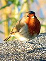 Robin alongside the River Dee - geograph.org.uk - 5624227.jpg 765 × 1,024; 252 KB
-
 Rooftops by the railway - geograph.org.uk - 4561565.jpg 640 × 426; 45 KB
-
 Saddlery Row - geograph.org.uk - 4561570.jpg 640 × 426; 39 KB
-
 Sandstone outcrop beside the Dee - geograph.org.uk - 4846205.jpg 640 × 480; 168 KB
-
 Sealand Road (A548), Chester - geograph.org.uk - 3329764.jpg 4,000 × 3,000; 2.01 MB
-
 Sealand Road, Chester - geograph.org.uk - 5810905.jpg 1,280 × 851; 348 KB
-
 Sealand Road, Chester - geograph.org.uk - 6184840.jpg 800 × 600; 107 KB
-
 Sheep in Antrobus fields - geograph.org.uk - 117.jpg 512 × 640; 45 KB
-
 Shell Oil Refinery - panoramio.jpg 4,288 × 2,864; 5.91 MB
-

-
 Skate Park at the Cop Park - geograph.org.uk - 2838211.jpg 640 × 480; 153 KB
-
 Solitude - Flickr - Fields of View.jpg 1,831 × 1,278; 2.45 MB
-
 South View Road Bridge 126C - geograph.org.uk - 6177461.jpg 800 × 537; 144 KB
-
 Spooky path - panoramio.jpg 1,024 × 768; 1.1 MB
-
 Stanlow Point and Stanlow Refinery from the air - geograph.org.uk - 5612712.jpg 2,618 × 1,957; 2.96 MB
-
 Stanney Woods car park and a boundary stone - geograph.org.uk - 5875988.jpg 1,600 × 1,203; 656 KB
-
 Station Road at Burton Point - geograph.org.uk - 2151348.jpg 1,500 × 966; 141 KB


.jpg)


_-_geograph.org.uk_-_6177376.jpg)


_-_geograph.org.uk_-_6184772.jpg)


_-_geograph.org.uk_-_6185861.jpg)


_-_geograph.org.uk_-_6185862.jpg)
_-_geograph.org.uk_-_6185887.jpg)


_-_geograph.org.uk_-_6185869.jpg)


.jpeg)

.jpg)


_-_geograph.org.uk_-_5110731.jpg)


.jpg)
_-_geograph.org.uk_-_6185874.jpg)


_-_geograph.org.uk_-_6235107.jpg)

.jpeg)

_-_geograph.org.uk_-_6177905.jpg)


_(geograph_6726013).jpg)


.jpg)


_-_geograph.org.uk_-_6177159.jpg)


,_Chester_-_geograph.org.uk_-_3329764.jpg)


