Category:Am Schlosspark 11 (Leer)
Jump to navigation
Jump to search
| Object location | | View all coordinates using: OpenStreetMap |
|---|
| Upload media | |||||
| Instance of | |||||
|---|---|---|---|---|---|
| Location | Leer, Lower Saxony, Germany | ||||
 | |||||
Media in category "Am Schlosspark 11 (Leer)"
The following 5 files are in this category, out of 5 total.
-
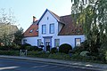
 Leer - Am Schlosspark + 11 + Neues Gärtnerhaus 01 ies.jpg 5,616 × 3,744; 21.31 MB
-
 Leer - Am Schlosspark - 11 01 ies.jpg 5,616 × 3,744; 19.45 MB
-
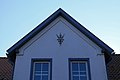
 Leer - Am Schlosspark - 11 02 ies.jpg 5,616 × 3,744; 17.62 MB
-
 Leer - Am Schlosspark - 11 03 ies.jpg 5,616 × 3,744; 18.15 MB
-
 Leer - Am Schlosspark - 11 04 ies.jpg 5,616 × 3,744; 12.94 MB


