Category:Amazon rainforest maps
Vai alla navigazione
Vai alla ricerca
English: Amazon Rainforest Maps
| NESSUN ID DI WIKIDATA TROVATO! Cerca Amazon rainforest maps su Wikidata | |
| Carica un file multimediale |
File nella categoria "Amazon rainforest maps"
Questa categoria contiene 32 file, indicati di seguito, su un totale di 32.
-
 Amazon map.jpg 1 440 × 900; 198 KB
-
 Chuvas da Amazônia.jpg 1 280 × 1 345; 745 KB
-
 Wunderling 2021 tipping cascade.png 2 067 × 1 310; 251 KB
-
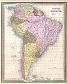 1850 Mitchell Map of South America - Geographicus - SouthAmerica-mitchell-1850.jpg 3 000 × 3 715; 2,41 MB
-
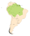
 Amazon biome outline map.svg 371 × 279; 4,58 MB
-
 Amazon map of forest loss, fires, agricultural and cattle areas, etc.jpg 510 × 627; 491 KB
-
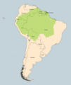
 Amazon rainforest (orthographic projection).svg 541 × 541; 149 KB
-
 Amazon rainforest.jpg 400 × 329; 50 KB
-
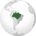 Amazonia legal.png 2 900 × 2 900; 1,22 MB
-
 Amazonia No Background.png 4 226 × 4 998; 1 020 KB
-
 Amazonia.png 4 226 × 4 998; 992 KB
-
 Bcamazonica-es.svg 2 280 × 1 557; 5,46 MB
-
 Bcamazonica.jpg 800 × 578; 260 KB
-
 BcamazonicaSimplificado-es.svg 2 280 × 1 557; 5,46 MB
-
 Cetacea range map Amazon River Dolphin-ar.png 2 044 × 2 095; 1,52 MB
-
 Cetacea range map Amazon River Dolphin.PNG 2 044 × 2 095; 628 KB
-
 Climate Conditions Determine Amazon Fire Risk (annotated).jpg 673 × 402; 312 KB
-
 Climate Conditions Determine Amazon Fire Risk.jpg 2 000 × 1 058; 2,25 MB
-
 Desm amazon.jpg 2 480 × 1 784; 1,29 MB
-
 Distribution of Mico munduruku sp. n. and records of M. leucippe.png 3 250 × 2 807; 1,42 MB
-
 ECDM 20230508 WF Amazonia fires.pdf 1 625 × 1 125; 616 KB
-
 Ecoregion NT0135.svg 1 995 × 1 585; 7,05 MB
-
 Ecoregion NT0166.svg 1 499 × 1 191; 7,07 MB
-
 Mapa Boto.png 699 × 938; 143 KB
-
 Mapa de áreas prioritárias para vertebrados em Balbina.tif 977 × 698; 653 KB
-
 Microsciurus flaviventer range map.svg 940 × 415; 1,5 MB
-
 Naturalist in River Amazons Map.png 872 × 394; 16 KB
-
 New Study Shows Atmosphere in the Amazon Drying Out - PIA23425.jpg 1 440 × 960; 94 KB
-
 New Study Shows Atmosphere in the Amazon Drying Out - PIA23425.tiff 1 440 × 960; 1,71 MB
-
 Rainfall anomaly brazil april-may 2009.JPG 1 232 × 707; 168 KB
-
 Río de la Paz map.png 1 500 × 1 500; 836 KB
-
 The American Indian Fig 74.jpg 1 600 × 2 474; 360 KB


.svg)


.jpg)


