Category:Amhara Region
Salti al navigilo
Salti al serĉilo
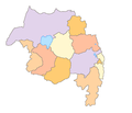
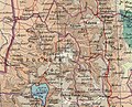
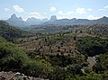
English: Amhara is one of the nine ethnic divisions of Ethiopia, its capital is Bahir Dar
regiono en Etiopio    | |||||
| Alŝuti plurmedion | |||||
| Estas | |||||
|---|---|---|---|---|---|
| Loko | Etiopio | ||||
| Ĉefurbo | |||||
| Oficiala lingvo | |||||
| Dato de fondo aŭ kreo |
| ||||
| Loĝantaro |
| ||||
| Areo |
| ||||
| Alia ol | |||||
 | |||||
Subkategorioj
Ĉi tiu kategorio havas la 15 jenajn subkategoriojn, el 15 entute.
A
- Abuna Yosef (1 D)
- Ashenda Festival (16 D)
B
- Beaches of Amhara Region (2 D)
C
L
- Lake Hayq (66 D)
M
- Maps of borders of Amhara Region (15 D)
S
T
Z
Dosieroj en kategorio “Amhara Region”
La jenaj 139 dosieroj estas en ĉi tiu kategorio, el 139 entute.
-
 105882397 gettyimages-188003505.jpg 2 048 × 1 362; 3,14 MB
-
 1550401415482-276931149vh.jpg 3 264 × 2 448; 3,73 MB
-

-
 A steep mountain - panoramio.jpg 2 448 × 3 264; 3,97 MB
-
 Aholalo.png 1 072 × 542; 983 KB
-
 Along The Trail (2210448349).jpg 1 824 × 1 707; 1,47 MB
-
 Amhara (24139160046).jpg 3 264 × 4 896; 3,87 MB
-
 Amhara elevation map.svg 1 065 × 1 041; 14,87 MB
-
 Amhara in Ethiopia.svg 1 843 × 1 494; 495 KB
-
 Amhara Region (23537055234).jpg 4 896 × 3 264; 4,87 MB
-
 Amhara Region (23537057784).jpg 4 896 × 3 264; 5,77 MB
-
 Amhara Region (23797444779).jpg 4 896 × 3 264; 4,66 MB
-
 Amhara Region (23797445749).jpg 4 896 × 3 264; 3,81 MB
-
 Amhara Region (24057185062).jpg 4 896 × 3 264; 4,77 MB
-
 Amhara Region (24082649881).jpg 4 372 × 2 915; 2,93 MB
-
 Amhara Region (24082651871).jpg 3 742 × 3 264; 3,48 MB
-
 Amhara Region (24082654701).jpg 4 896 × 3 264; 4,25 MB
-
 Amhara Region (24082659081).jpg 4 896 × 3 264; 5,08 MB
-
 Amhara Region (24139155726).jpg 3 264 × 4 896; 5,43 MB
-
 Amhara Region emblem.png 403 × 403; 268 KB
-
 Amhara Region Map.png 423 × 363; 9 KB
-
 Amhara topographic map.svg 1 065 × 1 041; 14,87 MB
-
 Amhara Village, Ethiopia.jpg 6 853 × 4 568; 1,97 MB
-

-
 Banana trees Ethiopia (1).jpg 4 000 × 3 000; 1,75 MB
-
 Banana trees Ethiopia (2).jpg 3 000 × 4 000; 1,63 MB
-
 Banana trees Ethiopia (3).jpg 4 000 × 3 000; 1,99 MB
-
 Banana trees Ethiopia (4).jpg 3 000 × 4 000; 1,54 MB
-
 Bernos.jpg 640 × 502; 62 KB
-
 Bernos1930.jpg 2 322 × 1 529; 928 KB
-
 Bet Giorgis Church (24165253415).jpg 4 812 × 3 208; 6,13 MB
-
-
 Cattle in Ethiopia.jpg 4 000 × 3 000; 1,45 MB
-
 Creek crossing - panoramio.jpg 3 264 × 2 448; 3,08 MB
-
 Dankaz.jpg 375 × 500; 139 KB
-
 DankazPalace.JPG 521 × 592; 41 KB
-
 Danqaz4.jpg 1 024 × 768; 228 KB
-
 Database historical maps Western Tigray graphical abstract.pdf 1 752 × 1 239; 368 KB
-
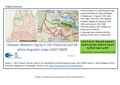
 Dataset Western Tigray maps - graphical abstract.jpg 1 512 × 801; 263 KB
-
 Debre Birhan Selassie II (24165210375).jpg 3 264 × 4 896; 3,46 MB
-
 Debre Birhan Selassie III (23537011744).jpg 3 264 × 4 896; 3,42 MB
-
 Debre Birhan Selassie IV (23797394529).jpg 4 896 × 3 264; 5,78 MB
-
 Debre Birhan Selassie VI (24057142852).jpg 2 932 × 4 400; 3,86 MB
-
 Debre Birhan Selassie VII (24165214955).jpg 3 176 × 4 766; 5,76 MB
-
 Dejen misura da cima W.jpg 1 780 × 1 260; 383 KB
-
 DSCF3593 (24165222595).jpg 4 896 × 3 264; 3,26 MB
-
 DSCF3595 - DSCF3596 (23538457133).jpg 6 146 × 4 573; 9,08 MB
-
 Emmigrants in amhara region.jpg 720 × 1 280; 158 KB
-
 Ethiopia bus.jpg 4 000 × 3 000; 995 KB
-
 Ethiopia1911.png 2 004 × 2 066; 3,06 MB
-
 Ethiopian countryside near Lalibela (1).jpg 4 000 × 3 000; 1,31 MB
-
 Ethiopian countryside near Lalibela - cattle (1).jpg 4 000 × 3 000; 1,46 MB
-
 Ethiopian countryside near Lalibela - cattle (2).jpg 4 000 × 3 000; 1,82 MB
-
 Ethiopian Landscape I (23538429323).jpg 4 184 × 2 789; 2,04 MB
-
 Ethiopian Landscape II (24057124482).jpg 2 991 × 1 994; 1,56 MB
-
 Ethiopian Landscape III (23536999884).jpg 4 674 × 3 115; 3,2 MB
-
 Ethiopie-Exploitation de l'eucalyptus (1).jpg 3 240 × 4 320; 4,16 MB
-
 Ethiopie-Exploitation de l'eucalyptus (10).jpg 4 320 × 3 240; 5,31 MB
-
 Ethiopie-Exploitation de l'eucalyptus (11).jpg 4 320 × 3 240; 4,63 MB
-
 Ethiopie-Exploitation de l'eucalyptus (2).jpg 4 320 × 3 240; 4,62 MB
-
 Ethiopie-Exploitation de l'eucalyptus (3).jpg 3 240 × 4 320; 4,94 MB
-
 Ethiopie-Exploitation de l'eucalyptus (4).jpg 4 320 × 3 240; 4,98 MB
-
 Ethiopie-Exploitation de l'eucalyptus (5).jpg 4 320 × 3 240; 4,75 MB
-
 Ethiopie-Exploitation de l'eucalyptus (6).jpg 3 240 × 4 320; 2,79 MB
-
 Ethiopie-Exploitation de l'eucalyptus (7).jpg 4 320 × 3 240; 3,95 MB
-
 Ethiopie-Exploitation de l'eucalyptus (8).jpg 4 320 × 3 240; 5,28 MB
-
 Ethiopie-Exploitation de l'eucalyptus (9).jpg 4 320 × 3 240; 4,88 MB
-

-
 Extract of Thomson’s map (1817) with borders of Tigray.jpg 520 × 563; 128 KB
-
 Fasil Ghebbi I (23797384929).jpg 4 896 × 3 264; 3,6 MB
-
 Fasil Ghebbi II (24082599491).jpg 4 896 × 3 264; 5,9 MB
-
 Fasil Ghebbi III (24165205315).jpg 4 896 × 3 264; 5,88 MB
-
 Fasil Ghebbi V (24057136902).jpg 4 896 × 3 264; 5,16 MB
-
 Flag of the Amhara Region.svg 1 200 × 600; 403 bajtoj
-
 GeladaTroopSimienMountains.jpg 6 000 × 4 000; 3,82 MB
-
 Guzara Castle I (23538433233).jpg 3 288 × 4 934; 6,98 MB
-
 Guzara Castle II (23869580780).jpg 4 896 × 3 264; 5,43 MB
-
 Guzara Castle III (24165201985).jpg 3 264 × 4 896; 5,01 MB
-
 GuzaraCastle.jpg 4 056 × 3 040; 4,45 MB
-
 Hauts plateaux d'Ethiopie-Région Amhara (10).jpg 4 320 × 3 240; 3,76 MB
-
 Hauts plateaux d'Ethiopie-Région Amhara (11).jpg 4 320 × 3 240; 3,44 MB
-
 Hauts plateaux d'Ethiopie-Région Amhara (12).jpg 4 320 × 3 240; 3,24 MB
-
 Hauts plateaux d'Ethiopie-Région Amhara (15).jpg 4 320 × 3 240; 3,98 MB
-
 Hauts plateaux d'Ethiopie-Région Amhara (16).jpg 4 320 × 3 240; 5,84 MB
-
 Hauts plateaux d'Ethiopie-Région Amhara (17).jpg 4 087 × 3 105; 4,91 MB
-
 Hauts plateaux d'Ethiopie-Région Amhara (18).jpg 4 320 × 3 240; 5,74 MB
-
 Hauts plateaux d'Ethiopie-Région Amhara (19).jpg 3 240 × 4 320; 6,03 MB
-
 Hauts plateaux d'Ethiopie-Région Amhara (2).jpg 4 320 × 3 240; 3,17 MB
-
 Hauts plateaux d'Ethiopie-Région Amhara (20).jpg 3 240 × 4 320; 4,68 MB
-
 Hauts plateaux d'Ethiopie-Région Amhara (21).jpg 3 240 × 4 320; 5,91 MB
-
 Hauts plateaux d'Ethiopie-Région Amhara (22).jpg 3 240 × 4 320; 4,25 MB
-
 Hauts plateaux d'Ethiopie-Région Amhara (23).jpg 3 240 × 4 320; 4,19 MB
-
 Hauts plateaux d'Ethiopie-Région Amhara (24).jpg 3 240 × 4 320; 4,32 MB
-
 Hauts plateaux d'Ethiopie-Région Amhara (25).jpg 4 320 × 3 240; 5,2 MB
-
 Hauts plateaux d'Ethiopie-Région Amhara (26).jpg 3 240 × 4 320; 4,85 MB
-
 Hauts plateaux d'Ethiopie-Région Amhara (27).jpg 4 320 × 3 240; 5,67 MB
-
 Hauts plateaux d'Ethiopie-Région Amhara (28).jpg 4 320 × 3 240; 6,4 MB
-
 Hauts plateaux d'Ethiopie-Région Amhara (3).jpg 4 320 × 3 240; 3,64 MB
-
 Hauts plateaux d'Ethiopie-Région Amhara (4).jpg 4 320 × 3 240; 3,98 MB
-
 Hauts plateaux d'Ethiopie-Région Amhara (5).jpg 3 240 × 4 320; 5,83 MB
-
 Kids hairdo, Lebe village, Amhara region, Ethiopia.JPG 2 480 × 1 752; 266 KB
-
 Lake Ardibbo.png 402 × 391; 265 KB
-
 Location of the border between Tigray and Amhara.png 1 027 × 244; 47 KB
-
-
 Nyssen and Demissie JoM supplemental map.tif 7 019 × 4 950; 99,41 MB
-
 Orthodox Church, Amhara (53562611601).jpg 6 815 × 4 544; 1,84 MB
-

-
 Promoting the benefits of suncream in Kosoye (5495108038).jpg 3 008 × 2 000; 2,47 MB
-
 Ras-Leul Kassa Hailu (cropped).jpg 363 × 497; 31 KB
-
 Ras-Leul Kassa Hailu.jpg 367 × 613; 48 KB
-
 Road between Gondar and Debarq.jpg 3 262 × 2 085; 1,63 MB
-
 Road to Debarq.jpg 4 056 × 3 040; 4,51 MB
-
 Région Amhara-Maisons.jpg 4 320 × 3 240; 3,62 MB
-
 Scenery at Wolleka (Falasha Jewish Village) - Outside Gondar - Ethiopia (8688070789).jpg 2 736 × 3 648; 4,64 MB
-
 Scenery en route to Bahir Dar - Ethiopia (8678181336).jpg 3 648 × 2 736; 2,29 MB
-
 Simien Mountains I (24057147692).jpg 4 896 × 3 264; 4,85 MB
-
 Simien Mountains II (24082616001).jpg 4 708 × 3 137; 2,91 MB
-
 Sorghum Ethiopia.jpg 4 000 × 3 000; 2,06 MB
-

-
 Sugar cane Ethiopia.jpg 4 000 × 3 000; 2,17 MB
-

-
 Susenyoscastle.jpg 709 × 472; 85 KB
-
 Territorial control of Welkait according to historical maps.png 1 027 × 286; 38 KB
-
 TESFA trek (5496201103).jpg 3 008 × 2 000; 2,72 MB
-
 TESFA trek (5496201923).jpg 3 008 × 2 000; 2,75 MB
-
 The Relic Box, Lake Tana, Ethiopia (7098501847).jpg 2 848 × 3 848; 2,1 MB
-
 Theodore.jpg 735 × 1 129; 140 KB
-
 Timeline of the location of the boundary between Amhara and Tigray.png 1 027 × 148; 32 KB
-
 Trekking down the path - panoramio.jpg 3 264 × 2 448; 4,66 MB
-
 View from Geech camp - panoramio.jpg 3 264 × 2 448; 2,06 MB
-
 View from Ras Bwahit - panoramio.jpg 8 944 × 2 332; 7,04 MB
-
 Village Scene near Lalibela - Ethiopia (8734134203).jpg 2 736 × 3 648; 3,55 MB
-
 Water puddles - panoramio.jpg 2 448 × 3 264; 3,8 MB
-
 Wegel Tena to Wurgessa day 1.jpg 1 280 × 720; 331 KB
-
 Wegel Tena to Wurgessa day 2.jpg 1 280 × 720; 350 KB
-
 Western Tigray Manesson-Mallet 1683.jpg 602 × 420; 84 KB
-
 White-backed Vulture eating dog.jpg 2 575 × 1 492; 1 MB
-
 Woman in Lebe village, Amhara region, Ethiopia.JPG 4 272 × 2 848; 2,95 MB
-
 Zebu near Gondar.jpg 3 291 × 2 194; 4,34 MB


.jpg)


.jpg)
.jpg)

.jpg)
.jpg)
.jpg)
.jpg)
.jpg)
.jpg)
.jpg)
.jpg)
.jpg)
.jpg)


.jpg)
.jpg)
.jpg)
.jpg)


.jpg)
.jpg)


.jpg)
.jpg)
.jpg)
.jpg)
.jpg)

.jpg)
.jpg)


.jpg)
.jpg)
.jpg)
.jpg)
.jpg)
.jpg)
.jpg)
.jpg)
.jpg)
.jpg)
.jpg)
.jpg)
.jpg)
.jpg)
.jpg)
.jpg)
.jpg)
_map_with_borders_of_Royaume_de_Tigre.jpg)
_with_borders_of_Tigray.jpg)
.jpg)
.jpg)
.jpg)
.jpg)

.jpg)
.jpg)
.jpg)

.jpg)
.jpg)
.jpg)
.jpg)
.jpg)
.jpg)
.jpg)
.jpg)
.jpg)
.jpg)
.jpg)
.jpg)
.jpg)
.jpg)
.jpg)
.jpg)
.jpg)
.jpg)
.jpg)
.jpg)
.jpg)


_representing_the_consensus_among_ethnographers_and_linguists_about_the_approximate_extent_of_the_Tigrinya_language.jpg)
.jpg)
_-_Outside_Gondar_-_Ethiopia_(8689192166).jpg)
.jpg)
.jpg)


_-_Outside_Gondar_-_Ethiopia_(8688070789).jpg)
.jpg)
.jpg)
.jpg)

_-_Outside_Gondar_-_Ethiopia_(8688063575).jpg)


.jpg)
.jpg)
.jpg)


.jpg)


