Category:An der alten Heidetrift (FNa Ruhland)
Jump to navigation
Jump to search
| Object location | | View all coordinates using: OpenStreetMap |
|---|
Diese Kategorie umfasst den alten Flurnamen An der alten Heidetrift in der Gemarkung Ruhland.
Media in category "An der alten Heidetrift (FNa Ruhland)"
The following 3 files are in this category, out of 3 total.
-
 Ruhland, alte Waldstraße auf dem Weg zur Furt, Blick nach Osten.jpg 1,600 × 1,200; 1.3 MB
-
 Ruhland, Alte Waldstraße, Blick auf die Sieggraben-Furt nach Westen, Frühsommer.jpg 1,600 × 1,200; 1.31 MB
-
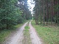
 Ruhland, alte Waldstraße, Blick nach Westen Richtung Sieggraben-Furt.jpg 1,600 × 1,200; 1.23 MB


