Category:Ancient Roman roads
Przejdź do nawigacji
Przejdź do wyszukiwania
Italiano: Questa categoria è destinata alle principali vie romane che attraversavano le Provinciae dell'Impero Romano. Per le principali vie romane che attraversavano le Regiones dell'Italia e portavano a Roma vedi Category:Ancient Roman roads in Italy. Per le strade all'interno delle città romane vedi Category:Ancient Roman streets. Le Strade dell' Antica Roma erano arterie commerciali, militari e civili che hanno permesso il commercio, lo sviluppo e la prosperità dell'Impero Romano.
English: This category is for the main Roman roads which crossed the Provinciae of the Roman Empire. For the main Roman roads which crossed the Regiones of Italy and led to Rome see Category:Ancient Roman roads in Italy. For the streets inside the Roman cities see Category:Ancient Roman streets. The Roman roads were essential for the growth of their empire, by enabling them to move armies speedily and by sustaining land transport for Roman mercantilism.
Español: Las Calzadas romanas fueron esenciales para la expansión del Imperio romano, permitiendo mover rápidamente al ejército y sustentar el comercio mediante el transporte por tierra.
Deutsch: Die Römerstraßen waren sehr wichtig für das Wachstum des Imperiums. Sie ermöglichten den Römern, ihre Armeen geschwind zu verlegen und erleichterten den Warentransport der Händler erheblich.
Français : Les voies romaines étaient essentielles à la croissance de l'empire : elles permettaient de déplacer les armées rapidement et favorisaient le commerce par voie terrestre.
Nederlands: De heirbanen waren essentieel voor de groei van hun rijk, omdat ze het transport van troepen en handelaars versnelden.
drogi budowane w okresie Cesarstwa Rzymskiego .jpg) Via Àpia | |||||
| Prześlij plik multimedialny | |||||
| Plik audio odczytywanego tekstu | |||||
|---|---|---|---|---|---|
| Podklasa dla | |||||
| Składa się z | |||||
| |||||
![]() PAY ATTENTION ! The most part of the pictures and categories are categorized by country.
PAY ATTENTION ! The most part of the pictures and categories are categorized by country.
Podkategorie
Poniżej wyświetlono 7 spośród wszystkich 7 podkategorii tej kategorii.
!
*
M
S
V
Pliki w kategorii „Ancient Roman roads”
Poniżej wyświetlono 65 spośród wszystkich 65 plików w tej kategorii.
-
 2192 - Waldensian - Opening Slide (Tree lined road).jpg 2668 × 2463; 1,48 MB
-
 A Római út kopjafája Dunaalmás közelében.jpg 1600 × 1200; 1,56 MB
-
 Ancient civilization; an introduction to modern history (1916) (14585038357).jpg 2240 × 1402; 1,21 MB
-
 Another snapshot of Ancient Roman Road.jpg 2112 × 2816; 2,85 MB
-
 Broken columns seen above regional highway 375.jpg 4000 × 3000; 4,71 MB
-
 Broken columns.jpg 3000 × 4000; 4,65 MB
-
 Broken shaft of column along Ancient Roman Road.jpg 4000 × 3000; 4,87 MB
-
 Caesar's Path.jpg 4000 × 3000; 4,84 MB
-
 Cam high road two miles from Bainbridge heading this way.jpg 6000 × 8000; 16,3 MB
-
 Cam high road two miles from Bainbridge.jpg 6000 × 8000; 11,76 MB
-
 Camino de las Baterías.jpg 4160 × 3120; 4,89 MB
-
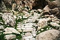
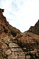
 Carved steps along Ancient Roman Road.jpg 4000 × 3000; 4,83 MB
-

-
 Drumul roman de la Podu Dâmboviţei.jpg 2000 × 3000; 4,56 MB
-
 Erromatar-galtzada-artzi-donazaharre.jpg 856 × 645; 110 KB
-
 Escudo de Villadepera.svg 550 × 965; 460 KB
-
 Glanum Roman Road.JPG 2816 × 2112; 1,47 MB
-
 Hydreuma at Paneion.jpg 285 × 424; 82 KB
-

-
 JuegoRomano-MedinaSidonia.png 491 × 656; 546 KB
-

-
 Nice (06) Thermes de Cimiez Route romain 599.jpg 4590 × 3060; 13,4 MB
-
 Nithsdale Roman Road, Irongray, Dumfries and Galloway.jpg 4896 × 2752; 2,63 MB
-
-
 Old Nithsdale Roman Road, Irongray, Dumfries and Galloway.jpg 4896 × 2752; 2,05 MB
-
 Old Roman road leading to Jerusalem.jpg 1200 × 1122; 876 KB
-
 Old roman road, now bridle path, towards Bainbridge, Yorkshire.jpg 3024 × 4032; 2,96 MB
-
 Path along Roman Road.jpg 2112 × 2816; 2,68 MB
-
 Perge - Straßenpflaster.jpg 1200 × 1600; 783 KB
-

-

-

-

-
 Roman columns broken.jpg 4000 × 3000; 4,74 MB
-
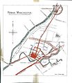
 Roman Manchester (1900) by Charles Roeder, Illustration 15.jpg 1064 × 770; 173 KB
-
 Roman Manchester by Charles Roeder p57.jpg 950 × 733; 184 KB
-
 Roman Manchester by Charles Roeder p83.jpg 1417 × 1632; 613 KB
-
 Roman Road - Steps.jpg 3000 × 4000; 4,73 MB
-
 Roman road 12 mills from Bet gubrin.jpg 2320 × 1627; 2,32 MB
-
 Roman road leading to the old River Earn Ford, Innerpeffray near Crieff.jpg 4896 × 3672; 7,3 MB
-
 Roman Road near Sandford. View West towards Boag Farm. Lanarkshire.jpg 4896 × 2752; 2,53 MB
-
 Roman Road near Walesley Farm. View East towards Craigmuir Farm. Lanarkshire.jpg 4896 × 2752; 2,86 MB
-
 Roman Road near Walesley Farm. View east towards Sandford. Lanarkshire.jpg 4180 × 2735; 2,61 MB
-
 Roman Road near Walesley Farm. View West from Craigmuir Farm. Lanarkshire.jpg 4896 × 2752; 2,79 MB
-
 Roman Road near Walesley Farm. View West towards Drumclog. Lanarkshire.jpg 4896 × 2752; 6,17 MB
-
 Roman road on which pedestrians and animals travel.png 943 × 287; 359 KB
-
 Roman Road plaque.jpg 850 × 567; 735 KB
-
 RomanBridgeAtPhilippi.JPG 2048 × 1536; 1,37 MB
-
 Romanroadalcazaba01.jpg 900 × 675; 239 KB
-
 Sign for cam high road two miles from Bainbridge.jpg 6000 × 8000; 15,05 MB
-
 Sopron z91.jpg 768 × 1024; 267 KB
-
 Steps along the Roman road.jpg 2112 × 2816; 2,81 MB
-
 Trajan's Danube Road.png 228 × 366; 109 KB
-
 Trekking the Old Roman Road.jpg 2816 × 2112; 2,87 MB
-
 Via Apia do Almofrey2 (5345916272).jpg 960 × 1280; 557 KB
-
 Via Caecilia - Tracciati ipotetici.jpg 1006 × 783; 321 KB
-
 Via romana.png 623 × 407; 348 KB
-
 Voie romaine à Beure.jpg 3024 × 4032; 7,64 MB
-
 Voie-romaine-chinon-saumur.png 334 × 462; 241 KB
-
 Voies romaines du Passais.png 1212 × 1940; 3,89 MB
-
 Vue voie Bolène 1.jpg 3264 × 2448; 1,38 MB
-
 Vue voie Bolène 2.jpg 3264 × 2448; 1,65 MB
-
 Worstead Street - geograph.org.uk - 770447.jpg 640 × 480; 112 KB
-
 سنگفرش راه باستانی در بهبهان.jpg 3456 × 2304; 5,94 MB
-
 سنگفرش راه کوهستانی باستانی در ارجان بهبهان.jpg 2304 × 3456; 3,96 MB
.jpg)

_(14585038357).jpg)


_Thermes_de_Cimiez_Route_romain_599.jpg)


_by_Charles_Roeder,_Illustration_15.jpg)


.jpg)


.jpg)