Category:Antonine Wall
Vai alla navigazione
Vai alla ricerca
|
Questo sito è inserito nell'elenco del Patrimonio Mondiale dell'UNESCO sotto l'intitolazione :
Frontiers of the Roman Empire.
|

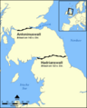
fortificazione romana in Britannia  Ruta de la Muralla Antonina prop de Bar Hill  Posició del mur de Antoní respecte al d'Adrià | |||||
| Carica un file multimediale | |||||
| Istanza di | |||||
|---|---|---|---|---|---|
| Parte di |
| ||||
| Prende il nome da | |||||
| Luogo | Scozia | ||||
| Commissionato da | |||||
| Consiste di | |||||
| Designazione del patrimonio |
| ||||
| Data di fondazione o creazione |
| ||||
| Ha sostituito |
| ||||
 | |||||
Sottocategorie
Questa categoria contiene le 8 sottocategorie indicate di seguito, su un totale di 8.
D
F
R
- RIB I 2146 (2 F)
- RIB I 2197 (1 F)
- Roman Bridge, Duntocher (7 F)
- Roughcastle Tunnel (11 F)
S
- Shirva, Twechar (9 F)
T
- The Roman wall in Scotland (1911) (109 F)
Pagine nella categoria "Antonine Wall"
Questa categoria contiene un'unica pagina, indicata di seguito.
File nella categoria "Antonine Wall"
Questa categoria contiene 110 file, indicati di seguito, su un totale di 110.
-
 2015.104912.Proceedings-Of-The-Society-Of-Antiquaries-Of-Scotland-1914-1915-Vol49 0170.jpg 3 624 × 4 396; 1,43 MB
-
 2015.104912.Proceedings-Of-The-Society-Of-Antiquaries-Of-Scotland-1914-1915-Vol49 0171.jpg 4 620 × 3 753; 1,25 MB
-
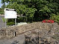
 A different looking Antonine Wall - geograph.org.uk - 1523264.jpg 640 × 480; 102 KB
-
 Antonine Wall - geograph.org.uk - 1460062.jpg 640 × 359; 79 KB
-
 Antonine Wall - geograph.org.uk - 1464443.jpg 640 × 480; 174 KB
-
 Antonine Wall - geograph.org.uk - 49196.jpg 640 × 480; 148 KB
-
 Antonine Wall at Watling Lodge (geograph 3175254).jpg 1 200 × 1 600; 806 KB
-
 Antonine Wall ditch above the Roughcastle Canal Tunnel, Falkirk, Scotland.jpg 4 490 × 3 294; 8,27 MB
-
 Antonine Wall ditch looking east at Roughcastle, Falkirk, Scotland.jpg 4 468 × 3 260; 7,21 MB
-
 Antonine Wall ditch looking west at Roughcastle, Falkirk, Scotland.jpg 4 608 × 3 456; 6,26 MB
-
 Antonine Wall monument, Auld Kirk Museum, Kirkintilloch, East Dunbartonshire.jpg 1 920 × 1 080; 844 KB
-
 Antonine Wall Plaque - geograph.org.uk - 4256323.jpg 640 × 480; 84 KB
-
 Antonine Wall, near Bar Hill - geograph.org.uk - 5431131.jpg 3 264 × 1 836; 2,73 MB
-
 Antonine wall.JPG 320 × 240; 14 KB
-
 Antonine's Wall at Watling Lodge - geograph.org.uk - 1140335.jpg 640 × 415; 87 KB
-
 Antonine.Wall.Roman.forts.jpg 1 513 × 778; 257 KB
-
 Antoninus Wall near Bar Hill.jpg 4 000 × 2 250; 5,83 MB
-
 Antoninus Wall near Bonnybridge.jpg 3 968 × 2 976; 7,68 MB
-
 Antoninus Wall W of Bonnybridge.jpg 4 000 × 2 250; 3,54 MB
-
 Antoninuswall Karte.png 800 × 995; 432 KB
-
 Bar Hill.jpg 633 × 475; 450 KB
-
 Bothwellhaugh.png 1 003 × 841; 1,33 MB
-
 Canal and towpath - geograph.org.uk - 6409527.jpg 1 600 × 1 131; 440 KB
-
 Canal at Twechar - geograph.org.uk - 422564.jpg 640 × 480; 91 KB
-
 Canal maintenance - geograph.org.uk - 6409545.jpg 1 600 × 1 043; 384 KB
-
 Canal maintenance - geograph.org.uk - 6409550.jpg 1 600 × 1 136; 500 KB
-
 Country Lane beside Golf Course - geograph.org.uk - 48117.jpg 640 × 457; 104 KB
-
 Course of the Antonine Wall at Bar Hill - geograph.org.uk - 308685.jpg 640 × 480; 166 KB
-

-
 Ditch of the Antonine Wall at Watling Lodge (geograph 1649848).jpg 640 × 410; 100 KB
-
-
 Farm Diversification Bo'ness - geograph.org.uk - 81875.jpg 640 × 480; 81 KB
-

-

-
 Forth and Clyde Canal - geograph.org.uk - 6409518.jpg 1 600 × 1 200; 502 KB
-
 Fortlet Tartlet, Roman Bake-Off, Callendar House.jpg 2 117 × 3 771; 4,96 MB
-
 Grange Primary School - geograph.org.uk - 531382.jpg 640 × 480; 84 KB
-
 Grangemouth from Inveravon. - geograph.org.uk - 112172.jpg 480 × 640; 90 KB
-
 Hadrians Wall map heb.png 800 × 995; 229 KB
-
 Hadrians Wall map hr.svg 800 × 995; 216 KB
-
 Hadrians Wall map mak.png 800 × 995; 243 KB
-
 Hadrians Wall map mk.svg 800 × 995; 337 KB
-
 Hadrians Wall map Swedish.png 800 × 995; 233 KB
-
 Hadrians Wall map-ca.svg 800 × 995; 217 KB
-
 Hadrians Wall map-es.svg 800 × 995; 217 KB
-
 Hadrians Wall map-fa.svg 800 × 995; 193 KB
-
 Hadrians Wall map-fi.png 800 × 995; 250 KB
-
 Hadrians Wall map-fr.svg 800 × 995; 218 KB
-
 Hadrians Wall map-id.svg 800 × 995; 222 KB
-
 Hadrians Wall map-lv.svg 800 × 995; 217 KB
-
 Hadrians Wall map-ru.svg 800 × 995; 217 KB
-
 Hadrians Wall map-sr.svg 800 × 995; 217 KB
-
 Hadrians Wall map.png 800 × 995; 215 KB
-
 Hadrians Wall map.svg 800 × 995; 226 KB
-
 Inveravon. - geograph.org.uk - 112161.jpg 640 × 480; 81 KB
-
-
 Map of the Flight of locks at Falkirk.png 836 × 908; 896 KB
-
 Mapa paret d'adrian.png 800 × 995; 214 KB
-
 Military Way at Seabegs Wood - geograph.org.uk - 930390.jpg 640 × 480; 107 KB
-
 Millstones in Goldenhill Park - geograph.org.uk - 1511442.jpg 640 × 480; 113 KB
-
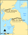 Muroj de Hadriano kaj de Antonino.svg 800 × 995; 217 KB
-
 Ordnance Survey Map of the Antonine Wall, Published 1969 Composite.jpg 62 525 × 13 260; 122,45 MB
-
 Ordnance Survey Map of the Antonine Wall, Published 1969.jpg 12 242 × 9 784; 50 MB
-
 Ordnance Survey part of 25-inch Sheet XXX.2 Falkirk Antonine Wall, Published 1897.jpg 4 605 × 1 621; 1,49 MB
-

-

-
 Picts (Two Left Feet) and runners at the Roman vs Picts 5k race, Callendar House.jpg 2 699 × 1 513; 1,18 MB
-
 Picts (Two Left Feet) at the finish line, Roman vs Picts 5k race, Callendar House.jpg 3 280 × 2 320; 1,79 MB
-
 Picts (Two Left Feet) at the finish, Roman vs Picts 5k race, Callendar House.jpg 3 665 × 2 592; 2,21 MB
-
 Picts (Two Left Feet) at the Roman Bake-off, Callendar House.jpg 3 446 × 2 438; 2,25 MB
-
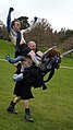 Picts (Two Left Feet) before the Roman vs Picts 5k race, Callendar House.jpg 2 988 × 5 312; 2,69 MB
-
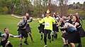 Picts (Two Left Feet) cheer a runner at the Roman vs Picts 5k race, Callendar House.jpg 4 608 × 2 592; 2,73 MB
-

-
 Picts (Two Left Feet) cheer on a runner at the Roman vs Picts 5k race, Callendar House.jpg 5 312 × 2 988; 2,54 MB
-
 Picts (Two Left Feet) in formation at the Roman vs Picts 5k race, Callendar House.jpg 3 914 × 2 936; 3,21 MB
-
 Picts (Two Left Feet) in human pyramid at the Roman vs Picts 5k race, Callendar House.jpg 2 592 × 3 670; 2,76 MB
-
 Polmont banner Roman Vallum of the Antonine Wall.jpg 2 450 × 350; 489 KB
-
 Recent harvest with a secret - geograph.org.uk - 554143.jpg 640 × 480; 82 KB
-
 Relics of the Antonine Wall, Milngavie - geograph.org.uk - 49092.jpg 640 × 480; 182 KB
-
 Rocky Roman Road, Roman Bake-Off, Callendar House.jpg 5 312 × 2 988; 3,48 MB
-
 Roman Bake-Off, Callendar House.jpg 2 988 × 5 312; 3,78 MB
-
 Roman pesto made with ground elder by Anna Canning of Floramedica.jpg 4 608 × 2 592; 3,05 MB
-
 Roman Vallum of the Antonine Wall, Scotland.jpg 2 560 × 1 920; 2,04 MB
-
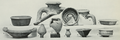
 Romanfortatbalmu00mill orig 0147.png 2 764 × 1 456; 3,49 MB
-
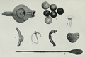
 Romanfortatbalmu00mill orig 0177.png 2 916 × 968; 3,01 MB
-
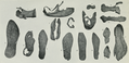
 Romanfortatbalmu00mill orig 0221.png 2 211 × 1 494; 2,92 MB
-
 Romanfortatbalmu00mill orig 0233.png 2 937 × 1 245; 4,08 MB
-
 Romanfortatbalmu00mill orig 0239.png 2 868 × 1 396; 3,53 MB
-

-

-

-
 Runners dressed as Picts and Romans complete the 5k race at Callendar House.jpg 3 547 × 2 660; 3,92 MB
-
 Sign at site of Roman influence - geograph.org.uk - 900122.jpg 480 × 640; 183 KB
-
 Site of the Antonine Wall. - geograph.org.uk - 90434.jpg 640 × 480; 73 KB
-
 Start of the Romans Vs Picts 5k race, Callendar House.jpg 5 312 × 2 988; 6,81 MB
-
 Summit of Crow Hill - geograph.org.uk - 56822.jpg 640 × 480; 155 KB
-
 The Antonine Wall at Dullatur - geograph.org.uk - 1522990.jpg 480 × 640; 136 KB
-

-

-
 The Antonine Wall near Westerwood - geograph.org.uk - 1523007.jpg 480 × 640; 142 KB
-
 The Antonine Wall, Rome's final frontier, the Hunterian Museum..JPG 4 288 × 2 848; 7,88 MB
-
 The ditch associated with the Antonine Wall (geograph 2794338).jpg 428 × 640; 106 KB
-
 The Wall - geograph.org.uk - 282048.jpg 640 × 480; 115 KB
-
 The Wall, The Road and The Canal - geograph.org.uk - 1747771.jpg 968 × 648; 199 KB
-
 Titulihunteriani00macdrich raw 0151 RIB2201v2.png 408 × 732; 391 KB
-
 Titulihunteriani00macdrich raw 0151 RS33.png 313 × 667; 306 KB
-
 Twechar - geograph.org.uk - 87783.jpg 640 × 480; 165 KB
-
 Veni Vidi Victoria Sponge Cake, Roman Bake-Off, Callendar House.jpg 2 117 × 3 771; 4,71 MB
-
 WallOfSeverusEngraving1854.jpg 988 × 636; 723 KB
-
 William Roy Plate XXIX Roman Station Camelon Antonine Wall.jpg 3 208 × 4 821; 4,19 MB


.jpg)


.jpg)


_at_the_Roman_vs_Picts_5k_race,_Callendar_House.jpg)
_at_the_Roman_vs_Picts_5k_race,_Callendar_House.jpg)


_and_Romans_(Antonine_Guard_Living_History_Society)_at_the_Roman_vs_Picts_5k_race,_Callendar_House.jpg)
_and_Romans_(Antonine_Guard_Living_History_Society)_before_the_Roman_vs_Picts_5k_race,_Callendar_House.jpg)
_and_runners_at_the_Roman_vs_Picts_5k_race,_Callendar_House.jpg)
_at_the_finish_line,_Roman_vs_Picts_5k_race,_Callendar_House.jpg)
_at_the_finish,_Roman_vs_Picts_5k_race,_Callendar_House.jpg)
_at_the_Roman_Bake-off,_Callendar_House.jpg)
_before_the_Roman_vs_Picts_5k_race,_Callendar_House.jpg)
_cheer_a_runner_at_the_Roman_vs_Picts_5k_race,_Callendar_House.jpg)
_cheer_on_a_child_runner_at_the_Roman_vs_Picts_5k_race,_Callendar_House.jpg)
_cheer_on_a_runner_at_the_Roman_vs_Picts_5k_race,_Callendar_House.jpg)
_in_formation_at_the_Roman_vs_Picts_5k_race,_Callendar_House.jpg)
_in_human_pyramid_at_the_Roman_vs_Picts_5k_race,_Callendar_House.jpg)


_parade_before_the_Roman_vs_Picts_5k_race,_Callendar_House.jpg)
_saluting_at_the_Roman_vs_Picts_5k_race,_Callendar_House.jpg)
_at_the_Roman_vs_Picts_5k_race,_Callendar_House.jpg)


.jpg)


