Category:Ardfert
Saltar para a navegação
Saltar para a pesquisa
village in Munster, Ireland  | |||||
| Carregar ficheiro | |||||
| Instância de | |||||
|---|---|---|---|---|---|
| Localização | Condado de Kerry, Munster, República da Irlanda | ||||
| Altitude |
| ||||
 | |||||
Subcategorias
Esta categoria contém as seguintes 6 subcategorias (de um total de 6).
A
F
- Ardfert Friary (114 F)
G
- Teampall na nGrifin, Ardfert (2 F)
R
- Rahoneen castle (2 F)
T
- Teampall na hÓighe, Ardfert (11 F)
Multimédia na categoria "Ardfert"
Esta categoria contém os seguintes 35 ficheiros (de um total de 35).
-
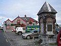
 Ardfert - Talbot-Crosbie Memorial - 20180826161108.jpeg 1 536 × 2 048; 1,02 MB
-
 Ardfert Abbey Cows 1.jpg 4 544 × 2 752; 5,73 MB
-
 Ardfert Abbey Cows 2.jpg 4 554 × 3 220; 5,06 MB
-
 Ardfert cathedral and churches - geograph.org.uk - 6293963.jpg 1 024 × 768; 165 kB
-
 Ardfert Cathedral, Co. Kerry - geograph.org.uk - 6443241.jpg 1 800 × 1 200; 423 kB
-
 Ardfert Cathedral, doorway - geograph.org.uk - 6293463.jpg 768 × 1 024; 298 kB
-
 Ardfert cathedral, east end - geograph.org.uk - 6293437.jpg 1 024 × 768; 179 kB
-
 Ardfert Cathedral, interior looking west - geograph.org.uk - 6293438.jpg 1 024 × 768; 191 kB
-
 Ardfert Cathedral, piscina and sedillia - geograph.org.uk - 6293985.jpg 1 024 × 764; 244 kB
-
 Ardfert Cathedral, south arcade - geograph.org.uk - 6293440.jpg 1 024 × 739; 235 kB
-
 Ardfert Cathedral. west portal - geograph.org.uk - 6293444.jpg 1 024 × 768; 277 kB
-
 Ardfert Friary (The Nave), Co. Kerry - geograph.org.uk - 6443250.jpg 1 797 × 1 198; 401 kB
-
 Ardfert Friary - geograph.org.uk - 6294008.jpg 1 024 × 768; 142 kB
-
 Ardfert Friary, east range of cloister - geograph.org.uk - 6294017.jpg 1 024 × 768; 160 kB
-
 Ardfert Friary, nave looking west - geograph.org.uk - 6294308.jpg 768 × 1 024; 161 kB
-
 Ardfert Friary, south arcade - geograph.org.uk - 6294313.jpg 1 024 × 768; 230 kB
-
 Ardfert Friary, south range of cloister - geograph.org.uk - 6294304.jpg 1 024 × 768; 170 kB
-
 Ardfert, Cathedral enclosure - geograph.org.uk - 6293454.jpg 1 024 × 768; 187 kB
-

-
 Ardfert, Templenagriffin - geograph.org.uk - 6293451.jpg 1 024 × 768; 161 kB
-
 Ardfert, Templenahoe - geograph.org.uk - 6293446.jpg 1 024 × 773; 156 kB
-
 Ardfert, Templenahoe, interior looking east - geograph.org.uk - 6293460.jpg 1 024 × 768; 230 kB
-
 Ballyroe Heights Hotel - geograph.org.uk - 495997.jpg 640 × 480; 79 kB
-
 Farm buildings near Ardfert Friary - geograph.org.uk - 6277228.jpg 1 024 × 768; 146 kB
-
 Limestone wall near Ardfert Friary - geograph.org.uk - 6294013.jpg 1 024 × 768; 181 kB
-
 Roadway, Abbeylands, Ardfert - geograph.org.uk - 6293997.jpg 1 024 × 768; 142 kB
-
 St. Brendan's church, Ardfert - geograph.org.uk - 6277207.jpg 1 024 × 768; 111 kB
-
 Talbot-Crosbie Memorial, Ardfert - geograph.org.uk - 6294319.jpg 768 × 1 024; 151 kB
-
 The Cathedral, Ardfert - geograph.org.uk - 6277220.jpg 1 024 × 768; 186 kB
-
 The centre of Ardfert - geograph.org.uk - 6294321.jpg 1 024 × 768; 118 kB
-
 Tombs in the churchyard, Ardfert - geograph.org.uk - 6293203.jpg 1 024 × 768; 224 kB
-

-
 Ardfert - geograph.org.uk - 258068.jpg 640 × 480; 88 kB
-
 Colourful hedgerow - geograph.org.uk - 530176.jpg 640 × 426; 90 kB
-
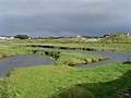 Rahoneen - geograph.org.uk - 658619.jpg 640 × 480; 247 kB


,_Co._Kerry_-_geograph.org.uk_-_6443250.jpg)


