Category:Armley
Zur Navigation springen
Zur Suche springen
Siedlung im Vereinigten Königreich .jpg) | |||||
| Medium hochladen | |||||
| Ist ein(e) | |||||
|---|---|---|---|---|---|
| Ort | City of Leeds, West Yorkshire, Yorkshire and the Humber, England | ||||
 | |||||
Unterkategorien
Es werden 20 von insgesamt 20 Unterkategorien in dieser Kategorie angezeigt:
In Klammern die Anzahl der enthaltenen Kategorien (K), Seiten (S), Dateien (D)
A
- Armley cemetery (17 D)
- Armley Hill Top Cemetery (41 D)
- Armley Liberal Bowling Club (1 D)
B
- Benchmarks in Armley (21 D)
C
- Cabbage Hill, Leeds (1 D)
- Charlie Cake Park, Armley (2 D)
- Clocks in Armley (1 D)
- Cunliff Wood (2 D)
F
- Fences in Armley (4 D)
L
R
S
W
- Western Flatts Cliff Park (10 D)
Medien in der Kategorie „Armley“
Folgende 63 Dateien sind in dieser Kategorie, von 63 insgesamt.
-
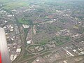
 Armley and Kirkstall from above.jpg 1.600 × 1.200; 592 KB
-
 Armley and Wortley aerial photograph.jpg 500 × 375; 161 KB
-
 Armley Arch Folly - geograph.org.uk - 4817961.jpg 1.280 × 960; 1,22 MB
-
 Armley asbestos disaster.jpg 4.608 × 3.456; 3,53 MB
-
 Armley Clothiers Banner.jpg 4.032 × 2.268; 2,19 MB
-
 Armley fire, Leeds - 13964137415.jpg 5.184 × 3.456; 3,32 MB
-
 Armley Grange Rise - Armley Grange Mount - geograph.org.uk - 1249166.jpg 640 × 440; 168 KB
-
 Armley Junction - geograph.org.uk - 5077980.jpg 1.024 × 768; 210 KB
-

-
 Armley Mills (34266012654).jpg 6.000 × 4.000; 15,02 MB
-
 Armley Mills (34945465122).jpg 6.000 × 4.000; 15,6 MB
-
 Armley Mills (34979702531).jpg 5.992 × 3.137; 10,99 MB
-
 Armley Mills (35070275016).jpg 6.000 × 4.000; 16,7 MB
-
 Armley Mills (35110199125).jpg 6.000 × 4.000; 21,77 MB
-
 Armley Moor - geograph.org.uk - 921917.jpg 640 × 480; 108 KB
-
 Armley Primary School - off Cecil Road - geograph.org.uk - 1014034.jpg 640 × 397; 187 KB
-
 Armley Recreation Ground - geograph.org.uk - 5621736.jpg 1.024 × 768; 87 KB
-
 Armley Sport and Leisure Centre.jpg 1.600 × 1.200; 716 KB
-
 Armley suburbs.jpg 3.115 × 1.893; 1,53 MB
-
 Armley Tennis Club courts - geograph.org.uk - 6455056.jpg 1.024 × 768; 111 KB
-
 Armley, Aviary (31745594766).jpg 1.280 × 853; 830 KB
-
 Aviaries Estate and Midland Works, Armley.png 923 × 561; 1,15 MB
-
 Benchmark on ^2 Salisbury Terrace - geograph.org.uk - 5291689.jpg 1.024 × 683; 249 KB
-
 Bridge (4764775195).jpg 1.681 × 1.712; 3,09 MB
-
 Diversion on NCN 66 - geograph.org.uk - 5049522.jpg 1.024 × 772; 169 KB
-
 Eyres Avenue, Armley, Leeds (38488869700).jpg 5.312 × 2.988; 7,48 MB
-

-
 Gate Piers And Flanking Walls To The Towers.jpg 4.608 × 3.456; 5,49 MB
-
 Girders (4757897295).jpg 2.560 × 1.840; 5,45 MB
-
 Grave detail, St Bartholomew, Armley (4757932859).jpg 1.770 × 1.770; 3,16 MB
-

-
 Leeds And Liverpool Canal (34474858123).jpg 5.808 × 3.036; 6,45 MB
-
 Leeds And Liverpool Canal (34496364024).jpg 3.840 × 2.160; 2,77 MB
-
 Leeds Views (28535645848).jpg 3.997 × 2.241; 8,9 MB
-
 Leeds Views (40600978720).jpg 5.985 × 2.959; 15,88 MB
-
 Leeds Views (41506455605).jpg 6.000 × 4.000; 16,53 MB
-
 Leeds Views (41506501225).jpg 5.904 × 3.832; 13,98 MB
-
 Ley Lane housing estate 16 July 2017.jpg 3.072 × 2.304; 2,62 MB
-
 Love Armley.jpg 2.516 × 3.007; 8,12 MB
-

-
-
 Mind the Gap (4764595651).jpg 2.260 × 1.772; 3,42 MB
-
 Norwood Soft Drinks (2316553277).jpg 2.560 × 1.920; 3,37 MB
-
 Oriental Place - Athlone Street, Armley - geograph.org.uk - 1032268.jpg 640 × 444; 180 KB
-
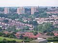 Overview of Western Armley.jpg 3.648 × 2.736; 2,29 MB
-
 Railway Bridge - geograph.org.uk - 2108267.jpg 800 × 531; 119 KB
-
 Recreation Ground - Moorfield Road - geograph.org.uk - 1249727.jpg 640 × 413; 146 KB
-
 Sarah Rodgers was buried (9061575238).jpg 2.325 × 3.654; 5,33 MB
-
 School (2317364192).jpg 2.560 × 1.920; 3,56 MB
-
 Skeltons of Armley (6882485839).jpg 2.202 × 2.991; 5,94 MB
-
 Snow on the rooftops in Armley.JPG 1.664 × 416; 197 KB
-

-
 Victorian post box, Armley, Aviary (30941364564).jpg 1.280 × 853; 809 KB
-
 Victorian post box, Armley, Aviary (30973037033).jpg 1.280 × 853; 627 KB
-
 Victorian post box, Armley, Aviary (31635356572).jpg 1.280 × 853; 773 KB
-
 Victorian post box, Armley, Aviary (31782731635).jpg 1.280 × 853; 498 KB
-
-

-
 View from Bridge LBE1-6 - Tong Road - geograph.org.uk - 1826216.jpg 640 × 544; 126 KB
-

-
-

-


.jpg)
.jpg)
.jpg)
.jpg)
.jpg)


.jpg)


.jpg)

.jpg)


.jpg)
.jpg)

.jpg)
.jpg)
.jpg)
.jpg)
.jpg)
.jpg)


.jpg)
.jpg)


.jpg)
.jpg)
.jpg)

.jpg)
.jpg)
.jpg)
.jpg)


