Category:Arnold, Nottinghamshire
Zur Navigation springen
Zur Suche springen
Vorort der Stadt Nottingham  | |||||
| Medium hochladen | |||||
| Ist ein(e) | |||||
|---|---|---|---|---|---|
| Ist Teil von |
| ||||
| Ort | Borough of Gedling, Nottinghamshire, East Midlands, England | ||||
| Fläche |
| ||||
| Verschieden von | |||||
 | |||||
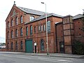
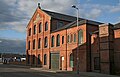
English: The town's most notable landmark is probably the Home Ales building in Daybrook. Founded in 1875, the brewery was famous for its Robin Hood logo on beermats. The brewery remained independent until 1986 when it (along with its 450 owned public houses) was purchased by Scottish & Newcastle for £123million. Scottish & Newcastle gradually moved production to its Mansfield brewery site, resulting in the eventual closure of the Daybrook building in 1996. Home Bitter is still brewed under contract at Everards in Leicester, although many of the public houses that used to serve it now sell Theakston's beers instead. The Home Ales building now houses county council offices. The illuminated 'Home of the Best Ales' sign was altered to include the Nottinghamshire County Council logo.
Deutsch: Arnold ist ein nord-östlich gelegener Vorort von Nottingham an der Stadtgrenze und gehört zum Bezirk Gedling. Die Stadt Arnold hat etwa 35.900 Einwohner (Stand 2000). Der Name stammt von Ernehale was so viel wie valley of eagles (Adlertal) bedeutet.
Italiano: Arnold è una cittadina di 35.900 abitanti della contea del Nottinghamshire, in Inghilterra.
Unterkategorien
Es werden 9 von insgesamt 9 Unterkategorien in dieser Kategorie angezeigt:
In Klammern die Anzahl der enthaltenen Kategorien (K), Seiten (S), Dateien (D)
A
- St Mary's Church, Arnold (4 D)
B
D
- Daybrook railway station (3 D)
- Dorket Head (3 D)
P
- Peggy's Park, Arnold (16 D)
S
W
Medien in der Kategorie „Arnold, Nottinghamshire“
Folgende 200 Dateien sind in dieser Kategorie, von 200 insgesamt.
-
 Killisick Lane, Arnold - geograph.org.uk - 50606.jpg 640 × 480; 193 KB
-
 321 Mansfield Road, Redhill.jpg 1.024 × 768; 202 KB
-
 Acton Road, Arnold - geograph.org.uk - 1633189.jpg 640 × 480; 76 KB
-
 Aerial photo of Surgeys Lane - geograph.org.uk - 51789.jpg 640 × 452; 124 KB
-
 Arnold Fire Station - geograph.org.uk - 418368.jpg 640 × 427; 193 KB
-
 Arnold Health Centre - geograph.org.uk - 1557729.jpg 640 × 479; 79 KB
-
 Arnold Methodist Church - geograph.org.uk - 1557725.jpg 640 × 479; 122 KB
-
 Arnold Post Office - geograph.org.uk - 1557717.jpg 640 × 479; 81 KB
-
 Arnold Town Centre 6526.jpg 4.608 × 3.456; 3,32 MB
-
 Arnold Town Centre 6527.jpg 4.608 × 3.456; 2,29 MB
-
 Arnold Town Centre 6528.jpg 4.608 × 3.456; 3,44 MB
-
 Arnold Town Centre 6529.jpg 4.608 × 3.456; 3,31 MB
-
 Arnold Town Centre 6530.jpg 4.608 × 3.456; 3,28 MB
-
 Arnold Town Centre 6531.jpg 4.608 × 3.456; 3,07 MB
-
 Arnold Town Centre 6532c.jpg 3.915 × 2.919; 1,7 MB
-
 Arnold Town Centre 6533.jpg 4.608 × 3.456; 3,27 MB
-
 Arnold Town Centre 6534.jpg 4.608 × 3.456; 3,26 MB
-
 Arnold Town Centre 6535.jpg 3.990 × 2.989; 2,02 MB
-
 Arnold Town Centre 6536.jpg 3.925 × 2.940; 2,16 MB
-
 Arnold Town Centre 6537.jpg 4.608 × 3.456; 3,09 MB
-
 Arnold Town Centre 6538.jpg 4.395 × 3.297; 2,44 MB
-
 Arnold Town Centre 6539.jpg 4.608 × 3.456; 3,26 MB
-
 Arnold Town Centre 6540.jpg 4.608 × 3.456; 3,24 MB
-
 Arnold Town Centre 6541.jpg 4.608 × 3.456; 3,23 MB
-
 Arnold Town Centre 6542.jpg 4.608 × 3.456; 3,47 MB
-
 Arnold Town Centre 6543.jpg 4.608 × 3.456; 3,46 MB
-
 Arnold Town Centre 6544.jpg 4.261 × 3.195; 2,3 MB
-
 Arnold Urban District, Nottinghamshire (1970).svg 455 × 745; 64 KB
-
 Arnold, The Market Place - geograph.org.uk - 1557723.jpg 640 × 479; 134 KB
-
 Arnot Hill Park, Arnold, Notts. - geograph.org.uk - 3814951.jpg 3.818 × 2.544; 1,78 MB
-
 Arnovale Road, Arnold - geograph.org.uk - 35576.jpg 640 × 480; 96 KB
-
 Back of Byrne Court - geograph.org.uk - 1145302.jpg 640 × 479; 64 KB
-
 Bark Graffiti - geograph.org.uk - 658340.jpg 480 × 640; 118 KB
-
 Barnby Walk - geograph.org.uk - 1198342.jpg 476 × 640; 98 KB
-
 Barnby Walk - geograph.org.uk - 1198371.jpg 430 × 640; 87 KB
-
 Beechwood Road, Arnold - geograph.org.uk - 35574.jpg 640 × 480; 112 KB
-
 Bestwood Pumping Station - geograph.org.uk - 661575.jpg 640 × 419; 51 KB
-
 Bestwood Pumping Station - geograph.org.uk - 661581.jpg 640 × 480; 73 KB
-
 Bonington House - geograph.org.uk - 1557733.jpg 479 × 640; 120 KB
-
 Bus at Killisick terminus - geograph.org.uk - 3006726.jpg 1.024 × 768; 238 KB
-
 Bus turn round - geograph.org.uk - 1145204.jpg 640 × 480; 59 KB
-
 Byron Street from Mansfield Road - geograph.org.uk - 857124.jpg 640 × 426; 106 KB
-
 Calverton Road, Arnold - geograph.org.uk - 1758652.jpg 640 × 480; 74 KB
-
 Chartwell Grove - geograph.org.uk - 1145289.jpg 640 × 479; 52 KB
-
 Chase Farm - geograph.org.uk - 1145262.jpg 640 × 479; 49 KB
-
 Chase Farm - geograph.org.uk - 1145334.jpg 640 × 452; 52 KB
-
 Chippenham Road - geograph.org.uk - 1206737.jpg 479 × 640; 69 KB
-
 Church Drive, Daybrook - geograph.org.uk - 857128.jpg 640 × 426; 74 KB
-
 Churn stand - geograph.org.uk - 1127272.jpg 640 × 477; 282 KB
-
 Coppice Road - geograph.org.uk - 1127361.jpg 640 × 479; 223 KB
-
 Coppice Road - geograph.org.uk - 1127365.jpg 640 × 472; 149 KB
-
 Corncrake Drive - geograph.org.uk - 1127360.jpg 640 × 473; 136 KB
-
 Coronation Buildings, Gedling.jpg 1.024 × 768; 139 KB
-
 Crimea Farm - geograph.org.uk - 1127256.jpg 640 × 467; 239 KB
-
 Crimea Farm - geograph.org.uk - 1127267.jpg 640 × 444; 121 KB
-
 Crimea Farm - geograph.org.uk - 1758018.jpg 800 × 600; 135 KB
-
 Crimea Farm - geograph.org.uk - 896129.jpg 640 × 480; 79 KB
-
 Cross Street Baptist Church, Arnold - geograph.org.uk - 1042525.jpg 640 × 495; 61 KB
-
 Cross Street, Arnold - geograph.org.uk - 1758639.jpg 800 × 600; 96 KB
-
 Daybrook 6549.jpg 4.608 × 3.456; 3,16 MB
-
 Daybrook 6550.jpg 4.608 × 3.456; 3,37 MB
-
 Daybrook 6551.jpg 4.608 × 3.456; 3,34 MB
-
 Daybrook 6552.jpg 4.608 × 3.456; 3,29 MB
-
 Daybrook 6553.jpg 4.608 × 3.456; 3,08 MB
-
 Daybrook 6554.jpg 4.363 × 3.206; 1,92 MB
-
 Daybrook 6555.jpg 4.167 × 2.698; 1,42 MB
-
 Daybrook 6556.jpg 4.608 × 3.456; 3,24 MB
-
 Daybrook Linen Services - geograph.org.uk - 857146.jpg 640 × 426; 84 KB
-
 Decorative panel - Mashing - geograph.org.uk - 857073.jpg 640 × 426; 85 KB
-
 Edward's Lane Community Centre 5744.JPG 4.608 × 3.456; 3,25 MB
-
 Family of the Black Sheep - geograph.org.uk - 661592.jpg 640 × 396; 90 KB
-
 Farmland East of the B684 - geograph.org.uk - 1757993.jpg 800 × 600; 159 KB
-
 Farmland near Arnold Lodge - geograph.org.uk - 1758658.jpg 640 × 480; 47 KB
-
 Farmland near Chase Farm - geograph.org.uk - 1145330.jpg 640 × 477; 69 KB
-
 Footballers Estate - geograph.org.uk - 1145303.jpg 640 × 479; 57 KB
-
 Footpath in Redhill, Nottinghamshire - geograph-3850286.jpg 3.835 × 3.018; 1,95 MB
-
 Front Street - geograph.org.uk - 1557724.jpg 479 × 640; 97 KB
-
 Front Street - geograph.org.uk - 1557734.jpg 640 × 479; 86 KB
-
 Gedling Miners' Welfare - geograph.org.uk - 1145214.jpg 640 × 479; 47 KB
-
 Gedling Road - geograph.org.uk - 1145255.jpg 640 × 479; 74 KB
-
 Gedling Road top - geograph.org.uk - 1145259.jpg 640 × 474; 69 KB
-
 Goddard Court - geograph.org.uk - 1127350.jpg 640 × 479; 152 KB
-
 Gym on Plains Road - geograph.org.uk - 1145242.jpg 640 × 479; 89 KB
-
 High Street Avenue - geograph.org.uk - 1557728.jpg 479 × 640; 95 KB
-
 Home Brewery building - geograph.org.uk - 857045.jpg 640 × 426; 67 KB
-
 Home Brewery buildings, Daybrook - geograph.org.uk - 18594.jpg 633 × 480; 284 KB
-
 Home Brewery Co crest monument Sir John Robinson Way Daybrook - Arnold.jpg 3.126 × 2.233; 2,14 MB
-
 Home Brewery main gate - geograph.org.uk - 857051.jpg 1.280 × 853; 370 KB
-
 Home Brewery tower - geograph.org.uk - 857055.jpg 858 × 1.280; 343 KB
-
 Horse and Jockey - geograph.org.uk - 1557737.jpg 640 × 479; 76 KB
-
 Houses on Woodthorpe Drive - geograph.org.uk - 1198292.jpg 640 × 479; 97 KB
-
 Howbeck Road - geograph.org.uk - 1127366.jpg 640 × 476; 131 KB
-
 Keepers Cottage - geograph.org.uk - 1761630.jpg 640 × 480; 99 KB
-
 Kirkley Gardens, Arnold - geograph.org.uk - 1757974.jpg 800 × 600; 123 KB
-
 Lane to Chase Farm - geograph.org.uk - 1145286.jpg 479 × 640; 163 KB
-
 Larkspur Avenue, Redhill - geograph.org.uk - 1758646.jpg 640 × 480; 75 KB
-
 Local shops - geograph.org.uk - 1198318.jpg 640 × 479; 151 KB
-
 Looking down Rolleston Drive - geograph.org.uk - 1127368.jpg 479 × 640; 97 KB
-
 Mansfield Rd, Daybrook - geograph.org.uk - 35570.jpg 640 × 480; 91 KB
-
 Mapperley Orchard - geograph.org.uk - 1127363.jpg 640 × 479; 139 KB
-
 Mapperley Plains - geograph.org.uk - 1145301.jpg 640 × 479; 84 KB
-
 Mapperley Plains, Gedling Borough - geograph.org.uk - 32047.jpg 640 × 480; 73 KB
-
 Mapperly Heights - New Block of Flats - geograph.org.uk - 896123.jpg 640 × 480; 100 KB
-
 Market Office - geograph.org.uk - 1557739.jpg 479 × 640; 109 KB
-
 Methodist Church Hall - geograph.org.uk - 1557738.jpg 640 × 479; 71 KB
-
 Montfort Crescent - geograph.org.uk - 1198331.jpg 640 × 479; 90 KB
-
 Morleys' Mill, Daybrook - geograph.org.uk - 857151.jpg 640 × 412; 81 KB
-
 Morleys' Mill, Daybrook - geograph.org.uk - 857155.jpg 442 × 640; 95 KB
-
 Mosswood Crescent - geograph.org.uk - 1206735.jpg 640 × 479; 78 KB
-
 New homes for the elderly - geograph.org.uk - 1145142.jpg 640 × 480; 51 KB
-
 Newcombe Drive - geograph.org.uk - 1127356.jpg 640 × 479; 121 KB
-
 North from Patricia Drive, Arnold - geograph.org.uk - 50601.jpg 640 × 480; 123 KB
-
 Odd objects in the park - geograph.org.uk - 1198285.jpg 640 × 479; 133 KB
-
 Old railway bridge - geograph.org.uk - 1557701.jpg 640 × 479; 100 KB
-
 Old railway line - geograph.org.uk - 1557704.jpg 479 × 640; 149 KB
-
 Oldest house in Arnold - geograph.org.uk - 35582.jpg 640 × 480; 124 KB
-
 Open space - geograph.org.uk - 1145304.jpg 640 × 479; 56 KB
-
 Orchard Park - geograph.org.uk - 1145291.jpg 640 × 479; 56 KB
-
 Over the edge - geograph.org.uk - 1144700.jpg 640 × 453; 105 KB
-
 Oxclose Lane - geograph.org.uk - 1206635.jpg 640 × 479; 99 KB
-
 Oxclose Lane Police Station - geograph.org.uk - 127090.jpg 640 × 480; 56 KB
-
 Pedestrianised Front Street - geograph.org.uk - 1557721.jpg 640 × 479; 114 KB
-
 Pedestrianised Front Street - geograph.org.uk - 1557726.jpg 479 × 640; 107 KB
-
 Pepperpots - geograph.org.uk - 1145282.jpg 640 × 479; 101 KB
-
 Pepperpots - geograph.org.uk - 1145308.jpg 640 × 479; 91 KB
-
 Prefabricated House Arnold Nottinghamshire.JPG 1.632 × 1.224; 238 KB
-
 Ramsey Drive - geograph.org.uk - 1127355.jpg 640 × 479; 123 KB
-
 Ramsey Drive - geograph.org.uk - 1127358.jpg 640 × 479; 156 KB
-
 Redhill, Nottinghamshire - geograph-3850530.jpg 3.376 × 2.107; 1,57 MB
-
 Road Junction, Arnold - geograph.org.uk - 1758640.jpg 640 × 480; 75 KB
-
 Roadside snacks - geograph.org.uk - 1145156.jpg 640 × 480; 68 KB
-
 Sainsbury's - geograph.org.uk - 307190.jpg 640 × 426; 79 KB
-
 Sandfield Road, Arnold - geograph.org.uk - 1557708.jpg 640 × 479; 133 KB
-
 Shops on Mansfield Road - geograph.org.uk - 1198323.jpg 640 × 479; 135 KB
-
 Somersby Road - geograph.org.uk - 1145196.jpg 640 × 480; 62 KB
-
 Somersby Road - geograph.org.uk - 896122.jpg 480 × 640; 71 KB
-
 Spoil tip - geograph.org.uk - 1145316.jpg 640 × 479; 113 KB
-
 Spring Lane - geograph.org.uk - 1127268.jpg 640 × 476; 166 KB
-
 Spring Lane - geograph.org.uk - 1127345.jpg 640 × 430; 154 KB
-
 Spring Lane - geograph.org.uk - 1758008.jpg 800 × 600; 160 KB
-
 Spring Lane - geograph.org.uk - 1758021.jpg 800 × 600; 172 KB
-
 Spring Lane Farm and spring - geograph.org.uk - 1127344.jpg 640 × 471; 125 KB
-
 The Friar Tuck - geograph.org.uk - 1557715.jpg 640 × 479; 81 KB
-
 The Longbow - geograph.org.uk - 1758651.jpg 640 × 480; 66 KB
-
 The Maid Marian, Arnold - geograph.org.uk - 1757981.jpg 800 × 386; 71 KB
-
 The new Killisick terminus - geograph.org.uk - 1952773.jpg 1.280 × 834; 260 KB
-
 The Oxclose - geograph.org.uk - 790407.jpg 640 × 384; 55 KB
-
 The Ram, Redhill - geograph.org.uk - 1758644.jpg 640 × 438; 49 KB
-
 The Tree Tops - geograph.org.uk - 1145232.jpg 640 × 479; 95 KB
-
 Tithby Drive - geograph.org.uk - 1198335.jpg 640 × 479; 102 KB
-
 Top Pepperpot - geograph.org.uk - 1145276.jpg 640 × 479; 136 KB
-
 View from Violet Hill - geograph.org.uk - 658377.jpg 640 × 480; 164 KB
-
 Waste ground on Mapperley Plains - geograph.org.uk - 1145249.jpg 640 × 479; 58 KB
-
 Winchester and Woodthorpe Courts bus stop – Nottingham (1197817).jpg 640 × 470; 101 KB
-
 Woodthorpe Drive - geograph.org.uk - 1198314.jpg 640 × 479; 115 KB
-
 Worrall Avenue, Arnold - geograph.org.uk - 1557716.jpg 640 × 479; 87 KB
-
 Arch Hill, Red Hill, Arnold - geograph.org.uk - 34203.jpg 640 × 480; 105 KB
-
 Belconnen Road - geograph.org.uk - 18538.jpg 640 × 480; 284 KB
-
 Boundary Marker - geograph.org.uk - 39360.jpg 480 × 640; 120 KB
-
 City Boundary - geograph.org.uk - 39357.jpg 640 × 480; 119 KB
-
 Collection boxes - geograph.org.uk - 661540.jpg 640 × 350; 121 KB
-
 Communications Mast - geograph.org.uk - 39364.jpg 640 × 480; 94 KB
-
 Countryside near Violet Hill - geograph.org.uk - 661536.jpg 640 × 640; 144 KB
-
 Death Row - geograph.org.uk - 486095.jpg 640 × 480; 136 KB
-
 Edwards Lane - geograph.org.uk - 18536.jpg 640 × 480; 342 KB
-
 Equestrian Centre at Violet Hill - geograph.org.uk - 658374.jpg 640 × 480; 105 KB
-

-
 Farmland near Tophouse Farm - geograph.org.uk - 661578.jpg 640 × 480; 99 KB
-
 Farmland near Tophouse Farm - geograph.org.uk - 661583.jpg 640 × 385; 80 KB
-
 Farmland with birdbox - geograph.org.uk - 661570.jpg 480 × 640; 134 KB
-
 Five ways - geograph.org.uk - 18589.jpg 640 × 480; 152 KB
-
 Footpath on Violet Hill - geograph.org.uk - 661541.jpg 450 × 640; 154 KB
-
 Foursquare^ - geograph.org.uk - 658412.jpg 640 × 473; 125 KB
-
 Front St, Arnold - geograph.org.uk - 35572.jpg 640 × 480; 87 KB
-
 Front Street - geograph.org.uk - 639650.jpg 640 × 427; 78 KB
-
 Front Street - geograph.org.uk - 639652.jpg 640 × 427; 79 KB
-
 Gate onto land next to Arnold Lodge - geograph.org.uk - 458451.jpg 640 × 480; 165 KB
-
 Harlequin Sky Over Woodthorpe Grange - geograph.org.uk - 189102.jpg 640 × 480; 39 KB
-
 Horse trail at the edge of Big Wood - geograph.org.uk - 1435327.jpg 640 × 480; 80 KB
-
 Im-Mobile Homes - geograph.org.uk - 661586.jpg 640 × 480; 109 KB
-

-
 Kent Road, Porchester Gardens - geograph.org.uk - 87818.jpg 640 × 480; 90 KB
-
 Lamin Plantation (Oak Woodland) - geograph.org.uk - 661544.jpg 640 × 480; 107 KB
-
 Lamin Plantation (Oak Woodland) - geograph.org.uk - 661568.jpg 640 × 480; 110 KB
-
 Lamins Lane - geograph.org.uk - 661542.jpg 480 × 640; 122 KB
-
 Landfill site, Bestwood Village - geograph.org.uk - 661594.jpg 640 × 433; 90 KB
-
 Major Oak Public House - geograph.org.uk - 34683.jpg 640 × 480; 115 KB
-
 Muddy curves - geograph.org.uk - 658366.jpg 640 × 394; 158 KB
-
 Nottingham Prison - geograph.org.uk - 18537.jpg 640 × 480; 283 KB
-
 Old Spot Public House - geograph.org.uk - 34690.jpg 640 × 480; 113 KB
-
 Out for a ride - geograph.org.uk - 658371.jpg 479 × 640; 133 KB
-
 Porchester Road, Nottingham - geograph.org.uk - 39355.jpg 640 × 480; 122 KB
-
 Remains of Middlebeck Farm - geograph.org.uk - 34674.jpg 640 × 480; 104 KB
-
 Scout Hut Gates, Black Woods - geograph.org.uk - 88554.jpg 640 × 480; 90 KB
-
 Sunrise Avenue, Killarney Park - geograph.org.uk - 661585.jpg 640 × 480; 99 KB
-
 The Lord Nelson - geograph.org.uk - 34687.jpg 640 × 480; 112 KB
-
 The Old Rectory - geograph.org.uk - 661591.jpg 480 × 640; 167 KB
-
 Top of Spring Lane, Arnold - geograph.org.uk - 35731.jpg 640 × 480; 106 KB
-
 Top Valley - geograph.org.uk - 18881.jpg 640 × 480; 56 KB
-
 View of Woodborough Lane - geograph.org.uk - 458442.jpg 640 × 480; 150 KB


.svg)


.jpg)


_-_geograph.org.uk_-_661544.jpg)
_-_geograph.org.uk_-_661568.jpg)


