Category:Bestwood Country Park
Jump to navigation
Jump to search
English: Bestwood Country Park is an area of grassland and wetland near Bestwood Village in en:Nottinghamshire
country park in Nottinghamshire  | |||||
| Upload media | |||||
| Instance of | |||||
|---|---|---|---|---|---|
| Location | Bestwood Village, Gedling, Nottinghamshire, East Midlands, England | ||||
 | |||||
Media in category "Bestwood Country Park"
The following 48 files are in this category, out of 48 total.
-

-

-
 Bestwood Country Park - geograph.org.uk - 657914.jpg 640 × 402; 90 KB
-
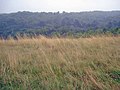
 Bestwood Country Park - Parkside Pasture - geograph.org.uk - 661595.jpg 640 × 480; 100 KB
-
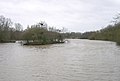
 Bestwood Country Park - the River Leen - geograph.org.uk - 661616.jpg 640 × 480; 130 KB
-
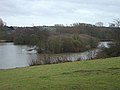
 Bestwood Country Park- Mill Lakes - geograph.org.uk - 661620.jpg 640 × 480; 113 KB
-
 Bestwood Country Park- Mill Lakes - geograph.org.uk - 661632.jpg 640 × 480; 79 KB
-
 Bestwood Country Park- Mill Lakes - geograph.org.uk - 661635.jpg 640 × 433; 53 KB
-

-
 Bestwood Country-park cycle National Cycle Network route 6 signing 6523.jpg 4,608 × 3,456; 3.54 MB
-
 Bestwood Country-park National Cycle Network route 6 sign 6521.jpg 4,608 × 3,456; 3.56 MB
-
 Bestwood Country-park National Cycle Network route 6 sign 6525.jpg 3,450 × 3,447; 2.48 MB
-
 Bestwood Country-park stone 6517.jpg 4,124 × 3,091; 2.61 MB
-
 Bestwood Country-park vista 6511.jpg 4,608 × 3,456; 3.3 MB
-
 Bestwood Country-park vista 6512.jpg 4,608 × 3,456; 3.28 MB
-
 Bestwood Country-park vista 6514.jpg 4,608 × 3,456; 3.39 MB
-
 Bestwood Country-park vista 6519.jpg 4,608 × 3,456; 3.48 MB
-
 Bestwood Lodge formal gardens - geograph.org.uk - 1340463.jpg 640 × 427; 121 KB
-
 Bestwood National Cycle Network route 6 6513.jpg 4,608 × 3,456; 3.35 MB
-
 Bestwood National Cycle Network route 6 6515.jpg 4,608 × 3,456; 3.37 MB
-
 Bestwood National Cycle Network route 6 6522.jpg 4,608 × 3,456; 3.54 MB
-
 Bestwood National Cycle Network route 6 sign 6520.jpg 4,608 × 3,456; 3.47 MB
-
 Big Wood - geograph.org.uk - 1435344.jpg 640 × 480; 92 KB
-
 Butlers-hill-panorama-1.jpg 7,666 × 2,454; 2.83 MB
-
 Car park, Bestwood Country Park - geograph.org.uk - 1340328.jpg 640 × 427; 128 KB
-
 Footpath in Bestwood Country Park - geograph.org.uk - 1340429.jpg 640 × 427; 126 KB
-
 Footpath through the park - geograph.org.uk - 1340412.jpg 427 × 640; 145 KB
-
 Former Garden Pond and Fountain - geograph.org.uk - 158150.jpg 640 × 480; 82 KB
-
 Former Quarry and Tip - geograph.org.uk - 158146.jpg 640 × 480; 56 KB
-

-

-
 Mill-lakes-panorama-1.jpg 9,462 × 2,160; 2.9 MB
-
 Mill-lakes-panorama-2.jpg 8,543 × 2,225; 2.86 MB
-
 On the edge of Bestwood Country Park - geograph.org.uk - 1340470.jpg 640 × 427; 119 KB
-

-
 Path Around Mill Lake - geograph.org.uk - 652046.jpg 640 × 427; 237 KB
-

-
 Tin-bridge-panorama-1.jpg 12,239 × 2,347; 5.13 MB
-
 Unidentified duck in Bestwood Country Park November 2009.jpg 3,648 × 2,736; 3.11 MB
-
 Bestwood Country Park - Birdbath ^ - geograph.org.uk - 658349.jpg 480 × 640; 157 KB
-
 Bestwood Country Park - campfire site - geograph.org.uk - 657922.jpg 640 × 480; 192 KB
-

-
 Bestwood Country Park - Colliers Pad - geograph.org.uk - 658351.jpg 480 × 640; 161 KB
-
 Bestwood Country Park - geograph.org.uk - 1436607.jpg 640 × 480; 75 KB
-

-

-

-
 Robin Hood Way in Bestwood Country Park - geograph.org.uk - 661589.jpg 480 × 640; 172 KB


