Category:Ashwell, Hertfordshire
Jump to navigation
Jump to search
village and civil parish in North Hertfordshire, United Kingdom  | |||||
| Upload media | |||||
| Instance of | |||||
|---|---|---|---|---|---|
| Location | North Hertfordshire, Hertfordshire, East of England, England | ||||
| Population |
| ||||
 | |||||
Subcategories
This category has the following 13 subcategories, out of 13 total.
A
- Arbury Banks (3 F)
- Ashwell Bury (4 F)
- Ashwell hoard (5 F)
- Ashwell Museum (7 F)
- Ashwell Springs (7 F)
- Ashwell War Memorial (3 F)
B
- Bear House, Ashwell (3 F)
D
- Ducklake, Ashwell (2 F)
T
- The Guild House, Ashwell (2 F)
Media in category "Ashwell, Hertfordshire"
The following 200 files are in this category, out of 498 total.
(previous page) (next page)-
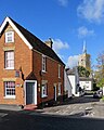
 'College', Ashwell - geograph.org.uk - 774080.jpg 640 × 480; 72 KB
-
 1 Mill Street - geograph.org.uk - 5138815.jpg 640 × 480; 73 KB
-
 16th C house in the High Street - geograph.org.uk - 5136715.jpg 640 × 480; 68 KB
-
-
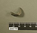
 2005 T32b, fragment of a Roman silver finger ring from Ashwell, Herts (FindID 212823).jpg 2,048 × 1,536; 1,021 KB
-
-

-

-
-
 29, 31, 33 Mill Street, Ashwell - geograph.org.uk - 4651057.jpg 640 × 428; 129 KB
-
 A back lane, Ashwell - geograph.org.uk - 676818.jpg 480 × 640; 55 KB
-
 A passing place on Northfield Road - geograph.org.uk - 5321402.jpg 1,024 × 682; 924 KB
-
 A road named Hodwell - geograph.org.uk - 1246807.jpg 640 × 480; 87 KB
-
 A rolling sea of green - geograph.org.uk - 4180611.jpg 640 × 362; 21 KB
-
 A spring-green willow on Station Road - geograph.org.uk - 4888806.jpg 1,024 × 683; 844 KB
-
 A505 approaching Slip End - geograph.org.uk - 2440016.jpg 640 × 416; 48 KB
-
 Across the fields to Ashwell - geograph.org.uk - 5581110.jpg 1,024 × 732; 926 KB
-
 Across the fields to Guilden Morden - geograph.org.uk - 5321194.jpg 819 × 1,024; 1.2 MB
-
 Along Shire Balk - geograph.org.uk - 4890779.jpg 1,024 × 732; 1.01 MB
-
 An evil pool - geograph.org.uk - 4650352.jpg 640 × 480; 105 KB
-
 Approaching Newnham Way - geograph.org.uk - 5300521.jpg 640 × 480; 73 KB
-
 Approaching the junction - geograph.org.uk - 5300520.jpg 640 × 480; 61 KB
-
 Arbury Banks - geograph.org.uk - 5300522.jpg 640 × 480; 55 KB
-
 Old cottages along Swan Street - geograph.org.uk - 1246790.jpg 640 × 475; 67 KB
-
 Ashwell (4956681024).jpg 2,639 × 1,980; 707 KB
-
 Ashwell (5633066424).jpg 2,497 × 1,873; 1.43 MB
-
 Ashwell , Church of St Mary - geograph.org.uk - 6597236.jpg 847 × 1,024; 722 KB
-
 Ashwell bus shelter - geograph.org.uk - 5300528.jpg 640 × 480; 109 KB
-
 Ashwell cemetery - geograph.org.uk - 5116796.jpg 640 × 480; 110 KB
-
 Ashwell church - geograph.org.uk - 4650304.jpg 640 × 480; 143 KB
-
 Ashwell churchyard - geograph.org.uk - 4889569.jpg 1,024 × 768; 1.2 MB
-
 Ashwell Country Show - geograph.org.uk - 1629835.jpg 640 × 480; 101 KB
-
 Ashwell Cricket Ground - geograph.org.uk - 4889982.jpg 1,024 × 732; 1.09 MB
-
 Ashwell cricket ground - geograph.org.uk - 5116791.jpg 640 × 480; 61 KB
-
 Ashwell End, a bend in the road - geograph.org.uk - 5580960.jpg 1,024 × 819; 1.08 MB
-
 Ashwell End, a cloudless sky in late October - geograph.org.uk - 5581087.jpg 1,024 × 768; 982 KB
-
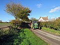 Ashwell End, a green tractor near Bluegates Farm - geograph.org.uk - 5580967.jpg 1,024 × 768; 1.16 MB
-
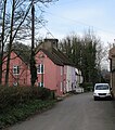
 Ashwell End, a pole and a pink house - geograph.org.uk - 5581093.jpg 1,024 × 768; 929 KB
-
 Ashwell End, autumn cultivation - geograph.org.uk - 5581102.jpg 1,024 × 819; 929 KB
-
 Ashwell End, towards Bluegates Farm - geograph.org.uk - 5581077.jpg 1,024 × 768; 917 KB
-
 Ashwell End, towards Common Lane - geograph.org.uk - 5729032.jpg 1,024 × 731; 796 KB
-
 Ashwell End, weatherboarding at Bluegates Farm - geograph.org.uk - 5580977.jpg 1,024 × 768; 919 KB
-
 Ashwell from the air - geograph.org.uk - 3367463.jpg 640 × 480; 153 KB
-
 Ashwell High Street - geograph.org.uk - 1066733.jpg 490 × 640; 99 KB
-
 Ashwell High Street - geograph.org.uk - 4889892.jpg 1,024 × 732; 905 KB
-
 Ashwell High Street, timber and brick - geograph.org.uk - 4889905.jpg 1,024 × 1,024; 1.11 MB
-
 Ashwell High Street, Victorian yellow brick - geograph.org.uk - 4889898.jpg 1,024 × 1,024; 1.25 MB
-
 Ashwell Lockup - geograph.org.uk - 1321856.jpg 640 × 480; 95 KB
-
 Ashwell Mill - geograph.org.uk - 1321841.jpg 640 × 480; 92 KB
-

-
 Ashwell Recreation Ground - geograph.org.uk - 4889966.jpg 1,024 × 732; 989 KB
-
 Ashwell Road - geograph.org.uk - 5557686.jpg 2,304 × 1,728; 909 KB
-
 Ashwell Road - geograph.org.uk - 5557693.jpg 2,304 × 1,728; 950 KB
-
 Ashwell Road past The Knoll - geograph.org.uk - 2558357.jpg 1,600 × 1,200; 443 KB
-
 Ashwell Springs (2) - geograph.org.uk - 5138415.jpg 640 × 480; 143 KB
-
 Ashwell Springs (3) - geograph.org.uk - 5138419.jpg 640 × 480; 140 KB
-
 Ashwell Springs (4) - geograph.org.uk - 5138422.jpg 640 × 480; 141 KB
-
 Ashwell Springs (5) - geograph.org.uk - 5138428.jpg 480 × 640; 121 KB
-
 Ashwell Springs (6) - geograph.org.uk - 5138431.jpg 640 × 480; 160 KB
-
 Ashwell Springs (7) - geograph.org.uk - 5138433.jpg 640 × 480; 125 KB
-
 Ashwell Springs (8) - geograph.org.uk - 5138436.jpg 640 × 480; 167 KB
-
 Ashwell Springs - geograph.org.uk - 5138411.jpg 640 × 480; 145 KB
-
 Ashwell Street (2) - geograph.org.uk - 5116784.jpg 640 × 480; 137 KB
-
 Ashwell Street - geograph.org.uk - 5116782.jpg 640 × 480; 127 KB
-
 Ashwell Surgery - geograph.org.uk - 1321830.jpg 640 × 480; 59 KB
-
 Ashwell Village Museum - geograph.org.uk - 4651027.jpg 640 × 480; 119 KB
-

-
 Ashwell Village Primary School - geograph.org.uk - 2075331.jpg 3,648 × 2,736; 1.21 MB
-
 Ashwell Village Store, High Street - geograph.org.uk - 5135711.jpg 640 × 480; 63 KB
-

-
 Ashwell, a pollarded avenue in the cemetery - geograph.org.uk - 5321441.jpg 1,024 × 819; 1.22 MB
-
 Ashwell, along the High Street - geograph.org.uk - 4889910.jpg 1,024 × 768; 1.04 MB
-
 Ashwell, Church Path - geograph.org.uk - 4889454.jpg 819 × 1,024; 1.13 MB
-
 Ashwell, church tower, footpath and fallen tree - geograph.org.uk - 5321425.jpg 1,024 × 768; 1.26 MB
-
 Ashwell, colour-washed houses - geograph.org.uk - 4889432.jpg 907 × 1,024; 1.21 MB
-
 Ashwell, down Church Lane - geograph.org.uk - 5580783.jpg 819 × 1,024; 990 KB
-
 Ashwell, High Street and Dixies Farmhouse - geograph.org.uk - 4889889.jpg 1,024 × 1,024; 1.05 MB
-
 Ashwell, Hodwell - geograph.org.uk - 4889444.jpg 819 × 1,024; 1.1 MB
-
 Ashwell, leaning lamp post on Mill Street - geograph.org.uk - 4889601.jpg 1,024 × 731; 1.08 MB
-
 Ashwell, Lucas Lane - geograph.org.uk - 4889975.jpg 1,024 × 732; 1.12 MB
-
 Ashwell, Mill Street and St Mary's tower - geograph.org.uk - 4889630.jpg 935 × 1,024; 1.12 MB
-
 Ashwell, Philosophers Gate - geograph.org.uk - 4890114.jpg 819 × 1,024; 950 KB
-
 Ashwell, Public Footpath 18 - geograph.org.uk - 5321419.jpg 1,024 × 768; 1.01 MB
-
 Ashwell, school house of 1681 - geograph.org.uk - 4889585.jpg 1,024 × 1,024; 1.27 MB
-
 Ashwell, Springhead - geograph.org.uk - 4889958.jpg 1,024 × 1,024; 1.25 MB
-
 Ashwell, St Mary - geograph.org.uk - 4889470.jpg 1,024 × 1,024; 1.52 MB
-
 Ashwell, Station Road - geograph.org.uk - 4888833.jpg 1,024 × 683; 836 KB
-
 Ashwell, Swan Street and St Mary's tower - geograph.org.uk - 4889634.jpg 1,024 × 1,024; 1.19 MB
-
 Ashwell, thatched wall in Gardiners Lane - geograph.org.uk - 5580793.jpg 1,024 × 768; 1,000 KB
-
 Ashwell, the corner of Station Road and Lucas Lane - geograph.org.uk - 4890087.jpg 1,024 × 1,024; 1.21 MB
-
 Ashwell, The Springs - geograph.org.uk - 4889954.jpg 819 × 1,024; 1.33 MB
-
 Ashwell, The Three Tuns - geograph.org.uk - 4889919.jpg 1,024 × 1,024; 1.18 MB
-
 Ashwell, The Three Tuns' car park entrance - geograph.org.uk - 4889915.jpg 819 × 1,024; 988 KB
-
 Ashwell, timber-framed - geograph.org.uk - 5675990.jpg 819 × 1,024; 1.02 MB
-
 Ashwell, traffic calming on Station Road - geograph.org.uk - 5729042.jpg 1,024 × 732; 837 KB
-
 Ashwell, turn right for the Mordens - geograph.org.uk - 5321440.jpg 1,024 × 683; 857 KB
-
 Ashwell, up Kingsland Way - geograph.org.uk - 4889908.jpg 1,024 × 1,024; 1.27 MB
-
 Autumn ploughland in North Hertfordshire - geograph.org.uk - 5581122.jpg 1,024 × 768; 983 KB
-
 Autumnal colours - geograph.org.uk - 5326595.jpg 640 × 426; 35 KB
-
 Bales at a field corner - geograph.org.uk - 5581411.jpg 1,024 × 768; 994 KB
-

-
 Barn at Mobb's Hole - geograph.org.uk - 409320.jpg 640 × 480; 74 KB
-
 Barn, Mobb's Hole - geograph.org.uk - 3097718.jpg 640 × 480; 67 KB
-

-
 Bedfordshire round the corner - geograph.org.uk - 5321184.jpg 1,024 × 731; 1.08 MB
-

-

-
 Big fields in North Hertfordshire - geograph.org.uk - 4888794.jpg 1,024 × 732; 967 KB
-
 Big fields in North Hertfordshire - geograph.org.uk - 5729048.jpg 1,024 × 732; 760 KB
-
 Bluegates Farm - geograph.org.uk - 3097862.jpg 640 × 366; 36 KB
-
 Bluegates Farmhouse, Ashwell, Hertfordshire 2014-03-02.JPG 2,007 × 1,252; 697 KB
-
 Bungalow on Ashwell Street - geograph.org.uk - 5552842.jpg 2,218 × 1,608; 1.39 MB
-

-
 Bushel ^ Strike, Ashwell - geograph.org.uk - 3324241.jpg 640 × 480; 92 KB
-
 Byway bikers - geograph.org.uk - 5321245.jpg 1,024 × 768; 999 KB
-

-
 Byway to Barrowsford Bridge - geograph.org.uk - 5321241.jpg 1,024 × 732; 906 KB
-
 Byway to the Mordens - geograph.org.uk - 4890214.jpg 1,024 × 731; 910 KB
-
 Caravan Site Entrance - geograph.org.uk - 204311.jpg 640 × 481; 89 KB
-

-
 Cemetery chapel, Ashwell - geograph.org.uk - 4651010.jpg 640 × 480; 147 KB
-
 Cemetery, Ashwell - geograph.org.uk - 4650326.jpg 640 × 480; 182 KB
-
 Chalky soils - geograph.org.uk - 6478485.jpg 1,024 × 681; 105 KB
-

-

-
 Church Hall, Ashwell - geograph.org.uk - 1321902.jpg 640 × 480; 58 KB
-
 Church Lane - geograph.org.uk - 5136713.jpg 480 × 640; 81 KB
-
 Church Street, Ashwell - geograph.org.uk - 3324143.jpg 480 × 640; 64 KB
-
 Cinque Cottages and the road to Ashwell - geograph.org.uk - 4888313.jpg 1,024 × 683; 824 KB
-
 Close to Ruddery Spring - geograph.org.uk - 5300529.jpg 640 × 480; 66 KB
-
 Clump of trees - geograph.org.uk - 5042834.jpg 640 × 426; 26 KB
-
 Clump of trees - geograph.org.uk - 5195219.jpg 640 × 289; 24 KB
-
 Clump of trees, Mitchell Hill - geograph.org.uk - 4789492.jpg 640 × 426; 27 KB
-
 Cob wall, Gardiners Lane - geograph.org.uk - 5138768.jpg 640 × 480; 75 KB
-
 Cottage at Ashwell End - geograph.org.uk - 1068925.jpg 457 × 640; 131 KB
-
 Cottage built in 1681 - Ashwell - geograph.org.uk - 6601656.jpg 768 × 1,024; 116 KB
-
 Cottage on Loves Lane - geograph.org.uk - 3097847.jpg 640 × 480; 71 KB
-
 Cottages - geograph.org.uk - 330156.jpg 640 × 426; 119 KB
-
 Cottages by Ashwell Spring - geograph.org.uk - 3333038.jpg 2,592 × 1,944; 1.63 MB
-
 Cottages off Swan Street - geograph.org.uk - 5135696.jpg 640 × 480; 95 KB
-
 Cottages to the north of Swan Street - geograph.org.uk - 5135708.jpg 640 × 480; 100 KB
-
 Cottages, Ashwell - geograph.org.uk - 1321866.jpg 640 × 480; 67 KB
-
 Cottages, Ashwell - geograph.org.uk - 1321893.jpg 640 × 480; 89 KB
-
 Cottages, Station Road, Ashwell - geograph.org.uk - 4651045.jpg 640 × 428; 123 KB
-
 Crop field near Kingsland Barn - geograph.org.uk - 3097950.jpg 640 × 480; 112 KB
-
 Crop field near Slip End - geograph.org.uk - 3097961.jpg 640 × 480; 63 KB
-
 Crop field south of Ashwell - geograph.org.uk - 5424810.jpg 640 × 480; 92 KB
-
 Cross roads on the tracks - geograph.org.uk - 3025079.jpg 2,560 × 1,920; 1.01 MB
-
-
 Derelict - geograph.org.uk - 5300524.jpg 640 × 480; 68 KB
-
 Dixie's Farmhouse, Ashwell (geograph 7163918).jpg 1,024 × 768; 118 KB
-
 Dray House, Fordham Close, Ashwell - geograph.org.uk - 1321846.jpg 640 × 460; 73 KB
-
 Elbrook House - geograph.org.uk - 5118079.jpg 640 × 480; 101 KB
-
 Entering Ashwell, Hertfordshire.jpg 1,037 × 778; 317 KB
-
 Entering Hertfordshire - geograph.org.uk - 4890842.jpg 1,024 × 732; 889 KB
-

-
 Farm Activity, Ashwell - geograph.org.uk - 205162.jpg 640 × 481; 75 KB
-
 Farm Buildings, Ashwell - geograph.org.uk - 809363.jpg 640 × 480; 95 KB
-
 Farm track (Byway) towards Ashwell - geograph.org.uk - 5424814.jpg 640 × 480; 86 KB
-
 Farmhouse Ashwell - geograph.org.uk - 1321874.jpg 640 × 480; 81 KB
-
 Farmland and burial mound, Ashwell - geograph.org.uk - 3097883.jpg 640 × 480; 85 KB
-
 Farmland east of Ashwell (2) - geograph.org.uk - 5116773.jpg 640 × 480; 70 KB
-
 Farmland east of Ashwell - geograph.org.uk - 5116072.jpg 640 × 480; 60 KB
-
 Farmland east of Ashwell - geograph.org.uk - 5116767.jpg 640 × 480; 65 KB
-
 Farmland east of Redlands Farm - geograph.org.uk - 5116050.jpg 640 × 480; 77 KB
-
 Farmland near Mitchell Hill - geograph.org.uk - 3777613.jpg 640 × 430; 33 KB
-
 Farmland near Slip End - geograph.org.uk - 3097959.jpg 640 × 480; 63 KB
-
 Farmland north of Ashwell - geograph.org.uk - 3333041.jpg 2,592 × 1,944; 1.66 MB
-
 Farmland north of Ashwell cemetery - geograph.org.uk - 5116798.jpg 640 × 480; 74 KB
-
 Farmland north of Redlands Farm - geograph.org.uk - 5116087.jpg 640 × 480; 92 KB
-
 Farmland off Northfield Road - geograph.org.uk - 3097736.jpg 640 × 480; 78 KB
-
 Farmland south of Ashwell - geograph.org.uk - 3097941.jpg 640 × 480; 75 KB
-
 Farmland southeast of Elbrook House - geograph.org.uk - 5118074.jpg 640 × 480; 99 KB
-
 Farmland west of Ashwell - geograph.org.uk - 3332989.jpg 2,592 × 1,944; 1.53 MB
-
 Farmland west of Beech House - geograph.org.uk - 5116063.jpg 640 × 480; 68 KB
-
 Farmland west of Shire Balk - geograph.org.uk - 5116070.jpg 640 × 480; 90 KB
-
 Farmland, Ashwell End - geograph.org.uk - 3097857.jpg 640 × 480; 68 KB
-
 Farmland, Bluegates Dairy - geograph.org.uk - 3097870.jpg 640 × 480; 63 KB
-
 Farmland, Dunston Lodge Farm - geograph.org.uk - 3097730.jpg 640 × 480; 68 KB
-
 Farmland, Hart's Spring - geograph.org.uk - 3097742.jpg 640 × 480; 80 KB
-
 Farmland, Mobb's Hole - geograph.org.uk - 3097720.jpg 640 × 480; 69 KB
-
 Farmland, north of Ashwell - geograph.org.uk - 204300.jpg 640 × 481; 118 KB
-
 Farrows Farm - geograph.org.uk - 4650285.jpg 640 × 480; 119 KB
-
 Farrows Farm off Newnham Way - geograph.org.uk - 3324131.jpg 640 × 480; 141 KB
-
 Field edges south of Ashwell Street - geograph.org.uk - 4890153.jpg 1,024 × 732; 1.04 MB
-
 Field with autumn growth - geograph.org.uk - 5592132.jpg 640 × 480; 152 KB
-
 Footpath and Claybush Hill - geograph.org.uk - 4275652.jpg 4,320 × 3,240; 4.42 MB
-
-
 Footpath by Redlands Farm Cottages - geograph.org.uk - 5116030.jpg 480 × 640; 133 KB
-
 Footpath by Redlands Farm Cottages - geograph.org.uk - 5116035.jpg 640 × 480; 103 KB
-
 Footpath from Ashwell Road - geograph.org.uk - 2558373.jpg 1,600 × 1,200; 670 KB
-
 Footpath north of Silver Street - geograph.org.uk - 5138453.jpg 640 × 480; 152 KB
-
 Footpath to Guilden Morden - geograph.org.uk - 5321189.jpg 1,024 × 731; 1.18 MB
-
 Footpath towards Ashwell End - geograph.org.uk - 3097878.jpg 640 × 480; 132 KB
-
 Foresters' Cottages, Ashwell - geograph.org.uk - 774053.jpg 640 × 480; 69 KB
-
 Former School, Ashwell - geograph.org.uk - 809344.jpg 640 × 480; 83 KB
-
 Forresters Cottages, High Street (2) - geograph.org.uk - 5136727.jpg 640 × 480; 106 KB
-
 Forresters Cottages, High Street (geograph 5136725).jpg 640 × 480; 85 KB
-
 Four ways - geograph.org.uk - 4890229.jpg 1,024 × 732; 972 KB
-
 Gardiners Lane, Ashwell - geograph.org.uk - 3097885.jpg 640 × 480; 97 KB


.jpg)
.jpg)
.jpg)
,_Roman_broken_silver_finger-ring_with_a_missing_gem_from_Ashwell,_Herts_(FindID_212829).jpg)
.jpg)
.jpg)


.jpg)
.jpg)


_-_geograph.org.uk_-_5138415.jpg)
_-_geograph.org.uk_-_5138419.jpg)
_-_geograph.org.uk_-_5138422.jpg)
_-_geograph.org.uk_-_5138428.jpg)
_-_geograph.org.uk_-_5138431.jpg)
_-_geograph.org.uk_-_5138433.jpg)
_-_geograph.org.uk_-_5138436.jpg)

_-_geograph.org.uk_-_5116784.jpg)


_-_geograph.org.uk_-_3482183.jpg)


.jpg)


_towards_Ashwell_-_geograph.org.uk_-_5424814.jpg)


_-_geograph.org.uk_-_5116773.jpg)


_-_geograph.org.uk_-_5136727.jpg)
.jpg)

