Category:Avenues, Kingston upon Hull
Jump to navigation
Jump to search
area of Kingston upon Hull, East Riding of Yorkshire, England  | |||||
| Upload media | |||||
| Instance of | |||||
|---|---|---|---|---|---|
| Part of | |||||
| Location | City of Kingston upon Hull, East Riding of Yorkshire, Yorkshire and the Humber, England | ||||
 | |||||
Subcategories
This category has the following 9 subcategories, out of 9 total.
Media in category "Avenues, Kingston upon Hull"
The following 82 files are in this category, out of 82 total.
-
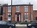 113, Coltman Street.jpg 4,032 × 3,024; 3.29 MB
-
 117, Coltman Street.jpg 2,100 × 1,574; 665 KB
-
 168, Coltman Street.jpg 3,024 × 4,032; 3.31 MB
-
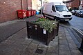
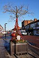
 1st World War Memorial Flower Tub ^1 - geograph.org.uk - 5189529.jpg 1,600 × 1,170; 652 KB
-
 1st World War Memorial Flower Tub ^2 - geograph.org.uk - 5189537.jpg 1,065 × 1,600; 1.14 MB
-
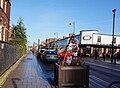
 1st World War Memorial Flower Tub ^21 - geograph.org.uk - 5190346.jpg 1,600 × 1,065; 627 KB
-
 1st World War Memorial Flower Tub ^3 - geograph.org.uk - 5189546.jpg 1,065 × 1,600; 1.04 MB
-
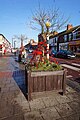 1st World War Memorial Flower Tub ^4 - geograph.org.uk - 5189989.jpg 1,065 × 1,600; 776 KB
-
 1st World War Memorial Flower Tub ^5 - geograph.org.uk - 5189990.jpg 1,067 × 1,600; 729 KB
-
 1st World War Memorial Flower Tub ^6 - geograph.org.uk - 5190098.jpg 1,088 × 1,600; 743 KB
-
 Anlaby Rd, Hull - panoramio.jpg 1,200 × 825; 421 KB
-
 Argyle St, Hull IMG 3145b - panoramio.jpg 1,800 × 1,070; 568 KB
-
 Avenues, Edwardian terrace.jpg 2,048 × 1,536; 741 KB
-
 Avenues, general view.jpg 2,048 × 1,536; 635 KB
-
 Bench dedicated to Mary Denness (geograph 4514093).jpg 2,000 × 1,332; 422 KB
-
 Bench dedicated to Yvonne Blenkinsop (geograph 4513888).jpg 2,000 × 1,332; 497 KB
-
 Blue Plaque to Lillian Bilocca (geograph 4303695).jpg 665 × 691; 187 KB
-
 Boulevard - Hessle Rd junction - panoramio.jpg 1,200 × 637; 383 KB
-
 Chanterlands Avenue, Hull - geograph.org.uk - 6079030.jpg 5,184 × 3,888; 3.86 MB
-
 Coltman St Corner - panoramio.jpg 659 × 992; 301 KB
-
 Cottingham Rd, Hull - panoramio.jpg 1,200 × 788; 613 KB
-
 Cottingham Rd, Hull IMG 2669 - panoramio.jpg 1,065 × 1,400; 679 KB
-
 Cottingham Rd, Hull IMG 6971F - panoramio.jpg 1,500 × 1,047; 628 KB
-
 Dorman Long I beam.jpg 4,000 × 3,000; 6.9 MB
-
 Double Elizabeth II postbox on Newlands Avenue, Hull - geograph.org.uk - 6080927.jpg 2,825 × 3,657; 2.22 MB
-
 Edward VII postbox on Westbourne Avenue, Hull - geograph.org.uk - 6081019.jpg 2,714 × 5,026; 3.3 MB
-
 Flytipping on Princes Avenue, Hull - geograph.org.uk - 5262698.jpg 1,200 × 799; 385 KB
-
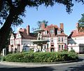
 Former Victoria Childrens Hospital, Hull - panoramio.jpg 1,100 × 799; 434 KB
-
 Fountain on Park Avenue, Hull - geograph.org.uk - 6082476.jpg 4,300 × 2,617; 2.77 MB
-
 George V postbox on Chanterlands Avenue, Hull - geograph.org.uk - 6079025.jpg 2,761 × 5,006; 2.96 MB
-
 Gilbert Scott house.jpg 1,000 × 842; 291 KB
-
 Goddard Avenue, Hull - geograph.org.uk - 6080933.jpg 5,184 × 3,888; 5.56 MB
-
 Goddard Avenue, Hull - geograph.org.uk - 6081618.jpg 5,184 × 3,888; 4.78 MB
-
 Gravestones in Western Cemetery, Hull - geograph.org.uk - 5261735.jpg 1,200 × 799; 551 KB
-
 Gravestones in Western Cemetery, Hull - geograph.org.uk - 5262694.jpg 1,200 × 799; 579 KB
-
 Hessle rd 20-3-9 - panoramio.jpg 1,068 × 712; 438 KB
-
 House on Park Avenue, Hull - geograph.org.uk - 6080944.jpg 4,736 × 2,967; 3.63 MB
-
 House on Park Avenue, Hull - geograph.org.uk - 6082478.jpg 3,522 × 3,385; 3.1 MB
-
 Houses on Goddard Avenue, Hull - geograph.org.uk - 6084098.jpg 5,184 × 3,888; 3.83 MB
-
 Houses on Marlborough Avenue, Hull - geograph.org.uk - 6081013.jpg 4,880 × 3,418; 4.39 MB
-
 Houses on Marlborough Avenue, Hull - geograph.org.uk - 6082462.jpg 640 × 445; 80 KB
-
 Houses on Marlborough Avenue, Hull - geograph.org.uk - 6082463.jpg 5,135 × 3,402; 4.32 MB
-
 Houses on Newland Avenue, Hull - geograph.org.uk - 6084078.jpg 4,742 × 3,126; 3.33 MB
-
 Houses on Park Avenue, Hull - geograph.org.uk - 6082470.jpg 4,797 × 3,268; 4.31 MB
-
 Houses on Westbourne Avenue, Hull - geograph.org.uk - 6081020.jpg 4,233 × 2,837; 3.44 MB
-
 Houses on Westbourne Avenue, Hull - geograph.org.uk - 6082466.jpg 5,184 × 3,888; 5.61 MB
-
 Jet Service Station - geograph.org.uk - 5262701.jpg 1,200 × 799; 323 KB
-
 K6 telephone box on Goddard Avenue, Hull - geograph.org.uk - 6084097.jpg 5,184 × 3,888; 3.81 MB
-
 K6 telephone box on Salisbury Street, Hull - geograph.org.uk - 6082479.jpg 5,184 × 3,888; 5.51 MB
-
 Larkins Bar, Hull - geograph.org.uk - 6084084.jpg 5,184 × 3,888; 4.35 MB
-
 Marlborough Avenue, Kingston upon Hull - geograph.org.uk - 5622235.jpg 3,264 × 2,448; 2.71 MB
-
 Newland Avenue, Hull - geograph.org.uk - 5189426.jpg 1,600 × 1,065; 896 KB
-
 Newland Avenue, Hull - panoramio.jpg 1,200 × 697; 409 KB
-
 Park Avenue, Hull - geograph.org.uk - 6078979.jpg 5,184 × 3,888; 5.97 MB
-
 Park Avenue, Hull - geograph.org.uk - 6078981.jpg 5,184 × 3,888; 6.97 MB
-
 Park Avenue, Hull - geograph.org.uk - 6082471.jpg 5,184 × 3,888; 6.21 MB
-
 Park Avenue, Kingston upon Hull - geograph.org.uk - 5704750.jpg 2,500 × 1,869; 2.77 MB
-
 Post Office on Chanterlands Avenue, Hull - geograph.org.uk - 6079028.jpg 4,828 × 3,514; 3.44 MB
-
 Post Office on Newlands Avenue, Hull - geograph.org.uk - 6080930.jpg 4,926 × 3,200; 2.91 MB
-
 Postbox on Park Avenue, Hull - geograph.org.uk - 6078977.jpg 2,907 × 5,181; 3.92 MB
-
 Princes Avenue Methodist Church, Hull - geograph.org.uk - 5262705.jpg 635 × 1,200; 288 KB
-
 Princes Avenue Methodist Church, Hull - geograph.org.uk - 5262709.jpg 1,200 × 799; 233 KB
-
 Princes Avenue, approaching the Methodist Church - geograph.org.uk - 6255463.jpg 1,024 × 769; 174 KB
-
 Railway bridge over Newland Avenue - geograph.org.uk - 6255455.jpg 1,024 × 769; 213 KB
-
 Railway bridge over Newland Avenue, Hull - geograph.org.uk - 6084082.jpg 5,184 × 3,888; 4.05 MB
-
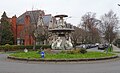
 Roundabout with fountain on Park Avenue, Hull - geograph.org.uk - 6082473.jpg 4,276 × 2,574; 2.32 MB
-
 Salisbury Street, Hull - geograph.org.uk - 6080948.jpg 4,436 × 3,182; 4.47 MB
-
 Salisbury Street, Kingston upon Hull - geograph.org.uk - 5704744.jpg 2,525 × 1,881; 3.33 MB
-
 Shops on Chanterlands Avenue, Hull - geograph.org.uk - 6082468.jpg 4,883 × 3,047; 3.12 MB
-
 Sign for Larkins Bar, Hull - geograph.org.uk - 6084088.jpg 2,559 × 3,484; 2.5 MB
-

-
 Small 1st World War Memorial Garden - geograph.org.uk - 5189510.jpg 1,600 × 1,193; 1,022 KB
-
 Sub station off Goddard Avenue, Hull - geograph.org.uk - 6084106.jpg 5,184 × 3,888; 4.07 MB
-
 The Lodge Bar ^ Grill, Hull - geograph.org.uk - 6084096.jpg 4,515 × 2,899; 2.58 MB
-
 The Newland Tofts Lane Bar ^ Grill - geograph.org.uk - 6084090.jpg 5,184 × 3,888; 3.44 MB
-
 Traffic calming on Goddard Avenue, Hull - geograph.org.uk - 6084099.jpg 4,244 × 3,556; 3.91 MB
-
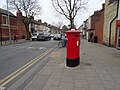
 Victorian postbox on Salisbury Street, Hull - geograph.org.uk - 6080942.jpg 2,374 × 4,112; 2.93 MB
-
 Welbeck Street, Hull - geograph.org.uk - 890738.jpg 640 × 498; 187 KB
-
 Westbourne Avenue, Hull - geograph.org.uk - 1315101.jpg 480 × 640; 142 KB
-
 Westbourne Avenue, Hull - geograph.org.uk - 6081021.jpg 5,184 × 3,888; 6.03 MB
-
 Crocus and Bee - geograph.org.uk - 718659.jpg 640 × 410; 114 KB
-
 Fountains in the Avenues - geograph.org.uk - 596504.jpg 480 × 640; 128 KB


.jpg)
.jpg)
.jpg)


