Category:Baddesley Ensor
Jump to navigation
Jump to search
village in United Kingdom .jpg) | |||||
| Upload media | |||||
| Instance of | |||||
|---|---|---|---|---|---|
| Location | North Warwickshire, Warwickshire, West Midlands, England | ||||
| Population |
| ||||
| Area |
| ||||
 | |||||
English: Baddesley Ensor is a village and civil parish in the district of North Warwickshire in Warwickshire, England, about three miles west of Atherstone. It runs into to the village of Grendon, which forms a parish itself.
Media in category "Baddesley Ensor"
The following 30 files are in this category, out of 30 total.
-

-

-
 Boot Inn, Grendon - geograph.org.uk - 2647149.jpg 3,488 × 2,616; 2.2 MB
-

-

-
 Discarded crop trays near Green Farm - geograph.org.uk - 2561333.jpg 640 × 480; 427 KB
-
-
 Distribution complex under construction - geograph.org.uk - 2563225.jpg 640 × 480; 340 KB
-
 Disused viaduct near Baddesley Ensor - geograph.org.uk - 1656420.jpg 640 × 480; 101 KB
-

-
 Farm access track near Dordon - geograph.org.uk - 2727610.jpg 640 × 428; 88 KB
-

-
 Footpath north of Green Farm - geograph.org.uk - 2561346.jpg 640 × 480; 395 KB
-
 Ford at Baddesley Ensor - geograph.org.uk - 2980667.jpg 3,872 × 2,592; 2.39 MB
-

-
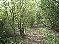
 Hidden lane, near Baddesley Ensor - geograph.org.uk - 110597.jpg 640 × 480; 124 KB
-
 Looking back towards Dordon - geograph.org.uk - 2727615.jpg 640 × 428; 61 KB
-

-

-
 Lower House Lane by Baddesley Farm - geograph.org.uk - 2562988.jpg 640 × 480; 350 KB
-
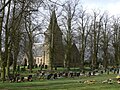 St Nicholas's Church, Baddesley Ensor (geograph 1785273).jpg 640 × 480; 132 KB
-

-
 Pond near Green Farm - geograph.org.uk - 2561336.jpg 640 × 480; 502 KB
-

-

-
 South end of Cope's Rough - geograph.org.uk - 2562985.jpg 640 × 480; 581 KB
-
 The Black Swan, Grendon - geograph.org.uk - 2647152.jpg 3,488 × 2,616; 2.2 MB
-

-
 View north from near Baddesley Farm - geograph.org.uk - 2563211.jpg 640 × 480; 381 KB
-
 View northwest from Lower House Lane - geograph.org.uk - 2563199.jpg 640 × 480; 328 KB


