Category:Badgers Mount
Aller à la navigation
Aller à la recherche
English: Badgers Mount is a village and civil parish in the Sevenoaks district district, in the county of Kent, south-east England, situated approximately north-northwest of Sevenoaks. It was part of the Shoreham civil parish until 2015 when it became a parish in its own right.
village britannique  | |||||
| Téléverser des médias | |||||
| Nature de l’élément | |||||
|---|---|---|---|---|---|
| Lieu | Sevenoaks, Kent, Angleterre du Sud-Est, Angleterre | ||||
 | |||||
Média dans la catégorie « Badgers Mount »
Cette catégorie comprend 111 fichiers, dont les 111 ci-dessous.
-
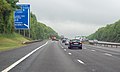
 1 1-2 miles to junction 5, M25 - geograph.org.uk - 3008578.jpg 800 × 600 ; 64 kio
-
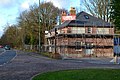
 7 Hotel and Diner, London Road Halstead - geograph.org.uk - 2587343.jpg 1 600 × 1 200 ; 578 kio
-
 A public path over the M25 - geograph.org.uk - 3004551.jpg 800 × 600 ; 94 kio
-
 Air shaft to a railway tunnel - geograph.org.uk - 1331637.jpg 640 × 480 ; 78 kio
-
 Andrew's Wood - geograph.org.uk - 3335894.jpg 3 000 × 4 000 ; 4,3 Mio
-
 Andrew's Wood, Badgers Mount - geograph.org.uk - 3009597.jpg 4 608 × 3 456 ; 3,93 Mio
-
 Badgers Mount Village Sign - geograph.org.uk - 4719782.jpg 1 704 × 2 272 ; 983 kio
-
 Badgers Mount, Millennium Sign - geograph.org.uk - 4125550.jpg 640 × 480 ; 62 kio
-
 Badgers Rise - geograph.org.uk - 3105230.jpg 640 × 425 ; 428 kio
-
 Badgers Rise, Badgers Mount - geograph.org.uk - 2804959.jpg 640 × 480 ; 108 kio
-
 Badgers Road - geograph.org.uk - 3105147.jpg 640 × 425 ; 506 kio
-
 Badgers Road - geograph.org.uk - 3105173.jpg 640 × 425 ; 340 kio
-
 Badgers Road, Badgers Mount - geograph.org.uk - 4719770.jpg 2 272 × 1 704 ; 984 kio
-
 Badgers Road, Badgers Mount, Kent - geograph.org.uk - 1133262.jpg 640 × 480 ; 115 kio
-
 Badgers Sub Rd - geograph.org.uk - 191472.jpg 640 × 426 ; 148 kio
-
 Bank and woodland beside M25 - geograph.org.uk - 6077045.jpg 2 990 × 1 615 ; 588 kio
-
-
 Bridge over the M25 at Polhill - geograph.org.uk - 3731089.jpg 640 × 436 ; 43 kio
-
 Bridge over the M25 at Polhill - geograph.org.uk - 6077053.jpg 3 729 × 1 964 ; 1,04 Mio
-
 Bridge over the M25, Andrew's Wood - geograph.org.uk - 3731107.jpg 640 × 430 ; 48 kio
-
 Bridlepath in Hollows Wood - geograph.org.uk - 1331663.jpg 640 × 480 ; 133 kio
-
 Bridleway Bridge, M25 - geograph.org.uk - 3307289.jpg 640 × 456 ; 56 kio
-
 Bridleway under the M25 - geograph.org.uk - 1977971.jpg 640 × 428 ; 181 kio
-
 Built for Geograph to photograph - geograph.org.uk - 3107731.jpg 640 × 456 ; 47 kio
-
 Byway under motorway - geograph.org.uk - 2135214.jpg 640 × 428 ; 163 kio
-
-
 Chelsfield Lane in Hollows Wood - geograph.org.uk - 1331669.jpg 640 × 480 ; 119 kio
-
 Christies Avenue, Badgers Mount - geograph.org.uk - 4719779.jpg 2 272 × 1 704 ; 960 kio
-
 Countryside near Timberden Farm - geograph.org.uk - 3335278.jpg 4 000 × 3 000 ; 4,13 Mio
-
 Daffodils alongside the entrance to Polhill Garden Centre - geograph.org.uk - 4875759.jpg 4 608 × 3 456 ; 3,38 Mio
-
 Entrance to Polhill Garden Centre - geograph.org.uk - 796313.jpg 640 × 432 ; 68 kio
-
 Everyone takes this picture - geograph.org.uk - 3103714.jpg 800 × 548 ; 76 kio
-
 Farmland by the railway - geograph.org.uk - 4455229.jpg 640 × 426 ; 57 kio
-
 Footbridge over the M25 - geograph.org.uk - 2739364.jpg 640 × 412 ; 50 kio
-
 Footbridge over the M25 - geograph.org.uk - 3307283.jpg 640 × 430 ; 52 kio
-
 Footbridge over the M25, Badgers Mount - geograph.org.uk - 2588490.jpg 1 600 × 1 200 ; 550 kio
-
 Footbridge, M25 - geograph.org.uk - 5724524.jpg 640 × 426 ; 47 kio
-
 Footbridge, M25, Polhill - geograph.org.uk - 5724519.jpg 640 × 426 ; 47 kio
-
 Footpath and map - geograph.org.uk - 3105196.jpg 640 × 425 ; 501 kio
-
 Former Car Dealer, Badgers Mount, Kent - geograph.org.uk - 1133393.jpg 640 × 480 ; 80 kio
-
 Former Polhill Arms - geograph.org.uk - 5093023.jpg 1 000 × 662 ; 863 kio
-
 Former Polhill Arms - geograph.org.uk - 5102033.jpg 1 000 × 662 ; 857 kio
-
 Former Polhill Arms - geograph.org.uk - 5297238.jpg 1 000 × 662 ; 764 kio
-
 Highland Road, Badgers Mount - geograph.org.uk - 4719775.jpg 2 272 × 1 704 ; 936 kio
-
 Highlands Road - geograph.org.uk - 1331658.jpg 640 × 480 ; 127 kio
-
 Johnson Avenue, Badgers Mount - geograph.org.uk - 4719773.jpg 2 272 × 1 704 ; 982 kio
-
 Knockholt geograph-3733029-by-Ben-Brooksbank.jpg 2 393 × 1 423 ; 3,61 Mio
-
 Lay-by on the A224 - geograph.org.uk - 2825160.jpg 640 × 426 ; 70 kio
-
 London Road at the junction of Otford Lane, Polhill - geograph.org.uk - 3156933.jpg 2 048 × 1 536 ; 1,47 Mio
-
 Looking across the northern entrance to Polhill Tunnel - geograph.org.uk - 3626468.jpg 4 000 × 3 000 ; 4,12 Mio
-
 Looking towards an airshaft of Polhill Tunnel - geograph.org.uk - 4875789.jpg 4 608 × 3 456 ; 3,58 Mio
-
 Looking towards Polhill Tunnel - geograph.org.uk - 3626679.jpg 4 000 × 3 000 ; 3,92 Mio
-
 M25 - 300 yds from junction 4 - geograph.org.uk - 3104683.jpg 800 × 558 ; 80 kio
-
 M25 at Polhill - geograph.org.uk - 2739386.jpg 640 × 383 ; 49 kio
-
 M25 clockwise - geograph.org.uk - 4231798.jpg 640 × 458 ; 50 kio
-
 M25 half mile to Junction 4 - geograph.org.uk - 3449415.jpg 1 600 × 1 097 ; 261 kio
-
 M25 heading south - geograph.org.uk - 2739368.jpg 640 × 430 ; 50 kio
-
 M25 looking clockwise - geograph.org.uk - 3803700.jpg 640 × 428 ; 117 kio
-
 M25 northbound approaching junction 4 - geograph.org.uk - 3485386.jpg 1 881 × 1 129 ; 1,08 Mio
-
 M25 over the North Downs - geograph.org.uk - 4806252.jpg 640 × 428 ; 98 kio
-
 M25, approaching J4 - geograph.org.uk - 5724526.jpg 640 × 426 ; 52 kio
-
 M25, northbound - geograph.org.uk - 3731103.jpg 640 × 430 ; 56 kio
-
 M25, northbound, J4 - geograph.org.uk - 3731113.jpg 640 × 430 ; 43 kio
-
 Modified sign - geograph.org.uk - 3105217.jpg 425 × 640 ; 394 kio
-
 Old bottom end of Badgers Road - geograph.org.uk - 2804963.jpg 640 × 480 ; 130 kio
-
 Orpington By-Pass, Badgers Mount, Kent - geograph.org.uk - 1133266.jpg 640 × 480 ; 98 kio
-
 Out of the fog - geograph.org.uk - 2167494.jpg 640 × 425 ; 54 kio
-
 Path between The A224 and London Road - geograph.org.uk - 3157647.jpg 2 048 × 1 536 ; 1,58 Mio
-
 Path junction below Badgers Mount - geograph.org.uk - 3802978.jpg 640 × 428 ; 188 kio
-
 Polhill Garden Centre mock windmill - geograph.org.uk - 796311.jpg 640 × 432 ; 72 kio
-
 Pre-Worboys sign on path by London Road - geograph.org.uk - 3159986.jpg 1 366 × 1 024 ; 357 kio
-
 Railway south of Polhill Tunnel - geograph.org.uk - 3803722.jpg 640 × 428 ; 129 kio
-
 Renovation under way at the top of Polhill - geograph.org.uk - 3807959.jpg 640 × 427 ; 102 kio
-
 Rodovia inglaterra.JPG 1 200 × 1 600 ; 293 kio
-
 Sandersons Avenue, Badgers Mount - geograph.org.uk - 4719778.jpg 2 272 × 1 704 ; 1,05 Mio
-
 Shacklands Road - geograph.org.uk - 1917654.jpg 1 024 × 768 ; 223 kio
-
 Shacklands Road - Steep Hill 1-10 - geograph.org.uk - 1479206.jpg 640 × 400 ; 111 kio
-
 Shacklands Road entering Andrew's Wood - geograph.org.uk - 3335896.jpg 3 000 × 4 000 ; 4,06 Mio
-
 Shacklands Road near Badger's Mount - geograph.org.uk - 3156991.jpg 2 048 × 1 536 ; 1,48 Mio
-
 Shacklands Road near Timberden Farm - geograph.org.uk - 3335242.jpg 4 000 × 3 000 ; 3,9 Mio
-
 Shacklands Road passing through Andrew's Wood - geograph.org.uk - 3335891.jpg 4 000 × 3 000 ; 4,23 Mio
-
 Shacklands Road under the M25 flyover - geograph.org.uk - 3156990.jpg 2 048 × 1 536 ; 1,63 Mio
-
 Shacklands Road, Badgers Mount - geograph.org.uk - 1612179.jpg 640 × 480 ; 68 kio
-
 Shepherds Barn Cottage - geograph.org.uk - 1331625.jpg 640 × 480 ; 112 kio
-
 Shoreham Woods - geograph.org.uk - 1397649.jpg 640 × 480 ; 145 kio
-
 Shoreham Woods car park - geograph.org.uk - 3105128.jpg 640 × 425 ; 579 kio
-
 Shoreham woods, looking across to Meenfield Wood - geograph.org.uk - 641915.jpg 640 × 480 ; 136 kio
-
 Sign for the junction 4 exit on the M25 - geograph.org.uk - 2588498.jpg 1 600 × 1 200 ; 545 kio
-
 Subway under the M25 - geograph.org.uk - 3105165.jpg 640 × 425 ; 288 kio
-
 The A224 approaching Badgers Mount - geograph.org.uk - 2587396.jpg 1 600 × 1 200 ; 588 kio
-
 The A224 at the corner of Badger's Road - geograph.org.uk - 3157668.jpg 2 048 × 1 536 ; 1,24 Mio
-
 The Badgers Mount public house - geograph.org.uk - 1362366.jpg 640 × 480 ; 78 kio
-
 The Calcutta Club, London Road Halstead - geograph.org.uk - 2587324.jpg 1 600 × 1 200 ; 491 kio
-
 The edge of Andrew's Wood - geograph.org.uk - 3335970.jpg 4 000 × 3 000 ; 4,11 Mio
-
 The junction of Shacklands Road and Chelsfield Lane - geograph.org.uk - 3335252.jpg 4 000 × 3 000 ; 4,05 Mio
-
 The M25 approaching footbridge, Polhill - geograph.org.uk - 2588554.jpg 1 600 × 1 200 ; 552 kio
-
 The on slip, junction 4, M25 - geograph.org.uk - 3004541.jpg 800 × 600 ; 93 kio
-
 The Polhill Arms - still closed - geograph.org.uk - 1977941.jpg 640 × 428 ; 115 kio
-
 The top of Polhill - geograph.org.uk - 3335977.jpg 4 000 × 3 000 ; 4,35 Mio
-
 There used to be a post office here.... - geograph.org.uk - 163527.jpg 640 × 480 ; 87 kio
-
 Timberden Bottom - geograph.org.uk - 3202287.jpg 4 288 × 3 216 ; 3,38 Mio
-
 Towards the M25 - geograph.org.uk - 3105152.jpg 640 × 425 ; 378 kio
-
 Track to Shepherds Barn Cottage - geograph.org.uk - 1331629.jpg 640 × 480 ; 99 kio
-
 Track to the car park at Andrew's Wood - geograph.org.uk - 3335971.jpg 4 000 × 3 000 ; 4,25 Mio
-
 Valley View - geograph.org.uk - 2442632.jpg 640 × 426 ; 72 kio
-
 View over the River Darent Valley from Polhill - geograph.org.uk - 2206417.jpg 1 130 × 737 ; 373 kio
-
 Wheatsheaf Hill, near Badgers Mount - geograph.org.uk - 4719746.jpg 2 272 × 1 704 ; 1,28 Mio
-
 Windmill at the entrance to Polhill Garden Centre - geograph.org.uk - 4875743.jpg 4 608 × 3 456 ; 3,41 Mio
-
 Windmill at the entrance to Polhill Garden Centre - geograph.org.uk - 4875751.jpg 4 608 × 3 456 ; 3,42 Mio
-
 Windmill at the entrance to Polhill Garden Centre - geograph.org.uk - 4875766.jpg 4 608 × 3 456 ; 3,36 Mio
-
 Woods at Polhill - geograph.org.uk - 3335979.jpg 4 000 × 3 000 ; 4,36 Mio


