Category:Kent
Jump to navigation
Jump to search
county of England, UK  Tonbridge Castle     | |||||
| Upload media | |||||
| Instance of | |||||
|---|---|---|---|---|---|
| Location |
| ||||
| Capital | |||||
| Population |
| ||||
| Area |
| ||||
| Different from | |||||
| Said to be the same as | Kent (historic county of England, ceremonial county of England, 1844) | ||||
| official website | |||||
 | |||||

Subcategories
This category has the following 56 subcategories, out of 56 total.
!
- Featured pictures of Kent (12 F)
- Valued images of Kent (25 F)
*
- Gallery pages of Kent (10 P)
?
A
- Archery in Kent (2 F)
B
- Boundary stones in Kent (8 F)
C
- Carved trees in Kent (18 F)
D
E
- Eden Valley Walk (82 F)
F
G
H
I
K
- Kent County Show (2 F)
L
M
N
O
P
- Postmarks of Kent (1 F)
S
T
V
W
Media in category "Kent"
The following 2 files are in this category, out of 2 total.
-
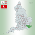 Kent Map.png 4,967 × 4,967; 4.26 MB
-
 Kent UK PCC election 2024.svg 1,425 × 1,000; 1.18 MB

