Category:Bainbridge, North Yorkshire
Jump to navigation
Jump to search
village and civil parish in North Yorkshire, UK  | |||||
| Upload media | |||||
| Instance of | |||||
|---|---|---|---|---|---|
| Location | Richmondshire, North Yorkshire, Yorkshire and the Humber, England | ||||
| Different from | |||||
| Said to be the same as | Bainbridge (Wikimedia duplicated page, civil parish) | ||||
 | |||||
English: Bainbridge is a village and civil parish in the Richmondshire district of North Yorkshire, England. The village is situated in the Yorkshire Dales National Park, near the confluence of the River Bain with the River Ure. According to the 2001 census the population was 438.
Subcategories
This category has the following 10 subcategories, out of 10 total.
A
- Addlebrough (20 F)
B
- Bainbridge Bridge (6 F)
C
F
S
- Semer Water Bridge (6 F)
- Semerwater (47 F)
W
- Worton, North Yorkshire (18 F)
Y
- Yore Bridge, Bainbridge (8 F)
Media in category "Bainbridge, North Yorkshire"
The following 200 files are in this category, out of 972 total.
(previous page) (next page)-
 'Brush House' on north side of the A684 - geograph.org.uk - 4199663.jpg 1,024 × 683; 267 KB
-
 'Castle' on the green, Bainbridge - geograph.org.uk - 4974347.jpg 720 × 540; 109 KB
-
 'Le Tour' comes to Bainbridge - geograph.org.uk - 3978060.jpg 640 × 480; 88 KB
-
 'Sheep with yellow jersey', Worton - geograph.org.uk - 3591168.jpg 640 × 480; 132 KB
-
 18thC Field Lime Kiln - geograph.org.uk - 5380173.jpg 2,898 × 3,049; 2.08 MB
-
 A "Windy Thing" With Van - geograph.org.uk - 286271.jpg 640 × 479; 97 KB
-
 A Corner of Countersett - geograph.org.uk - 4229004.jpg 5,179 × 3,451; 6.8 MB
-
 A farm in Wensleydale from the A684 - geograph.org.uk - 3587421.jpg 640 × 481; 83 KB
-
 A Field Below Gill Edge Farm - geograph.org.uk - 283245.jpg 640 × 480; 96 KB
-
 A grassy dell on Brough Scar - geograph.org.uk - 5358509.jpg 3,861 × 2,702; 3.67 MB
-
 A long wall on Stake Allotments - geograph.org.uk - 4697075.jpg 5,651 × 3,768; 3.54 MB
-
 A spring afternoon in Cragdale - geograph.org.uk - 4472864.jpg 3,776 × 2,520; 4.07 MB
-
 A Tiny Trickle - geograph.org.uk - 5380098.jpg 3,000 × 4,000; 3.04 MB
-
 A tributary of Ash Gill - geograph.org.uk - 4322050.jpg 5,400 × 3,600; 2.66 MB
-
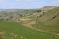
 A View Of Raydale - geograph.org.uk - 2340358.jpg 3,200 × 2,400; 4.1 MB
-
 A View over Bardale - geograph.org.uk - 4748165.jpg 1,600 × 1,067; 646 KB
-
 A View over the New Close Gill Valley - geograph.org.uk - 4748929.jpg 1,600 × 1,067; 650 KB
-
 A View over Upper Wensleydale - geograph.org.uk - 4228995.jpg 5,179 × 3,451; 6.27 MB
-

-
 A684 approaching Worton - geograph.org.uk - 5413711.jpg 640 × 480; 57 KB
-
 A684 east near Brush House - geograph.org.uk - 2960554.jpg 640 × 531; 137 KB
-

-
 A684 entering Worton from the west - geograph.org.uk - 2960558.jpg 640 × 494; 90 KB
-
 A684 towards Aysgarth - geograph.org.uk - 5413708.jpg 640 × 480; 76 KB
-
 A684 towards Aysgarth - geograph.org.uk - 5413724.jpg 640 × 480; 68 KB
-
 A684 towards Bainbridge - geograph.org.uk - 5413414.jpg 640 × 480; 52 KB
-
 A684 towards Bainbridge - geograph.org.uk - 5413683.jpg 640 × 480; 53 KB
-
 A684, Bainbridge - geograph.org.uk - 5413699.jpg 640 × 480; 52 KB
-
 A684, Borwins - geograph.org.uk - 5413680.jpg 640 × 480; 54 KB
-
 A684, modern road and loop of old road - geograph.org.uk - 3063922.jpg 1,024 × 683; 154 KB
-
 A684, Pry Hill - geograph.org.uk - 5413687.jpg 640 × 480; 63 KB
-
 A684, Wensleydale - geograph.org.uk - 5486462.jpg 1,024 × 683; 242 KB
-
 A684, Worton - geograph.org.uk - 5495861.jpg 1,024 × 683; 353 KB
-
 Above Oughtershaw Tarn - geograph.org.uk - 4575166.jpg 4,608 × 3,456; 3.46 MB
-
 Above Raydale - geograph.org.uk - 4749733.jpg 1,600 × 1,067; 627 KB
-
 Above the plantation on Crag - geograph.org.uk - 2610264.jpg 800 × 600; 88 KB
-
 Above Water Ling Force - geograph.org.uk - 5379440.jpg 3,240 × 4,320; 4.17 MB
-
 Access To Bainbridge High Pasture - geograph.org.uk - 283238.jpg 640 × 480; 94 KB
-
 Across Raydale - geograph.org.uk - 5413029.jpg 4,320 × 3,240; 3.17 MB
-
 Addlebrough Trig Point Site - geograph.org.uk - 4084342.jpg 2,560 × 1,920; 3.65 MB
-
 All is safely gathered in... - geograph.org.uk - 3570912.jpg 4,320 × 3,240; 4.62 MB
-
 Alongside Roman road near Bainbridge - geograph.org.uk - 399267.jpg 640 × 480; 74 KB
-
 Ancient Settlement - geograph.org.uk - 4512718.jpg 640 × 480; 97 KB
-

-
 Anemometer - geograph.org.uk - 267974.jpg 640 × 476; 71 KB
-
 Approaching Cam High Road from Marsett - geograph.org.uk - 2965850.jpg 3,072 × 2,304; 1.32 MB
-
 Approaching Longdale Cottage - geograph.org.uk - 4445501.jpg 5,184 × 3,456; 7.01 MB
-
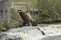 Archemedes Screw - geograph.org.uk - 5574280.jpg 2,000 × 1,333; 2.2 MB
-
 Archimedes screw churning powerfully - geograph.org.uk - 5999818.jpg 1,600 × 1,067; 412 KB
-
 Ascending Flaight Brow - geograph.org.uk - 4748188.jpg 1,600 × 1,067; 693 KB
-
 Askrigg - geograph.org.uk - 1809737.jpg 3,456 × 2,304; 1.59 MB
-
 Askrigg in Wensleydale - geograph.org.uk - 4835701.jpg 1,600 × 1,067; 714 KB
-
 Awaiting repair - geograph.org.uk - 2310012.jpg 2,412 × 2,761; 1.91 MB
-
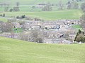
 Bainbridge - geograph.org.uk - 1809742.jpg 3,456 × 2,304; 1.57 MB
-
 Bainbridge - geograph.org.uk - 5486511.jpg 1,024 × 683; 324 KB
-

-
 Bainbridge from Brough Scar - geograph.org.uk - 3439447.jpg 4,000 × 3,000; 3.9 MB
-
 Bainbridge from Rose and Crown - geograph.org.uk - 1961628.jpg 640 × 426; 98 KB
-
 Bainbridge green - geograph.org.uk - 1390268.jpg 640 × 397; 250 KB
-
 Bainbridge High Pasture - geograph.org.uk - 283221.jpg 640 × 480; 94 KB
-
 Bainbridge in 1984 - geograph.org.uk - 2646113.jpg 1,005 × 686; 147 KB
-
 Bainbridge Institute - geograph.org.uk - 1390238.jpg 640 × 424; 224 KB
-
 Bainbridge Low Pasture - geograph.org.uk - 283227.jpg 640 × 480; 97 KB
-
 Bainbridge Low Pasture - geograph.org.uk - 5413415.jpg 640 × 480; 69 KB
-
 Bainbridge Methodist Church - geograph.org.uk - 1390243.jpg 640 × 420; 276 KB
-
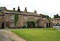 Bainbridge Old Hall - geograph.org.uk - 1390254.jpg 640 × 443; 246 KB
-
 Bainbridge playground - geograph.org.uk - 5574277.jpg 2,000 × 1,333; 2.16 MB
-
 Bainbridge Roman Fort - geograph.org.uk - 930341.jpg 640 × 480; 68 KB
-
 Bainbridge Telephone Exchange - geograph.org.uk - 2018557.jpg 3,072 × 2,304; 1.79 MB
-
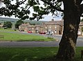 Bainbridge Village Green - geograph.org.uk - 3570885.jpg 3,170 × 2,339; 2.71 MB
-
 Bainbridge village green looking east - geograph.org.uk - 4929469.jpg 3,072 × 1,728; 1.08 MB
-
 Bainbridge village green looking north - geograph.org.uk - 4929472.jpg 3,072 × 1,728; 1.06 MB
-
 Bainbridge village green looking south - geograph.org.uk - 4929479.jpg 3,072 × 1,728; 829 KB
-
 Bainbridge, North Riding of Yorkshire.jpg 1,843 × 1,382; 424 KB
-
 Bainbridge-web.jpg 500 × 280; 65 KB
-
 Bank Wood - geograph.org.uk - 4690576.jpg 6,000 × 4,000; 5.34 MB
-
 Bardale above Marsett - geograph.org.uk - 2483054.jpg 3,296 × 2,472; 1.88 MB
-
 Bardale Beck - geograph.org.uk - 2610364.jpg 640 × 480; 78 KB
-
 Bardale Beck - geograph.org.uk - 2610369.jpg 640 × 480; 96 KB
-
 Bardale Beck - geograph.org.uk - 3637227.jpg 4,000 × 3,000; 4.21 MB
-
 Bardale Beck - geograph.org.uk - 4748197.jpg 1,600 × 1,067; 622 KB
-
 Bardale Head Plantation - geograph.org.uk - 2610341.jpg 640 × 480; 80 KB
-
 Bardale ^ Birk Haw - geograph.org.uk - 5380129.jpg 4,000 × 3,000; 2.57 MB
-
 Barn and grazing land - geograph.org.uk - 5572982.jpg 1,280 × 850; 488 KB
-
 Barn and grazing land - geograph.org.uk - 5577680.jpg 1,280 × 1,024; 575 KB
-

-
 Barn at centre of field - geograph.org.uk - 5551174.jpg 1,499 × 759; 1.1 MB
-
 Barn at farm on Cam High Road - geograph.org.uk - 5551152.jpg 1,500 × 914; 1.39 MB
-
 Barn at Field Gate Farm on north side of A684 - geograph.org.uk - 5548676.jpg 1,024 × 683; 157 KB
-
 Barn at Holly House - geograph.org.uk - 2727036.jpg 1,024 × 683; 186 KB
-
 Barn at road junction - geograph.org.uk - 2709071.jpg 1,024 × 683; 187 KB
-

-
 Barn beside A684 - geograph.org.uk - 4197810.jpg 1,024 × 683; 204 KB
-
 Barn beside Blean Lane - geograph.org.uk - 2686624.jpg 1,024 × 683; 178 KB
-

-
 Barn between the trees - geograph.org.uk - 3338768.jpg 2,048 × 1,536; 1.08 MB
-
 Barn conversion and Wesleyan Chapel - geograph.org.uk - 2728218.jpg 1,024 × 683; 212 KB
-
 Barn in field east of Worton - geograph.org.uk - 4199675.jpg 683 × 1,024; 283 KB
-
 Barn in field north of the A684 east of Worton - geograph.org.uk - 4197640.jpg 1,024 × 683; 161 KB
-
 Barn in Raydale - geograph.org.uk - 3570969.jpg 4,320 × 3,240; 4.88 MB
-
 Barn in Raydale - geograph.org.uk - 4318651.jpg 5,400 × 3,600; 2.19 MB
-
 Barn near Fieldgate Farm - geograph.org.uk - 2197445.jpg 640 × 480; 59 KB
-
 Barn near Low Blean - geograph.org.uk - 4317373.jpg 5,400 × 3,600; 2.67 MB
-
 Barn near Marsett - geograph.org.uk - 4321981.jpg 5,400 × 3,600; 2.47 MB
-
 Barn northeast of Semer Water - geograph.org.uk - 4784613.jpg 3,264 × 2,448; 1.73 MB
-
 Barn on Cam High Road near Bainbridge - geograph.org.uk - 2686616.jpg 1,024 × 683; 206 KB
-
 Barn south of Bainbridge - geograph.org.uk - 4784602.jpg 3,264 × 2,448; 1.64 MB
-
 Barn with farm machinery in Worton - geograph.org.uk - 5659004.jpg 1,500 × 996; 1.53 MB
-
 Barn, Fieldgate Farm - geograph.org.uk - 2198962.jpg 640 × 480; 65 KB
-
 Barns above Bainbridge - geograph.org.uk - 738422.jpg 640 × 427; 69 KB
-
 Barns near Bainbridge - geograph.org.uk - 4453648.jpg 640 × 427; 586 KB
-
 Barns near Holly House - geograph.org.uk - 1961736.jpg 640 × 480; 73 KB
-
 Barns north of Countersett - geograph.org.uk - 2708974.jpg 1,024 × 683; 271 KB
-
 Barns on Stake Road - geograph.org.uk - 2961994.jpg 3,072 × 2,304; 1.39 MB
-
 Beck near Low Blean Farm - geograph.org.uk - 1260883.jpg 640 × 480; 141 KB
-
 Beginning the descent - geograph.org.uk - 5413050.jpg 4,320 × 3,240; 2.99 MB
-
 Bella or Knight Close - geograph.org.uk - 4322018.jpg 5,400 × 3,600; 2.59 MB
-
 Bench Mark, Fieldgate Farm - geograph.org.uk - 2198939.jpg 480 × 640; 101 KB
-

-
 Benchmark in lichen patch on stone in track wall - geograph.org.uk - 5643356.jpg 1,024 × 683; 285 KB
-
 Benchmark on A684 gatepost - geograph.org.uk - 2722279.jpg 1,024 × 683; 304 KB
-
 Benchmark on barn at entrance to Fieldgate Farm - geograph.org.uk - 2638363.jpg 683 × 1,024; 249 KB
-
 Benchmark on barn at Gill Edge - geograph.org.uk - 2708820.jpg 683 × 1,024; 259 KB
-
 Benchmark on barn at High Force farm - geograph.org.uk - 2721621.jpg 683 × 1,024; 290 KB
-
 Benchmark on barn at Holly House - geograph.org.uk - 2727024.jpg 683 × 1,024; 271 KB
-
 Benchmark on barn beside A684 - geograph.org.uk - 4197795.jpg 1,024 × 683; 287 KB
-
 Benchmark on barn conversion - geograph.org.uk - 2728199.jpg 683 × 1,024; 310 KB
-
 Benchmark on barn in field off the A684 - geograph.org.uk - 4199672.jpg 683 × 1,024; 269 KB
-
 Benchmark on barn off the north side of the A684 - geograph.org.uk - 4197623.jpg 683 × 1,024; 310 KB
-
 Benchmark on barn on Blean Lane - geograph.org.uk - 2720637.jpg 683 × 1,024; 315 KB
-
 Benchmark on barn on Cam High Road - geograph.org.uk - 2708746.jpg 683 × 1,024; 298 KB
-
 Benchmark on Blean Lane wall - geograph.org.uk - 2721697.jpg 683 × 1,024; 308 KB
-
 Benchmark on Brush House - geograph.org.uk - 4199654.jpg 594 × 1,024; 165 KB
-

-
 Benchmark on Carpley Green House - geograph.org.uk - 5643354.jpg 1,024 × 667; 329 KB
-
 Benchmark on collapsed wall, Blean Lane - geograph.org.uk - 2720788.jpg 683 × 1,024; 248 KB
-
 Benchmark on Crag Side Road wall - geograph.org.uk - 2709276.jpg 683 × 1,024; 298 KB
-
 Benchmark on Crag Side Road wall - geograph.org.uk - 2727284.jpg 683 × 1,024; 329 KB
-
 Benchmark on Crag Side Road wall stone - geograph.org.uk - 2709143.jpg 1,024 × 683; 289 KB
-
 Benchmark on disused quarry, Carpley Green Road - geograph.org.uk - 2721865.jpg 1,024 × 683; 309 KB
-
 Benchmark on dry stone wall beside Busk Lane - geograph.org.uk - 5643898.jpg 1,024 × 683; 338 KB
-
 Benchmark on gatepost above Greensley Bank - geograph.org.uk - 2697335.jpg 683 × 1,024; 300 KB
-
 Benchmark on gatepost beside Cam High Road - geograph.org.uk - 2666085.jpg 683 × 1,024; 184 KB
-
 Benchmark on gateway on Carpley Green Road - geograph.org.uk - 2719755.jpg 1,024 × 683; 253 KB
-
 Benchmark on Marsett Lane stile step - geograph.org.uk - 2727867.jpg 1,024 × 683; 302 KB
-
 Benchmark on outbuilding of the Manor House - geograph.org.uk - 2722415.jpg 683 × 1,024; 326 KB
-
 Benchmark on outcrop at Drumaldrace - geograph.org.uk - 2665696.jpg 1,024 × 683; 339 KB
-
 Benchmark on outcrop by road near Out Brough - geograph.org.uk - 2720599.jpg 683 × 1,024; 362 KB
-
 Benchmark on roadside barn - geograph.org.uk - 2708945.jpg 683 × 1,024; 334 KB
-
 Benchmark on roadside barn at Field Gate Farm - geograph.org.uk - 5548666.jpg 1,024 × 683; 330 KB
-
 Benchmark on roadside wall NE of Long Slack Gate - geograph.org.uk - 2982335.jpg 683 × 1,024; 258 KB
-

-

-
 Benchmark on rock shelf beside Marsett footpath - geograph.org.uk - 2666214.jpg 683 × 1,024; 302 KB
-

-
 Benchmark on stone from demolished barn - geograph.org.uk - 2727983.jpg 683 × 1,024; 259 KB
-
 Benchmark on stone in wall at bend of Busk Lane - geograph.org.uk - 5644251.jpg 1,024 × 683; 254 KB
-
 Benchmark on stone in wall beside Stake Road - geograph.org.uk - 6103635.jpg 1,024 × 683; 297 KB
-
 Benchmark on stone in wall of Cam High Road - geograph.org.uk - 2666009.jpg 1,024 × 683; 280 KB
-
 Benchmark on stone in wall of Carpley Green Road - geograph.org.uk - 2721837.jpg 683 × 1,024; 284 KB
-
 Benchmark on stone of Carpley Green Road - geograph.org.uk - 2719675.jpg 1,024 × 683; 303 KB
-

-
 Benchmark on the bridge - geograph.org.uk - 2839426.jpg 1,500 × 1,021; 327 KB
-
 Benchmark on the Institute - geograph.org.uk - 2722452.jpg 683 × 1,024; 280 KB
-
 Benchmark on top of wall of Marsett Lane - geograph.org.uk - 2727950.jpg 683 × 1,024; 262 KB
-
 Benchmark on wall at gateway, Carr End Farm - geograph.org.uk - 2728167.jpg 683 × 1,024; 202 KB
-
 Benchmark on wall by Brough Pasture - geograph.org.uk - 2721805.jpg 683 × 1,024; 319 KB
-
 Benchmark on wall of Blean Lane - geograph.org.uk - 2721733.jpg 683 × 1,024; 315 KB
-
 Benchmark on wall of Carpley Green Road - geograph.org.uk - 2697259.jpg 683 × 1,024; 358 KB
-
 Benchmark on wall on NE side Carpley Green Road - geograph.org.uk - 2697294.jpg 683 × 1,024; 309 KB
-
 Benchmark on wall pier at footpath gateway - geograph.org.uk - 5643347.jpg 683 × 1,024; 222 KB
-
 Benchmark SE of Horton Gill Bridge - geograph.org.uk - 1964643.jpg 1,024 × 768; 374 KB
-
 Beside Raydale House Plantation - geograph.org.uk - 4445472.jpg 5,184 × 3,456; 7.75 MB
-
 Billinside Plantation - geograph.org.uk - 4444120.jpg 5,184 × 3,456; 7.58 MB
-
 Black sheep above Cragdale - geograph.org.uk - 4690561.jpg 6,000 × 4,000; 4.29 MB
-
 Blean West Pasture - geograph.org.uk - 6119566.jpg 1,600 × 1,067; 300 KB
-
 Blind Gill - geograph.org.uk - 5380146.jpg 2,348 × 2,900; 1.53 MB
-
 Boulders on the shore of Semer Water - geograph.org.uk - 5555754.jpg 2,160 × 1,215; 2.02 MB
-
 Boundary of Countersett - geograph.org.uk - 6155245.jpg 2,592 × 1,936; 2.38 MB
-
 Boundary Wall on Cragdale Moor - geograph.org.uk - 4443462.jpg 5,184 × 3,456; 6.92 MB
-
 Boundary Wall on Water Ling Pasture - geograph.org.uk - 4507845.jpg 5,184 × 3,456; 6.13 MB
-
 Bridge Number on Little Ings Bridge - geograph.org.uk - 2483102.jpg 3,296 × 2,472; 1.92 MB
-
 Bridge over Cragdale Water - geograph.org.uk - 4444148.jpg 5,184 × 3,456; 7.48 MB
-
 Bridge over the Bain - geograph.org.uk - 4553182.jpg 1,024 × 708; 662 KB
-
 Bridge over The River Bain - geograph.org.uk - 1961727.jpg 640 × 480; 89 KB
-
 Bridleway above Cubeck - geograph.org.uk - 4306584.jpg 4,320 × 3,240; 1.99 MB
-
 Bridleway below Drumaldrace - geograph.org.uk - 4511080.jpg 5,184 × 3,456; 5.61 MB
-
 Bridleway descending towards Countersett - geograph.org.uk - 5551638.jpg 1,500 × 778; 952 KB
-
 Bridleway on Stake Allotments - geograph.org.uk - 4696959.jpg 6,000 × 4,000; 3.78 MB
-
 Bridleway on Stake Allotments - geograph.org.uk - 4696973.jpg 6,000 × 4,000; 4.52 MB
-
 Bridleway on Stake Allotments - geograph.org.uk - 4697097.jpg 6,000 × 4,000; 3.97 MB
-
 Bridleway sign by Carpley Green Road - geograph.org.uk - 4306570.jpg 4,320 × 3,240; 1.76 MB
-
 Bridleway Through Stake Allotments - geograph.org.uk - 4512691.jpg 640 × 480; 57 KB
-
 Bridleway towards Common Allotments - geograph.org.uk - 1262384.jpg 640 × 480; 81 KB
-
 Broken down walls on Marsett High Pasture - geograph.org.uk - 4322059.jpg 5,400 × 3,600; 3.35 MB
-
 Broken Wall high above Upper Raydale - geograph.org.uk - 4443444.jpg 5,184 × 3,456; 6.26 MB
-
 Broken Wall on Stalling Busk Pasture - geograph.org.uk - 4443062.jpg 5,036 × 3,153; 7.61 MB
-
 Brough Scar - geograph.org.uk - 834331.jpg 640 × 420; 70 KB
-
 Bungalow on the A684, Bainbridge - geograph.org.uk - 5413697.jpg 640 × 480; 54 KB
-
 Burnet Force - geograph.org.uk - 2237226.jpg 1,600 × 1,200; 567 KB


