Category:Ballinamore
Zur Navigation springen
Zur Suche springen
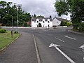
English: Ballinamore, in County Leitrim, means "mouth of the big ford", and the town is so named because it was the main crossing point of the Yellow River, which flows past the town. This waterway become known as the Ballinamore-Ballyconnell canal, built to link the Rivers Erne and Shannon in the 1840s. It reopened as the Shannon-Erne Waterway in 1994.
Gaelg: Ta Béal an Átha Móir ( Yernish son Beeal yn Aah Mooar, Baarle: Ballinamore) ny valley beg ayns Coontae Lheeahtrim, Pobblaght Nerin, 21 km veih'n joarey lesh Nerin Hwoaie. T'eh soit er y raad ardjynagh R202, raad dy vel eh kianglt rish ny raaidyn R199 as R204.
Slovenčina: Ballinamore ( ír. Béal an Átha Móir) je malé mesto v severozápadnom Írsku, na juhovýchode grófstva Leitrim. Žije tu 805 obyvateľov (2006).
Wikimedia-Kategorie | |||||
| Medium hochladen | |||||
| Ist ein(e) | |||||
|---|---|---|---|---|---|
| Zentrales Thema | |||||
| |||||
Unterkategorien
Diese Kategorie enthält folgende Unterkategorie:
In Klammern die Anzahl der enthaltenen Kategorien (K), Seiten (S), Dateien (D)
S
Medien in der Kategorie „Ballinamore“
Folgende 67 Dateien sind in dieser Kategorie, von 67 insgesamt.
-
 Anville Court, Ballinamore - geograph.org.uk - 3668529.jpg 640 × 480; 42 KB
-

-
 Ballinamore Golf Club bridge - geograph.org.uk - 1308922.jpg 640 × 480; 86 KB
-
 Ballinamore Main Street-High Street-August 2006-1.jpg 1.280 × 1.024; 157 KB
-

-

-
 Buille Toll - geograph.org.uk - 1309478.jpg 640 × 480; 73 KB
-
 Canal basin, Ballinamore - geograph.org.uk - 3667670.jpg 640 × 480; 60 KB
-

-
 Cara Pharmacy, Ballinamore - geograph.org.uk - 3667427.jpg 640 × 480; 55 KB
-
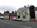
 Colourful house, Ballinamore - geograph.org.uk - 3667794.jpg 640 × 480; 56 KB
-
 Duignan's Drapery, Ballinamore - geograph.org.uk - 3667796.jpg 640 × 480; 49 KB
-

-

-
 Guesthouse sign, Ballinamore - geograph.org.uk - 3668837.jpg 640 × 480; 49 KB
-

-
 Hamill's B ^ B, Ballinamore - geograph.org.uk - 3668835.jpg 640 × 480; 39 KB
-
 Health Centre, Ballinamore - geograph.org.uk - 3667804.jpg 640 × 480; 37 KB
-
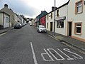
 High Street, Ballinamore - geograph.org.uk - 3667468.jpg 640 × 480; 41 KB
-
 High Street, Ballinamore - geograph.org.uk - 3667487.jpg 640 × 480; 42 KB
-
 High Street, Ballinamore - geograph.org.uk - 3667493.jpg 640 × 480; 42 KB
-
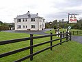
 House, Ballinamore - geograph.org.uk - 3668515.jpg 640 × 480; 51 KB
-
 Inscription, St Patrick's Church - geograph.org.uk - 3668538.jpg 640 × 480; 64 KB
-

-

-
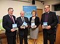 Leitrim is Loving Getting its Roots back.jpg 3.936 × 2.912; 405 KB
-

-

-
 Main Street, Ballinamore - geograph.org.uk - 1308952.jpg 640 × 480; 89 KB
-
 Main Street, Ballinamore - geograph.org.uk - 3667566.jpg 640 × 480; 49 KB
-

-
 McHugh's Meat Market, Ballinamore - geograph.org.uk - 3668509.jpg 640 × 480; 44 KB
-
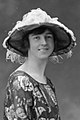 Miss W. Mandeville, 21 February 1920 (6915299403) (cropped).jpg 800 × 1.200; 228 KB
-
 Miss W. Mandeville, 21 February 1920 (6915299403).jpg 1.890 × 2.485; 1.012 KB
-
 Mural on a gable wall, Ballinamore - geograph.org.uk - 3667453.jpg 640 × 480; 46 KB
-
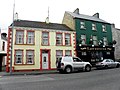
 Murphy's, Ballinamore - geograph.org.uk - 3668517.jpg 640 × 480; 51 KB
-
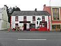
 O'Carolan's, Ballinamore - geograph.org.uk - 3667463.jpg 640 × 480; 48 KB
-
 Old railway building, Ballinamore - geograph.org.uk - 3667421.jpg 640 × 480; 67 KB
-
 Painting, Ballinamore - geograph.org.uk - 3667557.jpg 640 × 480; 45 KB
-
 Park Road sign, Ballinamore - geograph.org.uk - 3667426.jpg 640 × 480; 105 KB
-
 Park Road, Ballinamore - geograph.org.uk - 3667251.jpg 640 × 480; 46 KB
-
 Park Store, Ballinamore - geograph.org.uk - 3667447.jpg 640 × 480; 55 KB
-
 Pat Joe's pub, Ballinamore - geograph.org.uk - 3667801.jpg 640 × 480; 48 KB
-
 Plaque, Augustine Martin - geograph.org.uk - 3667471.jpg 640 × 480; 62 KB
-
-
 R202 Park Road, Ballinamore - geograph.org.uk - 3667419.jpg 640 × 480; 58 KB
-
 Railway mural, Ballinamore - geograph.org.uk - 3667457.jpg 640 × 480; 45 KB
-
 Railway Terrace, Ballinamore - geograph.org.uk - 3668882.jpg 640 × 480; 53 KB
-

-
 Reynold's, Ballinamore - geograph.org.uk - 3668519.jpg 640 × 480; 46 KB
-
 Road at Ballinamore - geograph.org.uk - 847980.jpg 640 × 479; 60 KB
-
 Scorpio Boutique, Ballinamore - geograph.org.uk - 3667438.jpg 640 × 480; 53 KB
-
 Senior School, Ballinamore - geograph.org.uk - 3667651.jpg 640 × 480; 62 KB
-

-
 Smyths, Ballinamore - geograph.org.uk - 3667499.jpg 640 × 480; 48 KB
-
 Snooker tables, Ballinamore - geograph.org.uk - 3667479.jpg 640 × 480; 46 KB
-
 St Brigid's Street sign, Ballinamore - geograph.org.uk - 3668506.jpg 640 × 480; 42 KB
-
 St Brigid's Street,Ballinamore - geograph.org.uk - 3668503.jpg 640 × 480; 54 KB
-
 St Brigid's Street,Ballinamore - geograph.org.uk - 3668526.jpg 640 × 480; 39 KB
-
 St Patrick's RC Church, Ballinamore - geograph.org.uk - 3668536.jpg 640 × 480; 42 KB
-
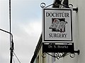 Surgery sign, Ballinamore - geograph.org.uk - 3667429.jpg 640 × 481; 42 KB
-
 The Forhe, Ballinamore - geograph.org.uk - 3668824.jpg 640 × 480; 53 KB
-
 The quayside at Ballinamore - geograph.org.uk - 3667673.jpg 640 × 480; 72 KB
-
 Town house, Ballinamore - geograph.org.uk - 3667496.jpg 640 × 480; 43 KB
-
 Tully Townland - geograph.org.uk - 3667109.jpg 640 × 480; 61 KB
-
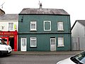
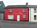 Vacant building, Ballinamore - geograph.org.uk - 3668512.jpg 640 × 480; 43 KB
-
 Wind-turbine-3m-01.jpg 449 × 650; 46 KB


_(cropped).jpg)
.jpg)


