Category:Ballymurphy, County Carlow
Aller à la navigation
Aller à la recherche
town in County Carlow, Ireland  | |||||
| Téléverser des médias | |||||
| Nature de l’élément | |||||
|---|---|---|---|---|---|
| Lieu | comté de Carlow, Leinster, Irlande | ||||
 | |||||
English: Ballymurphy (Baile Uí Mhurchú in Irish) is a village in County Carlow, Ireland on the R702 regional road. It lies on the western flank of the Blackstairs Mountains.
Gaeilge: Baile in Éirinn is ea Baile Uí Mhurchú. Tá an baile suite in oirdheisceart na tíre i g Contae Cheatharlach.
Nederlands: Ballymurphy ( Iers: Baile Uí Mhurchú , is een plaats in Ierse graafschap Carlow. Het ligt in het zuiden van het graafschap op de westelijke flank van de Blackstairs Mountains en telde in 2006 244 inwoners .
Sous-catégories
Cette catégorie comprend seulement la sous-catégorie ci-dessous.
B
Média dans la catégorie « Ballymurphy, County Carlow »
Cette catégorie comprend 8 fichiers, dont les 8 ci-dessous.
-
 Ballymurphy, County Carlow - geograph.org.uk - 1825410.jpg 3 755 × 2 415 ; 2,41 Mio
-
 BallymurphyR702at138.jpg 3 888 × 2 592 ; 3,35 Mio
-
 BlackstairsMountain133.jpg 3 718 × 1 960 ; 1,17 Mio
-
 C Ballymurphy.jpg 3 888 × 2 592 ; 3 Mio
-
 Commemorative Plaque - geograph.org.uk - 1221998.jpg 600 × 450 ; 288 kio
-
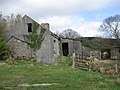 Deserted Cottage - geograph.org.uk - 1222462.jpg 640 × 480 ; 79 kio
-
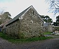 Shannon's Farm - geograph.org.uk - 1221983.jpg 600 × 493 ; 284 kio
-
 Shannon's Lane - geograph.org.uk - 1222463.jpg 640 × 480 ; 93 kio


