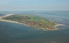
Category:Baltrum
Jump to navigation
Jump to search
municipality in Germany | |||||
| Upload media | |||||
| Instance of |
| ||||
|---|---|---|---|---|---|
| Located in protected area | |||||
| Location | Baltrum, Niedersachsen, Alemanya | ||||
| Population |
| ||||
| Area |
| ||||
| Elevation above sea level |
| ||||
| official website | |||||
 | |||||
Landkreis Aurich  Aurich · Baltrum · Berumbur · Dornum · Großefehn · Großheide · Hage · Hagermarsch · Halbemond · Hinte · Ihlow · Juist · Krummhörn · Leezdorf · Lütetsburg · Marienhafe · Norden · Norderney · Osteel · Rechtsupweg · Südbrookmerland · Upgant-Schott · Wiesmoor · Wirdum · Unincorporated area: Memmert ·
Frisian Islands: Ameland · Amrum · Baltrum · Borkum · Engelsmanplaat · Föhr · Griend · Hamburger Hallig · Heligoland · Hooge · Japsand · Juist · Jungnamensand · Kachelotplate · Karkhof · Langeneß · Langeoog · Lütje Hörn · Mellum · Memmert · Minsener Oog · Noorderhaaks · Norderney · Norderoog · Norderoogsand · Nordstrand, Alemanya · Pellworm · Richel · Rif · Rottumeroog · Rottumerplaat · Schiermonnikoog · Simonszand · Spiekeroog · Süderoogsand · Sylt · Terschelling · Texel · Trischen · Vlieland · Wangerooge · Zuiderduintjes ·
Deutsch: Baltrum ist eine Düneninsel vor der Küste von Ostfriesland in Niedersachsen. Sie liegt in der Mitte der Kette der sieben bewohnten Ostfriesischen Inseln
English: Baltrum is an island near the coast of East Frisia (Ostfriesland), Germany and a municipality in the district of Aurich, Lower Saxony
Mga ubos-nga-kaarangay
Ini nga kaarangay mayda han mga nasunod nga 15 nga mga ubos-nga-kaarangay, tikang hin 15 nga kabug-osan.
Mga pakli ha kaarangay nga "Baltrum"
Ini nga kaarangay mayda han amo la nga nasunod nga pakli.
Media ha kaarangay nga "Baltrum"
An mga nasunod nga 38 ka mga fayl aada han hini nga kaarangay, tikang hin 38 nga kabug-osan.
-
00 2661 Neßmersiel - Baltrum.jpg 3,300 × 2,200; 4.82 nga MB
-
Auf Baltrums Strand (On Baltrum's beach) - geo.hlipp.de - 3731.jpg 640 × 480; 36 nga KB
-
Ausblick vom Leuchtturm Norderney 04.jpg 3,881 × 2,587; 5.7 nga MB
-
Baltrum "Lichtspiele".jpg 4,000 × 3,000; 1.91 nga MB
-
Baltrum 015.jpg 3,072 × 2,048; 2.74 nga MB
-
Baltrum 017.jpg 3,072 × 2,048; 1.34 nga MB
-
Baltrum and Langeoog, Germany.jpg 3,890 × 2,131; 577 nga KB
-
Baltrum Autofrei.jpg 3,220 × 1,585; 600 nga KB
-
Baltrum Sporthafen.jpg 2,950 × 1,953; 927 nga KB
-
Baltrum Strand.jpg 3,150 × 2,277; 1.43 nga MB
-
Baltrum Strandabgang.jpg 5,000 × 5,000; 11.62 nga MB
-
Baltrum Strandkörbe.jpg 3,256 × 1,583; 1.03 nga MB
-
Baltrum von Deich pano.jpg 5,967 × 1,192; 974 nga KB
-
Baltrum, Germany (Unsplash ACw2yRal8n4).jpg 5,312 × 2,905; 6.51 nga MB
-
Baltrum, Germany (Unsplash).jpg 5,472 × 3,648; 15.49 nga MB
-
Baltrum.jpg 400 × 268; 44 nga KB
-
Baltrumdämmerung.png 1,181 × 778; 1.34 nga MB
-
Bienenstock Baltrum.JPG 2,270 × 1,425; 416 nga KB
-
Elli hoffmann roeser.JPG 2,048 × 1,536; 630 nga KB
-
Flugplatz auf Baltrum (Airfield on Baltrum) - geo.hlipp.de - 3708.jpg 640 × 480; 53 nga KB
-
Fraction line (Unsplash).jpg 3,127 × 2,345; 1.86 nga MB
-
Franzosenschanze Baltrum-8972.jpg 1,091 × 1,098; 1.05 nga MB
-
Grave deBoer 2021a.jpg 1,488 × 1,800; 825 nga KB
-
Grave deBoer 2021b.jpg 3,528 × 2,004; 1.91 nga MB
-
Hafen Westdorf auf Baltrum (Westdorf harbour on Baltrum) - geo.hlipp.de - 3713.jpg 640 × 480; 76 nga KB
-
Küstenschutzbau Baltrum (1).JPG 2,272 × 1,168; 322 nga KB
-
Küstenschutzbau Baltrum (2).JPG 2,270 × 1,132; 243 nga KB
-
Muellabfuhr.jpg 1,360 × 1,020; 746 nga KB
-
Nordseestrand Baltrum (On the beach of Baltrum) - geo.hlipp.de - 3732.jpg 640 × 480; 78 nga KB
-
Outer part of a breakwater.jpg 6,000 × 4,000; 14.28 nga MB
-
Pano-Langeoog-von-Wasserturm-SSW-NNW-2024.jpg 45,712 × 4,061; 69.51 nga MB
-
Rathaus-Kurverwaltung Baltrum.jpg 1,360 × 1,020; 797 nga KB
-
Sandflug am Strand von Baltrum.jpg 5,470 × 3,647; 18.88 nga MB
-
Sea mark with view onto Norderney.jpg 6,000 × 4,000; 11.79 nga MB
-
Sonnenuntergang vor Baltrum.jpg 3,024 × 4,032; 2.9 nga MB
-
SRB Elli Hoffmann-Röser.JPG 2,270 × 1,432; 355 nga KB
-
Walter Leistikow Bauernhütten auf Baltrum 1902.jpg 668 × 357; 104 nga KB
-
Western sea mark.jpg 4,000 × 6,000; 13.8 nga MB


