Category:Kachelotplate
Jump to navigation
Jump to search
Frisian Islands: Ameland · Amrum · Baltrum · Borkum · Engelsmanplaat · Föhr · Griend · Hamburger Hallig · Heligoland · Hallig Hooge · Japsand · Juist · Jungnamensand · Kachelotplate · Karkhof · Langeneß · Langeoog · Lütje Hörn · Mellum · Memmert · Minsener Oog · Noorderhaaks · Norderney · Norderoog · Norderoogsand · Nordstrand · Pellworm · Richel · Rif · Rottumeroog · Rottumerplaat · Schiermonnikoog · Simonszand · Spiekeroog · Süderoogsand · Sylt · Terschelling · Texel · Trischen · Vlieland · Wangerooge · Zuiderduintjes ·
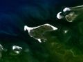
sandbar in the North Sea _und_Halichoerus_grypus_(1),_Kachelotplate.jpg) | |||||
| Upload media | |||||
| Instance of | |||||
|---|---|---|---|---|---|
| Part of | |||||
| Located in protected area | |||||
| Location |
| ||||
| Located in or next to body of water | |||||
| Width |
| ||||
| Length |
| ||||
| Population |
| ||||
| Area |
| ||||
 | |||||
Subcategories
This category has the following 2 subcategories, out of 2 total.
Media in category "Kachelotplate"
The following 6 files are in this category, out of 6 total.
-
 Borkum 6.72782E 53.59398N.jpg 1,280 × 958; 87 KB
-
 Juist2.jpg 1,405 × 492; 356 KB
-
 Karte Insel Juist.png 1,580 × 641; 489 KB
-
 Ostfriesische Inseln (Karte).png 13,425 × 5,135; 6.04 MB
-
 Sandwatt bei der Kachelotplate.jpg 3,600 × 2,700; 5.59 MB
-
 Wadden - Kachelot.PNG 921 × 512; 36 KB


.png)