Category:Bandon, County Cork
Zur Navigation springen
Zur Suche springen
Български: 300px|мини|Селскостопанският пазар в Бандън
Dansk: Bandon (County Cork) ( Irsk: Droichead na Bandan) er en irsk by i County Cork i provinsen Munster, i den sydlige del af Republikken Irland med en befolkning (inkl. opland) på 5.822 indb i 2006 (5.161 i 2002)
Deutsch: Bandon ( irisch: Droichead na Bandan; dt.: „Brücke über den Bandon“) ist eine Stadt im County Cork im Süd(west)en der Republik Irland.
English: Bandon (Droichead na Bandan in Irish) is a town in County Cork, Ireland. With a population of 5,161 as of census 2002, Bandon lies on the River Bandon between two hills. The name in Irish means "Bridge of the Bandon", a reference to the origin of the town as a crossing-point on the river. In 2004 Bandon celebrated its quatercentenary. Bandon is sometimes called the "Gateway to West Cork".
Français : Bandon (Droichead na Bandan en irlandais) est une ville du comté de Cork en République d'Irlande.
Bahasa Indonesia: Bandon ( bahasa Irlandia: Droichead na Bandan) ialah sebuah kota di County Cork yang terletak 27 kilometer di barat daya Cork (Corcaigh), Republik Irlandia. Bandon dijuluki Pintu Gerbang West Cork. Kota ini berasal dari abad ke-16.
Bahasa Melayu: Bandon ( bahasa Ireland: Droichead na Bandan) merupakan sebuah bandar di County Cork yang terletak 27 kilometer di barat daya Cork (Corcaigh), Republik Ireland. Bandon dijuluki Pintu Gerbang West Cork. Bandar ini berasal pada abad ke-16.
Svenska: Bandon ( iriska: Droichead na Bandan) är ett samhälle i Cork belägen 27 kilometer sydväst om Cork på Irland. Bandon kallas ibland the Gatway to West Cork. Samhället härstammar från tidiga 1600-talet.
Kleinstadt in Irland  | |||||
| Medium hochladen | |||||
| Ist ein(e) | |||||
|---|---|---|---|---|---|
| Ort | County Cork, Munster, Irland | ||||
| Einwohnerzahl |
| ||||
| Fläche |
| ||||
| Höhe über dem Meeresspiegel |
| ||||
| Verschieden von | |||||
| offizielle Website | |||||
 | |||||
Unterkategorien
Es werden 5 von insgesamt 5 Unterkategorien in dieser Kategorie angezeigt:
In Klammern die Anzahl der enthaltenen Kategorien (K), Seiten (S), Dateien (D)
B
- Christ Church, Bandon (2 D)
- St Patrick's Church, Bandon (2 D)
- Bandon Town Hall (1 D)
M
- Methodist Church, Bandon (5 D)
S
Medien in der Kategorie „Bandon, County Cork“
Folgende 61 Dateien sind in dieser Kategorie, von 61 insgesamt.
-
 A Portable Joanna!.jpg 2.000 × 1.488; 1,45 MB
-
 A sharp turn left off the R586 - geograph.org.uk - 4190599.jpg 1.024 × 768; 525 KB
-

-
 Arches and Church - geograph.org.uk - 2388272.jpg 3.456 × 2.304; 1,11 MB
-
 Bandon Bridge - geograph.org.uk - 2386413.jpg 3.456 × 2.304; 1,55 MB
-
 Bandon Bridge - geograph.org.uk - 2388260.jpg 3.456 × 2.304; 1,43 MB
-
 Bandon Bridge.JPG 2.048 × 3.072; 2,08 MB
-
 Bandon Fireater - geograph.org.uk - 2386505.jpg 2.304 × 3.456; 1,47 MB
-
 Bandon Footbridge - geograph.org.uk - 2388219.jpg 3.456 × 2.304; 1,27 MB
-

-
 Bandon Station c1898.jpg 900 × 498; 139 KB
-
 Bandon town centre - geograph.org.uk - 3568612.jpg 640 × 361; 75 KB
-
 Bandon Tributary - geograph.org.uk - 2388281.jpg 3.456 × 2.304; 1,12 MB
-
 Bandon Weir - geograph.org.uk - 2388233.jpg 3.456 × 2.304; 1,45 MB
-
 Bandon, New Road - geograph.org.uk - 5845466.jpg 800 × 533; 461 KB
-
 Bandon.JPG 3.072 × 2.048; 1,93 MB
-
 Castle Bernard - geograph.org.uk - 6278067.jpg 1.024 × 763; 83 KB
-
 Castles of Munster, Castle Bernard, Cork (1) - geograph.org.uk - 3036634.jpg 1.024 × 683; 906 KB
-
 Castles of Munster, Castle Bernard, Cork (3) - geograph.org.uk - 3036654.jpg 1.024 × 683; 824 KB
-

-
 Clonakilty Road (N71), Bandon - geograph.org.uk - 5845454.jpg 800 × 533; 521 KB
-
 Clonakilty Road, Oldchapel - geograph.org.uk - 5856937.jpg 800 × 533; 555 KB
-
 Convent Buildings - geograph.org.uk - 552762.jpg 480 × 640; 44 KB
-
 Ducks on the wall - geograph.org.uk - 1928808.jpg 4.000 × 3.000; 3,47 MB
-
 Filling Station on the N71 at Bandon - geograph.org.uk - 5845492.jpg 800 × 533; 602 KB
-
 Glasslin Road - geograph.org.uk - 3561201.jpg 640 × 427; 166 KB
-
 Golf club near Bandon - geograph.org.uk - 5518328.jpg 1.600 × 1.200; 538 KB
-
 Hooded Cloaks of Bandon - geograph.org.uk - 2386474.jpg 640 × 427; 87 KB
-
 Invisible roads - geograph.org.uk - 4465135.jpg 1.024 × 768; 506 KB
-
 Junction on the R603 - geograph.org.uk - 2113631.jpg 640 × 480; 130 KB
-
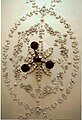 Kilbrogan ceiling.jpg 1.358 × 1.982; 445 KB
-
 Kilbrogan House garden - geograph.org.uk - 1928821.jpg 4.000 × 3.000; 3,67 MB
-
 Kilbrogan House, Bandon - geograph.org.uk - 1928818.jpg 4.000 × 3.000; 1,6 MB
-
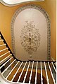 Kilbrogan stairs.jpg 1.344 × 1.984; 416 KB
-
 Little ^ Large - geograph.org.uk - 2386485.jpg 3.456 × 2.304; 1,45 MB
-
 Long's are up and Callaghan's are down.jpg 3.000 × 2.279; 3,54 MB
-
 Major John Waring Belcher Wellcome L0025700.jpg 1.182 × 1.726; 710 KB
-
 Maxol Service Station, Oldchapel - geograph.org.uk - 5856943.jpg 800 × 533; 491 KB
-
 Model T - geograph.org.uk - 2386514.jpg 3.456 × 2.304; 1,39 MB
-
 New buildings - geograph.org.uk - 3550805.jpg 800 × 600; 119 KB
-
 O'Farrell's newsagents, Bandon - geograph.org.uk - 3568807.jpg 800 × 451; 195 KB
-
 Oldchapel, Clonakilty Road - geograph.org.uk - 5856945.jpg 800 × 533; 556 KB
-

-
 On the bypass - geograph.org.uk - 2913557.jpg 1.024 × 768; 191 KB
-
 Poachers Inn, Clonakilty Road, Bandon - geograph.org.uk - 5845449.jpg 800 × 533; 600 KB
-
 Produce market in Bandon, County Cork.jpg 1.280 × 960; 245 KB
-
 Shops in South Main Street - geograph.org.uk - 3561205.jpg 640 × 427; 232 KB
-
 Slate wall - geograph.org.uk - 4193170.jpg 1.024 × 768; 323 KB
-
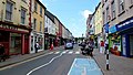 South Main Street, Bandon - geograph.org.uk - 3568801.jpg 800 × 451; 219 KB
-
 St Peter's church, Ballymodan, Bandon - geograph.org.uk - 3809594.jpg 3.240 × 4.320; 3,59 MB
-
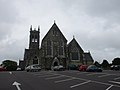 St. Patrick's, Bandon - geograph.org.uk - 4568626.jpg 1.024 × 768; 95 KB
-
 Street Tumblers - geograph.org.uk - 2386493.jpg 3.456 × 2.304; 1,49 MB
-
 The Bandon River looking towards Bandon Bridge - geograph.org.uk - 6278357.jpg 1.024 × 768; 169 KB
-
 The Brogan Inn - geograph.org.uk - 1928785.jpg 4.000 × 3.000; 1,73 MB
-
 The Shambles - geograph.org.uk - 1928817.jpg 4.000 × 3.000; 2,95 MB
-
 There was a distillery here - geograph.org.uk - 4190589.jpg 1.024 × 768; 221 KB
-
 Traffic Lights on the Bandon Relief Road - geograph.org.uk - 5845473.jpg 800 × 600; 643 KB
-
 Two gates - geograph.org.uk - 4465126.jpg 1.024 × 768; 530 KB
-
 View from St. Patrick's to St. Peter's - geograph.org.uk - 4568637.jpg 1.024 × 768; 115 KB
-
 View from St. Peter's churchyard, Bandon - geograph.org.uk - 6278358.jpg 1.024 × 768; 162 KB
-
 Weir on the river - geograph.org.uk - 1928803.jpg 4.000 × 3.000; 3,44 MB


_-_geograph.org.uk_-_3036634.jpg)
_-_geograph.org.uk_-_3036654.jpg)
_(2)_-_geograph.org.uk_-_3036641.jpg)
,_Bandon_-_geograph.org.uk_-_5845454.jpg)


