Category:Barnes, London
Zur Navigation springen
Zur Suche springen
Stadtbezirk von London  | |||||
| Medium hochladen | |||||
| Ist ein(e) | |||||
|---|---|---|---|---|---|
| Ort | London Borough of Richmond upon Thames, Groß-London, London, England | ||||
| Liegt am oder im Gewässer | |||||
| Fläche |
| ||||
 | |||||
Unterkategorien
Es werden 28 von insgesamt 28 Unterkategorien in dieser Kategorie angezeigt:
In Klammern die Anzahl der enthaltenen Kategorien (K), Seiten (S), Dateien (D)
B
- Barnes Bridge railway station (71 D)
- Barnes Pond (15 D)
C
H
- Harrods Furniture Depository (45 D)
L
- Lonsdale Road Reservoir (18 D)
O
- Old Essex House (4 D)
P
R
S
- Steve Fairbairn Memorial (9 D)
T
- The Homestead, Barnes (5 D)
W
Medien in der Kategorie „Barnes, London“
Folgende 190 Dateien sind in dieser Kategorie, von 190 insgesamt.
-
 'Fish on Bicycles' at Barnes - geograph.org.uk - 1446525.jpg 640 × 480; 116 KB
-

-
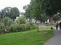
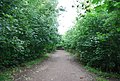 A leafy Thames Path - geograph.org.uk - 2110945.jpg 640 × 430; 175 KB
-
 Aibus A380 (14378573395).jpg 4.608 × 3.456; 4,76 MB
-
 Aircraft (14191961388).jpg 4.608 × 3.456; 4,18 MB
-
 Aircraft (14192006780).jpg 4.608 × 3.456; 4,42 MB
-
 Archway Street, Barnes - geograph.org.uk - 2721876.jpg 1.600 × 1.200; 571 KB
-
 Arundel Terrace - geograph.org.uk - 5182358.jpg 4.000 × 3.000; 3,17 MB
-
 Atherton Road, SW13 - geograph.org.uk - 2247431.jpg 640 × 416; 52 KB
-
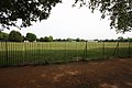
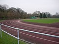 Barn Elms Athletics Track - geograph.org.uk - 1110311.jpg 640 × 480; 91 KB
-
 Barn Elms Plane (1).jpg 3.024 × 4.032; 5,54 MB
-
 Barn Elms Plane (2).jpg 3.024 × 4.032; 6,42 MB
-
 Barn Elms Plane (3).jpg 3.024 × 4.032; 7,3 MB
-
 Barn Elms Plane (4).jpg 3.024 × 4.032; 5,96 MB
-
 Barn Elms Plane (5).jpg 3.024 × 4.032; 6,24 MB
-
 Barn Elms Playing Fields - geograph.org.uk - 2057697.jpg 3.296 × 2.472; 1,8 MB
-
 Barn Elms Playing Fields - geograph.org.uk - 2399284.jpg 1.000 × 667; 180 KB
-
 Barn Elms Recreation Ground - geograph.org.uk - 789523.jpg 640 × 430; 79 KB
-
 Barn elms.jpg 688 × 444; 80 KB
-
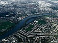
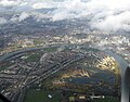
 Barnes and Hammersmith from the air - geograph.org.uk - 2246845.jpg 640 × 353; 144 KB
-
 Barnes Bridge in London (2015).jpg 3.677 × 1.156; 533 KB
-
 Barnes Elm recreation Ground - geograph.org.uk - 789535.jpg 640 × 430; 65 KB
-
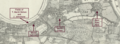 Barnes FC Map.png 3.676 × 1.356; 5,93 MB
-
 Barnes from Chiswick - geograph.org.uk - 800748.jpg 640 × 480; 44 KB
-
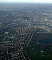
 Barnes from the air - geograph.org.uk - 3893265.jpg 640 × 480; 196 KB
-
 Barnes from the air - geograph.org.uk - 4262075.jpg 549 × 640; 158 KB
-
 Barnes from the air - geograph.org.uk - 4418633.jpg 640 × 480; 201 KB
-
 Barnes from the air - geograph.org.uk - 6080444.jpg 1.024 × 768; 807 KB
-
 Barnes from the air - geograph.org.uk - 6087184.jpg 1.024 × 806; 648 KB
-
 Barnes Green - geograph.org.uk - 1309212.jpg 640 × 480; 92 KB
-
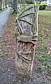 Barnes Green, Bat carving.jpg 1.212 × 2.000; 1,14 MB
-
 Barnes Hedgehog Highway - 2023-01-21.jpg 3.024 × 3.024; 6,93 MB
-
 Barnes Old Police Station - geograph.org.uk - 2111559.jpg 640 × 419; 99 KB
-
 Barnes village green - geograph.org.uk - 2219244.jpg 1.600 × 1.200; 582 KB
-
 Barnes, an important road junction - geograph.org.uk - 3288362.jpg 3.440 × 2.288; 4,47 MB
-
 Barnes, Ranelagh Avenue - geograph.org.uk - 3288360.jpg 3.396 × 2.245; 4,66 MB
-
 Barnes, seen from across the river - geograph.org.uk - 3281128.jpg 3.436 × 2.249; 5,02 MB
-
 Barns Elms Athletics Track - geograph.org.uk - 3416856.jpg 4.288 × 3.216; 4,87 MB
-
 Beverley Brook - geograph.org.uk - 4837182.jpg 1.066 × 1.600; 888 KB
-
 Beverley Road - geograph.org.uk - 4837169.jpg 1.600 × 1.066; 479 KB
-
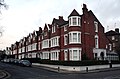
 Beverley Road, Barnes - geograph.org.uk - 4428226.jpg 2.304 × 1.728; 831 KB
-
 Block of flats, Trinity Church Road, Barnes - geograph.org.uk - 2251582.jpg 1.600 × 1.200; 580 KB
-
 Bowling Green - geograph.org.uk - 5006606.jpg 640 × 426; 64 KB
-
 Byrne Hammersmith.jpg 1.831 × 735; 643 KB
-
-
 Chiswick and the River Thames from the air - geograph.org.uk - 6087188.jpg 1.024 × 768; 715 KB
-
 Cross Street, Barnes - geograph.org.uk - 3983491.jpg 768 × 1.024; 113 KB
-
 De Worde House, Lonsdale Rd - geograph.org.uk - 2111540.jpg 640 × 399; 82 KB
-
 East Sheen, Hertford Avenue allotments - geograph.org.uk - 676733.jpg 640 × 480; 100 KB
-
 Entrance to Barnes infant school, Archway Street - geograph.org.uk - 2721878.jpg 1.600 × 1.200; 666 KB
-

-
 Ferry Road, SW13 - geograph.org.uk - 2247428.jpg 640 × 480; 99 KB
-
 Flats on Wyatt Drive, Harrods Village - geograph.org.uk - 2251618.jpg 1.600 × 1.200; 534 KB
-
 Flood wall by the Thames Path, Barnes - geograph.org.uk - 2112910.jpg 640 × 430; 158 KB
-
 Fulham and the Thames from the air - geograph.org.uk - 2246841.jpg 568 × 640; 215 KB
-
 Gables in Elm Bank Gardens, SW13 - geograph.org.uk - 3983022.jpg 739 × 1.024; 119 KB
-
 Grimm Barnes.jpg 2.100 × 1.621; 1,31 MB
-
 Hammersmith Bridge from the air - geograph.org.uk - 5074223.jpg 640 × 480; 209 KB
-
 Henry Fielding - Milbourne House Barnes Green Station Road Barnes London SW13 0LW.jpg 2.000 × 1.500; 780 KB
-
 Herbert Howells - 3 Beverley Close Barnes SW13 0EH.jpg 2.000 × 1.500; 841 KB
-
 Houses on Lonsdale Road - geograph.org.uk - 2898690.jpg 640 × 428; 79 KB
-
 Houses on Lonsdale Road, Barnes - geograph.org.uk - 4081953.jpg 2.188 × 1.562; 1,16 MB
-
-
 Kurt Schwitters - 39 Westmoreland Road Barnes London SW13 9RZ.jpg 1.500 × 2.000; 853 KB
-
 Level crossing on Vine Road, Barnes - geograph.org.uk - 4428224.jpg 2.304 × 1.728; 800 KB
-
 Level crossings on Vine Road - geograph.org.uk - 3810844.jpg 640 × 480; 129 KB
-
 Level crossings on Vine Road, Barnes - geograph.org.uk - 2234607.jpg 1.280 × 960; 624 KB
-
 Lodge (14398759223).jpg 4.608 × 3.456; 10,07 MB
-
 London bus 209.jpg 500 × 500; 179 KB
-
 London Bus route 209 Barnes.jpg 1.600 × 1.200; 593 KB
-
 London Bus route 283 Barnes.jpg 1.600 × 1.200; 595 KB
-
 London Buses route 33 Barnes.jpg 1.600 × 1.200; 650 KB
-
 London Buses route 485 Barnes.jpg 1.600 × 1.200; 605 KB
-
 London Wetland Centre from the air - geograph.org.uk - 3893262.jpg 640 × 480; 183 KB
-
 London Wetland Centre May 2015.JPG 5.472 × 3.648; 11,16 MB
-
 London Wetlands Centre from the air - geograph.org.uk - 6080442.jpg 1.024 × 768; 742 KB
-
 London Wetlands Centre from the air - geograph.org.uk - 6087183.jpg 1.024 × 768; 699 KB
-
 Lonsdale Road at the junction of Castlenau - geograph.org.uk - 4081954.jpg 2.304 × 1.728; 1,24 MB
-
 Lonsdale Road, Barnes - geograph.org.uk - 2129081.jpg 640 × 480; 76 KB
-
 Lonsdale Road, Barnes - geograph.org.uk - 2251608.jpg 1.600 × 1.200; 576 KB
-
 Lonsdale Road, Barnes - geograph.org.uk - 2251609.jpg 1.600 × 1.200; 615 KB
-
 Lonsdale Road, Barnes - geograph.org.uk - 3199388.jpg 2.048 × 1.536; 1,52 MB
-
 Lonsdale Road, SW13 - geograph.org.uk - 963239.jpg 640 × 563; 75 KB
-
-
 Looking along Cedars Road - geograph.org.uk - 3670864.jpg 800 × 600; 106 KB
-
 Looking east on Arundel Terrace - geograph.org.uk - 3670889.jpg 800 × 600; 184 KB
-
 Looking east on Mill Hill Road - geograph.org.uk - 3670871.jpg 800 × 600; 183 KB
-
 Looking south on Vine Road - geograph.org.uk - 3670626.jpg 800 × 600; 144 KB
-
 Lowther Parade in Barnes.jpg 4.742 × 3.119; 7,29 MB
-
 Lowther Parade Turret in Barnes.jpg 3.161 × 4.747; 7,3 MB
-
 Lyric Rd, Barnes - geograph.org.uk - 2111547.jpg 640 × 430; 137 KB
-
 Merthyr Terrace, Barnes - geograph.org.uk - 2251544.jpg 1.600 × 1.200; 428 KB
-
 Merthyr Terrace, Barnes - geograph.org.uk - 2251552.jpg 1.600 × 1.200; 523 KB
-
 Migrant hawker dragonflies (Aeshna mixta) mating.jpg 2.479 × 1.649; 810 KB
-

-
 Mill Hill Road at the junction of Station Road - geograph.org.uk - 4428221.jpg 2.304 × 1.728; 805 KB
-
 Mill Hill Road, Barnes - geograph.org.uk - 1309132.jpg 427 × 640; 122 KB
-
 Mortlake, East Sheen, Barnes map.jpg 1.490 × 1.613; 452 KB
-

-
 Muddy Thameside path - geograph.org.uk - 3804133.jpg 640 × 482; 135 KB
-
 Nassau Rd, Barnes - geograph.org.uk - 2111537.jpg 640 × 390; 78 KB
-
 New flats on the Harrods Village development - geograph.org.uk - 2251627.jpg 1.600 × 1.200; 317 KB
-
 Old sign on Priest's Bridge, Barnes - geograph.org.uk - 4210199.jpg 2.304 × 1.728; 845 KB
-
 Path beside Rocks Lane - geograph.org.uk - 3417020.jpg 4.288 × 3.216; 6,78 MB
-
 Path to Lower Richmond Road, Barnes - geograph.org.uk - 3417006.jpg 4.288 × 3.216; 6,47 MB
-
 Path to the River Thames - geograph.org.uk - 5238483.jpg 4.000 × 3.000; 4,79 MB
-
 Path to the River Thames - geograph.org.uk - 5238485.jpg 4.000 × 3.000; 4,82 MB
-
 Police stop and search in Barnes.jpg 4.032 × 3.024; 2,73 MB
-
 Pontoon on the Thames - geograph.org.uk - 473511.jpg 640 × 480; 99 KB
-
 Possible charity autonomous.jpg 1.000 × 562; 168 KB
-

-
 Queen Elizabeth Walk in autumn - geograph.org.uk - 5197508.jpg 4.608 × 3.456; 3,43 MB
-
 Queen Elizabeth Walk, Barnes - geograph.org.uk - 5205636.jpg 640 × 480; 330 KB
-
 Queen's Ride, Barnes - geograph.org.uk - 1309045.jpg 640 × 480; 137 KB
-
 Railway Side, Barnes - geograph.org.uk - 2237211.jpg 1.280 × 960; 621 KB
-
 Railway Side, Barnes - geograph.org.uk - 2237219.jpg 960 × 1.280; 609 KB
-
 Railway Side, Barnes - geograph.org.uk - 3986505.jpg 768 × 1.024; 135 KB
-
 Railway to Barnes - geograph.org.uk - 3287688.jpg 4.288 × 3.216; 5,27 MB
-
 Railway to London - geograph.org.uk - 3287622.jpg 4.288 × 3.216; 4,56 MB
-
 River Thames at Barnes Bridge - geograph.org.uk - 5006585.jpg 640 × 426; 48 KB
-
 Riverfront buildings, Barnes - geograph.org.uk - 3409930.jpg 1.600 × 1.064; 342 KB
-

-
 Rosales - Pyracantha coccinea - 3.jpg 800 × 600; 69 KB
-
 Rowers under Barnes Bridge.jpg 1.920 × 1.080; 590 KB
-
 Scarth Road, Barnes - geograph.org.uk - 4428229.jpg 2.304 × 1.728; 797 KB
-
 Shop, Verdun Road, SW13 - geograph.org.uk - 2247441.jpg 640 × 427; 91 KB
-

-

-
 St Anne's Terrace, Barnes - geograph.org.uk - 2111543.jpg 640 × 430; 133 KB
-
 St Mary's Grove, Putney - geograph.org.uk - 3287637.jpg 4.288 × 3.216; 7,45 MB
-
 St Paul's School Front Entrance.jpg 2.860 × 2.145; 3,79 MB
-
 Suffolk Road, Barnes - geograph.org.uk - 3199367.jpg 2.048 × 1.536; 1,53 MB
-
 Suffolk Road, Barnes - geograph.org.uk - 3199378.jpg 2.048 × 1.536; 1,43 MB
-
 Superscoop on Barnes Green - geograph.org.uk - 3807198.jpg 640 × 480; 111 KB
-
 Taken from Peacock Tower - panoramio.jpg 5.184 × 2.916; 11,31 MB
-
 Thames at Barnes.jpg 1.837 × 1.033; 468 KB
-
 Thames Path - geograph.org.uk - 2111472.jpg 640 × 430; 185 KB
-

-

-
 Thames Path by the River, Corney Reach - geograph.org.uk - 2111463.jpg 640 × 430; 184 KB
-
 Thames Path heading north - geograph.org.uk - 2109020.jpg 640 × 430; 176 KB
-
 Thames Path heading upstream - geograph.org.uk - 2111431.jpg 640 × 430; 172 KB
-
 Thames Path near Barnes Bridge - geograph.org.uk - 2112891.jpg 640 × 430; 163 KB
-
 Thames Path north of Barnes - geograph.org.uk - 2111424.jpg 640 × 430; 169 KB
-
 Thames Path north to Hammersmith - geograph.org.uk - 2109011.jpg 640 × 430; 183 KB
-
 Thames Path to Barnes - geograph.org.uk - 2111411.jpg 640 × 430; 164 KB
-
 Thames Path to Hammersmith - geograph.org.uk - 2108993.jpg 640 × 430; 191 KB
-
 Thames Path to Putney - geograph.org.uk - 2108950.jpg 640 × 430; 182 KB
-
 Thames Path, south bank - geograph.org.uk - 2111420.jpg 640 × 430; 188 KB
-

-
 The Barnes Church Hall - geograph.org.uk - 2070621.jpg 639 × 401; 166 KB
-

-
 The eastern end of Riverview Gardens - geograph.org.uk - 3670922.jpg 800 × 600; 159 KB
-

-

-
 The River Thames from the air - geograph.org.uk - 4262082.jpg 640 × 480; 124 KB
-
 The Thames Path - geograph.org.uk - 2109017.jpg 640 × 430; 185 KB
-
 The Thames Path - geograph.org.uk - 2110642.jpg 640 × 430; 163 KB
-
 The Thames Path - geograph.org.uk - 2110933.jpg 640 × 430; 191 KB
-
 The Thames Path at Lonsdale Road, Barnes - geograph.org.uk - 3870920.jpg 1.200 × 798; 302 KB
-
 The Thames Path heading to Barnes - geograph.org.uk - 2111455.jpg 640 × 430; 195 KB
-
 The Thames Path heading upstream - geograph.org.uk - 2110691.jpg 640 × 430; 200 KB
-
 The Thames Path heading upstream - geograph.org.uk - 2110952.jpg 640 × 430; 198 KB
-
 The Thames Path heading west to Barnes - geograph.org.uk - 2110923.jpg 640 × 430; 192 KB
-
 The Thames Path near St Paul's School - geograph.org.uk - 2129159.jpg 480 × 640; 139 KB
-

-
 The Thames Path past St Paul's School - geograph.org.uk - 2110921.jpg 640 × 430; 192 KB
-
 The Thames Path to Barnes - geograph.org.uk - 2110939.jpg 640 × 430; 186 KB
-
 The Thames Path towards Barnes - geograph.org.uk - 3870922.jpg 1.200 × 798; 513 KB
-

-
 The Thames Path, Riverside - geograph.org.uk - 2110925.jpg 640 × 430; 192 KB
-
 The Thames Path, south bank of the river - geograph.org.uk - 2110943.jpg 640 × 430; 190 KB
-

-
 The Thames, looking towards Barnes - geograph.org.uk - 369721.jpg 640 × 480; 123 KB
-

-
 Thorne Passage, Barnes - geograph.org.uk - 2721927.jpg 1.600 × 1.200; 549 KB
-
 Thorne Street, Barnes - geograph.org.uk - 3982936.jpg 1.024 × 789; 159 KB
-
 Unidentified sculpture, Barnes Pond - 2023-01-21.jpg 3.024 × 4.032; 8,28 MB
-
 View from Barnes Railway bridge - geograph.org.uk - 3465162.jpg 1.600 × 1.000; 163 KB
-
 View of a 283 bus standing at its terminus - geograph.org.uk - 4438535.jpg 3.872 × 2.592; 3,21 MB
-
 Vine Road - geograph.org.uk - 3810833.jpg 640 × 480; 154 KB
-
 Vine Road level crossings, Barnes Common - geograph.org.uk - 2252547.jpg 1.280 × 960; 627 KB
-
 Vine Road level crossings, Barnes Common - geograph.org.uk - 2252556.jpg 1.280 × 960; 638 KB
-
 Vine Road, Barnes - geograph.org.uk - 2684293.jpg 1.600 × 1.200; 607 KB
-
 Vine Road, Barnes - geograph.org.uk - 4428230.jpg 2.304 × 1.728; 778 KB
-
 Walking on the Thames Path - geograph.org.uk - 2108995.jpg 640 × 430; 176 KB
-
-

-

-
 Wyatt Drive, Harrods Village - geograph.org.uk - 2251570.jpg 1.600 × 1.200; 503 KB

.jpg)

.jpg)
.jpg)
.jpg)


.jpg)
.jpg)
.jpg)
.jpg)
.jpg)


.jpg)


_mating.jpg)


_by_Barnes_Common._-_geograph.org.uk_-_27867.jpg)


.jpg)