Category:London Borough of Richmond upon Thames
Jump to navigation
Jump to search
Boroughs of London: City of London · City of Westminster · Barking and Dagenham · Barnet · Bexley · Brent · Bromley · Camden · Croydon · Ealing · Enfield · Greenwich · Hackney · Hammersmith and Fulham · Haringey · Harrow · Havering · Hillingdon · Hounslow · Islington · Kensington and Chelsea · Kingston · Lambeth · Lewisham · Merton · Newham · Redbridge · Richmond · Southwark · Sutton · Tower Hamlets · Waltham Forest · Wandsworth
borough in the London Region in England   | |||||
| Upload media | |||||
| Instance of | |||||
|---|---|---|---|---|---|
| Location | Greater London, London, England | ||||
| Capital | |||||
| Legislative body |
| ||||
| Executive body |
| ||||
| Head of government |
| ||||
| Inception |
| ||||
| Population |
| ||||
| Area |
| ||||
| Different from | |||||
| official website | |||||
 | |||||
Subcategories
This category has the following 21 subcategories, out of 21 total.
A
E
F
G
H
N
P
S
Media in category "London Borough of Richmond upon Thames"
The following 200 files are in this category, out of 1,754 total.
(previous page) (next page)-
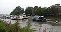
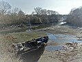
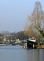 'Bairn's Pride' moored at Platt's Eyot, Hampton - geograph.org.uk - 2856594.jpg 744 × 1,024; 150 KB
-
 'Ghost sign' in St Leonard's Road, Mortlake - geograph.org.uk - 3174955.jpg 651 × 1,024; 110 KB
-
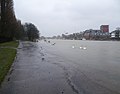 'Wild Wednesday' on the Thames at Kingston - geograph.org.uk - 3846492.jpg 3,776 × 2,945; 1.39 MB
-
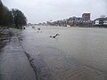 'Wild Wednesday' on the Thames at Kingston - geograph.org.uk - 3846527.jpg 4,000 × 3,000; 4.1 MB
-
 A basement extension gone badly wrong - geograph.org.uk - 4755716.jpg 4,608 × 3,456; 3.34 MB
-
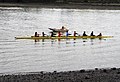 A Boatload of Oars - geograph.org.uk - 3334278.jpg 2,920 × 1,988; 4.67 MB
-

-
 A heron by the Thames - geograph.org.uk - 2134542.jpg 517 × 640; 138 KB
-
 A January evening by the riverside, Brentford - geograph.org.uk - 3812025.jpg 759 × 1,024; 159 KB
-
 A Lincoln keel at Teddington Lock (1) - geograph.org.uk - 4056925.jpg 746 × 1,024; 177 KB
-
 A Lincoln keel at Teddington Lock (2) - geograph.org.uk - 4056946.jpg 768 × 1,024; 200 KB
-
 A Lincoln keel at Teddington Lock (3) - geograph.org.uk - 4061442.jpg 1,024 × 993; 342 KB
-
 A misty view across the Thames to Brentford - geograph.org.uk - 3913919.jpg 3,264 × 1,832; 674 KB
-
 A narrowboat moored near Teddington Weir - geograph.org.uk - 2508001.jpg 640 × 480; 104 KB
-
 A pollard willow by Beverley Brook, March 2018 - geograph.org.uk - 5717875.jpg 768 × 1,024; 257 KB
-
 A quiet morning on the river - geograph.org.uk - 1854278.jpg 640 × 481; 61 KB
-
 A Richmond garden - geograph.org.uk - 2137097.jpg 480 × 640; 115 KB
-
 A rural scene in London - geograph.org.uk - 2134562.jpg 640 × 480; 87 KB
-
 A single skiff at Raven's Ait - geograph.org.uk - 2507369.jpg 640 × 480; 90 KB
-
 A Small Pointed Building - geograph.org.uk - 5697581.jpg 3,812 × 2,592; 4.91 MB
-
 A variety of rubbish bins - geograph.org.uk - 4119935.jpg 640 × 480; 94 KB
-
 A windy Thames on Boat Race Day - geograph.org.uk - 4881204.jpg 640 × 480; 67 KB
-
 Across the river (1) - geograph.org.uk - 5272430.jpg 4,320 × 3,240; 2.18 MB
-
 Across the river (2) - geograph.org.uk - 5272431.jpg 4,320 × 3,240; 2.49 MB
-
 Across the river (3) - geograph.org.uk - 5272443.jpg 4,320 × 3,240; 2.57 MB
-
 Across the river (4) - geograph.org.uk - 5273631.jpg 4,320 × 3,240; 2.96 MB
-
 Across the river (5) - geograph.org.uk - 5273668.jpg 4,320 × 3,240; 2.53 MB
-
 Across the river (6) - geograph.org.uk - 5274766.jpg 4,320 × 3,240; 2.49 MB
-
 Across the Thames to St. Nicholas Church, Chiswick - geograph.org.uk - 5734439.jpg 2,784 × 1,568; 2.19 MB
-
 After the Boat Race 2015 - geograph.org.uk - 4430092.jpg 4,000 × 2,249; 6.52 MB
-
 After the Boat Race 2015 - geograph.org.uk - 4430100.jpg 4,000 × 2,250; 6.73 MB
-
 After the rut - geograph.org.uk - 4772501.jpg 1,024 × 802; 348 KB
-
 Ait landing place - geograph.org.uk - 5274764.jpg 4,320 × 3,240; 3.78 MB
-
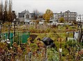
 Allotments and apple tree, Railway Side, Barnes - geograph.org.uk - 3987467.jpg 1,024 × 786; 202 KB
-

-
 Allotments and houses of Westfields Avenue - geograph.org.uk - 4342412.jpg 1,024 × 683; 186 KB
-
 Allotments near the Thames at Kew - geograph.org.uk - 2138822.jpg 640 × 480; 116 KB
-
 Allotments near the Thames at Kew - geograph.org.uk - 2651032.jpg 640 × 480; 114 KB
-
 Amaryllis Above Teddington Lock - geograph.org.uk - 2970942.jpg 4,288 × 3,216; 3.19 MB
-
 An 'Education Land' boundary stone close up - geograph.org.uk - 5540524.jpg 767 × 1,024; 345 KB
-
-
 Apartment Block by Steven's Eyots - geograph.org.uk - 2970539.jpg 4,288 × 3,216; 3.51 MB
-
-
 Apartments on the Thames - geograph.org.uk - 2619213.jpg 1,024 × 680; 186 KB
-

-
 Approach to Teddington Locks - geograph.org.uk - 6185881.jpg 1,024 × 768; 400 KB
-
 Approaching Raven's Ait - geograph.org.uk - 3400035.jpg 640 × 425; 113 KB
-
 Approaching Richmond - geograph.org.uk - 3453567.jpg 640 × 480; 138 KB
-
-

-
-
 Artificial Sand Martin bank on Eel Pie Island - geograph.org.uk - 5499567.jpg 1,024 × 682; 217 KB
-
 Ash Island - geograph.org.uk - 5862309.jpg 1,024 × 768; 254 KB
-
 Ash keys at mid-summer, Palewell Common - geograph.org.uk - 5828681.jpg 768 × 1,024; 203 KB
-
 Astoria moored on the Thames - geograph.org.uk - 2586658.jpg 1,024 × 680; 267 KB
-
 ATS on the A312, Hanworth - geograph.org.uk - 5875359.jpg 2,034 × 1,356; 1.64 MB
-
 Autumn in Hanworth - geograph.org.uk - 3209756.jpg 762 × 1,024; 202 KB
-
 Barge on the mud, Riverside, Hammersmith - geograph.org.uk - 2109166.jpg 640 × 430; 127 KB
-
 Barges at The Dove Pier - geograph.org.uk - 2618473.jpg 1,024 × 680; 172 KB
-
 Barges on the River Thames - geograph.org.uk - 2144648.jpg 640 × 430; 138 KB
-
 Barmy Arms, Twickenham. From Eel Pie Island - geograph.org.uk - 5619865.jpg 5,202 × 3,465; 2.8 MB
-
 Barn Elms allotments, circa 1992 - geograph.org.uk - 3320711.jpg 1,024 × 752; 207 KB
-
 Barnes , view of The Thames - geograph.org.uk - 6215062.jpg 768 × 1,024; 672 KB
-
 Barnes Common on a very hot day - geograph.org.uk - 6230512.jpg 3,807 × 2,855; 2.79 MB
-
 Barnes, Barn Elms Boathouse - geograph.org.uk - 3334281.jpg 3,456 × 2,304; 4.15 MB
-
 Barnes, Cycle path link from Thames Path - geograph.org.uk - 3334271.jpg 640 × 427; 115 KB
-
 Barnes, The 'Old London' - geograph.org.uk - 3281131.jpg 3,456 × 2,304; 4.93 MB
-
 Be careful not to drive in - geograph.org.uk - 3400020.jpg 640 × 425; 125 KB
-
 Beach volleyball courts - geograph.org.uk - 4056763.jpg 1,600 × 1,058; 478 KB
-
 Beavers Versus Cards - geograph.org.uk - 2823927.jpg 2,560 × 1,920; 1.74 MB
-
 Bench looking across the river - geograph.org.uk - 2112976.jpg 640 × 430; 154 KB
-
 Bench mark and bolt near Pembroke Lodge - geograph.org.uk - 4351036.jpg 640 × 480; 216 KB
-

-
 Bench mark in Manor Road, Teddington - geograph.org.uk - 5543040.jpg 768 × 1,024; 235 KB
-
 Bench sleeper - geograph.org.uk - 3523739.jpg 1,200 × 1,600; 464 KB
-
 Better by Bus - geograph.org.uk - 6215721.jpg 4,537 × 2,935; 4.89 MB
-
 Beveree, Hampton FC - geograph.org.uk - 2823957.jpg 2,560 × 1,920; 1.64 MB
-
 Beverley Bridge, Richmond Park - geograph.org.uk - 3302833.jpg 4,288 × 3,216; 6.81 MB
-
 Beverley Brook from Priest's Bridge - geograph.org.uk - 4210189.jpg 2,304 × 1,728; 824 KB
-
 Beverley Brook, Roehampton - geograph.org.uk - 4126513.jpg 2,304 × 1,728; 839 KB
-
 Beverley Brook, Roehampton - geograph.org.uk - 4126515.jpg 2,304 × 1,728; 815 KB
-
 Beware - Rowing Boats Crossing - geograph.org.uk - 3455164.jpg 640 × 480; 125 KB
-
 Beware of slow boats - geograph.org.uk - 5273609.jpg 4,320 × 3,240; 3.11 MB
-
 Bicycle made for three - geograph.org.uk - 4863696.jpg 1,600 × 1,340; 637 KB
-
 Bird box on Oak Tree - geograph.org.uk - 4146980.jpg 640 × 480; 104 KB
-
 Birds being fed - geograph.org.uk - 3239106.jpg 1,000 × 667; 224 KB
-
 Birds galore - geograph.org.uk - 5274762.jpg 4,320 × 3,240; 4.18 MB
-
-
 Black Lion Stairs - geograph.org.uk - 3807063.jpg 640 × 480; 88 KB
-
 Block by the railway line, North Sheen - geograph.org.uk - 5881333.jpg 1,920 × 1,280; 1.91 MB
-
 Boat club - geograph.org.uk - 5267702.jpg 4,320 × 3,240; 2.55 MB
-
 Boat house - geograph.org.uk - 5267701.jpg 4,320 × 3,240; 3.31 MB
-
 Boat House on Taggs Island - geograph.org.uk - 3587116.jpg 1,600 × 1,200; 333 KB
-
 Boat Houses at Kingston - geograph.org.uk - 3466793.jpg 1,600 × 1,541; 805 KB
-
 Boat moored at Teddington Lock - geograph.org.uk - 4091734.jpg 2,304 × 1,728; 865 KB
-
 Boat moored by Eel Pie Island - geograph.org.uk - 4596149.jpg 1,500 × 999; 221 KB
-
 Boat moored on the Thames - geograph.org.uk - 5421447.jpg 1,600 × 1,253; 341 KB
-
 Boat moored on the Thames at Kingston on 'Wild Wednesday' - geograph.org.uk - 3846534.jpg 4,000 × 3,000; 4.27 MB
-
 Boat moored upstream of Richmond Lock - geograph.org.uk - 2121640.jpg 640 × 430; 139 KB
-
 Boat on River Thames - geograph.org.uk - 2874528.jpg 1,600 × 1,035; 418 KB
-
 Boat on The Pond - geograph.org.uk - 3847748.jpg 640 × 478; 123 KB
-
 Boat on the River Thames - geograph.org.uk - 2130436.jpg 640 × 430; 135 KB
-
 Boat on the River Thames - geograph.org.uk - 2131977.jpg 640 × 430; 152 KB
-

-
 Boat rollers and head of skiff lock, Teddington - geograph.org.uk - 6185979.jpg 1,024 × 768; 315 KB
-
 Boat trips, Richmond - geograph.org.uk - 6186363.jpg 1,024 × 768; 337 KB
-
 Boathouse and slipway - geograph.org.uk - 2115345.jpg 640 × 430; 120 KB
-
 Boathouse at Chiswick - geograph.org.uk - 2498460.jpg 640 × 480; 93 KB
-
 Boathouse by Chiswick Bridge - geograph.org.uk - 2115174.jpg 640 × 430; 123 KB
-
 Boathouse by Hampton Wick - geograph.org.uk - 2970669.jpg 4,288 × 3,216; 3.44 MB
-
 Boathouse Design Studio - geograph.org.uk - 2859801.jpg 1,024 × 768; 450 KB
-
 Boathouse near Twickenham - geograph.org.uk - 2494324.jpg 640 × 480; 66 KB
-
 Boathouse on the River Thames - geograph.org.uk - 2140662.jpg 640 × 430; 106 KB
-
 Boathouse opposite Eel Pie Island - geograph.org.uk - 4596151.jpg 1,500 × 991; 269 KB
-
 Boathouse, Teddington - geograph.org.uk - 2140732.jpg 640 × 404; 77 KB
-
 Boathouses by Duke's Meadows, Chiswick - geograph.org.uk - 3333419.jpg 2,592 × 1,944; 1.59 MB
-

-
 Boats and riverside houses - geograph.org.uk - 2131937.jpg 640 × 430; 143 KB
-
 Boats at mouth of Grand Union Canal, Brentford - geograph.org.uk - 4502807.jpg 3,648 × 2,736; 3.11 MB
-
 Boats by Richmond Railway Bridge - geograph.org.uk - 2121702.jpg 640 × 430; 118 KB
-
 Boats by River Thames at West Molesey - geograph.org.uk - 3586865.jpg 1,600 × 1,200; 265 KB
-
 Boats moored along the River Thames - geograph.org.uk - 4638166.jpg 800 × 544; 129 KB
-

-
 Boats moored at Platt's Eyot, near Hampton - geograph.org.uk - 2855930.jpg 1,024 × 768; 144 KB
-
 Boats moored at Richmond - geograph.org.uk - 2600224.jpg 640 × 430; 89 KB
-
 Boats moored at Thames Ditton - geograph.org.uk - 2655953.jpg 640 × 480; 75 KB
-
-
 Boats moored by Hampton Court Palace - geograph.org.uk - 2144817.jpg 640 × 430; 100 KB
-
 Boats moored by Kew Bridge - geograph.org.uk - 4983175.jpg 640 × 426; 84 KB
-
 Boats moored by Kingston Bridge - geograph.org.uk - 3245688.jpg 640 × 430; 69 KB
-
 Boats moored by Trowlock Island - geograph.org.uk - 2140541.jpg 640 × 430; 137 KB
-
 Boats moored near Glover's Island - geograph.org.uk - 4638409.jpg 800 × 598; 124 KB
-
 Boats moored near Teddington - geograph.org.uk - 2140677.jpg 640 × 430; 111 KB
-
 Boats moored near Teddington Weir - geograph.org.uk - 2859797.jpg 1,024 × 768; 682 KB
-
 Boats moored on the River Thames - geograph.org.uk - 2121598.jpg 640 × 430; 146 KB
-
 Boats moored on the Thames - geograph.org.uk - 2600291.jpg 640 × 430; 70 KB
-
-
 Boats near Ferry Jetty at Richmond - geograph.org.uk - 2874013.jpg 1,600 × 1,200; 525 KB
-
 Boats on Horse Reach, River Thames - geograph.org.uk - 2130542.jpg 640 × 430; 137 KB
-
 Boats on the River Thames - geograph.org.uk - 3569760.jpg 4,000 × 3,000; 3.93 MB
-
 Boats on the River Thames at Richmond - geograph.org.uk - 2121705.jpg 640 × 430; 113 KB
-
 Boats on the River Thames, Richmond - geograph.org.uk - 2123129.jpg 640 × 337; 79 KB
-
 Boats on the Thames - geograph.org.uk - 2123251.jpg 640 × 430; 118 KB
-
 Boats on the Thames - geograph.org.uk - 3227525.jpg 640 × 430; 100 KB
-
 Boats on the Thames near Richmond - geograph.org.uk - 2134516.jpg 640 × 480; 123 KB
-
-
 Boats opposite Richmond Ferry Jetty - geograph.org.uk - 2874026.jpg 1,600 × 1,177; 502 KB
-
 Boats outside Hampton Court Palace - geograph.org.uk - 2144824.jpg 640 × 430; 104 KB
-
 Boats, Horse Reach, River Thames - geograph.org.uk - 2130548.jpg 640 × 430; 133 KB
-
 Boatyard at Hampton - geograph.org.uk - 2657691.jpg 640 × 480; 86 KB
-
 Boatyard at the eastern end of Platt's Eyot - geograph.org.uk - 5860173.jpg 1,024 × 768; 216 KB
-
 Boatyards at Hampton - geograph.org.uk - 3399947.jpg 640 × 426; 83 KB
-
 Boyle Farm Island - geograph.org.uk - 5170052.jpg 3,072 × 2,048; 1.21 MB
-
 Branch of River Crane - geograph.org.uk - 4121421.jpg 640 × 480; 172 KB
-
 Brentford Ait - geograph.org.uk - 5270695.jpg 4,320 × 3,240; 3.41 MB
-
 Brentford high-rise - geograph.org.uk - 2318410.jpg 768 × 1,024; 225 KB
-
 Brentford Towers - geograph.org.uk - 4384847.jpg 530 × 800; 550 KB
-

-
 Bridge over the River Crane, Twickenham - geograph.org.uk - 5938671.jpg 1,280 × 1,920; 1.9 MB
-

-
 Bridge to Teddington Marina - geograph.org.uk - 5813162.jpg 1,924 × 1,354; 1.68 MB
-
 Broom Close rear garden with view of the Thames - geograph.org.uk - 5420725.jpg 2,048 × 1,536; 260 KB
-
-

-
 Building new houses - geograph.org.uk - 4955931.jpg 640 × 426; 81 KB
-
 Building on Railshead Rd - geograph.org.uk - 2600296.jpg 640 × 430; 59 KB
-
 Building over tunnel shaft - geograph.org.uk - 3124757.jpg 480 × 640; 182 KB
-
-
 Buildings in Isleworth, viewed from the Thames Path - geograph.org.uk - 2494976.jpg 2,048 × 1,536; 778 KB
-
 Buoy shows incoming tide, Thames at Brentford - geograph.org.uk - 4502331.jpg 3,648 × 2,736; 3.79 MB
-
 Burnell Road, Ham - geograph.org.uk - 3607534.jpg 1,600 × 1,200; 495 KB
-
 Bus turnaround, Queen's Road - geograph.org.uk - 1921461.jpg 640 × 480; 90 KB
-
 By the Barge Walk - geograph.org.uk - 5169280.jpg 3,072 × 2,048; 1.76 MB
-
 By the river, Kingston upon Thames - geograph.org.uk - 3104904.jpg 640 × 480; 124 KB
-
 Canoeing at Hampton Court Bridge - geograph.org.uk - 5690582.jpg 1,024 × 684; 246 KB
-
 Canoeists approach the east end of Eel Pie Island - geograph.org.uk - 4242549.jpg 1,600 × 1,200; 387 KB
-

-
 Captive bicycles - geograph.org.uk - 3726429.jpg 2,000 × 3,008; 2.58 MB
-
 Car park and car wash, Manor Road, Richmond - geograph.org.uk - 3789184.jpg 1,024 × 806; 197 KB
-
 Car park and Thames - geograph.org.uk - 6147001.jpg 1,024 × 683; 636 KB
-
 Car park on Hampton Court Green - geograph.org.uk - 5872122.jpg 4,032 × 3,024; 3.5 MB
-
 Car park on Manor Road, North Sheen - geograph.org.uk - 5332671.jpg 2,304 × 1,728; 839 KB
-
 Carlie Park Pavilion - geograph.org.uk - 2926391.jpg 640 × 427; 100 KB
-
-

-
-
 Centenarian Cob - geograph.org.uk - 2970965.jpg 4,288 × 3,216; 3.23 MB
-
 Chancellor Wharf - geograph.org.uk - 2109039.jpg 640 × 430; 130 KB
-
 Changing Rooms, Barnes - geograph.org.uk - 3416997.jpg 4,213 × 3,110; 5.67 MB
-
 Channel of the River Thames at Brentford - geograph.org.uk - 6069735.jpg 5,067 × 3,801; 4.89 MB
-
 Charing Cross Hospital at Fulham - geograph.org.uk - 2623099.jpg 1,024 × 680; 149 KB
-

-
 Children enjoy the "Tutti Frutti Boating Experience" at Kew - geograph.org.uk - 3542536.jpg 2,544 × 1,906; 2.18 MB
-
 Chiswick Church across the Thames - geograph.org.uk - 2325194.jpg 1,280 × 960; 645 KB
-
 Chiswick Eyot across the River Thames - geograph.org.uk - 2325211.jpg 1,280 × 960; 606 KB
-

-
-
 Chiswick Quay Marina - geograph.org.uk - 2498455.jpg 640 × 480; 77 KB
-
 Chocolate Soldier - geograph.org.uk - 2888561.jpg 683 × 1,024; 253 KB
-
 Christian Hymns.jpg 3,024 × 4,032; 2.95 MB


_-_geograph.org.uk_-_4056925.jpg)
_-_geograph.org.uk_-_4056946.jpg)
_-_geograph.org.uk_-_4061442.jpg)


_-_geograph.org.uk_-_5272430.jpg)
_-_geograph.org.uk_-_5272431.jpg)
_-_geograph.org.uk_-_5272443.jpg)
_-_geograph.org.uk_-_5273631.jpg)
_-_geograph.org.uk_-_5273668.jpg)
_-_geograph.org.uk_-_5274766.jpg)


_-_geograph.org.uk_-_4445523.jpg)
_-_geograph.org.uk_-_4445543.jpg)
_-_geograph.org.uk_-_4445559.jpg)


,_Ham_Street_carpark_-_geograph.org.uk_-_5499612.jpg)


