Category:Barningham, County Durham
Jump to navigation
Jump to search
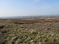
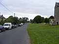
English: Barningham is a village in the Pennines of England. It is historically located in the North Riding of Yorkshire but along with the rest of the former Startforth Rural District it was transferred to County Durham for administrative and ceremonial purposes on 1 April 1974, under the provisions of the Local Government Act 1972.
Main Wikipedia article: Barningham, County Durham.

village and civil parish in County Durham, England, UK  | |||||
| Upload media | |||||
| Instance of | |||||
|---|---|---|---|---|---|
| Location | County Durham, North East England, England | ||||
 | |||||
Subcategories
This category has the following 3 subcategories, out of 3 total.
H
- How Tallon (5 F)
M
- Milbank Arms, Barningham (2 F)
Media in category "Barningham, County Durham"
The following 139 files are in this category, out of 139 total.
-
 A bend in Cowclose Lane - geograph.org.uk - 2391581.jpg 640 × 465; 83 KB
-
 A former chapel building at Barningham - geograph.org.uk - 2391522.jpg 2,736 × 3,648; 1.15 MB
-
 A nice place to sit^ - geograph.org.uk - 1808843.jpg 1,600 × 1,200; 796 KB
-
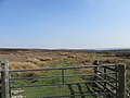
 Access to Barningham Moor - geograph.org.uk - 2391548.jpg 1,819 × 1,091; 369 KB
-

-
 An unfenced moorland road - geograph.org.uk - 2391564.jpg 1,463 × 1,003; 506 KB
-
 Badger Way - geograph.org.uk - 1596813.jpg 576 × 640; 148 KB
-
 Badger Way Stoop (BS) - geograph.org.uk - 1810378.jpg 2,472 × 3,296; 2.06 MB
-
 Badger Way Stoop - geograph.org.uk - 2664611.jpg 640 × 480; 69 KB
-
 Bale castle - geograph.org.uk - 1566145.jpg 640 × 520; 111 KB
-
 Barn to the north of Barningham - geograph.org.uk - 4698696.jpg 1,600 × 1,039; 704 KB
-
 Barningham bypass - geograph.org.uk - 1566106.jpg 576 × 640; 126 KB
-
 Barningham Ford - geograph.org.uk - 5718915.jpg 4,032 × 3,024; 3.23 MB
-
 Barningham Moor - geograph.org.uk - 2664618.jpg 640 × 480; 66 KB
-
 Barningham Moor - geograph.org.uk - 6132192.jpg 2,048 × 1,536; 1.1 MB
-
 Barningham Moor - geograph.org.uk - 871139.jpg 640 × 427; 93 KB
-
 Barningham Moor - geograph.org.uk - 871923.jpg 640 × 427; 106 KB
-
 Barningham Moor - geograph.org.uk - 871932.jpg 640 × 427; 103 KB
-
 Barningham Moor - geograph.org.uk - 871949.jpg 640 × 427; 121 KB
-
 Barningham Park - geograph.org.uk - 6132139.jpg 2,048 × 1,536; 1.29 MB
-
 Barningham telephone exchange - geograph.org.uk - 1566120.jpg 570 × 640; 123 KB
-
 Barningham.JPG 3,072 × 2,304; 1.31 MB
-
 Black Hill Gate - geograph.org.uk - 1716558.jpg 640 × 510; 120 KB
-
 Black Hill Gate - geograph.org.uk - 2664601.jpg 640 × 480; 69 KB
-
 Blooming heather beside dry stone wall on Cocker Hill - geograph.org.uk - 2186555.jpg 2,000 × 1,500; 2.6 MB
-
 Boundary on Barningham Moor - geograph.org.uk - 871921.jpg 640 × 427; 83 KB
-
 Boundary stone on Barningham Moor - geograph.org.uk - 871960.jpg 427 × 640; 94 KB
-
 Bragg House - geograph.org.uk - 3120534.jpg 3,837 × 2,517; 1.69 MB
-
 Bridge Number on Norbeck Bridge - geograph.org.uk - 1808837.jpg 3,296 × 2,472; 2.53 MB
-
 Bridleway across Barningham Moor - geograph.org.uk - 871914.jpg 640 × 427; 61 KB
-
 Bridleway into Barningham - geograph.org.uk - 6132199.jpg 2,048 × 1,536; 1,008 KB
-
 Bridleway north towards Haythwaite - geograph.org.uk - 1597027.jpg 512 × 640; 131 KB
-

-
 Buttercup field with trees - geograph.org.uk - 3494485.jpg 1,500 × 996; 1.91 MB
-
 Carter Allotment - geograph.org.uk - 6132195.jpg 2,048 × 1,536; 1.1 MB
-
 Cathaw Stoop - geograph.org.uk - 1810193.jpg 2,472 × 3,296; 2.01 MB
-
 Converted chapel at Barningham - geograph.org.uk - 528144.jpg 640 × 359; 84 KB
-
 Corner of Barningham Moor - geograph.org.uk - 1810294.jpg 2,459 × 1,584; 1.12 MB
-
 Cotton grass moorland - geograph.org.uk - 871934.jpg 427 × 640; 110 KB
-
 County boundary - geograph.org.uk - 871938.jpg 427 × 640; 90 KB
-
 Cowclose House - geograph.org.uk - 1808866.jpg 2,637 × 1,648; 995 KB
-
 Cowclose House and lake - geograph.org.uk - 6341196.jpg 5,184 × 3,888; 4.97 MB
-
 Cowclose Lane - geograph.org.uk - 4404386.jpg 1,500 × 1,125; 2.22 MB
-
 Cowclose Nature Reserve - geograph.org.uk - 1808863.jpg 2,429 × 1,575; 1.2 MB
-
 Crossbeck Bridge - geograph.org.uk - 1808861.jpg 2,472 × 3,296; 1.8 MB
-
 Cup marked rock - geograph.org.uk - 1596883.jpg 480 × 640; 175 KB
-
 Distant Haythwaite - geograph.org.uk - 1247176.jpg 640 × 480; 91 KB
-
 Durham-Yorkshire county boundary - geograph.org.uk - 871965.jpg 640 × 427; 91 KB
-
 Eastern entrance to Barningham - geograph.org.uk - 2391369.jpg 1,779 × 1,143; 592 KB
-
 Eastwood Hall - geograph.org.uk - 1191545.jpg 640 × 427; 85 KB
-
 Eastwood Hall - geograph.org.uk - 4407757.jpg 3,264 × 2,448; 1.56 MB
-
 Eastwood Hall's garden - geograph.org.uk - 1191548.jpg 640 × 427; 88 KB
-
 Eel Hill - geograph.org.uk - 1596847.jpg 640 × 512; 151 KB
-
 Entrance to Saunders House Farm - geograph.org.uk - 4698683.jpg 1,600 × 1,065; 532 KB
-
 Erect stone with waymark on Barningham Moor - geograph.org.uk - 3494279.jpg 1,500 × 1,125; 1.33 MB
-
 Fields west of Barningham - geograph.org.uk - 6341172.jpg 5,184 × 3,888; 6 MB
-
 Footbridge and ford over minor stream near Barningham - geograph.org.uk - 2496266.jpg 1,500 × 1,125; 1.64 MB
-
 Footings of a former wall on How Tallon Ridge - geograph.org.uk - 1810475.jpg 2,472 × 3,296; 1.84 MB
-
 Footpath to Barningham Park - geograph.org.uk - 1691282.jpg 640 × 512; 110 KB
-
 Ford , Woodclose Gill , Hope Plantation - geograph.org.uk - 145584.jpg 640 × 479; 135 KB
-
 Ford at Haythwaite - geograph.org.uk - 4460577.jpg 3,872 × 2,592; 4.21 MB
-
 Ford on Low Lane - geograph.org.uk - 3339663.jpg 640 × 480; 141 KB
-
 Gate at bridleway passage through dry stone wall - geograph.org.uk - 4404100.jpg 1,500 × 1,125; 1.89 MB
-
 Gate at How Tallon - geograph.org.uk - 6132186.jpg 2,048 × 1,536; 862 KB
-
 Gateway access to Barningham Park - geograph.org.uk - 2391504.jpg 3,648 × 2,736; 1.64 MB
-
 Gillbeck Bridge - geograph.org.uk - 2391618.jpg 1,824 × 1,368; 1.14 MB
-
 Gillbeck Bridge - geograph.org.uk - 3401969.jpg 3,952 × 2,295; 2.48 MB
-
 Gillbeck Foot - geograph.org.uk - 3339741.jpg 640 × 480; 139 KB
-
 Glacial Meltwater Channel - geograph.org.uk - 1810390.jpg 2,097 × 1,123; 550 KB
-
 Goods van shelter on Barningham Moor - geograph.org.uk - 1596792.jpg 640 × 530; 149 KB
-
 Gordale Gill - geograph.org.uk - 3120508.jpg 3,888 × 2,389; 1.37 MB
-
 Grassy moorland east of Stang Forest - geograph.org.uk - 2186544.jpg 2,000 × 1,337; 2.17 MB
-
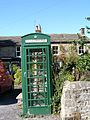 Green Phone Box-Barningham.jpg 1,704 × 2,272; 1.74 MB
-
 Grouse Butts on Barningham Moor - geograph.org.uk - 1810311.jpg 3,188 × 1,459; 1.33 MB
-
 Hawthorn in Gordale Gill - geograph.org.uk - 3667525.jpg 4,000 × 3,000; 5.28 MB
-
 Haythwaite - geograph.org.uk - 3120535.jpg 3,888 × 2,592; 1.54 MB
-

-
 Haythwaite Farm - geograph.org.uk - 2664550.jpg 640 × 480; 47 KB
-
 Hedgehog warning sign - geograph.org.uk - 6132205.jpg 2,048 × 1,536; 877 KB
-
 High Band - geograph.org.uk - 2664455.jpg 640 × 480; 44 KB
-
 High Moor - geograph.org.uk - 2664477.jpg 640 × 480; 66 KB
-
 Keepers Track - geograph.org.uk - 1810301.jpg 2,045 × 1,754; 1.2 MB
-
 Kyloe Beck - geograph.org.uk - 1810229.jpg 2,472 × 1,880; 1.3 MB
-
 Kyloe Beck FB and watersplash - geograph.org.uk - 1810246.jpg 3,296 × 2,472; 2.38 MB
-
 Limestone Pasture - geograph.org.uk - 1810486.jpg 3,296 × 2,472; 1.97 MB
-
 Lone tree, sheep beyond - geograph.org.uk - 5652104.jpg 1,500 × 1,125; 1.3 MB
-
 Low Lane Ford - geograph.org.uk - 5718908.jpg 4,032 × 3,024; 5.91 MB
-
 Main Elevation of Barningham Park.png 1,064 × 1,080; 954 KB
-
 Moorcock Farm - geograph.org.uk - 6341186.jpg 5,164 × 3,655; 3.76 MB
-
 Moorland drainage - geograph.org.uk - 871952.jpg 427 × 640; 103 KB
-
 Moorland Track on Barningham Moor - geograph.org.uk - 528136.jpg 640 × 359; 55 KB
-
 More 'Royal Wedding' decorations - geograph.org.uk - 2391455.jpg 1,824 × 1,368; 943 KB
-
 Mown lane on heather moor - geograph.org.uk - 3494515.jpg 1,500 × 1,101; 1.49 MB
-
 Mud road^ - geograph.org.uk - 4833856.jpg 1,499 × 962; 1.21 MB
-
 Mysterious Mound - geograph.org.uk - 1811216.jpg 3,296 × 2,472; 2.02 MB
-
 Nameless reservoir - geograph.org.uk - 2664486.jpg 640 × 480; 48 KB
-
 Norbeck (new) Bridge - geograph.org.uk - 1808833.jpg 2,927 × 1,746; 1.4 MB
-
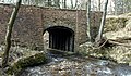
 Norbeck Bridge - geograph.org.uk - 1808820.jpg 3,296 × 2,472; 1.99 MB
-
 Norbeck Bridge - geograph.org.uk - 251050.jpg 640 × 479; 155 KB
-
 Norbeck Bridge - geograph.org.uk - 2664650.jpg 640 × 480; 151 KB
-
 Old Hollow-way next to Cowclose Lane - geograph.org.uk - 3401987.jpg 3,000 × 4,000; 3.59 MB
-
 Osmaril Gill - geograph.org.uk - 2664459.jpg 640 × 480; 74 KB
-
 Osmonds Gill - geograph.org.uk - 1596877.jpg 480 × 640; 147 KB
-
 Park House - geograph.org.uk - 1691342.jpg 640 × 525; 109 KB
-
 Path above south side of River Greta - geograph.org.uk - 6095373.jpg 1,600 × 1,119; 1,000 KB
-
 Peat Hill pond - geograph.org.uk - 2391608.jpg 3,648 × 2,736; 2.13 MB
-
 Public footpath in Barningham - geograph.org.uk - 3494196.jpg 1,500 × 1,125; 1.8 MB
-
 Road Bridge over stream - geograph.org.uk - 1808855.jpg 2,015 × 2,380; 1.61 MB
-
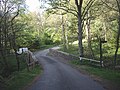
 Road to Haythwaite - geograph.org.uk - 2664647.jpg 640 × 480; 49 KB
-
 Rotting stile onto Barningham Moor - geograph.org.uk - 1691357.jpg 640 × 512; 119 KB
-
 Ruined Wall near Black Hill Gate - geograph.org.uk - 1811244.jpg 2,472 × 3,296; 1.87 MB
-
 Scale Knoll - geograph.org.uk - 3120540.jpg 3,888 × 2,301; 1.27 MB
-
 Scale Knoll - geograph.org.uk - 3120573.jpg 3,725 × 2,429; 1.26 MB
-
 Scale Knoll - geograph.org.uk - 3120746.jpg 3,888 × 2,592; 1.85 MB
-
 Scale Knoll footbridge - geograph.org.uk - 1811344.jpg 3,296 × 2,472; 1.91 MB
-
 Scale Knoll Ford - geograph.org.uk - 4460553.jpg 3,872 × 2,592; 3.52 MB
-
 Scale Knoll Gill - geograph.org.uk - 1811330.jpg 2,472 × 3,296; 1.87 MB
-
 Scale Knoll Gill - geograph.org.uk - 3120537.jpg 3,888 × 2,417; 2.02 MB
-

-
 Stone with waymark on Barningham Moor - geograph.org.uk - 3494497.jpg 1,500 × 1,125; 1.53 MB
-
 Strange stones on Barningham Moor - geograph.org.uk - 3667473.jpg 4,000 × 3,000; 5.34 MB
-
 The back of Eastwood Hall - geograph.org.uk - 1191551.jpg 640 × 427; 105 KB
-
 The edge of Barningham Park - geograph.org.uk - 6132151.jpg 2,048 × 1,536; 863 KB
-
 The main house at Barningham Park - geograph.org.uk - 4834796.jpg 1,500 × 1,125; 1.44 MB
-
 The Millbank Arms, Barningham - geograph.org.uk - 4698506.jpg 1,600 × 1,065; 720 KB
-
 The Millbank Arms, Barningham - geograph.org.uk - 4698509.jpg 1,065 × 1,600; 749 KB
-
 The Millbank Arms, Braningham - geograph.org.uk - 4698517.jpg 1,065 × 1,600; 754 KB
-
-
 Two trees on a knoll - geograph.org.uk - 5652145.jpg 1,499 × 943; 1.21 MB
-
 Village drinking trough, Barningham - geograph.org.uk - 2391475.jpg 2,736 × 3,648; 1.81 MB
-
 Village Hall, Barningham - geograph.org.uk - 2391412.jpg 3,648 × 2,736; 1.52 MB
-
 Waiting sheep on Crook's House Farm - geograph.org.uk - 6095451.jpg 1,600 × 910; 460 KB
-
 Well in Barningham - geograph.org.uk - 4832652.jpg 1,395 × 1,600; 988 KB
-
 Wilson House - geograph.org.uk - 3120521.jpg 3,691 × 1,943; 1.24 MB
-
 Woodclose Gill - geograph.org.uk - 2664568.jpg 640 × 480; 119 KB
-

-
 Barningham Village Hall - geograph.org.uk - 528165.jpg 640 × 359; 77 KB
-
 Old school, Barningham - geograph.org.uk - 136721.jpg 640 × 426; 83 KB
-
 Park House Farm - geograph.org.uk - 556541.jpg 640 × 480; 111 KB


_-_geograph.org.uk_-_1810378.jpg)


_Bridge_-_geograph.org.uk_-_1808833.jpg)


