Category:Barrow, Cheshire
Aller à la navigation
Aller à la recherche
civil parish in Cheshire, UK  | |||||
| Téléverser des médias | |||||
| Nature de l’élément | |||||
|---|---|---|---|---|---|
| Lieu | Cheshire West and Chester, Cheshire, Angleterre du Nord-Ouest, Angleterre | ||||
 | |||||
Sous-catégories
Cette catégorie comprend 3 sous-catégories, dont les 3 ci-dessous.
Média dans la catégorie « Barrow, Cheshire »
Cette catégorie comprend 102 fichiers, dont les 102 ci-dessous.
-
 Ashton Brook near Swinfordmill Farm - geograph.org.uk - 4801112.jpg 1 200 × 800 ; 194 kio
-
 B5132 looking south at The Foxcote - geograph.org.uk - 3359802.jpg 640 × 481 ; 45 kio
-
 Barnhouse Lane heading towards Barnhouse Farm - geograph.org.uk - 5979254.jpg 4 000 × 3 000 ; 3,62 Mio
-
 Barnhouse Lane looking north - geograph.org.uk - 3359757.jpg 640 × 480 ; 120 kio
-
 Barnhouse Lane near Dunham Heath - geograph.org.uk - 2439128.jpg 4 000 × 3 000 ; 3,35 Mio
-
-
 Barnhouse Lane towards Long Green - geograph.org.uk - 2439142.jpg 4 000 × 3 000 ; 3,13 Mio
-
 Barrow - Broomhill Orchard Farm.jpg 640 × 480 ; 113 kio
-
 Barrow Mill - geograph.org.uk - 4949702.jpg 1 200 × 900 ; 332 kio
-
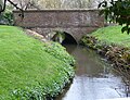
 Bridge over Barrow Brook - geograph.org.uk - 2439237.jpg 4 000 × 3 000 ; 2,19 Mio
-
 Broomhill Farm - geograph.org.uk - 4959621.jpg 1 200 × 900 ; 210 kio
-
 Country lane near Dunham Heath - geograph.org.uk - 2439051.jpg 4 000 × 3 000 ; 3,38 Mio
-
 Cut Mark, Barrow Brook Bridge, Little Barrow - geograph.org.uk - 2267596.jpg 3 648 × 2 736 ; 3,65 Mio
-
 Cut Mark, Broomhill Bridge - geograph.org.uk - 2267539.jpg 3 648 × 2 736 ; 4,4 Mio
-
 Cut Mark, Heath Road Gatepost, Great Barrow - geograph.org.uk - 2337730.jpg 3 648 × 2 736 ; 4,01 Mio
-
 Cut Mark, Long Green Railway Bridge - geograph.org.uk - 2267584.jpg 3 648 × 2 736 ; 3,66 Mio
-
 Electricity substation - geograph.org.uk - 2439014.jpg 4 000 × 3 000 ; 2,94 Mio
-
 Farmland in Cheshire - geograph.org.uk - 1995465.jpg 4 416 × 3 312 ; 3,63 Mio
-
 Farmland in Hollowmoor Heath - geograph.org.uk - 1995423.jpg 4 416 × 3 312 ; 3,63 Mio
-
 Ferma Lane - geograph.org.uk - 4950006.jpg 1 200 × 900 ; 359 kio
-
 Ferma Lane - geograph.org.uk - 4950012.jpg 1 200 × 900 ; 286 kio
-
 Ferma Lane - geograph.org.uk - 4954491.jpg 1 200 × 900 ; 430 kio
-
 Ferma Lane near Ferma Wood - geograph.org.uk - 4954482.jpg 900 × 1 200 ; 385 kio
-
 Ferma Lane, Great Barrow - geograph.org.uk - 1995257.jpg 3 312 × 4 416 ; 5,36 Mio
-
 Ferma Wood - geograph.org.uk - 4954488.jpg 1 200 × 900 ; 351 kio
-
 Fingerpost on the Longster Trail - geograph.org.uk - 2463494.jpg 3 000 × 4 000 ; 2,39 Mio
-
 Footbridge off Wildmoor Lane - geograph.org.uk - 4959520.jpg 1 600 × 1 167 ; 630 kio
-
 Footbridge on the Longster Trail - geograph.org.uk - 4076866.jpg 4 000 × 2 248 ; 2,59 Mio
-
 Footbridge over Milton Brook - geograph.org.uk - 4959737.jpg 900 × 1 200 ; 377 kio
-
 Footpath and stile - geograph.org.uk - 2439005.jpg 4 000 × 3 000 ; 3,21 Mio
-
 Footpath at Long Green - geograph.org.uk - 2439203.jpg 4 000 × 3 000 ; 2,66 Mio
-
 Footpath beside the Sweetcorn - geograph.org.uk - 1995434.jpg 4 416 × 3 312 ; 4,87 Mio
-
 Footpath near Hollowmoor Heath - geograph.org.uk - 1995452.jpg 4 416 × 3 312 ; 4,2 Mio
-
 Footpath near Swinfordmill Farm - geograph.org.uk - 2481585.jpg 4 000 × 3 000 ; 3,56 Mio
-
 Footpath to Broomhill - geograph.org.uk - 2481653.jpg 4 000 × 3 000 ; 3,12 Mio
-
 Footpath to Great Barrow - geograph.org.uk - 1995243.jpg 4 416 × 3 312 ; 4,08 Mio
-
 Footpath to Great Barrow - geograph.org.uk - 1995251.jpg 4 416 × 3 312 ; 3,72 Mio
-
 Footpath to Peel Hall - geograph.org.uk - 4801104.jpg 1 200 × 800 ; 169 kio
-
 Footpath to Railway - geograph.org.uk - 1995501.jpg 4 416 × 3 312 ; 4,58 Mio
-
 Footpath to Stamford Bridge - geograph.org.uk - 4959788.jpg 1 200 × 900 ; 304 kio
-
 Footpath to Tarvin - geograph.org.uk - 4949718.jpg 1 200 × 900 ; 203 kio
-
 Great Barrow Church - geograph.org.uk - 4959785.jpg 1 200 × 900 ; 262 kio
-
 Heath Road near Old Hall Farm - geograph.org.uk - 2481519.jpg 4 000 × 3 000 ; 3,85 Mio
-
 Heath Road near Old Hall Farm - geograph.org.uk - 2481524.jpg 4 000 × 3 000 ; 2,09 Mio
-
 Hollowmoor Heath - geograph.org.uk - 4959624.jpg 1 200 × 900 ; 190 kio
-
 Hollowmoor Heath approaching Brook Farm - geograph.org.uk - 5979344.jpg 4 000 × 3 000 ; 4,25 Mio
-
 Hollowmoor Heath near Great Barrow - geograph.org.uk - 2481629.jpg 4 000 × 3 000 ; 2,49 Mio
-
 Hollowmoor Heath near Great Barrow - geograph.org.uk - 5979328.jpg 4 000 × 3 000 ; 3,68 Mio
-
 Hollowmoor Heath near Old Hall Farm - geograph.org.uk - 5979356.jpg 4 000 × 3 000 ; 3,79 Mio
-
 House near Barrow station - geograph.org.uk - 4959580.jpg 1 200 × 900 ; 244 kio
-
 Irons Lane at Hollowmoor Heath - geograph.org.uk - 2481637.jpg 4 000 × 3 000 ; 2,17 Mio
-
 Irons Lane at Hollowmoor Heath - geograph.org.uk - 2481672.jpg 4 000 × 3 000 ; 2,48 Mio
-
 Irons Lane at Hollowmoor Heath - geograph.org.uk - 2481682.jpg 4 000 × 3 000 ; 3,32 Mio
-
 Irons Lane near Great Barrow - geograph.org.uk - 5979315.jpg 4 000 × 3 000 ; 4,88 Mio
-
 Irons Lane, Hollowmore Heath - geograph.org.uk - 1995415.jpg 4 416 × 3 312 ; 3,03 Mio
-
 Junction of B5132 and Lansdowne Road - geograph.org.uk - 4949944.jpg 1 200 × 900 ; 225 kio
-
 Junction of Barnhouse Lane and Nortons Lane - geograph.org.uk - 2439103.jpg 4 000 × 3 000 ; 3,04 Mio
-
 Junction of Long Green and the B5132 - geograph.org.uk - 2439261.jpg 4 000 × 3 000 ; 2,55 Mio
-
 Kissing gate and footbridge on permitted path - geograph.org.uk - 4949961.jpg 1 200 × 900 ; 328 kio
-
 Lane junction at Broomhill - geograph.org.uk - 2481559.jpg 4 000 × 3 000 ; 4,45 Mio
-
 Lane near Great Barrow - geograph.org.uk - 2762765.jpg 4 000 × 3 000 ; 3,48 Mio
-
 Lane near Swinfordmill Farm - geograph.org.uk - 2481590.jpg 4 000 × 3 000 ; 4,36 Mio
-
 Little Barrow Hall.jpg 1 200 × 900 ; 233 kio
-
 Long Green - geograph.org.uk - 2439211.jpg 4 000 × 3 000 ; 2,78 Mio
-
 Long Green - geograph.org.uk - 2439224.jpg 4 000 × 3 000 ; 2,49 Mio
-
 Long Green junction with the B5132 - geograph.org.uk - 3359785.jpg 640 × 480 ; 52 kio
-
 Long Green looking west - geograph.org.uk - 3359773.jpg 640 × 480 ; 81 kio
-
 Longster Trail at Great Barrow - geograph.org.uk - 4950005.jpg 1 200 × 900 ; 344 kio
-
 Longster Trail near Norton's Lane - geograph.org.uk - 1995517.jpg 4 416 × 3 312 ; 4,22 Mio
-
 Longster Trail near Swinfordmill Farm - geograph.org.uk - 1995494.jpg 4 416 × 3 312 ; 4,14 Mio
-
 Mill bridge, Great Barrow - geograph.org.uk - 4959635.jpg 1 600 × 1 226 ; 703 kio
-
 Mill stream off Milton Brook - geograph.org.uk - 4949963.jpg 1 200 × 900 ; 240 kio
-
 Morely Lane towards Dunham Heath - geograph.org.uk - 2438992.jpg 4 000 × 3 000 ; 3,01 Mio
-
 Norton's Lane - geograph.org.uk - 1995520.jpg 4 416 × 3 312 ; 4,56 Mio
-
 Nortons Lane near Dunham Heath - geograph.org.uk - 2439117.jpg 4 000 × 3 000 ; 3,96 Mio
-

-
 Owl box by Milton Brook - geograph.org.uk - 4949953.jpg 900 × 1 200 ; 357 kio
-
 Permitted path along Milton Brook - geograph.org.uk - 4949951.jpg 1 200 × 900 ; 267 kio
-
 Permitted path to Great Barrow - geograph.org.uk - 4949967.jpg 1 200 × 900 ; 385 kio
-
 Permitted path to Stamford Bridge - geograph.org.uk - 4949665.jpg 1 200 × 900 ; 340 kio
-
 Permitted path to Stamford Bridge - geograph.org.uk - 4949969.jpg 1 200 × 900 ; 314 kio
-
 Railway bridge at Little Barrow - geograph.org.uk - 2439253.jpg 4 000 × 3 000 ; 2,3 Mio
-
 Restricted Byway at Long Green - geograph.org.uk - 2439171.jpg 4 000 × 3 000 ; 3,67 Mio
-
 Rose Farm - geograph.org.uk - 4959549.jpg 1 200 × 900 ; 166 kio
-
 Swinfordmill Farm - geograph.org.uk - 4801106.jpg 1 200 × 800 ; 233 kio
-
 The A51 near Stamford Bridge - geograph.org.uk - 5536231.jpg 4 917 × 3 145 ; 3,97 Mio
-
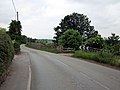
 The B5132 (Barrow Lane) approaching Great Barrow - geograph.org.uk - 3331486.jpg 5 184 × 3 456 ; 4,11 Mio
-
 The B5132 near Broomhill - geograph.org.uk - 2481210.jpg 4 000 × 3 000 ; 2,14 Mio
-
 The B5132 near Broomhill - geograph.org.uk - 2481216.jpg 4 000 × 3 000 ; 2,1 Mio
-
 The Foxcote - geograph.org.uk - 4959613.jpg 1 200 × 900 ; 148 kio
-
 The Foxcote pub - geograph.org.uk - 98294.jpg 640 × 480 ; 84 kio
-
 The Foxcote Tea Rooms and Bygone Centre, Little Barrow - geograph.org.uk - 3331528.jpg 5 184 × 3 456 ; 2,75 Mio
-
 The Foxcote, Little Barrow - geograph.org.uk - 2481198.jpg 7 000 × 5 250 ; 4,11 Mio
-
 The Longster Trail - geograph.org.uk - 4076874.jpg 4 000 × 2 248 ; 2,4 Mio
-
 The Longster Trail at Swinford Farm - geograph.org.uk - 2463514.jpg 4 000 × 3 000 ; 3,27 Mio
-
 The Mid-Cheshire Railway Line - geograph.org.uk - 1995509.jpg 4 416 × 3 312 ; 4,62 Mio
-
 Valley of Milton Brook - geograph.org.uk - 4949988.jpg 1 200 × 889 ; 263 kio
-
 View from a train - Over the fields towards Bridge Trafford - geograph.org.uk - 4436135.jpg 1 600 × 1 200 ; 258 kio
-
 View of Brook Farm and Footpath - geograph.org.uk - 1995443.jpg 4 416 × 3 312 ; 3,15 Mio
-
 Waterlogged Farmland near Great Barrow - geograph.org.uk - 3331498.jpg 5 184 × 3 456 ; 4,97 Mio
-
 Wheatears on a bridge - geograph.org.uk - 4954508.jpg 1 200 × 900 ; 191 kio
-
 Wheatears on a bridge - geograph.org.uk - 4954511.jpg 1 200 × 900 ; 135 kio


_approaching_Great_Barrow_-_geograph.org.uk_-_3331486.jpg)


