Category:Beachport, South Australia
Jump to navigation
Jump to search
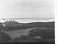
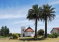
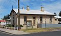
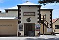
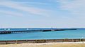
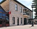
English: Beachport is a small coastal town 379 kilometres south-east of Adelaide, South Australia, located in the Wattle Range Council. Known for its 772 metre long jetty (the second longest in SA), Beachport is located on the northern end of Rivoli Bay. It has a large crayfish fishing fleet. (→Beachport, South Australia)
日本語: ビーチポートとは、 オーストラリア・南オーストラリア州の南東部に位置する小さな町である。州都アデレードの南東約379km南東に位置し、ワタル・レンジ郡の一部である。北へ約40kmにはローブという町があり、南へ約35kmにはミリセントという町がある。2006年の国勢調査では人口は346人だった。この町は、南オーストラリア州で2番目の長さ(772m)を持つ桟橋があることで有名である。また、この町は伊勢エビの多く棲むリボリー湾という湾に面していて、伊勢エビ釣りが盛んである。町の郊外にはジョージ湖という湖や、海水の6倍もの塩分が含まれているソルトレークと言う沼、10マイルビーチと呼ばれる長い砂浜もある。この町は、1878年に灯台と鉄道が建設されたときにこの名前が付けられた。灯台は今でも残っているが、鉄道は1956年に廃線となった。 (→ビーチポート)
town in South Australia  | |||||
| Upload media | |||||
| Instance of | |||||
|---|---|---|---|---|---|
| Named after | |||||
| Location |
| ||||
| Population |
| ||||
| Elevation above sea level |
| ||||
 | |||||
Subcategories
This category has the following 3 subcategories, out of 3 total.
Media in category "Beachport, South Australia"
The following 23 files are in this category, out of 23 total.
-
 Admiralty Chart No 1015 South coast of Australia from Guichen Bay to Glenelg River, Published 1872.jpg 16,458 × 12,007; 64.72 MB
-
 Beachport - Ships in the distance(GN09125).jpg 3,264 × 2,448; 719 KB
-
 Beachport Coney Island(GN05380).jpg 3,264 × 2,448; 761 KB
-
 Beachport Looking South(GN05933).jpg 3,264 × 2,448; 871 KB
-
 Beachport pier.JPG 2,592 × 1,944; 2.63 MB
-
 Beachport shoreline.JPG 640 × 480; 169 KB
-
 Beachport The Chair Looking North(GN05939).jpg 3,264 × 2,448; 704 KB
-
 Beachport View Showing Jetty(GN07981).jpg 3,264 × 2,448; 577 KB
-
 Beachport(GN07636).jpg 3,264 × 2,448; 1.04 MB
-
 BeachportAnglicanChurch.JPG 2,804 × 2,012; 1.43 MB
-
 BeachportCourthouse.JPG 3,136 × 1,880; 1.6 MB
-
 BeachportCustomsOffice.JPG 3,356 × 2,280; 2.2 MB
-
 BeachportInstitute&Cinema.JPG 3,548 × 2,468; 1.99 MB
-
 BeachportJetty.JPG 3,652 × 2,040; 1.33 MB
-
 BeachportMainStreet.JPG 3,015 × 2,014; 1.44 MB
-
 BeachportMuseum.JPG 3,128 × 2,452; 2.05 MB
-
 BeachportOldAnglicanChurch.JPG 3,284 × 2,336; 1.69 MB
-
 BeachportPostOffice.JPG 3,028 × 2,436; 1.5 MB
-
 BeachportRomanCatholicChurch.JPG 2,840 × 1,976; 1.41 MB
-
 His Excellency Kevin Scarce with Dume and Celine.jpg 1,575 × 932; 1.89 MB
-
 Recruiting at Beachport Railway Station(GN00838).jpg 3,264 × 2,448; 753 KB
-
 South Australian Recruiting Tour at Beachport(GN00760).jpg 3,264 × 2,448; 1.05 MB
-
 The Chair Beachport Coastal View(GN07841).jpg 3,264 × 2,448; 1.15 MB

.jpg)
.jpg)
.jpg)


.jpg)
.jpg)
.jpg)


.jpg)
.jpg)
.jpg)