Category:Bear Road area, Brighton
Jump to navigation
Jump to search
| Upload media | |||||
 | |||||
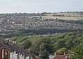
The Bear Road area is a mostly residential area to the northeast of Brighton, part of the English city of Brighton and Hove. It developed on a steep valley side between 1895 and 1920, and is effectively made up of two halves separated by the long, steep west–east road called Bear Road. North of this is a densely developed residential area; to the south is a series of Victorian and Edwardian cemeteries and two later crematoria.
Subcategories
This category has the following 5 subcategories, out of 5 total.
Media in category "Bear Road area, Brighton"
The following 55 files are in this category, out of 55 total.
-
 Bear Rd - geograph.org.uk - 2272688.jpg 640 × 442; 70 KB
-
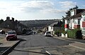
 Bear Road - geograph.org.uk - 1091200.jpg 464 × 640; 63 KB
-
 Bear Road - geograph.org.uk - 1091202.jpg 479 × 640; 66 KB
-
 Brighton and Preston Cemetery and Downs Crematorium (from Bear Road) (August 2013).JPG 3,000 × 2,000; 1.78 MB
-
 Church Hall of former St Alban's Church, Riley Road, Brighton (February 2014).JPG 3,400 × 2,200; 1.37 MB
-

-
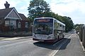 Compass Bus GX62 CJU on Route 37B at Bevendean Road, Brighton.JPG 3,000 × 2,000; 1.55 MB
-
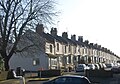
 Coombe Terrace, Lewes Road - geograph.org.uk - 1091221.jpg 479 × 640; 63 KB
-

-
 Eastward view along Ladysmith Road, Brighton (August 2013).JPG 3,200 × 2,400; 2.11 MB
-

-

-
 Housing at junction of Nesbitt Road and Natal Road, Brighton (August 2013).JPG 3,200 × 2,400; 2.25 MB
-
 Housing on Bear Road, Brighton (July 2010).JPG 2,400 × 1,600; 777 KB
-
 Housing on East side of Dewe Road, Brighton (February 2020).JPG 2,000 × 1,400; 919 KB
-
 Housing on Kimberley Road, Brighton (August 2013).JPG 3,200 × 2,400; 2.09 MB
-
 Housing on North side of Bear Road, Brighton (August 2013) (1).JPG 3,200 × 2,400; 2.1 MB
-
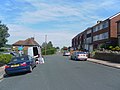
 Modern Housing at Bevendean Road, Brighton (July 2010).JPG 2,400 × 1,800; 779 KB
-
 Newmarket Arms pub, 32 Bear Road, Brighton (August 2013).JPG 2,400 × 1,600; 1.09 MB
-
 Southward view from London Road Viaduct, Brighton (April 2010) (1).JPG 2,400 × 1,600; 857 KB
-
 Sussex Beacon, Bevendean Road, Brighton (August 2013).JPG 2,000 × 1,400; 770 KB
-
 Ursa Court, Bear Road, Brighton (February 2014).JPG 2,600 × 2,800; 1.27 MB
-

-

-

-

-

-
 View down Ladysmith Road, Brighton (July 2010).JPG 2,500 × 1,600; 876 KB
-

-

-
 View from Hollingdean towards Bear Road area, Brighton (September 2018) (1).JPG 3,008 × 2,000; 2.97 MB
-
 View from Hollingdean towards Bear Road area, Brighton (September 2018) (2).JPG 3,008 × 2,000; 3.25 MB
-

-

-
 View from junction of Coombe Road and Ladysmith Road, Brighton (August 2013) (1).JPG 3,200 × 1,800; 1.61 MB
-
 View from junction of Coombe Road and Ladysmith Road, Brighton (August 2013) (2).JPG 3,200 × 2,400; 2.2 MB
-

-

-
 View of Bear Road area from D'Aubigny Road, Round Hill, Brighton (February 2014) (1).JPG 3,600 × 2,600; 1.89 MB
-
 View of Bear Road area from D'Aubigny Road, Round Hill, Brighton (February 2014) (2).JPG 3,600 × 2,600; 1.85 MB
-
 View of Bear Road area from D'Aubigny Road, Round Hill, Brighton (February 2014) (3).JPG 3,600 × 2,600; 1.83 MB
-
 View of Bear Road area from D'Aubigny Road, Round Hill, Brighton (February 2014) (4).JPG 3,600 × 2,600; 1.8 MB
-
 View of Bear Road area from Saunders Park View, Brighton (February 2014) (1).JPG 3,600 × 2,000; 1.49 MB
-
 View of Bear Road area from Saunders Park View, Brighton (February 2014) (2).JPG 3,600 × 2,600; 1.9 MB
-
 View of Bear Road area from Saunders Park View, Brighton (February 2014).JPG 2,400 × 1,800; 1.12 MB
-
 View towards Brighton City Centre from Canfield Close, near Coombe Road (July 2010).JPG 2,400 × 1,400; 744 KB
-

-
-

-
 Views of Brighton - View Westwards towards Hollingdean from Ladysmith Road (August 2013).JPG 3,200 × 1,800; 1.39 MB
-

-
 Westward view along Bear Road, Brighton (August 2013) (2).JPG 2,400 × 3,200; 2.11 MB
-
 Westward view along Ladysmith Road, Brighton (August 2013) (1).JPG 3,200 × 2,400; 2.14 MB
-
 Westward view along Ladysmith Road, Brighton (August 2013) (2).JPG 3,200 × 2,400; 2.2 MB
-
 Westward view along Ladysmith Road, Brighton (August 2013) (3).JPG 3,200 × 2,400; 2.1 MB


_(August_2013).JPG)
.JPG)
.JPG)


_(1).JPG)
.JPG)
_(March_2009).JPG)
_(October_2011).JPG)
.JPG)
.JPG)
.JPG)
.JPG)
_(1).JPG)
.JPG)
.JPG)
_(1).JPG)
.JPG)
_(1).JPG)
_(2).JPG)
_(3).JPG)
_(4).JPG)
.JPG)
.JPG)
_(1).JPG)
_(2).JPG)
_(1).JPG)
_(2).JPG)
_(1).JPG)
_(2).JPG)
_(1).JPG)
_(2).JPG)
_(1).JPG)
_(2).JPG)
_(1).JPG)
_(2).JPG)
_(3).JPG)
_(4).JPG)
_(1).JPG)
_(2).JPG)
.JPG)
.JPG)
_(July_2010).JPG)
.jpg)
.JPG)

_(2).JPG)
_(1).JPG)
_(2).JPG)
_(3).JPG)
.JPG)
.jpg)