Category:Beinn Fhionnlaidh, Argyll and Bute
Zur Navigation springen
Zur Suche springen
959m high mountain in Argyll and Bute, Scotland, UK .jpg) | |||||
| Medium hochladen | |||||
| Ist ein(e) | |||||
|---|---|---|---|---|---|
| Ort | Argyll and Bute, Schottland | ||||
| Gebirgszug | |||||
| Schartenhöhe |
| ||||
| Höhe über dem Meeresspiegel |
| ||||
 | |||||
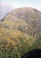
Beinn Fhionnlaidh is a mountain between Glen Creran and Glen Etive, in Argyll and Bute, Scotland. It is 959 m high, and listed as a Munro.
Medien in der Kategorie „Beinn Fhionnlaidh, Argyll and Bute“
Folgende 22 Dateien sind in dieser Kategorie, von 22 insgesamt.
-
 Allt Ceitlein - geograph.org.uk - 241324.jpg 640 × 480; 267 KB
-
 An Grianan - geograph.org.uk - 271073.jpg 457 × 640; 88 KB
-
 Approaching the summit of Beinn Fhionnlaidh (geograph 2006375).jpg 1.600 × 1.032; 260 KB
-
 Beinn Fhionnlaidh - geograph.org.uk - 2495828.jpg 1.600 × 1.116; 392 KB
-
 Beinn Fhionnlaidh - geograph.org.uk - 299957.jpg 640 × 457; 81 KB
-
 Boulders, S face of Beinn Fhionnlaidh - geograph.org.uk - 816207.jpg 640 × 480; 255 KB
-
 Cairn, Pt. 841m, Beinn Fhionnlaidh - geograph.org.uk - 816215.jpg 640 × 480; 263 KB
-
 Glen Etive House from Ben Starav - geograph.org.uk - 52935.jpg 640 × 480; 121 KB
-

-

-
 Summit cairn of Beinn Maol Chaluim - geograph.org.uk - 892368.jpg 500 × 375; 99 KB
-
 Summit of Beinn Fhionnlaidh - geograph.org.uk - 221585.jpg 640 × 480; 51 KB
-

-
 The summit of Beinn Fhionnlaidh - geograph.org.uk - 1538468.jpg 1.000 × 687; 877 KB
-
 The summit of Beinn Fhionnlaidh - geograph.org.uk - 953106.jpg 640 × 403; 158 KB
-
 View from Beinn Fhionnlaidh - geograph.org.uk - 300019.jpg 640 × 449; 68 KB
-
 View from Beinn Fhionnlaidh. - geograph.org.uk - 516603.jpg 640 × 449; 59 KB
-
 View northeast from Beinn Fhionnlaidh - geograph.org.uk - 1538475.jpg 1.000 × 676; 1,07 MB
-
 View south west from Sgor na h-Ulaidh - geograph.org.uk - 497747.jpg 800 × 600; 199 KB
-
 View SW from Beinn Fhionnlaidh - geograph.org.uk - 1263449.jpg 640 × 480; 105 KB
-
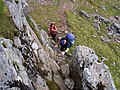 A rocky step - geograph.org.uk - 263555.jpg 640 × 480; 147 KB
-


_rising_to_right_-_geograph.org.uk_-_932071.jpg)


