Category:Argyll and Bute
Jump to navigation
Jump to search
Council areas (municipalities) of Scotland: Aberdeen · Aberdeenshire · Angus · Argyll and Bute · Clackmannanshire · Dumfries and Galloway · Dundee · East Ayrshire · East Dunbartonshire · East Lothian · East Renfrewshire · Edinburgh · Falkirk · Fife · Glasgow · Highland · Inverclyde · Midlothian · Moray · North Ayrshire · North Lanarkshire · Outer Hebrides · Orkney Islands · Perth and Kinross · Renfrewshire · Scottish Borders · Shetland Islands · South Ayrshire · South Lanarkshire · Stirling · West Dunbartonshire · West Lothian
unitary authority council area in Scotland   | |||||
| Upload media | |||||
| Instance of |
| ||||
|---|---|---|---|---|---|
| Location |
| ||||
| Capital | |||||
| Population |
| ||||
| Area |
| ||||
| official website | |||||
 | |||||


Subcategories
This category has the following 17 subcategories, out of 17 total.
*
A
D
E
G
H
N
P
S
T
V
Media in category "Argyll and Bute"
The following 200 files are in this category, out of 2,915 total.
(previous page) (next page)-
 "Wallaby Island" - geograph.org.uk - 6693663.jpg 1,024 × 683; 439 KB
-
 Argyll Bute Council.jpg 592 × 493; 42 KB
-
 120930-N-AB355-002 (8046939470).jpg 3,000 × 1,914; 2.77 MB
-
 A beached 'puffer' at Aros - geograph.org.uk - 6434358.jpg 1,799 × 1,199; 333 KB
-
 A beached 'puffer' at Aros with Aros Castle behind - geograph.org.uk - 6434409.jpg 1,797 × 1,198; 359 KB
-
 A few surviving trees on Scarba - geograph.org.uk - 4525400.jpg 2,592 × 1,944; 1.3 MB
-

-
 A flotilla of eiders put to sea - geograph.org.uk - 2847222.jpg 640 × 480; 67 KB
-
 A gaggle of eiders - geograph.org.uk - 2847220.jpg 640 × 480; 88 KB
-
 A guillemot takes flight - geograph.org.uk - 5834337.jpg 1,164 × 1,000; 829 KB
-
 A heron fishing - geograph.org.uk - 5362979.jpg 2,000 × 1,333; 2.36 MB
-
 A house with a view on Airds Bay - geograph.org.uk - 2991086.jpg 800 × 560; 150 KB
-
 A perfect day to visit Staffa - geograph.org.uk - 5723632.jpg 640 × 480; 79 KB
-
 A pink exposure - geograph.org.uk - 529332.jpg 640 × 480; 80 KB
-
 A ruin on Island Davaar - geograph.org.uk - 6548132.jpg 1,600 × 1,200; 742 KB
-
 A seat with a view - geograph.org.uk - 5444803.jpg 1,600 × 900; 231 KB
-
 A small stream reaches Loch Fyne - geograph.org.uk - 5795344.jpg 1,600 × 1,067; 542 KB
-
 A Standing Stone or a Big Boulder^ - geograph.org.uk - 1774569.jpg 426 × 640; 112 KB
-
 A stream emerges from the sand - geograph.org.uk - 2942000.jpg 1,600 × 1,200; 480 KB
-
 A Tideline Trailer - geograph.org.uk - 4158543.jpg 4,592 × 3,448; 4.56 MB
-
 A triassic shoreline - geograph.org.uk - 3390102.jpg 4,320 × 3,240; 3.07 MB
-

-
 A view of Loch Awe - geograph.org.uk - 6699192.jpg 1,024 × 683; 179 KB
-
 A wall by Loch na Keal - geograph.org.uk - 5462004.jpg 1,600 × 1,200; 943 KB
-
 A Wider View - geograph.org.uk - 4487303.jpg 640 × 473; 547 KB
-
 A wreck at Loch Etive - geograph.org.uk - 2401745.jpg 640 × 429; 202 KB
-
-

-
 A' Chùli - geograph.org.uk - 4527490.jpg 2,338 × 1,823; 2.22 MB
-
 A814 beside Loch Long - geograph.org.uk - 5275937.jpg 1,024 × 768; 535 KB
-
 A849 East - geograph.org.uk - 5929280.jpg 4,745 × 3,559; 3.68 MB
-
 A886 heading north past Undraynian Point - geograph.org.uk - 4242319.jpg 1,024 × 682; 144 KB
-
 Aasfjord approaching Port Glasgow - geograph.org.uk - 5993033.jpg 1,024 × 768; 251 KB
-
 Abandoned Boat - geograph.org.uk - 5974555.jpg 5,184 × 3,888; 5.51 MB
-

-
 Abbot's Isles - geograph.org.uk - 5406236.jpg 1,500 × 966; 951 KB
-
 Abhainn na h-Uamha - geograph.org.uk - 3443194.jpg 640 × 429; 86 KB
-
 Abhainn Shira - geograph.org.uk - 919849.jpg 640 × 469; 65 KB
-
 Above Upper Ettrick - geograph.org.uk - 909378.jpg 640 × 480; 54 KB
-
 Acres of sand - geograph.org.uk - 4484283.jpg 4,000 × 3,000; 1.85 MB
-
 Across Add estuary - geograph.org.uk - 1301344.jpg 640 × 480; 45 KB
-
 Across Holy Loch - geograph.org.uk - 4167426.jpg 3,072 × 1,728; 1.65 MB
-
 Across Ledaig Point towards Eilean Beag - geograph.org.uk - 3915514.jpg 800 × 506; 278 KB
-
 Across Loch Fyne - geograph.org.uk - 4909467.jpg 640 × 427; 77 KB
-
 Across Port Leathan to Rubha Stillaig - geograph.org.uk - 3398755.jpg 1,024 × 682; 187 KB
-
 Across the rock arch, Slochd Maol Doiridh, Islay - geograph.org.uk - 1898229.jpg 768 × 1,024; 265 KB
-
-
 Add Estuary Bird Hide - geograph.org.uk - 922481.jpg 640 × 480; 110 KB
-
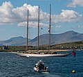 Adix in Oban Bay - geograph.org.uk - 3975310.jpg 4,609 × 4,271; 2.67 MB
-
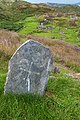 Aethne's grave - geograph.org.uk - 2014435.jpg 425 × 640; 115 KB
-

-
 Airds Bay shoreline from Rubha Clach Thoull - geograph.org.uk - 4739726.jpg 4,320 × 2,432; 4.54 MB
-
 Allt Achadh na Mòine from the beach - geograph.org.uk - 2692011.jpg 2,560 × 1,920; 2.92 MB
-
 Allt Ardvorlich - geograph.org.uk - 877139.jpg 640 × 360; 37 KB
-
 Allt Breac-Laraich. - geograph.org.uk - 105158.jpg 640 × 480; 98 KB
-
 Allt Chreaga Dubha - geograph.org.uk - 403141.jpg 640 × 480; 111 KB
-
 Allt Cruachan Bridge (13966509033).jpg 2,336 × 3,504; 4.01 MB
-
 Allt Cumhang - geograph.org.uk - 1392819.jpg 640 × 480; 140 KB
-
 Allt Fionn Leirg - geograph.org.uk - 928067.jpg 640 × 480; 57 KB
-
 Allt Gàradh-Ealabais, Islay - geograph.org.uk - 3722603.jpg 640 × 427; 87 KB
-
 Allt Mhungain falls to the sea - geograph.org.uk - 1750488.jpg 1,080 × 1,280; 502 KB
-
 Allt na Ceardiath, Islay - geograph.org.uk - 3722607.jpg 640 × 427; 51 KB
-
 Allt Sugach - geograph.org.uk - 865608.jpg 640 × 480; 108 KB
-
 Am Brù - geograph.org.uk - 6234100.jpg 1,024 × 577; 273 KB
-
 Am Brù - geograph.org.uk - 6234107.jpg 1,024 × 577; 239 KB
-
 Am Buachaille (The Herdsman), Staffa - geograph.org.uk - 5189957.jpg 640 × 476; 390 KB
-
 Am Buachaille - geograph.org.uk - 2988093.jpg 640 × 395; 289 KB
-
 Am Buachaille Staffa - geograph.org.uk - 2598026.jpg 3,648 × 2,736; 3.79 MB
-
 Am Fraoch Eilean - geograph.org.uk - 2834184.jpg 4,272 × 2,848; 3.65 MB
-
 Am Fraoch Eilean - geograph.org.uk - 5441769.jpg 1,600 × 1,070; 174 KB
-
 Am Fraoch Eilean - geograph.org.uk - 5825761.jpg 3,179 × 2,384; 1,002 KB
-
 An Càrnan, Slochd Bay, Isle of Mull - geograph.org.uk - 4173856.jpg 2,048 × 1,536; 498 KB
-
 An Doirlinn - geograph.org.uk - 1599512.jpg 640 × 480; 97 KB
-
 An Dubh-sgeir and Na Dubh-sgeireagan from Gigha - geograph.org.uk - 5849546.jpg 1,226 × 1,600; 416 KB
-
 An Dun - geograph.org.uk - 198312.jpg 640 × 480; 37 KB
-
 An Gleann, Scarba - geograph.org.uk - 4525378.jpg 2,592 × 1,944; 1.58 MB
-
 An Islay shaped hole in the wall^ - geograph.org.uk - 865599.jpg 640 × 480; 85 KB
-
 An Islay-eye view^ - geograph.org.uk - 865600.jpg 640 × 480; 77 KB
-
 An Leth Fhonn - geograph.org.uk - 5974552.jpg 5,184 × 3,888; 4.68 MB
-
 An Leth Fhonn at high tide - geograph.org.uk - 2074742.jpg 640 × 480; 75 KB
-
 An Leth-onn - geograph.org.uk - 408486.jpg 640 × 478; 78 KB
-
 An outcrop on Meall Voirlich - geograph.org.uk - 1340076.jpg 640 × 427; 146 KB
-
 An Tuail, Colonsay - geograph.org.uk - 5792348.jpg 1,024 × 768; 124 KB
-
 An unconformity at Ardmore Point - geograph.org.uk - 2058555.jpg 1,600 × 711; 310 KB
-
 Anchorage, Aldochlay - geograph.org.uk - 6691705.jpg 1,024 × 683; 138 KB
-
 Ancient cross - geograph.org.uk - 1568050.jpg 360 × 640; 101 KB
-
 Anti-invasion defences, Scalpsie Bay, Isle of Bute - geograph.org.uk - 3259318.jpg 3,648 × 2,736; 997 KB
-
 Anticline at Ardmore Point - geograph.org.uk - 5121874.jpg 1,600 × 1,200; 556 KB
-
 Anticyclonic weather on Loch Lomond - geograph.org.uk - 6690452.jpg 1,024 × 683; 115 KB
-
 Approaching Coire an Dòthaidh - geograph.org.uk - 918313.jpg 640 × 426; 51 KB
-
 Approaching Inchmurrin - geograph.org.uk - 5504830.jpg 1,280 × 960; 704 KB
-
 Approaching the Island of Staffa - geograph.org.uk - 6434391.jpg 1,802 × 1,201; 401 KB
-
 Ard Annraidh - geograph.org.uk - 5369318.jpg 1,000 × 665; 721 KB
-
 Ardalanish Striped Formation at Port an t-Slaoichain - geograph.org.uk - 5797266.jpg 5,120 × 3,400; 3.57 MB
-
 Ardbeg Point - geograph.org.uk - 5860096.jpg 1,024 × 534; 191 KB
-
 Ardbeg Point - Isle of Bute - geograph.org.uk - 5687621.jpg 4,226 × 3,208; 3.85 MB
-
 Ardbeg Road - geograph.org.uk - 5830290.jpg 1,024 × 472; 186 KB
-
 Arden House, Loch Lomond - geograph.org.uk - 5504817.jpg 1,280 × 960; 740 KB
-
 Ardencaple, Seil Island - 1971 - geograph.org.uk - 2950131.jpg 1,514 × 2,271; 162 KB
-
 Ardentallen grazing - geograph.org.uk - 1302831.jpg 640 × 495; 93 KB
-
 Ardfenaig, Ross of Mull - geograph.org.uk - 4532556.jpg 1,024 × 751; 256 KB
-
 Ardmaddy Castle (21847904524).jpg 5,472 × 3,648; 5.15 MB
-
 Ardmaddy Castle (22444631696).jpg 3,648 × 5,472; 5.66 MB
-
 Ardmaddy farm and Glen Kinglass - geograph.org.uk - 1387668.jpg 640 × 347; 206 KB
-
 Ardmaleish Booster Station - geograph.org.uk - 5423620.jpg 3,264 × 2,448; 2.61 MB
-
 Ardmaleish Point shipyard - geograph.org.uk - 5860098.jpg 1,024 × 575; 229 KB
-

-
 Ardmore Farm - geograph.org.uk - 5259395.jpg 640 × 378; 112 KB
-
 Ardmore Farm from Port Glasgow - geograph.org.uk - 4825863.jpg 640 × 372; 89 KB
-
 Ardmore fault plane - geograph.org.uk - 1358962.jpg 640 × 480; 112 KB
-
 Ardmore fault plane - geograph.org.uk - 2546277.jpg 640 × 320; 71 KB
-
 Ardnave Point - geograph.org.uk - 5207289.jpg 1,024 × 683; 333 KB
-
 Ardyne Burn estuary shingle banks - geograph.org.uk - 5866493.jpg 1,600 × 1,067; 554 KB
-
 Ardyne Point - geograph.org.uk - 3475960.jpg 1,024 × 669; 157 KB
-
 Ardyne Point - geograph.org.uk - 6725798.jpg 1,024 × 768; 432 KB
-
 Argyll and Bute, UK - panoramio (14).jpg 3,968 × 2,648; 1.75 MB
-
 Argyll and Bute, UK - panoramio (25).jpg 5,184 × 3,456; 9.13 MB
-
 Argyll and Bute, UK - panoramio (6).jpg 1,047 × 785; 279 KB
-
 Argyll and Bute-02-Stausee-2009-gje.jpg 3,072 × 2,048; 2.34 MB
-
 Argyll and Bute-04-Stausee-Wald-2009-gje.jpg 3,072 × 2,048; 2.6 MB
-
 Argyll and Bute-06-Stausee-Wald-2009-gje.jpg 3,072 × 2,048; 3.65 MB
-
 Argyll and Bute-08-Craobh-Shop-2009-gje.jpg 2,895 × 1,674; 1.35 MB
-
 Argyll and Bute-10-Craobh-2009-gje.jpg 2,988 × 1,773; 1.69 MB
-
 Argyll and Bute-12-Schafweide-2009-gje.jpg 3,072 × 1,669; 1.81 MB
-
 Argyll and Bute-14-Vogelbeerbaum-Haus-2009-gje.jpg 3,072 × 2,048; 2.77 MB
-
 Argyll and Bute-16-Standing Stone-2009-gje.jpg 3,072 × 1,905; 2.39 MB
-
 Argyll and Bute-18-Standing Stone-2009-gje.jpg 3,072 × 2,048; 2.84 MB
-
 Argyll and Bute-20-Standing Stone-2009-gje.jpg 2,048 × 2,876; 2.15 MB
-
 Argyll and Bute-22-Dunchraigaig-Grabhuegel-2009-gje.jpg 3,072 × 2,048; 3.41 MB
-
 Argyll and Bute-24-Standing Stones-2009-gje.jpg 2,832 × 1,507; 1.41 MB
-
 Argyll and Bute-26-Standing Stones-Schafweide-2009-gje.jpg 3,072 × 2,048; 2.41 MB
-
 Argyll and Bute-28-Schafe-2009-gje.jpg 3,072 × 2,048; 2.67 MB
-
 Argyll and Bute-30-Wegweiser Campbeltown-Oban-2009-gje.jpg 3,072 × 2,048; 2.23 MB
-
 Argyll and Bute-32-Lochgilphead-2009-gje.jpg 3,072 × 2,048; 2.7 MB
-
 Argyll and Bute-34-Lochgilphead-2009-gje.jpg 3,072 × 2,048; 2.61 MB
-
 Argyll and Bute-36-Loch Fyne-2009-gje.jpg 3,072 × 1,779; 1.8 MB
-
 Argyll and Bute-38-Loch Fyne-2009-gje.jpg 3,072 × 2,048; 1.66 MB
-
 Argyll and Bute-40-Knapdale-Haus-2009-gje.jpg 2,883 × 1,810; 2.51 MB
-
 Argyll and Bute-42-Loch Fyne-Meeresfarm-2009-gje.jpg 2,919 × 1,965; 1.84 MB
-
 Argyll and Bute-44-Loch Fyne-Lilien-2009-gje.jpg 2,970 × 1,860; 2.25 MB
-
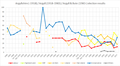 Argyll election results.png 794 × 434; 45 KB
-
-
 Arichonan Township.jpg 640 × 480; 96 KB
-
 Aros Castle - geograph.org.uk - 6455496.jpg 704 × 1,024; 172 KB
-
 Aros Estuary - geograph.org.uk - 5979460.jpg 5,184 × 3,888; 3.87 MB
-
 Aros Hall, Main Street - geograph.org.uk - 5733803.jpg 480 × 640; 79 KB
-
 Arran from the beach at Scalpsie Bay - geograph.org.uk - 4008198.jpg 1,024 × 678; 153 KB
-
 Astilbe (5033434203).jpg 1,752 × 1,168; 479 KB
-
 At Carraig Dubh - geograph.org.uk - 6151209.jpg 640 × 416; 123 KB
-
 Atlantic Grey Seal pup - geograph.org.uk - 2586428.jpg 640 × 480; 111 KB
-
 Auch viaduct and Glen Coralan - geograph.org.uk - 1186220.jpg 640 × 480; 94 KB
-
 Auchalick Bay - geograph.org.uk - 1940329.jpg 3,648 × 2,736; 2.15 MB
-
 Auchendennan Muir - geograph.org.uk - 1193252.jpg 640 × 480; 96 KB
-
 Autumn on Loch Lomond - geograph.org.uk - 6679250.jpg 1,600 × 1,200; 543 KB
-
 B8035 below Creag Mhòr - geograph.org.uk - 4389899.jpg 800 × 637; 388 KB
-
 B8035 below Creag Mhòr - geograph.org.uk - 5750560.jpg 1,500 × 1,125; 1.73 MB
-
 Bac Mòr (Dutchman's Cap) ^ Bac Beag - geograph.org.uk - 6065865.jpg 2,036 × 1,000; 1.48 MB
-
 Bac Mòr - geograph.org.uk - 2988150.jpg 640 × 218; 135 KB
-
 Bach Island - geograph.org.uk - 5083345.jpg 3,197 × 2,393; 1.79 MB
-
 Bach Island - geograph.org.uk - 5337995.jpg 1,600 × 970; 107 KB
-
 Baile Mor, Iona (9757966445).jpg 2,048 × 1,340; 4.07 MB
-
 Balephuil Bay - geograph.org.uk - 4484331.jpg 4,000 × 3,000; 2.03 MB
-
 Balephuil Bay - geograph.org.uk - 6349983.jpg 1,024 × 576; 98 KB
-

-
-
-
 Balevullin, enjoying the beach - geograph.org.uk - 4131798.jpg 640 × 480; 50 KB
-
-
 Ballevoulin Farm - geograph.org.uk - 1535730.jpg 640 × 480; 72 KB
-
 Ballimenach Yair - geograph.org.uk - 2529071.jpg 1,600 × 889; 444 KB
-
 Ballimenach Yair - geograph.org.uk - 2530879.jpg 1,600 × 800; 334 KB
-
 Ballimenach Yair - geograph.org.uk - 2545796.jpg 1,600 × 533; 205 KB
-
 Ballimenach Yair - geograph.org.uk - 2545828.jpg 1,024 × 512; 197 KB
-
 Ballimenach Yair - geograph.org.uk - 2545850.jpg 1,024 × 569; 217 KB
-
 Ballimenach Yair - geograph.org.uk - 5403244.jpg 1,600 × 1,200; 449 KB
-
 Ballimenach Yair - geograph.org.uk - 5403251.jpg 1,600 × 1,200; 381 KB
-
 Ballimore - geograph.org.uk - 384834.jpg 640 × 426; 152 KB
-
 Ballychatrigan Farm, Islay - geograph.org.uk - 1757872.jpg 640 × 426; 59 KB
-
 Ballygown Bay, Mull - geograph.org.uk - 6021423.jpg 4,000 × 3,000; 3.37 MB
-
 Ballymeanoch stone - panoramio.jpg 2,000 × 3,008; 2.72 MB
-
 Balmavicar - geograph.org.uk - 1430550.jpg 640 × 428; 102 KB
-
 Balmavicar - geograph.org.uk - 1430553.jpg 640 × 428; 91 KB
-
 Balmavicar - geograph.org.uk - 1430562.jpg 640 × 428; 98 KB
-
 Balnahard beach - geograph.org.uk - 4678454.jpg 1,600 × 1,200; 348 KB
-
 Balnahard Beach - geograph.org.uk - 6429815.jpg 1,280 × 853; 440 KB
-
 Balnahard Beach, Colonsay - geograph.org.uk - 5441927.jpg 1,600 × 900; 257 KB
-
 Balvicar - geograph.org.uk - 1274343.jpg 640 × 427; 236 KB
-
 Ban Eileanan, a spit of land, Sound of Mull - geograph.org.uk - 2647399.jpg 2,560 × 1,920; 2.86 MB
-
-
 Barnacle Geese - geograph.org.uk - 5327969.jpg 2,000 × 1,333; 1.84 MB
-
 Barnhill (Orwell's 1984) - panoramio.jpg 3,072 × 2,048; 3.31 MB
-
 Barons Point - geograph.org.uk - 2005606.jpg 640 × 413; 89 KB
-
 Barons Point and Loch Long - geograph.org.uk - 2463606.jpg 640 × 373; 71 KB
-
 Barr Point - Isle of Bute - geograph.org.uk - 5588755.jpg 3,022 × 2,222; 1.09 MB
-
 Barr Point - Isle of Bute - geograph.org.uk - 5588780.jpg 2,998 × 2,218; 1.21 MB
-
 Barr Point - Isle of Bute - geograph.org.uk - 5589266.jpg 3,079 × 2,313; 1.45 MB
-
 Barr Reamhar - geograph.org.uk - 764877.jpg 640 × 480; 72 KB
-
 Barr-nam-boc Bay - geograph.org.uk - 1917661.jpg 2,560 × 1,920; 1.03 MB
-
 Barrnacarry Bay - geograph.org.uk - 3565671.jpg 640 × 480; 49 KB
-
 Basalt and beach - geograph.org.uk - 2087476.jpg 640 × 480; 100 KB


.jpg)


.jpg)


,_Staffa_-_geograph.org.uk_-_5189957.jpg)


.jpg)
.jpg)


.jpg)
.jpg)
.jpg)


.jpg)


_%5E_Bac_Beag_-_geograph.org.uk_-_6065865.jpg)


.jpg)


_near_Loch_Awe._-_geograph.org.uk_-_1349626.jpg)

_-_panoramio.jpg)


