Category:Belmore Mountain
Jump to navigation
Jump to search
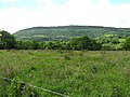
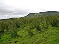
English: Belmore Mountain is a hill in the townland of Gortgall, western County Fermanagh, Northern Ireland. With a summit roughly 398 metres (1,306 ft) above sea level, it is the second highest point in the county.
mountain in the United Kingdom  | |||||
| Upload media | |||||
| Instance of | |||||
|---|---|---|---|---|---|
| Location |
| ||||
| Topographic prominence |
| ||||
| Elevation above sea level |
| ||||
 | |||||
Media in category "Belmore Mountain"
The following 7 files are in this category, out of 7 total.
-

-
 Belmore Mountain.JPG 1,005 × 654; 61 KB
-
 Drumhirk Townland - geograph.org.uk - 487410.jpg 640 × 479; 69 KB
-
 Drumsillagh Townland - geograph.org.uk - 492450.jpg 640 × 479; 70 KB
-
 Leam Beg - geograph.org.uk - 492479.jpg 640 × 479; 58 KB
-
 Leam Beg Townland - geograph.org.uk - 492463.jpg 640 × 479; 71 KB
-


