Category:Besthorpe, Nottinghamshire
Jump to navigation
Jump to search
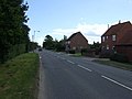
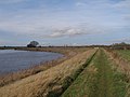
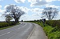
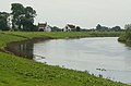
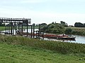
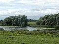
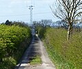
English: Besthorpe is a village and civil parish in the Newark and Sherwood district of Nottinghamshire, England. According to the 2001 census it had a population of 190. The village is between Collingham and Girton on the A1133 road, and is near the River Trent, north of Newark-on-Trent.
village and civil parish in Nottinghamshire, England, UK | |||||
| Upload media | |||||
| Instance of | |||||
|---|---|---|---|---|---|
| Location | Newark and Sherwood, Nottinghamshire, East Midlands, England | ||||
 | |||||
Subcategories
This category has the following 2 subcategories, out of 2 total.
L
- The Lord Nelson, Besthorpe (7 F)
T
Media in category "Besthorpe, Nottinghamshire"
The following 200 files are in this category, out of 223 total.
(previous page) (next page)-
 49km - geograph.org.uk - 1432619.jpg 640 × 479; 155 KB
-
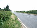
 A1133 heading south - geograph.org.uk - 3514045.jpg 640 × 480; 57 KB
-
 Apple Tree Barn - geograph.org.uk - 2270069.jpg 1,024 × 768; 200 KB
-
 Approaching Besthorpe Wharf on the River Trent - geograph.org.uk - 2817237.jpg 3,072 × 2,304; 1.12 MB
-
 Baler at work - geograph.org.uk - 206989.jpg 640 × 427; 70 KB
-
 Baling - geograph.org.uk - 206988.jpg 640 × 427; 66 KB
-
 Bend in the A1133 Besthorpe Road - geograph.org.uk - 5120259.jpg 800 × 526; 124 KB
-
 Besthorpe - geograph.org.uk - 145760.jpg 640 × 427; 99 KB
-
 Besthorpe - Holy Trinity Church - geograph.org.uk - 4754346.jpg 1,024 × 768; 170 KB
-
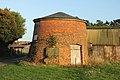 Besthorpe Mill - geograph.org.uk - 3734597.jpg 800 × 533; 179 KB
-
 Besthorpe Mill - geograph.org.uk - 3734633.jpg 800 × 533; 105 KB
-
 Besthorpe Mill - geograph.org.uk - 3734636.jpg 800 × 533; 132 KB
-
 Besthorpe Mill - geograph.org.uk - 3734638.jpg 800 × 533; 104 KB
-
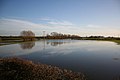
 Besthorpe Nature Reserve - geograph.org.uk - 1432717.jpg 640 × 479; 213 KB
-
 Besthorpe Nature Reserve - geograph.org.uk - 1432719.jpg 640 × 479; 132 KB
-
 Besthorpe nature reserve - geograph.org.uk - 5614391.jpg 3,670 × 2,752; 4.27 MB
-
 Besthorpe Quarry jetty - geograph.org.uk - 1432608.jpg 640 × 479; 140 KB
-
-

-
 Besthorpe Road - geograph.org.uk - 4820739.jpg 3,072 × 1,728; 1.56 MB
-
 Besthorpe road the A1133 - geograph.org.uk - 2730187.jpg 640 × 427; 55 KB
-
 Besthorpe road, towards Besthorpe - geograph.org.uk - 3110829.jpg 2,256 × 1,504; 633 KB
-
 Besthorpe Village Hall - geograph.org.uk - 2270129.jpg 1,024 × 768; 147 KB
-
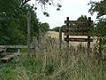
 Besthorpe village sign - geograph.org.uk - 5221372.jpg 800 × 600; 134 KB
-
 Besthorpe Wharf - geograph.org.uk - 1831682.jpg 1,600 × 1,200; 603 KB
-
 Besthorpe wharf - geograph.org.uk - 3161120.jpg 640 × 427; 181 KB
-
 Besthorpe Wharf - geograph.org.uk - 5614369.jpg 2,393 × 1,794; 1.53 MB
-
 Black sheep - geograph.org.uk - 1432713.jpg 640 × 479; 220 KB
-
 Black sheep at Besthorpe, Nottinghamshire.jpg 640 × 479; 159 KB
-
 Boat on the Trent near Besthorpe reserve - geograph.org.uk - 5614364.jpg 4,608 × 3,456; 4.59 MB
-
 Cabbages in the field - geograph.org.uk - 1720541.jpg 640 × 440; 69 KB
-
 Carlton Rack - geograph.org.uk - 2271104.jpg 1,024 × 768; 178 KB
-
 Carlton Rack Besthorpe - geograph.org.uk - 5487709.jpg 4,608 × 3,456; 4.88 MB
-
 Chestnut Cottages - geograph.org.uk - 236509.jpg 640 × 427; 89 KB
-
 Church Lane - geograph.org.uk - 2012614.jpg 640 × 426; 131 KB
-
 Church Lane - geograph.org.uk - 3514054.jpg 640 × 480; 87 KB
-
 Church Lane, South Scarle - geograph.org.uk - 4979312.jpg 480 × 640; 65 KB
-
 Corner of Folly Lane - geograph.org.uk - 4824640.jpg 3,072 × 1,728; 2.48 MB
-
 Cottage on Low Road, Besthorpe - geograph.org.uk - 2270050.jpg 1,024 × 768; 216 KB
-
 County boundary - geograph.org.uk - 3746653.jpg 800 × 540; 202 KB
-
 Cover crop - geograph.org.uk - 2012639.jpg 640 × 426; 140 KB
-
 Curious cattle - geograph.org.uk - 5120856.jpg 800 × 600; 144 KB
-
 Dead End access lane from A1133 - geograph.org.uk - 2730193.jpg 640 × 427; 61 KB
-
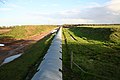
 Drainage channel - geograph.org.uk - 1432711.jpg 479 × 640; 177 KB
-
 Farmland south of Besthorpe village - geograph.org.uk - 5120244.jpg 800 × 522; 115 KB
-
 Farmland, Besthorpe - geograph.org.uk - 3514050.jpg 640 × 480; 56 KB
-
 Ferguson tractor - geograph.org.uk - 5120863.jpg 800 × 600; 161 KB
-
 Field path to the north of Collingham - geograph.org.uk - 5221375.jpg 800 × 600; 128 KB
-
 Fine fungus - geograph.org.uk - 1432670.jpg 640 × 479; 281 KB
-
 Fleet Lane, Besthorpe - geograph.org.uk - 2270042.jpg 1,024 × 768; 153 KB
-
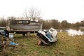
 Fly tipping by the River Trent - geograph.org.uk - 5120204.jpg 800 × 510; 122 KB
-
 Folly Lane - geograph.org.uk - 4824631.jpg 3,064 × 1,714; 3.43 MB
-
 Footpath from Church Lane - geograph.org.uk - 503260.jpg 640 × 427; 85 KB
-
 Footpath in Besthorpe - geograph.org.uk - 2270143.jpg 768 × 1,024; 196 KB
-
 Footpath, Besthorpe - geograph.org.uk - 2386602.jpg 480 × 640; 84 KB
-
 Footpath, Besthorpe - geograph.org.uk - 2386615.jpg 640 × 481; 77 KB
-
 Former Methodist Chapel, Besthorpe - geograph.org.uk - 2270094.jpg 1,024 × 768; 150 KB
-
 Frank R - geograph.org.uk - 666083.jpg 640 × 427; 93 KB
-
 Frozen farmland - geograph.org.uk - 1631642.jpg 640 × 426; 80 KB
-
 Gate on the floodbank of the River Trent - geograph.org.uk - 5129821.jpg 800 × 600; 140 KB
-
 Gate, Besthorpe - geograph.org.uk - 2386610.jpg 640 × 480; 79 KB
-
 Girton floodmarks - geograph.org.uk - 666010.jpg 640 × 427; 124 KB
-
 Girton to Besthorpe footpath - geograph.org.uk - 5615136.jpg 4,608 × 3,456; 4.62 MB
-
 Girton to Besthorpe Public path - geograph.org.uk - 5614396.jpg 4,608 × 3,456; 6.1 MB
-
 Gravel island - geograph.org.uk - 1432699.jpg 640 × 479; 148 KB
-
 Green Lane - geograph.org.uk - 1432654.jpg 479 × 640; 193 KB
-
 Growing leeks at Besthorpe - geograph.org.uk - 2285198.jpg 1,024 × 768; 202 KB
-

-
 Holy Trinity church, Besthorpe - geograph.org.uk - 4820732.jpg 3,072 × 1,728; 1.47 MB
-
 Irrigation pump - geograph.org.uk - 1513259.jpg 640 × 465; 87 KB
-
 Just another drainage ditch, near Besthorpe - geograph.org.uk - 4824622.jpg 3,072 × 1,728; 3.51 MB
-
 Lake on River Fleet at Besthorpe - geograph.org.uk - 4820726.jpg 3,072 × 1,728; 1.76 MB
-
 Leeks growing at Besthorpe - geograph.org.uk - 2012611.jpg 640 × 426; 80 KB
-
 Low Road, Besthorpe - geograph.org.uk - 1513305.jpg 640 × 480; 83 KB
-
 Manor Cottage, Besthorpe - geograph.org.uk - 2270114.jpg 1,024 × 768; 173 KB
-
 Manor House and Low Road, Besthorpe - geograph.org.uk - 2270124.jpg 1,024 × 768; 185 KB
-
 Meering Lane, near Besthorpe - geograph.org.uk - 3109441.jpg 2,256 × 1,504; 1.45 MB
-
 Mill Farm House - geograph.org.uk - 3734624.jpg 800 × 533; 193 KB
-
 Mill Farm lane - geograph.org.uk - 3734626.jpg 800 × 533; 190 KB
-
 Mill Farm, Besthorpe - geograph.org.uk - 3156705.jpg 1,024 × 768; 114 KB
-
 Monster tracks - geograph.org.uk - 1432682.jpg 640 × 448; 168 KB
-
 Moor Lane - geograph.org.uk - 1513216.jpg 640 × 480; 110 KB
-
 Moor Lane - geograph.org.uk - 2012651.jpg 640 × 426; 114 KB
-
 Moor Lane - geograph.org.uk - 3746776.jpg 800 × 533; 174 KB
-
 Moor Lane - geograph.org.uk - 3746791.jpg 800 × 533; 160 KB
-
 Moor Lane, Besthorpe - geograph.org.uk - 3156657.jpg 1,024 × 768; 185 KB
-
 Moor Lane, near Lodge Farm - geograph.org.uk - 3110482.jpg 2,256 × 1,504; 1.06 MB
-
 Mounting block, Besthorpe - geograph.org.uk - 2384587.jpg 480 × 640; 82 KB
-
 New houses in Fleet Street, Besthorpe - geograph.org.uk - 4820722.jpg 3,072 × 1,728; 1.2 MB
-
 North along the A1133 Besthorpe Road - geograph.org.uk - 5120237.jpg 800 × 528; 103 KB
-
 Old brick hut by Trent Lane - geograph.org.uk - 5120214.jpg 800 × 557; 112 KB
-
 Over the border - geograph.org.uk - 1631648.jpg 640 × 426; 88 KB
-
 Path to Collingham - geograph.org.uk - 4979313.jpg 480 × 640; 76 KB
-
 Path to Collingham - geograph.org.uk - 4979315.jpg 480 × 640; 99 KB
-
 Path to Collingham - geograph.org.uk - 4979316.jpg 640 × 480; 76 KB
-
 Path to Collingham - geograph.org.uk - 4979318.jpg 480 × 640; 89 KB
-
 Path to Collingham - geograph.org.uk - 4979319.jpg 480 × 640; 50 KB
-
 Pedestrian lights - geograph.org.uk - 1432678.jpg 640 × 479; 162 KB
-
 Playing field, Besthorpe - geograph.org.uk - 2270102.jpg 1,024 × 768; 199 KB
-
 Plumtree Farm, Besthorpe - geograph.org.uk - 2270062.jpg 1,024 × 768; 199 KB
-
 Polythene ridges - geograph.org.uk - 2867878.jpg 640 × 427; 60 KB
-
 Polythene ridges - geograph.org.uk - 2867918.jpg 640 × 427; 82 KB
-
 Polytunnels at Lodge Farm - geograph.org.uk - 2012622.jpg 640 × 426; 74 KB
-
 Pond and field drain - geograph.org.uk - 5120855.jpg 800 × 600; 142 KB
-
 Pot holes on Trent Lane - geograph.org.uk - 5120232.jpg 800 × 578; 132 KB
-
 Potato ridges - geograph.org.uk - 2867900.jpg 640 × 427; 113 KB
-
 Potato ridges - geograph.org.uk - 2867906.jpg 640 × 427; 115 KB
-
 Processing plant - geograph.org.uk - 1432675.jpg 640 × 479; 179 KB
-
 River Trent at Besthorpe Wharf - geograph.org.uk - 4820746.jpg 3,072 × 1,728; 1.57 MB
-
 River Trent below Carlton - geograph.org.uk - 1432613.jpg 640 × 424; 109 KB
-
 River Trent distance marker - geograph.org.uk - 5129814.jpg 800 × 641; 130 KB
-
 River Trent from Besthorpe Wharf - geograph.org.uk - 48143.jpg 640 × 480; 121 KB
-
 Riverside gate - geograph.org.uk - 1432612.jpg 639 × 438; 80 KB
-
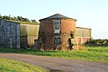
 Ruined farm building adjacent to Moor Lane - geograph.org.uk - 3156649.jpg 1,024 × 768; 225 KB
-
 S-bend - geograph.org.uk - 1432697.jpg 537 × 640; 212 KB
-
 Sand delta - geograph.org.uk - 1432706.jpg 640 × 479; 116 KB
-
 Sand Lane heading east - geograph.org.uk - 3514041.jpg 640 × 480; 101 KB
-
 Setting off - geograph.org.uk - 1432600.jpg 640 × 479; 148 KB
-
 Slack's Farmhouse (2) - geograph.org.uk - 2270082.jpg 1,024 × 768; 308 KB
-
 Slack's Farmhouse - geograph.org.uk - 2270078.jpg 1,024 × 768; 255 KB
-
 Sluice next to the River Trent - geograph.org.uk - 5129808.jpg 800 × 598; 161 KB
-
 Sluice on the River Trent - geograph.org.uk - 5129805.jpg 800 × 545; 96 KB
-
 Soay Sheep - geograph.org.uk - 146680.jpg 640 × 427; 105 KB
-

-
 Steps to the river - geograph.org.uk - 3161122.jpg 640 × 447; 232 KB
-
 Sunflowers - geograph.org.uk - 2012647.jpg 426 × 640; 143 KB
-
 Sunsetting at Besthorpe Wharf - geograph.org.uk - 4820748.jpg 3,072 × 1,728; 1.28 MB
-
 The Fleet - geograph.org.uk - 3820526.jpg 800 × 533; 151 KB
-
 The Fleet - geograph.org.uk - 5120864.jpg 800 × 600; 115 KB
-
 The Fleet at Besthorpe - geograph.org.uk - 145762.jpg 640 × 427; 90 KB
-
 The Fleet, north of Trent Lane - geograph.org.uk - 2817247.jpg 3,072 × 2,304; 1.19 MB
-
 The Fleet, north of Trent Lane - geograph.org.uk - 2817251.jpg 3,072 × 2,304; 1.68 MB
-
 The lane to Besthorpe - geograph.org.uk - 2285193.jpg 1,024 × 768; 157 KB
-
 The Lord Nelson Inn - geograph.org.uk - 5120857.jpg 800 × 600; 134 KB
-
 The Lord Nelson pub, Besthorpe - geograph.org.uk - 3514043.jpg 640 × 480; 65 KB
-
 The Old School - geograph.org.uk - 2867869.jpg 640 × 427; 104 KB
-
 The School - geograph.org.uk - 2817259.jpg 3,072 × 2,304; 1.41 MB
-
 The Trent Valley way between Besthorpe and Girton - geograph.org.uk - 2817271.jpg 3,072 × 2,304; 1.11 MB
-
 The village green, Besthorpe - geograph.org.uk - 2270134.jpg 1,024 × 768; 193 KB
-
 This is Moor Lane - geograph.org.uk - 4824630.jpg 3,072 × 1,728; 2.85 MB
-
 Tinker's Lane - geograph.org.uk - 3839214.jpg 800 × 533; 177 KB
-
 Tipping gravel - geograph.org.uk - 1432688.jpg 640 × 430; 123 KB
-
 Track to Lilac Cottage - geograph.org.uk - 3514063.jpg 640 × 480; 59 KB
-
 Track to the Sewage Works - geograph.org.uk - 4884604.jpg 640 × 384; 83 KB
-
 Track to the sewage works - geograph.org.uk - 5120265.jpg 800 × 671; 208 KB
-
 Transfer point - geograph.org.uk - 1432597.jpg 640 × 479; 133 KB
-
 Trees forming a field boundary - geograph.org.uk - 5120849.jpg 800 × 600; 141 KB
-
 Trent Lane - geograph.org.uk - 1532206.jpg 640 × 480; 94 KB
-
 Trent Lane - geograph.org.uk - 3109436.jpg 2,256 × 1,504; 1.57 MB
-
 Trent Lane leading towards Besthorpe Wharf - geograph.org.uk - 4754342.jpg 1,024 × 768; 144 KB
-
 Trent Lane meets the Trent - geograph.org.uk - 2271100.jpg 1,024 × 768; 137 KB
-
 Trent Lane, Besthorpe - geograph.org.uk - 2271094.jpg 1,024 × 768; 125 KB
-
 Trent Valley Way - geograph.org.uk - 5615143.jpg 4,608 × 3,456; 6.54 MB
-

-
 Trent Valley Way crossing Church Lane - geograph.org.uk - 1513206.jpg 640 × 480; 108 KB
-
 Trent Valley Way near Besthorpe - geograph.org.uk - 4824610.jpg 3,072 × 1,728; 1.79 MB
-
 Trent Valley Way near Besthorpe - geograph.org.uk - 4824613.jpg 3,072 × 1,728; 3.68 MB
-
 Trent Valley Way near Holly House Farm - geograph.org.uk - 5120853.jpg 800 × 600; 160 KB
-
-
 View from Moor Lane - geograph.org.uk - 3746784.jpg 800 × 533; 186 KB
-
 West View Farm - geograph.org.uk - 3514059.jpg 1,024 × 628; 80 KB
-
 Willow Cottage - geograph.org.uk - 2817265.jpg 3,072 × 2,304; 1.36 MB
-
 Windmill at Mill Farm, Besthorpe - geograph.org.uk - 2584061.jpg 989 × 677; 470 KB
-
 Woodland off Sand Lane - geograph.org.uk - 3514040.jpg 480 × 640; 134 KB
-
 Access road - geograph.org.uk - 1432647.jpg 640 × 479; 130 KB
-
 After the flood - geograph.org.uk - 340284.jpg 640 × 427; 48 KB
-
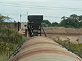
 Aggregate conveyor belt - geograph.org.uk - 264550.jpg 640 × 427; 82 KB
-
 Aggregate extraction - geograph.org.uk - 264557.jpg 640 × 427; 50 KB
-
 Aggregate extraction works - geograph.org.uk - 264544.jpg 640 × 427; 56 KB
-
 Aggregate extraction works - geograph.org.uk - 264546.jpg 640 × 427; 75 KB
-
 Aggregate extraction works - geograph.org.uk - 264548.jpg 640 × 427; 53 KB
-
 Anticipation ^ - geograph.org.uk - 666078.jpg 640 × 427; 73 KB
-
 Besthorpe Aggregates Jetty - geograph.org.uk - 811832.jpg 640 × 480; 69 KB
-
 Besthorpe from the Fleet - geograph.org.uk - 340281.jpg 640 × 427; 40 KB
-
 Besthorpe Quarry - geograph.org.uk - 1432680.jpg 640 × 479; 123 KB
-
 Bridge over the conveyor - geograph.org.uk - 1432691.jpg 640 × 479; 181 KB
-
 Carlton Ferry Lane - geograph.org.uk - 1432756.jpg 640 × 479; 186 KB
-
 Chantry Cottage - geograph.org.uk - 666008.jpg 640 × 427; 64 KB
-
 Charity School - geograph.org.uk - 146698.jpg 640 × 427; 81 KB
-
 Conveyor and hopper - geograph.org.uk - 1432693.jpg 640 × 479; 146 KB
-
 Conveyor and track - geograph.org.uk - 1432705.jpg 640 × 479; 156 KB
-
 Conveyor belt - geograph.org.uk - 264551.jpg 640 × 427; 58 KB
-
 Conveyor cover - geograph.org.uk - 1432686.jpg 640 × 479; 225 KB
-
 Conveyor hopper - geograph.org.uk - 1432684.jpg 640 × 479; 134 KB
-
 Deep water - geograph.org.uk - 1432598.jpg 640 × 479; 142 KB
-
 Double cross - geograph.org.uk - 1432637.jpg 479 × 640; 248 KB
-
 Flooded fields - geograph.org.uk - 340283.jpg 640 × 427; 36 KB
-
 Flooding at Girton - geograph.org.uk - 666014.jpg 640 × 427; 43 KB
-
 Footpath alongside the conveyor - geograph.org.uk - 1432696.jpg 640 × 479; 152 KB
-
 Footpath east - geograph.org.uk - 264541.jpg 640 × 427; 76 KB
-
 Footpath junction - geograph.org.uk - 1432700.jpg 640 × 479; 163 KB
-
 Footpath through the quarry - geograph.org.uk - 1432625.jpg 640 × 479; 196 KB
-
 Footpath through the quarry - geograph.org.uk - 1432710.jpg 640 × 479; 159 KB
-
 Footpath with bridge - geograph.org.uk - 1432702.jpg 479 × 640; 180 KB
-
 Girton from the Fleet - geograph.org.uk - 340272.jpg 640 × 427; 65 KB
-
 Going nowhere - geograph.org.uk - 666086.jpg 640 × 427; 112 KB
-
 Gravel pit at Besthorpe - geograph.org.uk - 1432631.jpg 640 × 479; 164 KB
-
 Gravel pit at Besthorpe - geograph.org.uk - 1432633.jpg 640 × 479; 159 KB
-
 Heavy plant crossing - geograph.org.uk - 1432685.jpg 640 × 479; 183 KB
-
 High water on the Fleet - geograph.org.uk - 340271.jpg 640 × 427; 52 KB


,_heading_south_-_geograph.org.uk_-_3514064.jpg)
,_heading_south_-_geograph.org.uk_-_3514065.jpg)


_-_geograph.org.uk_-_2270082.jpg)


