Category:Bethnal Green
Salti al navigilo
Salti al serĉilo
Bethnal Green is a London district which forms part of the London Borough of Tower Hamlets, in the East End of London. Bethnal Green is located north east of Charing Cross. ‘’From en:WP’’
district in East London, England, UK  | |||||
| Alŝuti plurmedion | |||||
| Estas | |||||
|---|---|---|---|---|---|
| Loko | Tower Hamlets, Granda Londono, London, Anglio | ||||
 | |||||
Subkategorioj
Ĉi tiu kategorio havas la 43 jenajn subkategoriojn, el 43 entute.
B
- Bonner Hall Bridge (18 D)
- Buses in Bethnal Green (4 D)
C
- Canrobert Street, London (4 D)
E
- Elwin street, London (6 D)
F
- Fleet Street Hill (4 D)
G
H
I
- Ion Square Gardens (7 D)
J
- Jesus Green, Bethnal Green (4 D)
M
- Meath Gardens (4 D)
- Morpeth School (2 D)
O
- Old Bethnal Green Road (7 D)
- Oxford House (7 D)
P
R
- Ravenscroft Park (5 D)
S
- Sulkin House (3 D)
- Suttons Wharf (1 D)
- Swanfield Street, London (1 D)
V
Y
Dosieroj en kategorio “Bethnal Green”
La jenaj 200 dosieroj estas en ĉi tiu kategorio, el 222 entute.
(antaŭa paĝo) (sekva paĝo)-
 "Happy Nightmares" - panoramio.jpg 1 600 × 1 200; 653 KB
-
 17 Hereford Street, Bethnal Green - geograph.org.uk - 5037607.jpg 1 600 × 1 395; 688 KB
-
 17 Hereford Street, Bethnal Green - geograph.org.uk - 5037637.jpg 1 600 × 1 374; 544 KB
-
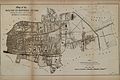
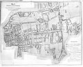 Chadwick's Bethnal Green Parish map. Wellcome L0009782.jpg 3 572 × 2 892; 4,15 MB
-
 Back garden nichol street 1863.jpg 400 × 250; 47 KB
-
 Queen Adelaide's Dispensary, Bethnal Green. Wood engraving b Wellcome V0012884.jpg 3 172 × 2 497; 4,04 MB
-
 Image taken from page 751 of 'Old and New London, etc' (11191645916).jpg 1 758 × 1 221; 916 KB
-
 2-14 Shipton Street (6993754911).jpg 3 264 × 2 448; 3,07 MB
-
 20, St Matthew's Row, Bethnal Green, E2 - geograph.org.uk - 6118072.jpg 1 024 × 768; 317 KB
-
 A woman with a wig in one hand and an umbrella in the other Wellcome V0039145.jpg 3 069 × 2 469; 3,47 MB
-
 Adelphi Chapel School (6993789359).jpg 2 448 × 3 264; 2,03 MB
-
 Ainsley Street (6806247338).jpg 2 448 × 3 264; 3,87 MB
-
 Allen & Hanbury's Ltd (6806249918).jpg 3 264 × 2 448; 2,77 MB
-
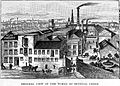 Allen & Hanburys, works at Bethnal Green Wellcome L0005128.jpg 1 706 × 1 218; 1,04 MB
-
 Allenbury large.jpg 2 600 × 1 560; 2,09 MB
-
 Allenbury small.jpg 2 520 × 1 680; 1,85 MB
-
 Approach Road (6952336001).jpg 3 264 × 2 448; 4,25 MB
-
 Ashington House (6993699025).jpg 2 448 × 3 264; 2,75 MB
-
 Attic occupied by a family of ten persons. Wellcome L0001381.jpg 4 008 × 2 603; 6,49 MB
-
 B108 in Bethnal Green - geograph.org.uk - 5468729.jpg 1 024 × 683; 159 KB
-
 Bangladesh flag.jpg 4 879 × 3 426; 8,22 MB
-
 Barges on the Icy Regent's Canal, Bethnal Green, London (5261549765).jpg 3 648 × 2 736; 2,76 MB
-
 Bethnal Green , Church of St John , tower and cupola - geograph.org.uk - 6060530.jpg 1 067 × 1 600; 584 KB
-
 Bethnal Green - London (7251221766).jpg 4 752 × 3 168; 10,9 MB
-
 Bethnal Green - London (7251224888).jpg 4 457 × 2 698; 12,3 MB
-
 Bethnal Green - London (7257912660).jpg 4 752 × 3 168; 6,12 MB
-
 Bethnal Green - London (7257973722).jpg 4 752 × 3 168; 5,01 MB
-
 Bethnal Green - London (7257976984).jpg 3 168 × 4 752; 14,08 MB
-
 Bethnal Green E2.jpg 3 072 × 2 304; 1,52 MB
-
 Bethnal Green Estate (6806215382).jpg 3 264 × 2 448; 2,71 MB
-
 Bethnal Green Estate - geograph.org.uk - 397566.jpg 640 × 480; 109 KB
-
 Bethnal Green Fire Station - geograph.org.uk - 6060539.jpg 1 600 × 1 149; 467 KB
-
 Bethnal Green from the air - geograph.org.uk - 3321764.jpg 480 × 640; 177 KB
-
 Bethnal Green Gardens - geograph.org.uk - 5184076.jpg 640 × 480; 572 KB
-
 Bethnal Green London (136476347).jpeg 2 048 × 1 365; 934 KB
-
 Bethnal Green London (136476349).jpeg 2 048 × 1 365; 1,19 MB
-
 Bethnal Green London (136476353).jpeg 2 048 × 1 365; 1,02 MB
-
 Bethnal Green London (136476355).jpeg 2 048 × 1 320; 801 KB
-
 Bethnal Green London (136476359).jpeg 2 048 × 1 367; 659 KB
-
 Bethnal Green London (136478319).jpeg 2 048 × 1 485; 805 KB
-
 Bethnal Green Met. B Ward Map 1916.svg 850 × 673; 34 KB
-
 Bethnal Green Methodist Church - geograph.org.uk - 2207394.jpg 640 × 480; 100 KB
-
 Bethnal Green Methodist Church.jpg 3 072 × 2 921; 2,55 MB
-
 Bethnal Green Mission Church (built 1955) - geograph.org.uk - 3799058.jpg 1 964 × 2 013; 1,86 MB
-
 Bethnal Green Montessori School - geograph.org.uk - 1716721.jpg 2 763 × 2 039; 4,63 MB
-
 Bethnal Green Police Station (geograph 6120271).jpg 1 024 × 1 024; 389 KB
-
 Bethnal Green Sculpture Description.JPG 3 888 × 2 592; 5,75 MB
-
 Bethnal Green Sculpture.JPG 2 592 × 3 888; 3,38 MB
-
 Bethnal green slum.jpg 428 × 308; 41 KB
-
 Bethnal Green, Billy's Cafe, Pritchard's Road - geograph.org.uk - 1717053.jpg 2 816 × 2 112; 3,15 MB
-
 Bethnal Green, Coate Street - geograph.org.uk - 1717082.jpg 2 816 × 2 112; 3,16 MB
-
 Bethnal Green, Corbridge Crescent - geograph.org.uk - 1727082.jpg 2 816 × 2 112; 3,04 MB
-
 Bethnal Green, Gasholder - geograph.org.uk - 1726965.jpg 2 719 × 2 012; 3,56 MB
-
 Bethnal Green, gasometers - geograph.org.uk - 3121306.jpg 1 024 × 743; 188 KB
-
 Bethnal Green, Grove Passage - geograph.org.uk - 1726898.jpg 2 816 × 2 112; 3,61 MB
-
 Bethnal Green, Hare Row - geograph.org.uk - 1727000.jpg 2 816 × 2 112; 3,16 MB
-
 Bethnal Green, Hemming Street - geograph.org.uk - 3133016.jpg 1 024 × 743; 151 KB
-
 Bethnal Green, Junction of Hackney Road with Clare Street - geograph.org.uk - 1717351.jpg 2 816 × 2 112; 3,37 MB
-
 Bethnal Green, Junction of Hackney Road with Treadway Street - geograph.org.uk - 1717123.jpg 2 816 × 2 112; 2,99 MB
-
 Bethnal Green, Mansford Street - geograph.org.uk - 1716878.jpg 2 763 × 2 051; 3,97 MB
-
 Bethnal Green, Morpeth School - geograph.org.uk - 3112212.jpg 1 024 × 760; 121 KB
-
 Bethnal Green, mosque - geograph.org.uk - 3112200.jpg 1 024 × 760; 143 KB
-
 Bethnal Green, Pritchard's Road - geograph.org.uk - 1716991.jpg 2 816 × 2 112; 3,3 MB
-
 Bethnal Green, Pub sign at south end of Sebright Passage - geograph.org.uk - 1716930.jpg 2 816 × 2 112; 3,33 MB
-
 Bethnal Green, Queen Elizabeth Hospital for Children - geograph.org.uk - 1716805.jpg 2 743 × 2 019; 4,55 MB
-
 Bethnal Green, railway arches - geograph.org.uk - 3101078.jpg 1 024 × 768; 173 KB
-
 Bethnal Green, railway bridge - geograph.org.uk - 3101130.jpg 1 024 × 775; 186 KB
-
 Bethnal Green, railway bridge - geograph.org.uk - 3133001.jpg 1 024 × 746; 188 KB
-
 Bethnal Green, Royal Mail sorting office, Emma Street - geograph.org.uk - 1726886.jpg 2 816 × 2 112; 3,4 MB
-
 Bethnal Green, sixth form centre - geograph.org.uk - 3112189.jpg 1 024 × 720; 115 KB
-
 Bethnal Green, support unit - geograph.org.uk - 3101209.jpg 1 024 × 768; 228 KB
-
 Bethnal Green, The Oval - geograph.org.uk - 1717316.jpg 2 816 × 2 112; 3,12 MB
-
 Bethnal Green, The Oval - geograph.org.uk - 1726917.jpg 2 816 × 2 112; 3,04 MB
-
 Bethnal-Green Company of Irish Impresst Volunteers (BM 2000,0521.33).jpg 2 500 × 1 938; 929 KB
-
 Bishop's Way (6806226346).jpg 3 264 × 2 448; 4,34 MB
-
 Blackwood House (6993696867).jpg 3 264 × 2 448; 2,93 MB
-
 BML.graffiti.Bethnal Green.jpg 750 × 1 334; 289 KB
-
 Board School (6993698485).jpg 2 448 × 3 264; 3,03 MB
-
 Bonner Gate - the entrance to Victoria Park - geograph.org.uk - 3765129.jpg 4 000 × 3 000; 4,29 MB
-
 Bonner Road, Bethnal Green - geograph.org.uk - 3484223.jpg 640 × 480; 89 KB
-
 Bonner Street, Bethnal Green - geograph.org.uk - 3500620.jpg 640 × 480; 73 KB
-
 Cambridge Heath Estate (6952319907).jpg 3 264 × 2 448; 3,01 MB
-
 Canal warehouses, Bethnal Green - geograph.org.uk - 1541827.jpg 640 × 480; 75 KB
-
 Cheshire Street, Bethnal Green - geograph.org.uk - 5036460.jpg 1 600 × 1 084; 509 KB
-
 Church House Mission and Hall (6847590716).jpg 2 448 × 3 264; 2,88 MB
-
 Clare Street E2 (32995381392).jpg 2 272 × 1 704; 1,28 MB
-

-
 Congregationalist Church (6847655462).jpg 2 448 × 3 264; 2,75 MB
-
 Corfield Street (6806248752).jpg 3 264 × 2 448; 3,41 MB
-
 Crossroads by railway, Bethnal Green - geograph.org.uk - 6119568.jpg 1 024 × 684; 353 KB
-
 Cyprus Street (6806238602).jpg 3 264 × 2 448; 3,62 MB
-
 Cyprus Street (6806239376).jpg 2 448 × 3 264; 2,9 MB
-
 Cyprus Street War Memorial (6806238130).jpg 2 448 × 3 264; 3,32 MB
-
 Delta House (6847644102).jpg 3 264 × 2 448; 2,92 MB
-
 Dinmont Estate (6847663520).jpg 3 264 × 2 448; 2,65 MB
-
 Dunbridge Street in Bethnal Green - geograph.org.uk - 3321543.jpg 1 500 × 1 000; 204 KB
-
 Dwellings of the poor in Bethnal Green, water supply 1863 Wellcome L0001380.jpg 4 002 × 2 618; 5,49 MB
-
 East End Dwellings Co Cottages (6952349553).jpg 3 264 × 2 448; 2,88 MB
-
 Flyte Bethnal Green 2017.jpg 2 048 × 1 365; 179 KB
-
 Former Bethnel Green Infirmary (6806220126).jpg 3 264 × 2 448; 3,2 MB
-
 Former Bethnel Green Infirmary (6952333761).jpg 3 264 × 2 448; 3,49 MB
-
 Former Police Station (6806245660).jpg 2 448 × 3 264; 2,93 MB
-
 Former St Peters School (6847650404).jpg 3 264 × 2 448; 2,58 MB
-
 Former Tram Depot (6952355763).jpg 3 264 × 2 448; 2,95 MB
-
 Former Weavers Field School, Bethnal Green - geograph.org.uk - 6119603.jpg 1 024 × 768; 302 KB
-
 Gardens bordering the canal - geograph.org.uk - 1538946.jpg 640 × 480; 101 KB
-
 Gascoigne Place (6993747707).jpg 2 448 × 3 264; 3,3 MB
-
 Gasholder, Bethnal Green - geograph.org.uk - 4746733.jpg 640 × 480; 107 KB
-
 Gasometers at Bethnal Green - geograph.org.uk - 3478270.jpg 4 320 × 3 240; 3,12 MB
-
 Gibraltar Walk, Bethnal Green - geograph.org.uk - 4560016.jpg 2 272 × 1 704; 783 KB
-
 Globe Road (6952320287).jpg 2 448 × 3 264; 2,82 MB
-
 Globe Road, Bethnal Green - geograph.org.uk - 4697355.jpg 1 280 × 960; 406 KB
-
 Great Eastern Goods Depot (6847589208).jpg 3 264 × 2 448; 2,65 MB
-
 Grove Passage, Bethnal Green - geograph.org.uk - 1726979.jpg 2 816 × 2 112; 1,04 MB
-
 Guinness Trust Housing (6993758155).jpg 3 264 × 2 448; 3,31 MB
-
 Horwood Estate, Bethnal Green - geograph.org.uk - 394866.jpg 640 × 480; 130 KB
-
 ILN 1869, p. 440.jpg 1 441 × 1 000; 239 KB
-
 In Bethnal Green - geograph.org.uk - 5790856.jpg 640 × 426; 51 KB
-
 Jeremy Bentham House.jpg 1 552 × 2 592; 1,81 MB
-
 Labour Yard in Bethnel Green. Also Sewing-class. Wellcome L0001113.jpg 1 124 × 1 660; 1,02 MB
-
 Lamp standard, Museum Passage, Bethnal Green.jpg 4 608 × 3 456; 3,7 MB
-
 Lawdale School (6993776381).jpg 3 264 × 2 448; 2,82 MB
-
 London - Hassard Street.jpg 5 184 × 3 456; 9,58 MB
-
 London - Squirries Street.jpg 5 184 × 3 456; 6,23 MB
-
 London Borough of Tower Hamlets - 27-45, Approach Road E2 - 20230320160235.jpg 5 312 × 2 988; 4,55 MB
-
-
 London Borough of Tower Hamlets - Former Bethnal Green British School - 20230804142932.jpg 5 312 × 2 988; 3,43 MB
-

-
 London Borough of Tower Hamlets - Former Bethnal Green British School - 20230804150416.jpg 2 988 × 5 312; 4,19 MB
-
 London Chest Hospital (6806224456).jpg 2 448 × 3 264; 2,66 MB
-
 London City and Midland Bank (6952367725).jpg 2 448 × 3 264; 2,56 MB
-
 Mace Street and Tagg Street War Memorial (6952353967).jpg 3 264 × 2 448; 4,18 MB
-
 Mansford Street Central School (6847656438).jpg 3 264 × 2 448; 2,88 MB
-
 Map of City of London and its Environs Sheet 027, Ordnance Survey, 1869-1880.png 11 280 × 7 551; 58,06 MB
-
 Map of the Parish of Bethnal Green, Shewing the Cholera Mist Wellcome L0071632.jpg 5 765 × 3 856; 5,32 MB
-
 Mayfield House (6806217008).jpg 3 264 × 2 448; 2,44 MB
-
 Merceron House (6952348943).jpg 3 264 × 2 448; 2,55 MB
-
 Merceron Houses (6952350047).jpg 3 264 × 2 448; 3,61 MB
-
 Minerva Estate (6993782699).jpg 3 264 × 2 448; 3,62 MB
-
 Mother Kelly's, Bethnal Green, E2 (13937975944).jpg 3 074 × 2 052; 2,92 MB
-
 Museum Passage - geograph.org.uk - 5184120.jpg 640 × 481; 567 KB
-
 Museum Passage, Bethnal Green - geograph.org.uk - 5287857.jpg 3 264 × 2 448; 2,72 MB
-
 Nags Head Estate (6993757365).jpg 3 264 × 2 448; 3,58 MB
-
 Noel Mander Church Organ Works, 1.jpg 4 032 × 3 024; 8,91 MB
-
 Noel Mander Church Organ Works, 2.jpg 3 024 × 4 032; 7,49 MB
-
 Noel Mander Church Organ Works, 3.jpg 3 024 × 4 032; 7,54 MB
-
 Noodle King, Bethnal Green, E2 (2678614806).jpg 1 280 × 960; 315 KB
-
 Ombra, Bethnal Green, E2 (7899378984).jpg 3 236 × 2 160; 3,52 MB
-
 One Careful Owner^ - geograph.org.uk - 36889.jpg 640 × 482; 125 KB
-
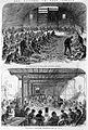
 Opening of the Bethnal Green Museum 1872 ILN.jpg 600 × 434; 109 KB
-
 Ozone Coffee Roasters, Bethnal Green (51000363358).jpg 5 184 × 3 888; 5,4 MB
-
 Ozone Coffee Roasters, Bethnal Green (51001182222).jpg 4 032 × 3 024; 3,07 MB
-
 Paradise Gardens, Bethnal Green - geograph.org.uk - 4825151.jpg 4 000 × 3 000; 4,97 MB
-
 Park View Estate (6952341979).jpg 2 448 × 3 264; 2,7 MB
-
 Parmiter Street - geograph.org.uk - 3784767.jpg 3 648 × 2 056; 4,13 MB
-
 Peabody Estate (6993785045).jpg 3 264 × 2 448; 3,04 MB
-
 Pelican Passage. (17147388033).jpg 5 184 × 3 456; 7,37 MB
-
 Pott Street Chapel (6806245140).jpg 2 448 × 3 264; 2,46 MB
-
 Poyser Street E2 (33151730605).jpg 1 704 × 2 272; 1,4 MB
-
 Poyser Street, Bethnal Green.jpg 5 771 × 3 847; 11,47 MB
-
 Prince's Terrace (6952337251).jpg 3 264 × 2 448; 2,9 MB
-
 Queen Elizabeth's Childrens Hospital (6993793339).jpg 2 448 × 3 264; 3,12 MB
-
 Quilter Street, E2-geograph-2953324-by-Christopher-Hilton.jpg 1 600 × 1 064; 384 KB
-
 Railway Arches, Bethnal Green - geograph.org.uk - 2967359.jpg 4 288 × 3 216; 4,68 MB
-
 Railway arches, Bethnal Green - geograph.org.uk - 6119588.jpg 1 024 × 684; 274 KB
-
 Railway Arches, Bethnal Green.jpg 4 274 × 3 206; 10,06 MB
-
 Raine's Foundation School (6952336527).jpg 2 448 × 3 264; 3,42 MB
-
 Raine's Foundation School-view-1.jpg 2 616 × 3 488; 1,05 MB
-
 Raine's Foundation School-view-2.jpg 2 616 × 3 488; 1,19 MB
-
 Raine's Foundation School-view-3.jpg 3 488 × 2 616; 1,41 MB
-

-
 Report to Her Majesty's principal secretary of state... Wellcome L0067887.jpg 5 300 × 4 210; 6,98 MB
-
 Reynold's House (6806224994).jpg 3 264 × 2 448; 4,07 MB
-
 Rochelle Primary School (6993736337).jpg 3 264 × 2 448; 3,8 MB
-
 Rosebery House (6952341441).jpg 3 264 × 2 448; 3,94 MB
-
 Scenes at one of the London Military Hospitals and the Zoo. Wellcome L0027206.jpg 3 696 × 4 896; 8,75 MB
-
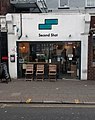 Second Shot coffee shop, Bethnal Green, London.jpg 1 653 × 2 081; 535 KB
-
 Second Shot in Bethnal Green (27735295945).jpg 5 184 × 3 456; 5,46 MB
-
 Sewardstone Road (6806226792).jpg 3 264 × 2 448; 2,93 MB
-
 Sewardstone Road (6806227696).jpg 2 448 × 3 264; 2,99 MB
-
 Shipton Street (6993755977).jpg 3 264 × 2 448; 2,95 MB
-
 Sidney Godley Memorial.jpg 3 264 × 2 448; 4,47 MB
-
 Sivill House (17232472641).jpg 4 325 × 3 089; 3,36 MB
-
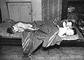 Slum children bethnal green.jpg 428 × 305; 41 KB
-
 St Bartholomew's (6847578054).jpg 2 448 × 3 264; 3,31 MB
-
 St Elizabeth Catholic Church, Bethnal Green.jpg 3 491 × 5 236; 11,95 MB
-
 St James the Great (6952365977).jpg 3 264 × 2 448; 2,95 MB
-
 St Matthew's Row (6847585756).jpg 2 448 × 3 264; 2,79 MB
-
 St Matthew's Watch House (6993704711).jpg 3 264 × 2 448; 3,98 MB
-
 St Matthews National Schools (6993707201).jpg 3 264 × 2 448; 3,15 MB
-
 St Matthews Parish Hall (6847588722).jpg 2 448 × 3 264; 2,69 MB
-
 St Matthews Rectory (6993709965).jpg 3 264 × 2 448; 3,77 MB
-
 St. Margaret's House (Bethnal Green).jpg 2 394 × 4 240; 5,24 MB
-
 St. Margaret's House (community charity).jpg 2 147 × 4 240; 5,3 MB
-
 St. Peter's Vicarage, Bethnal Green - geograph.org.uk - 2965290.jpg 3 072 × 2 304; 2,22 MB
-
 Stepney Civil Parish Map 1870.png 8 701 × 9 067; 2,91 MB
-
 Stockton Tower (6952367239).jpg 2 448 × 3 264; 2,73 MB
-
 Stools (4820527733).jpg 4 950 × 3 510; 12,4 MB
-
 Sun Life Assurance Co (6952357955).jpg 2 448 × 3 264; 2,6 MB
-
 Tapp Street, Bethnal Green - geograph.org.uk - 2783741.jpg 640 × 480; 69 KB


.jpg)
.jpg)


.jpg)
.jpg)
.jpg)


.jpg)
.jpg)


.jpg)

.jpg)
.jpg)
.jpg)
.jpg)
.jpg)

.jpg)


.jpeg)
.jpeg)
.jpeg)
.jpeg)
.jpeg)
.jpeg)


_-_geograph.org.uk_-_3799058.jpg)

.jpg)


.jpg)
.jpg)
.jpg)

.jpg)


.jpg)


.jpg)
.jpg)

.jpg)
.jpg)

.jpg)
.jpg)
.jpg)
.jpg)
.jpg)


.jpg)

.jpg)
.jpg)
.jpg)
.jpg)
.jpg)


.jpg)


.jpg)

.jpg)

.jpg)


.jpg)


_-_20230804142450.jpg)


.jpg)
.jpg)
.jpg)
.jpg)


.jpg)
.jpg)
.jpg)
.jpg)
.jpg)


.jpg)


.jpg)
.jpg)


.jpg)
.jpg)

.jpg)

.jpg)
.jpg)
.jpg)
.jpg)

.jpg)
.jpg)


.jpg)


.jpg)
.jpg)
.jpg)


.jpg)
.jpg)
.jpg)
.jpg)

.jpg)

.jpg)

.jpg)
.jpg)
.jpg)
.jpg)
.jpg)
.jpg)
.jpg)
.jpg)


.jpg)
.jpg)
.jpg)
