Category:Beyton
Aller à la navigation
Aller à la recherche
English: Beyton is a village and civil parish in the Mid Suffolk district of Suffolk, England. According to Eilert Ekwall the meaning of the village name is homestead by brook or Beaga's homestead.The Domesday Book records the population of Beyton in 1086 to be 1 free man. The village is about east of Bury St Edmunds, on the A14 road.
village britannique | |||||
| Téléverser des médias | |||||
| Nature de l’élément | |||||
|---|---|---|---|---|---|
| Lieu | Mid Suffolk, Suffolk, Angleterre de l'Est, Angleterre | ||||
| Réputé identique à | Beyton (page en doublon, paroisse civile) | ||||
 | |||||
Sous-catégories
Cette catégorie comprend 4 sous-catégories, dont les 4 ci-dessous.
Média dans la catégorie « Beyton »
Cette catégorie comprend 32 fichiers, dont les 32 ci-dessous.
-
 A crowd of conifers - geograph.org.uk - 371816.jpg 640 × 480 ; 82 kio
-
 A road junction in Beyton village - geograph.org.uk - 2262905.jpg 3 648 × 2 736 ; 2,29 Mio
-
 A14 Looking Northwest - geograph.org.uk - 1367794 (cropped).jpg 268 × 477 ; 26 kio
-
 A14 Looking Northwest - geograph.org.uk - 1367794.jpg 640 × 480 ; 64 kio
-
 A14, westbound - geograph.org.uk - 4128716.jpg 640 × 411 ; 54 kio
-
 A14, westbound - geograph.org.uk - 4128717.jpg 640 × 403 ; 53 kio
-
 Beyton Green - geograph.org.uk - 4385099.jpg 3 600 × 2 547 ; 2,77 Mio
-
 Beyton War Memorial - geograph.org.uk - 5431401.jpg 2 592 × 3 456 ; 2,95 Mio
-
 Broken Stile - geograph.org.uk - 1365769.jpg 480 × 640 ; 79 kio
-
 Drinkstone Road, Beyton - geograph.org.uk - 4505361.jpg 1 024 × 768 ; 424 kio
-
 Eastbound A14 - geograph.org.uk - 3844161.jpg 640 × 480 ; 293 kio
-
 Entrance to Beyton Middle School - geograph.org.uk - 3072686.jpg 3 264 × 2 448 ; 1,96 Mio
-
 Farmers Bridge - geograph.org.uk - 1367787.jpg 640 × 480 ; 72 kio
-
 Farmland and woodland near Beyton Green - geograph.org.uk - 4664659.jpg 640 × 480 ; 58 kio
-
 Footbridge over Westbound A14 - geograph.org.uk - 3853619.jpg 640 × 480 ; 305 kio
-
 Footbridge, A14 - geograph.org.uk - 4128719.jpg 640 × 430 ; 48 kio
-
 Footbridge, Westbound A14 - geograph.org.uk - 3868222.jpg 640 × 480 ; 288 kio
-
 Footpath towards Chevins Wood - geograph.org.uk - 3072704.jpg 3 264 × 2 448 ; 2,5 Mio
-
 Layby, Westbound A14 - geograph.org.uk - 3853623.jpg 640 × 480 ; 308 kio
-
 Middle Of The Road - geograph.org.uk - 1728697.jpg 1 600 × 1 200 ; 496 kio
-
 Redundant Water Pump - geograph.org.uk - 791342.jpg 640 × 480 ; 135 kio
-
 ROC Beyton Post - geograph.org.uk - 4882169.jpg 1 362 × 1 162 ; 1,1 Mio
-
 The Bear public house, Beyton - geograph.org.uk - 6217368.jpg 3 264 × 2 448 ; 1,94 Mio
-
 The Green at Beyton - geograph.org.uk - 4505295.jpg 1 024 × 768 ; 311 kio
-
 The sign of The Bear public house - geograph.org.uk - 6217370.jpg 2 271 × 3 189 ; 1,36 Mio
-
 The sign of The White Horse, Beyton - geograph.org.uk - 6217363.jpg 3 264 × 2 448 ; 1,64 Mio
-
 The sign of The White Horse, Beyton - geograph.org.uk - 6217365.jpg 3 264 × 2 448 ; 1,67 Mio
-
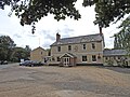
 The White Horse public house, Beyton - geograph.org.uk - 6217364.jpg 3 264 × 2 448 ; 1,64 Mio
-
 UK Beyton.jpg 670 × 1 822 ; 272 kio
-
 Westbound A14, Woolpit Road Bridge - geograph.org.uk - 3868220.jpg 640 × 480 ; 295 kio
-
 Westbound, Layby A14 near Beyton - geograph.org.uk - 3868225.jpg 640 × 480 ; 260 kio
-
 Bury Road Beyton - geograph.org.uk - 1467415.jpg 640 × 480 ; 94 kio


.jpg)


