Category:Beyton
Jump to navigation
Jump to search
English: Beyton is a village and civil parish in the Mid Suffolk district of Suffolk, England. According to Eilert Ekwall the meaning of the village name is homestead by brook or Beaga's homestead.The Domesday Book records the population of Beyton in 1086 to be 1 free man. The village is about east of Bury St Edmunds, on the A14 road.
village in United Kingdom | |||||
| Upload media | |||||
| Instance of | |||||
|---|---|---|---|---|---|
| Location | Mid Suffolk, Suffolk, East of England, England | ||||
| Population |
| ||||
| Said to be the same as | Beyton (Wikimedia duplicated page, civil parish) | ||||
 | |||||
Subcategories
This category has the following 4 subcategories, out of 4 total.
Media in category "Beyton"
The following 49 files are in this category, out of 49 total.
-
 A crowd of conifers - geograph.org.uk - 371816.jpg 640 × 480; 82 KB
-
 A road junction in Beyton village - geograph.org.uk - 2262905.jpg 3,648 × 2,736; 2.29 MB
-
 A14 Looking Northwest - geograph.org.uk - 1367794 (cropped).jpg 268 × 477; 26 KB
-
 A14 Looking Northwest - geograph.org.uk - 1367794.jpg 640 × 480; 64 KB
-
 A14, westbound - geograph.org.uk - 4128716.jpg 640 × 411; 54 KB
-
 A14, westbound - geograph.org.uk - 4128717.jpg 640 × 403; 53 KB
-
 Beyton Green - geograph.org.uk - 4385099.jpg 3,600 × 2,547; 2.77 MB
-
 Beyton War Memorial - geograph.org.uk - 5431401.jpg 2,592 × 3,456; 2.95 MB
-
 Beyton, All Saints Church, North doorway - geograph.org.uk - 6533240.jpg 4,032 × 6,048; 6.23 MB
-
 Beyton, All Saints Church, Northern aspect - geograph.org.uk - 6533231.jpg 5,529 × 3,686; 4.6 MB
-
 Beyton, All Saints Church, Part of the north eastern aspect - geograph.org.uk - 6533236.jpg 6,162 × 4,108; 5.95 MB
-
 Beyton, All Saints Church, Part of the northern aspect - geograph.org.uk - 6533264.jpg 6,144 × 4,096; 7.66 MB
-
 Beyton, All Saints Church, Properties in Church Road - geograph.org.uk - 6533245.jpg 6,202 × 4,134; 6.83 MB
-
 Beyton, All Saints Church, Southern aspect - geograph.org.uk - 6533247.jpg 6,253 × 4,169; 6.86 MB
-
 Beyton, All Saints Church, Tower - geograph.org.uk - 6533254.jpg 3,050 × 4,576; 3.8 MB
-
 Beyton, All Saints Church, Tower and south porch - geograph.org.uk - 6533250.jpg 4,359 × 6,537; 7.62 MB
-
 Beyton, All Saints Church, Western aspect - geograph.org.uk - 6533257.jpg 6,639 × 4,427; 5.93 MB
-
 Beyton, All Saints Church, Western aspect - geograph.org.uk - 6533261.jpg 6,849 × 4,565; 6.97 MB
-
 Beyton, Detached house next to All Saints Church - geograph.org.uk - 6533268.jpg 6,075 × 4,050; 7.26 MB
-
 Beyton, Public footpath-farm track - geograph.org.uk - 6533274.jpg 5,297 × 3,532; 6.82 MB
-
 Beyton, Quaker Lane - geograph.org.uk - 6533323.jpg 5,787 × 3,858; 4.63 MB
-
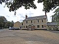
 Beyton, The Bear Inn - geograph.org.uk - 6533327.jpg 6,806 × 4,537; 6.27 MB
-

-

-
 Beyton, The White Horse P.H. - geograph.org.uk - 6533330.jpg 7,519 × 5,012; 5.85 MB
-
 Broken Stile - geograph.org.uk - 1365769.jpg 480 × 640; 79 KB
-
 Drinkstone Road, Beyton - geograph.org.uk - 4505361.jpg 1,024 × 768; 424 KB
-
 Eastbound A14 - geograph.org.uk - 3844161.jpg 640 × 480; 293 KB
-
 Entrance to Beyton Middle School - geograph.org.uk - 3072686.jpg 3,264 × 2,448; 1.96 MB
-
 Farmers Bridge - geograph.org.uk - 1367787.jpg 640 × 480; 72 KB
-

-
 Footbridge over Westbound A14 - geograph.org.uk - 3853619.jpg 640 × 480; 305 KB
-
 Footbridge, A14 - geograph.org.uk - 4128719.jpg 640 × 430; 48 KB
-
 Footbridge, Westbound A14 - geograph.org.uk - 3868222.jpg 640 × 480; 288 KB
-
 Footpath towards Chevins Wood - geograph.org.uk - 3072704.jpg 3,264 × 2,448; 2.5 MB
-
 Layby, Westbound A14 - geograph.org.uk - 3853623.jpg 640 × 480; 308 KB
-
 Middle Of The Road - geograph.org.uk - 1728697.jpg 1,600 × 1,200; 496 KB
-
 Redundant Water Pump - geograph.org.uk - 791342.jpg 640 × 480; 135 KB
-
 ROC Beyton Post - geograph.org.uk - 4882169.jpg 1,362 × 1,162; 1.1 MB
-
 The Bear public house, Beyton - geograph.org.uk - 6217368.jpg 3,264 × 2,448; 1.94 MB
-
 The Green at Beyton - geograph.org.uk - 4505295.jpg 1,024 × 768; 311 KB
-
 The sign of The Bear public house - geograph.org.uk - 6217370.jpg 2,271 × 3,189; 1.36 MB
-
 The sign of The White Horse, Beyton - geograph.org.uk - 6217363.jpg 3,264 × 2,448; 1.64 MB
-
 The sign of The White Horse, Beyton - geograph.org.uk - 6217365.jpg 3,264 × 2,448; 1.67 MB
-
 The White Horse public house, Beyton - geograph.org.uk - 6217364.jpg 3,264 × 2,448; 1.64 MB
-
 UK Beyton.jpg 670 × 1,822; 272 KB
-
 Westbound A14, Woolpit Road Bridge - geograph.org.uk - 3868220.jpg 640 × 480; 295 KB
-
 Westbound, Layby A14 near Beyton - geograph.org.uk - 3868225.jpg 640 × 480; 260 KB
-
 Bury Road Beyton - geograph.org.uk - 1467415.jpg 640 × 480; 94 KB


.jpg)


