Category:Bibury
Vai alla navigazione
Vai alla ricerca
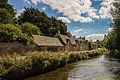
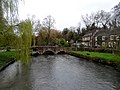
Parrocchia civile dell'Inghilterra  Un alignement de cottages à Bibury. | |||||
| Carica un file multimediale | |||||
| Istanza di | |||||
|---|---|---|---|---|---|
| Luogo | Cotswold, Gloucestershire, Sud Ovest dell'Inghilterra, Inghilterra | ||||
| Gestore | |||||
| Considerato essere uguale a | Bibury (pagina Wikimedia duplicata, parrocchia civile dell'Inghilterra) | ||||
| sito web ufficiale | |||||
 | |||||
Sottocategorie
Questa categoria contiene le 12 sottocategorie indicate di seguito, su un totale di 12.
A
- Ablington War Memorial (2 F)
- Arlington Row, Bibury (66 F)
B
- Bibury Court (11 F)
- Bibury foot bridge (7 F)
- Bibury Mill (12 F)
- Bibury road bridge (14 F)
R
- Ready Token (5 F)
S
- Swan Hotel, Bibury (13 F)
File nella categoria "Bibury"
Questa categoria contiene 200 file, indicati di seguito, su un totale di 348.
(pagina precedente) (pagina successiva)-
 'Private Fishing' sign, River Coln, Bibury - geograph.org.uk - 3248829.jpg 1 600 × 1 281; 642 KB
-
 10, 11 and 12 The Street, Bibury.jpg 4 150 × 2 757; 12,15 MB
-
 10–12 The Street, Bibury.jpg 4 000 × 3 000; 4,87 MB
-
 15 The Street, Bibury.jpg 4 000 × 3 000; 4,77 MB
-
 17–20, The Square, Bibury 01.jpg 4 000 × 3 000; 4,6 MB
-
 17–20, The Square, Bibury 02.jpg 4 000 × 3 000; 4,8 MB
-
 17–20, The Square, Bibury 03.jpg 4 000 × 3 000; 4,5 MB
-
 17–20, The Square, Bibury 04.jpg 4 000 × 3 000; 4,8 MB
-
 18 The Square, Bibury.jpg 4 752 × 3 168; 7,02 MB
-
 19, The Square, Bibury 01.jpg 4 000 × 3 000; 1,26 MB
-
 19, The Square, Bibury 02.jpg 4 000 × 3 000; 4,68 MB
-
 21, The Square, Bibury.jpg 3 000 × 4 000; 3,87 MB
-
 22 and 23, The Square, Bibury.jpg 4 000 × 3 000; 4,87 MB
-
 25, The Square, Bibury.jpg 4 000 × 3 000; 1,37 MB
-
 26, The Square, Bibury.jpg 4 000 × 3 000; 1,07 MB
-
 30, The Square, Bibury, Gloucestershire.jpg 4 000 × 3 000; 1,09 MB
-
 34, The Square, Bibury, Gloucestershire 01.jpg 4 000 × 3 000; 4,6 MB
-
 34, The Square, Bibury, Gloucestershire 02.jpg 4 000 × 3 000; 4,6 MB
-
 34, The Square, Bibury, Gloucestershire 03.jpg 3 000 × 4 000; 4,08 MB
-
 A Cotswold house (40195751603).jpg 5 852 × 3 907; 16,24 MB
-
 A field near Bibury - geograph.org.uk - 5463301.jpg 1 024 × 768; 330 KB
-
 A flooded Rack Isle - geograph.org.uk - 3279874.jpg 1 024 × 680; 234 KB
-
 A hare on the run - geograph.org.uk - 3010058.jpg 1 024 × 684; 106 KB
-

-
 A Riverside Cottage, Bibury - geograph.org.uk - 1575499.jpg 632 × 441; 290 KB
-
 A typical Cotswold field - geograph.org.uk - 385516.jpg 640 × 480; 102 KB
-
 Ablington - geograph.org.uk - 5326660.jpg 640 × 480; 143 KB
-
 Ablington buildings (2) (geograph 7503304).jpg 2 969 × 1 670; 1,4 MB
-
 Ablington features (1) (geograph 7502218).jpg 4 310 × 3 232; 4,1 MB
-
 Ablington features (2) (geograph 7502220).jpg 4 320 × 3 240; 4,5 MB
-
 Ablington features (3) (geograph 7503311).jpg 3 197 × 4 263; 3,02 MB
-
 Ablington houses (1) (geograph 7502217).jpg 4 320 × 3 240; 4,06 MB
-
 Ablington houses (2) (geograph 7502230).jpg 4 249 × 3 186; 3,35 MB
-
 Ablington houses (3) (geograph 7502241).jpg 4 157 × 3 118; 2,92 MB
-
 Ablington houses (5) (geograph 7502253).jpg 4 225 × 3 169; 3,92 MB
-
 Ablington houses (6) (geograph 7503323).jpg 4 099 × 3 074; 3,3 MB
-
 Ablington Turning to Winson - geograph.org.uk - 5326654.jpg 640 × 480; 98 KB
-
 Almshouses' gardens, Bibury - geograph.org.uk - 2345231.jpg 640 × 480; 96 KB
-
 Approaching Bibury - geograph.org.uk - 2345172.jpg 640 × 480; 120 KB
-
 Approaching Kilkenny Farm - geograph.org.uk - 4673391.jpg 1 920 × 1 266; 445 KB
-
 Approaching Saltway Barn - geograph.org.uk - 4423504.jpg 1 920 × 1 342; 666 KB
-
 Approaching the Salt Way - geograph.org.uk - 4695743.jpg 1 920 × 1 382; 603 KB
-
 Arlington Mill - geograph.org.uk - 4192938.jpg 640 × 1 024; 232 KB
-
 Arlington Mill head-race byewash - geograph.org.uk - 4192974.jpg 705 × 1 024; 328 KB
-
 Arlington Mill, Bibury, Gloucestershire - geograph.org.uk - 4564056.jpg 5 517 × 3 032; 3,37 MB
-
 Arlington Row - geograph.org.uk - 4194593.jpg 1 024 × 576; 251 KB
-
 Arlington Row - geograph.org.uk - 4194678.jpg 1 024 × 576; 177 KB
-
 Arlington Row - geograph.org.uk - 4194683.jpg 1 024 × 576; 219 KB
-
 Arlington Row - geograph.org.uk - 5993128.jpg 1 024 × 768; 221 KB
-
 Arlington Row Bibury (2) - geograph.org.uk - 5326290.jpg 640 × 480; 90 KB
-
 Arlington Row Bibury - geograph.org.uk - 4084118.jpg 1 280 × 960; 1,12 MB
-
 Arlington Row Bibury - geograph.org.uk - 4084121.jpg 1 280 × 960; 953 KB
-
 Arlington Row Bibury - geograph.org.uk - 4084137.jpg 1 280 × 960; 979 KB
-
 Arlington Row Bibury - geograph.org.uk - 5326289.jpg 640 × 480; 122 KB
-
 Arlington Row cottages, Bibury - geograph.org.uk - 6130628.jpg 1 894 × 1 240; 1,05 MB
-
 Arlington Row, Bibury, Gloucestershire - geograph.org.uk - 4564446.jpg 6 016 × 4 000; 2,44 MB
-
 B4425 Approaching Arlington - geograph.org.uk - 5326280.jpg 640 × 413; 97 KB
-
 B4425 Arlington - geograph.org.uk - 4193070.jpg 1 500 × 1 145; 329 KB
-
 B4425 Arlington-Bibury - geograph.org.uk - 4194659.jpg 1 024 × 576; 193 KB
-
 Bale tomb at Bibury - geograph.org.uk - 5861367.jpg 1 024 × 768; 341 KB
-
 Bibury (14871818759).jpg 1 818 × 1 204; 3,04 MB
-
 Bibury (14871833639).jpg 1 200 × 1 818; 1,03 MB
-
 Bibury (14871972808).jpg 1 818 × 1 204; 2,82 MB
-
 Bibury (14871985698).jpg 1 818 × 1 204; 2,06 MB
-
 Bibury (15055484401).jpg 1 818 × 1 204; 1,59 MB
-
 Bibury - 7 And 9 Swan Cottages - 20220822175820.jpeg 2 048 × 1 536; 1,68 MB
-
 Bibury - geograph.org.uk - 2309318.jpg 3 216 × 2 136; 1,61 MB
-
 Bibury - The bridge over the River Coln - geograph.org.uk - 6406870.jpg 1 799 × 1 199; 460 KB
-
 Bibury 2015 01.jpg 5 184 × 3 456; 5,31 MB
-
 Bibury 2015 09.jpg 5 184 × 3 456; 5,36 MB
-
 Bibury 2015 13.jpg 5 184 × 3 456; 4,31 MB
-
 Bibury 2015 14.jpg 5 184 × 3 456; 6,14 MB
-
 Bibury 2015 15.jpg 5 184 × 3 456; 5,45 MB
-
 Bibury 2015 16.jpg 5 184 × 3 456; 4,94 MB
-
 Bibury 2015 17.jpg 3 456 × 5 184; 6,11 MB
-
 Bibury 2015 18.jpg 5 184 × 3 456; 4,7 MB
-
 Bibury 2015 19.jpg 5 184 × 3 456; 5,03 MB
-
 Bibury 21-09-2013.jpg 2 048 × 1 008; 265 KB
-
 Bibury 22-09-2013.jpg 1 695 × 2 048; 297 KB
-
 Bibury after snowfall at dusk - geograph.org.uk - 1158861.jpg 640 × 480; 75 KB
-
 Bibury after snowfall at dusk - geograph.org.uk - 1158864.jpg 640 × 480; 78 KB
-
 Bibury after snowfall at dusk - geograph.org.uk - 1158866.jpg 640 × 480; 93 KB
-
 Bibury after snowfall at dusk - geograph.org.uk - 1158867.jpg 640 × 480; 87 KB
-
 Bibury barley field - geograph.org.uk - 2527918.jpg 800 × 600; 423 KB
-
 Bibury by the Trout Farm - geograph.org.uk - 5326283.jpg 640 × 480; 71 KB
-
 Bibury Cottages.jpg 3 965 × 2 832; 11,54 MB
-
 Bibury houses (1) (geograph 7503357).jpg 4 270 × 3 203; 3,43 MB
-
 Bibury houses (2) (geograph 7503370).jpg 4 241 × 3 181; 2,8 MB
-
 Bibury in Mini Europe.jpg 4 032 × 3 024; 3,7 MB
-
 Bibury MMB 01.jpg 1 600 × 1 200; 784 KB
-
 Bibury MMB 02.jpg 1 600 × 1 200; 776 KB
-
 Bibury MMB 03.jpg 2 316 × 1 521; 1,51 MB
-
 Bibury on Christmas Day 2010 - geograph.org.uk - 2309320.jpg 3 216 × 2 136; 1,74 MB
-
 Bibury Primary School 01.jpg 4 000 × 3 000; 4,85 MB
-
 Bibury Primary School 02.jpg 4 000 × 3 000; 4,65 MB
-
 Bibury River bank - geograph.org.uk - 2309321.jpg 3 216 × 2 136; 1,6 MB
-
 Bibury School (geograph 5444267).jpg 3 678 × 2 456; 4,79 MB
-
 Bibury Telephone Exchange (1) - geograph.org.uk - 5545842.jpg 2 592 × 1 944; 1,41 MB
-
 Bibury Telephone Exchange (2) - geograph.org.uk - 5545856.jpg 2 592 × 1 944; 1,39 MB
-
 Bibury Trout Farm - geograph.org.uk - 1440334.jpg 640 × 427; 97 KB
-
 Bibury Trout Farm - geograph.org.uk - 4194713.jpg 1 024 × 576; 245 KB
-
 Bibury Trout Farm - geograph.org.uk - 6406873.jpg 1 802 × 1 201; 478 KB
-
 Bibury trout farm.jpg 2 736 × 3 648; 4,21 MB
-
 Bibury Village (26817441595).jpg 4 903 × 3 108; 4,93 MB
-
 Bibury with Arlington traffic sign - geograph.org.uk - 3794821.jpg 1 280 × 960; 1,01 MB
-
 Bibury, Arlington Row - geograph.org.uk - 4461528.jpg 3 678 × 2 456; 5,28 MB
-
 Bibury, Arlington Row - geograph.org.uk - 4461533.jpg 4 455 × 2 912; 6,87 MB
-
 Bibury, Arlington Row - geograph.org.uk - 4461562.jpg 3 679 × 2 455; 6,22 MB
-
 Bibury, Arlington Row and cottages beyond - geograph.org.uk - 4461550.jpg 3 678 × 2 456; 5,5 MB
-

-
 Bibury, Church Road - geograph.org.uk - 5444308.jpg 3 678 × 2 456; 6,51 MB
-
 Bibury, Cottages , The Rack Isle - geograph.org.uk - 4461546.jpg 2 451 × 1 636; 2,69 MB
-

-
 Bibury, Cottages opposite The Rack Isle - geograph.org.uk - 4447518.jpg 3 679 × 2 456; 5,06 MB
-
 Bibury, Mute swan on the River Coln - geograph.org.uk - 4461554.jpg 2 452 × 1 639; 1,91 MB
-

-
 Bibury, St. Mary's Church - geograph.org.uk - 5444262.jpg 4 472 × 2 923; 6,34 MB
-
 Bibury22-09-2013.jpg 2 048 × 1 366; 271 KB
-
 Bridge at Bibury - geograph.org.uk - 3933458.jpg 4 320 × 3 240; 4,88 MB
-
 Bridge House, Bibury 01.jpg 4 103 × 3 138; 2,42 MB
-
 Bridge House, Bibury 02.jpg 4 000 × 3 000; 4,8 MB
-
 Bridge House, Bibury 03.jpg 4 000 × 3 000; 5,1 MB
-
 Bridleway near Kilkenny Farm - geograph.org.uk - 4695706.jpg 1 920 × 1 331; 398 KB
-
 Bridleway northeast of Saltway Barn - geograph.org.uk - 4423511.jpg 1 920 × 1 440; 806 KB
-
 Bridleway northeast of Saltway Barn - geograph.org.uk - 4696189.jpg 2 737 × 1 747; 829 KB
-

-
 Bridleway to Ablington - geograph.org.uk - 4423108.jpg 1 920 × 1 181; 634 KB
-
 Bridleway to Bibury - geograph.org.uk - 4423178.jpg 2 454 × 1 860; 1,08 MB
-
 Bridleway to Hay Barn - geograph.org.uk - 2530835.jpg 640 × 426; 163 KB
-
 Bridleway to Kilkenny Barn - geograph.org.uk - 4423170.jpg 2 726 × 1 969; 1,39 MB
-
 Bridleway to Kilkenny Barn - geograph.org.uk - 4695714.jpg 1 920 × 1 291; 554 KB
-
 Building in an old street. (Unsplash).jpg 4 272 × 2 848; 2,97 MB
-
 Church House, Bibury.jpg 4 000 × 3 000; 1 009 KB
-
 Church Road, Bibury, Gloucestershire - geograph.org.uk - 2891960.jpg 640 × 411; 91 KB
-
 Converted barn, Bibury, Gloucestershire - geograph.org.uk - 4605046.jpg 5 350 × 3 552; 2,89 MB
-
 Corner Cottage, Bibury, Gloucestershire.jpg 4 000 × 3 000; 4,65 MB
-
 Corner houses, Ablington - geograph.org.uk - 5324340.jpg 640 × 480; 148 KB
-
 Cotswold bridleway - geograph.org.uk - 4423725.jpg 1 920 × 1 381; 618 KB
-
 Cotswold footpath - geograph.org.uk - 2527928.jpg 800 × 600; 322 KB
-
 Cotswold grassland - geograph.org.uk - 3009368.jpg 1 024 × 680; 170 KB
-
 Cotswold headland - geograph.org.uk - 3010029.jpg 1 024 × 680; 218 KB
-
 Cotswold Houses Bibury (geograph 5326646).jpg 640 × 480; 75 KB
-
 Cottage by the B4425, Arlington - geograph.org.uk - 6417395.jpg 1 862 × 1 186; 1,41 MB
-
 Cottage in Bibury - geograph.org.uk - 4084166.jpg 960 × 1 280; 1,02 MB
-
 Cottage, Bibury - geograph.org.uk - 1917378.jpg 2 587 × 3 508; 4,42 MB
-
 Cottages by the B4425, Bibury - geograph.org.uk - 6130629.jpg 1 920 × 1 280; 1,23 MB
-
 Cottages in Bibury - geograph.org.uk - 4084171.jpg 1 280 × 960; 592 KB
-
 Cottages on Arlington Row Bibury - geograph.org.uk - 4084130.jpg 1 280 × 960; 1 001 KB
-
 Cottages on B4425, Bibury - geograph.org.uk - 3248835.jpg 1 600 × 1 117; 539 KB
-
 Country road to Ablington - geograph.org.uk - 5463257.jpg 1 024 × 768; 207 KB
-
 Court Farm, Bibury - geograph.org.uk - 2701153.jpg 1 024 × 682; 160 KB
-
 Crop by the lane to Kilkenny Farm - geograph.org.uk - 4696312.jpg 1 920 × 1 084; 686 KB
-
 Crop near RAF Bibury - geograph.org.uk - 4695771.jpg 1 920 × 1 249; 665 KB
-
 Crop north-west of Kilkenny Farm - geograph.org.uk - 4696205.jpg 1 920 × 1 308; 808 KB
-
 Crop north-west of Kilkenny Farm - geograph.org.uk - 4696253.jpg 1 920 × 1 194; 795 KB
-
 Crop of oilseed rape - geograph.org.uk - 3010034.jpg 1 024 × 680; 230 KB
-
 Crossroads on the B4425 between Aldsworth and Bibury - geograph.org.uk - 6416739.jpg 1 920 × 1 280; 1,55 MB
-
 Damaged Cotswold wall - geograph.org.uk - 4696296.jpg 1 920 × 1 069; 466 KB
-
 Direction Signs in Bibury - geograph.org.uk - 955672.jpg 640 × 480; 140 KB
-
 Entering Bibury on the B4425 - geograph.org.uk - 6095443.jpg 1 866 × 1 194; 1,36 MB
-
 Fading autumn light - geograph.org.uk - 2706496.jpg 1 024 × 680; 106 KB
-
 Farmland in the Leach valley - geograph.org.uk - 3010876.jpg 1 024 × 680; 204 KB
-
 Farmland near Kilkenny Cottages - geograph.org.uk - 4673676.jpg 1 920 × 1 143; 477 KB
-
 Field boundary near Saltway Barn - geograph.org.uk - 4423210.jpg 2 715 × 2 078; 673 KB
-
 Field boundary north-west of Kilkenny Farm - geograph.org.uk - 4696267.jpg 1 920 × 1 152; 612 KB
-
 Field gate - geograph.org.uk - 5463298.jpg 1 024 × 768; 314 KB
-
 Field headland track - geograph.org.uk - 5463279.jpg 1 024 × 768; 360 KB
-
 Field of barley - geograph.org.uk - 3009449.jpg 1 024 × 680; 168 KB
-
 Footbridge over the Coln - geograph.org.uk - 2832179.jpg 3 072 × 2 304; 3,39 MB
-

-
 Footbridge to Arlington Row - geograph.org.uk - 4194748.jpg 1 024 × 576; 213 KB
-
 Footpath and headland track - geograph.org.uk - 3009442.jpg 1 024 × 680; 197 KB
-
 Footpath on Rack Isle in Bibury - geograph.org.uk - 1440330.jpg 640 × 427; 106 KB
-
 Footpath through a wheat field - geograph.org.uk - 3009415.jpg 1 024 × 680; 240 KB
-
 Ford across the Leach - geograph.org.uk - 4673405.jpg 1 920 × 1 297; 874 KB
-
 Former Jesus Almshouse, Bibury.jpg 4 752 × 3 168; 4,75 MB
-
 Former village Lock-up (geograph 7545908).jpg 1 600 × 1 069; 515 KB
-
 Furzey Lane - geograph.org.uk - 2532586.jpg 640 × 426; 221 KB
-
 Gate into a field - geograph.org.uk - 3009393.jpg 1 024 × 680; 229 KB
-
 Gatepost, Saltway Barn - geograph.org.uk - 4695772.jpg 1 920 × 1 389; 883 KB
-
 Gateway into a field of wheat - geograph.org.uk - 5463306.jpg 1 024 × 768; 315 KB
-
 Gateway on bridleway KBY 5-1 - geograph.org.uk - 4696282.jpg 2 758 × 1 640; 896 KB
-
 Gift Shop cum Post Office, Bibury - geograph.org.uk - 1577245.jpg 640 × 449; 218 KB
-
 Hare in the headland - geograph.org.uk - 3010045.jpg 1 024 × 680; 171 KB
-
 Harvested barley - geograph.org.uk - 2549466.jpg 800 × 600; 413 KB
-
 Hay Lane - geograph.org.uk - 2549475.jpg 800 × 600; 378 KB
-

-
 Hotel in Bibury - geograph.org.uk - 2309319.jpg 3 216 × 2 136; 2,01 MB
-
 House on Church Street, Bibury - geograph.org.uk - 4027064.jpg 1 600 × 1 064; 652 KB
-
 House opposite Bibury church (geograph 5861743).jpg 1 024 × 768; 262 KB
-
 Houses near Ablington - geograph.org.uk - 4027097.jpg 1 600 × 1 064; 865 KB
-
 Houses near Arlington Pike - geograph.org.uk - 4027085.jpg 1 600 × 1 064; 491 KB
-
 Houses on the B4425, Arlington - geograph.org.uk - 6417163.jpg 1 920 × 1 280; 1,54 MB
-
 Into Oxhill Wood - geograph.org.uk - 2345193.jpg 640 × 480; 104 KB
-
 Into the morning sun near Kilkenny - geograph.org.uk - 4423715.jpg 1 875 × 1 335; 445 KB
-
 Just chillin' - geograph.org.uk - 2532660.jpg 640 × 426; 224 KB
-
 Kilkenny Barn - geograph.org.uk - 4423132.jpg 1 920 × 1 448; 450 KB
-
 Kilkenny Barn - geograph.org.uk - 4423140.jpg 1 920 × 1 330; 660 KB
-
 Kilkenny Cottages by the B4425 - geograph.org.uk - 6416737.jpg 1 810 × 1 086; 1,42 MB
-
 Landscaped gardens by the River Colne, Bibury - geograph.org.uk - 6415212.jpg 1 920 × 1 280; 2,08 MB


.jpg)


_(geograph_7503304).jpg)
_(geograph_7502218).jpg)
_(geograph_7502220).jpg)
_(geograph_7503311).jpg)
_(geograph_7502217).jpg)
_(geograph_7502230).jpg)
_(geograph_7502241).jpg)
_(geograph_7502253).jpg)
_(geograph_7503323).jpg)


_-_geograph.org.uk_-_5326290.jpg)


.jpg)
.jpg)
.jpg)
.jpg)
.jpg)


_(geograph_7503357).jpg)
_(geograph_7503370).jpg)


.jpg)
_-_geograph.org.uk_-_5545842.jpg)
_-_geograph.org.uk_-_5545856.jpg)


.jpg)


.jpg)


.jpg)


.jpg)


.jpg)


