Category:Arlington, Gloucestershire
Jump to navigation
Jump to search
village in Gloucestershire, England  | |||||
| Upload media | |||||
| Instance of | |||||
|---|---|---|---|---|---|
| Location | Cotswold, Gloucestershire, South West England, England | ||||
| Different from | |||||
 | |||||
Subcategories
This category has the following 2 subcategories, out of 2 total.
A
- Arlington Row, Bibury (66 F)
Media in category "Arlington, Gloucestershire"
The following 42 files are in this category, out of 42 total.
-
 11, Awkward Hill, Arlington.jpg 4,000 × 3,000; 4.61 MB
-

-
 Arlington Baptist Church (geograph 5326648).jpg 480 × 640; 91 KB
-
 Arlington Manor With Forecourt Wall.jpg 4,709 × 3,296; 10.08 MB
-
 Arlington-Bibury, Cottages - geograph.org.uk - 22432.jpg 640 × 480; 567 KB
-
 Byway to Arlington Pike - geograph.org.uk - 2530830.jpg 640 × 414; 244 KB
-
 Cottage by the B4425, Arlington (geograph 6184667).jpg 1,920 × 1,280; 1.01 MB
-
 Cottage opposite Arlington Row, Bibury.jpg 4,000 × 3,000; 2.04 MB
-

-
 Field Cottage, Arlington.jpg 4,000 × 3,000; 5 MB
-
-
 Houses in Arlington Gloucestershire - geograph.org.uk - 2891533.jpg 640 × 480; 77 KB
-
 In an English country garden... - geograph.org.uk - 231339.jpg 480 × 640; 313 KB
-
-
 Phone box on the B4425, Arlington (geograph 6130622).jpg 1,920 × 1,280; 1.35 MB
-
-

-
-

-
 The Catherine Wheel, Arlington (geograph 4027081).jpg 1,600 × 1,064; 647 KB
-
 The Wool House, Arlington 01.jpg 4,000 × 3,000; 4.93 MB
-
 The Wool House, Arlington 02.jpg 4,000 × 3,000; 4.79 MB
-
 The Wool House, Arlington 03.jpg 4,000 × 3,000; 4.9 MB
-
 The Wool House, Arlington 04.jpg 3,000 × 4,000; 4.05 MB
-
 Tiny cottage near Arlington Row - geograph.org.uk - 231333.jpg 480 × 640; 363 KB
-
 Arlington - geograph.org.uk - 22423.jpg 640 × 480; 176 KB
-
 Coneygar Cottages - geograph.org.uk - 387418.jpg 640 × 449; 112 KB
-

-
 Entrance to Quarry Hill Farm - geograph.org.uk - 22417.jpg 640 × 480; 440 KB
-
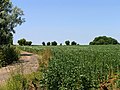
 Farmland north of Akeman Street - geograph.org.uk - 22413.jpg 640 × 480; 411 KB
-
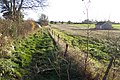
 Farmland north of the Roman Road - geograph.org.uk - 22412.jpg 640 × 480; 167 KB
-
 Farmland South of Akeman Street - geograph.org.uk - 22415.jpg 450 × 600; 410 KB
-
 Fields off Akeman Street. - geograph.org.uk - 286519.jpg 640 × 427; 120 KB
-
 Footpath by Shagborough Copse - geograph.org.uk - 387422.jpg 640 × 480; 98 KB
-
 Gorgeous Gates - geograph.org.uk - 161907.jpg 640 × 480; 601 KB
-
 Grounds of the Swan Hotel - geograph.org.uk - 161881.jpg 640 × 480; 584 KB
-
 Late autumn colour at Poulton Grange. - geograph.org.uk - 286525.jpg 640 × 427; 128 KB
-
 Mushroom compost manufacturer. - geograph.org.uk - 286522.jpg 640 × 427; 86 KB
-
 New Barn - geograph.org.uk - 387426.jpg 640 × 480; 117 KB
-
 Roman Road and Farmland - geograph.org.uk - 22411.jpg 640 × 480; 197 KB
-
 Shagborough Copse - geograph.org.uk - 387425.jpg 640 × 480; 104 KB
-
 The Rack Isle - geograph.org.uk - 22426.jpg 640 × 480; 174 KB


.jpg)


.jpg)


.jpg)


.jpg)


