Category:Biggar, Cumbria
Jump to navigation
Jump to search
English: Biggar is a village towards the south of Walney Island in Cumbria, England. Along with the village of North Scale, it is the oldest settlement on the island. It now forms part of the Borough of Barrow-in-Furness.
village in Cumbria, United Kingdom  | |||||
| Upload media | |||||
| Instance of | |||||
|---|---|---|---|---|---|
| Location | Barrow-in-Furness, Cumbria, North West England, England | ||||
 | |||||
Media in category "Biggar, Cumbria"
The following 19 files are in this category, out of 19 total.
-
 Beach at Bent Haw - geograph.org.uk - 6189516.jpg 1,280 × 720; 478 KB
-
-
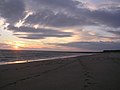
 Beach At Thorney Nook - geograph.org.uk - 95998.jpg 624 × 458; 41 KB
-
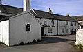
 Biggar Village, Walney Island.jpg 640 × 480; 112 KB
-
 Eroding coastline at Middle Hill - geograph.org.uk - 6189517.jpg 1,280 × 856; 549 KB
-

-
 Loverholme Bed, Walney Island - geograph.org.uk - 224078.jpg 640 × 480; 98 KB
-
 Ordnance Survey Cut Mark - geograph.org.uk - 6296046.jpg 673 × 1,024; 195 KB
-
 Thorny Nook Lane is flooded - geograph.org.uk - 5685777.jpg 640 × 480; 50 KB
-
 Another One Bites the Dust - geograph.org.uk - 1434377.jpg 640 × 404; 55 KB
-
 Back Street - geograph.org.uk - 484336.jpg 640 × 480; 91 KB
-
 Bent Haw Scar - geograph.org.uk - 1436659.jpg 640 × 480; 65 KB
-
 Delhi Street - geograph.org.uk - 484303.jpg 640 × 480; 110 KB
-
 Earnse Scar - geograph.org.uk - 487616.jpg 640 × 480; 104 KB
-
 Foreshore at Bent Haw - geograph.org.uk - 1434402.jpg 640 × 480; 59 KB
-
 Pond near South Walney Nature Reserve - geograph.org.uk - 497606.jpg 640 × 480; 92 KB
-

-
 Sandy Gap - geograph.org.uk - 485637.jpg 640 × 480; 105 KB
-
 Strathaird Avenue - geograph.org.uk - 484312.jpg 640 × 480; 122 KB


