Category:Bingley St. Ives
Jump to navigation
Jump to search
 | |||||
| Upload media | |||||
| Instance of | |||||
|---|---|---|---|---|---|
| Location | Harden, Bradford, West Yorkshire, Yorkshire and the Humber, England | ||||
 | |||||
Bingley St. Ives is a country park between Harden and Bingley in the City of Bradford, West Yorkshire.
Media in category "Bingley St. Ives"
The following 15 files are in this category, out of 15 total.
-
 Altar Lane, St. Ives Estate - geograph.org.uk - 375231.jpg 640 × 477; 146 KB
-
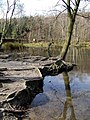
 Baxter's Pond - geograph.org.uk - 376177.jpg 460 × 640; 157 KB
-
 Betty's Lodge, St. Ives Estate - geograph.org.uk - 375200.jpg 640 × 480; 149 KB
-
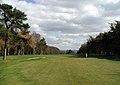 Bingley St. Ives Golf Course - geograph.org.uk - 375275.jpg 640 × 451; 81 KB
-
 Coach House St.Ives estate Bingley - geograph.org.uk - 40330.jpg 640 × 480; 75 KB
-
 Coppice Pond - geograph.org.uk - 375297.jpg 480 × 640; 140 KB
-
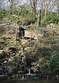
 Druids' Altar - geograph.org.uk - 1530433.jpg 640 × 480; 132 KB
-

-
 Lady Blantyre's Rock St. Ives Bingley - geograph.org.uk - 40326.jpg 640 × 480; 155 KB
-
 Scotch Fir Plantation, St. Ives Estate - geograph.org.uk - 375283.jpg 640 × 492; 163 KB
-

-
 Baxter's Pond - geograph.org.uk - 376186.jpg 475 × 640; 174 KB
-
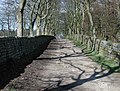 Cross Gates Lane, St. Ives Estate - geograph.org.uk - 375228.jpg 640 × 484; 145 KB
-
 Lady Blantyre's Rock - geograph.org.uk - 375273.jpg 480 × 640; 125 KB
-
 Sports Turf Research Institute - geograph.org.uk - 40329.jpg 640 × 480; 91 KB


