Category:Bird's eye view maps of the United Kingdom
Jump to navigation
Jump to search
Media in category "Bird's eye view maps of the United Kingdom"
The following 4 files are in this category, out of 4 total.
-
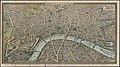 1890s pictorial map of London - London towards the close of the 19th century.jpg 5,000 × 2,792; 12.82 MB
-

-
 Liverpool, designed, drawn & engraved by John R. Isaac.jpg 640 × 473; 86 KB
-
 Stratford on Avon. LOC 93686544.jpg 10,635 × 8,275; 18.88 MB

.jpg)

